
Last updated May 21, 2026
Haleakalā Climb Guide: House of the Sun, the Demigod Māui Legend & the World’s Steepest 38-Mile Road Climb (2026)
Haleakalā — “House of the Sun” in Hawaiian — is the dormant shield volcano that forms three-quarters of the island of Maui. At 3,055m / 10,023 ft, it is the third-highest peak in Hawaii after Mauna Kea and Mauna Loa, and one of the most visited summits in the United States — with 1+ million annual park visitors. The mountain is sacred to Native Hawaiians as the place where the demigod Māui (for whom the island is named) lassoed the sun to slow its journey across the sky. Modern visitors come for the iconic sunrise reservation system (mandatory October-May), the 11-mile Sliding Sands Trail descent into a 7.5-mile-long erosional depression, and the world record shortest sea-level-to-10,000-ft climb at just 38 paved-road miles. Here’s the verified 2026 guide.
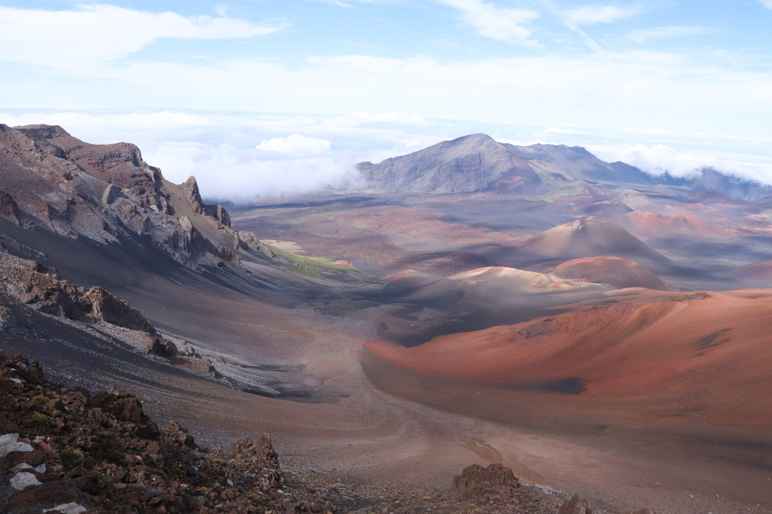
Haleakalā National Park. Haleakalā became a National Park in its own right in 1961 — when Congress split the original 1916 Hawaiʻi National Park into two separate units: Hawaiʻi Volcanoes National Park (on the Big Island, covering Mauna Loa and Kīlauea) and Haleakalā National Park (on Maui). The Haleakalā park covers approximately 33,265 acres / 134.6 km² and protects both the summit area and the dramatic Kīpahulu coastal area. The park is divided into two districts that do not connect by road internally: the Summit District (accessed via Haleakalā Highway / Route 378 from Kahului side) containing the summit, crater, and Sliding Sands Trail; and the Kīpahulu District (accessed via the famous Hāna Highway, ~3-hour drive from Kahului) containing the Pīpīwai Trail, Waimoku Falls, and the ʻOheʻo Gulch coastal pools. Park entrance fee: $30/vehicle for 3 days (covers both districts). America the Beautiful annual pass accepted. The park is one of the most-visited US national parks with approximately 1+ million annual visitors despite Maui’s island remoteness.
The History of Hale-a-ka-lā
Haleakalā — properly Hale-a-ka-lā, meaning “House of the Sun” — rises 3,055 meters (10,023 feet) above sea level on the island of Maui, Hawaii. The mountain is the highest point on Maui and the third-highest peak in the Hawaiian Islands after Mauna Kea (4,207m) and Mauna Loa (4,169m) on the Big Island. The summit point is Puʻu ʻUlaʻula (“Red Hill”), where the small Puʻu ʻUlaʻula Observatory provides the main sunrise viewing area.
Haleakalā is a massive shield volcano covering approximately three-quarters of Maui’s total land area — about 1,470 km² (570 mi²). With approximately 97% of the volcano’s total volume below sea level, the full edifice is approximately 30,000 km³ (7,200 mi³) — making Haleakalā one of the larger volcanic structures on Earth despite its modest 10,023-ft above-sea-level summit. The mountain began forming approximately 2 million years ago, with the oldest dated lava flows approximately 1.1 million years old. Haleakalā is currently in the post-shield rejuvenated stage — the late phase of Hawaiian volcanic evolution characterized by widely-spaced eruptions of small volume rather than the frequent large eruptions of the shield-building phase.
The Demigod Māui and the House of the Sun. The name Hale-a-ka-lā (“House of the Sun”) derives from one of the most famous legends in Hawaiian mythology — the story of Māui, the demigod hero for whom the island of Maui is named. According to the legend, Māui lived in a Hawaiian community where his mother Hina made tapa (traditional Hawaiian bark cloth) — but the sun crossed the sky so quickly that Hina could never complete her work in proper daylight. Māui resolved to slow the sun. He climbed to the summit of Haleakalā with a lasso made of his sister’s hair (some versions say his grandmother’s hair, or coconut fiber rope), waited at the crater rim, and as the sun emerged at dawn from the “house” of the volcano, Māui snared the sun and held it fast. The sun agreed to slow its journey across the sky in exchange for release — and according to the legend, this is why days are longer in summer than in winter, and why Hawaiian seasons have their character. Māui’s grandmother lived in the crater itself per the legend and provided Māui with both wisdom and the lasso. The story is among the most widely-known in Polynesian mythology and exists in variant forms across the Pacific (similar Māui-and-the-sun stories appear in Māori, Samoan, and Tahitian traditions). The “House of the Sun” name reflects both this legend and the fact that Haleakalā is one of the first places in the United States to receive sunlight each morning. The mountain is also associated with Pele (the volcano goddess of Mauna Loa/Kīlauea) through legends of her battles with siblings on the crater floor — though Pele’s primary domain remains the Big Island, and Haleakalā’s eruptive activity is religiously secondary to the active Hawaiian volcanoes.
~2 Million Years Ago: Haleakalā Begins Forming
Haleakalā’s volcanic construction began approximately 2 million years ago on the Pacific seafloor as part of the Hawaiian-Emperor hotspot chain. The eastern half of the island of Maui was created entirely by this single shield volcano (the western half by the smaller, older West Maui Volcano). The oldest exposed lava flows on Haleakalā are approximately 1.1 million years old; the mountain entered its post-shield stage approximately 200,000-400,000 years ago. Throughout the past 30,000 years, Haleakalā has produced numerous smaller eruptions — at least 10 in the past 1,000 years alone — primarily from the southwest and east rift zones radiating from the crater area.
The Haleakalā “Crater” — An Erosional Depression
The most famous feature of Haleakalā is the dramatic “crater” at the summit — a 7.5-mile (12 km) long, 2.5-mile (4 km) wide, approximately 2,600-foot (790m) deep depression that dominates the upper mountain landscape. The “crater” is, however, technically not a true volcanic crater — it was not formed by an eruption or collapse event. Instead, geologists classify the depression as an erosional feature created when two large stream valleys (Keanae Valley to the north and Kaupō Valley to the south) eroded backward into the mountain over hundreds of thousands of years until they merged at the summit area. The result is a depression that looks like a volcanic caldera but is actually a coalescence of erosion features. Subsequent volcanic activity on the crater floor (multiple cinder cones, lava flows) has produced the dramatic colorful landscape — reds, oranges, blacks, browns from iron weathering of the basalt — that gives the area its lunar character. Approximately 30+ cinder cones dot the crater floor, with significant features including Puʻu o Maui, Puʻu o Pele, and the Bottomless Pit (Kawilinau).
1480-1600 AD: The Most Recent Eruption
USGS carbon dating and Hawaiian oral history place Haleakalā’s most recent eruption between 1480 and 1600 AD — approximately 400-550 years ago. The eruption originated from cones on the southwest rift zone and produced lava flows that reached the sea at present-day La Pérouse Bay on Maui’s southwestern coast, near the modern resort town of Wailea. The lava delta visible at La Pérouse Bay today is the product of this eruption — the dark, fresh-looking lava terrain is among the most recent volcanic landscape in the Hawaiian Islands.
For decades, the standard date for the eruption was 1790, based on European exploration records: the 1786 La Pérouse expedition map of the Maui coast did not show a lava delta, while George Vancouver’s 1793 map clearly showed the peninsula now identified as the 1790 eruption product. The discrepancy was assumed to date the eruption between these two visits. However, USGS carbon dating of the lava flows themselves consistently produced 1480-1600 AD dates, suggesting that the La Pérouse Bay terrain predates European observation entirely and the eruption was earlier than the maps had suggested. The current USGS standard date is 1480-1600 AD; some Maui tourism material still uses the older 1790 date.
1916: Hawaiʻi National Park Established (Including Haleakalā)
Hawaiʻi National Park was established on 1 August 1916 as the 13th US National Park — covering Mauna Loa, Kīlauea (on the Big Island), and Haleakalā (on Maui) as a single combined unit. Haleakalā was specifically designated within the park because of its dramatic volcanic landscape, exceptional native ecosystem, and cultural significance to Native Hawaiians. The 1916 designation included the summit area but excluded the lower Kīpahulu region, which was added in later decades.
1961: Haleakalā Becomes Its Own National Park
In 1961, Congress split the original combined Hawaiʻi National Park into two separate units: Hawaiʻi Volcanoes National Park (on the Big Island) and Haleakalā National Park (on Maui). The split reflected the substantially different character of the two areas — the active Big Island volcanoes versus Maui’s dormant shield with its dramatic erosional depression — and allowed for more focused management of each. The Kīpahulu District was added to Haleakalā National Park in 1969, expanding the park to include the dramatic coastal area with the Pīpīwai Trail and Waimoku Falls. The park’s current total area is approximately 33,265 acres / 134.6 km².
1976: International Biosphere Reserve Designation
Haleakalā National Park was designated an International Biosphere Reserve by UNESCO in 1976 — recognizing the park’s exceptional biological diversity and the substantial concentration of endangered species. Haleakalā hosts more endangered species per acre than any other US National Park. Notable native and endemic species include the Haleakalā silversword (ʻāhinahina, Argyroxiphium sandwicense ssp. macrocephalum) — a dramatic high-altitude plant that lives 15-50 years, flowers once with a 6-foot stalk, then dies; the nēnē (Hawaiian goose, the state bird, Branta sandvicensis); various endemic honeycreeper birds; and unique invertebrates and plants found nowhere else on Earth. The biosphere reserve designation acknowledges the global ecological significance of the Haleakalā ecosystem.
2017: The Sunrise Reservation System
By the 2010s, Haleakalā’s iconic sunrise viewing experience had grown into a massive overcrowding problem. The Haleakalā Visitor Center and Puʻu ʻUlaʻula Observatory areas were accommodating up to 1,500 visitors per sunrise — with cars parked along narrow shoulders, visitors crowding limited viewing platforms, traffic backed up for miles on the access highway, and substantial impact on the park’s fragile alpine environment. In response, the National Park Service implemented a sunrise reservation system in February 2017: all vehicles entering the summit area between 3:00 AM and 7:00 AM are required to have advance reservations issued via Recreation.gov. Reservations cost $1.50 per vehicle (in addition to the standard $30 park entrance fee) and become available exactly 60 days before each date at 7:00 AM HST. The system reduced sunrise overcrowding substantially while preserving access for visitors willing to plan ahead. As of 2026, the reservation requirement applies year-round (not only October-May as some older sources suggest); a limited number of last-minute reservations also become available 48 hours before each date.
House of the Sun — Why Haleakalā Is Unlike the Big Island Volcanoes
Haleakalā is the third major Hawaiian volcano covered in our climbing guides — paired with Mauna Kea (sacred summit of Wākea) and Mauna Loa (realm of Pele, the active fire goddess). But Haleakalā is structurally a different kind of mountain. Where the Big Island volcanoes demand multi-day expeditions, technical altitude management, or substantial cultural-context preparation, Haleakalā is something closer to a “drive-up cultural experience with substantial hiking options” — easier than its 10,023-ft elevation suggests, but with its own distinctive character that makes it indispensable in any thorough Hawaiian peak-experience series.
What makes Haleakalā structurally distinct:
- The world’s steepest paved-road sea-to-summit climb. Haleakalā Highway (Route 378) rises from approximately sea level to 10,023 ft in just 38 miles (61 km) — making it the steepest paved-road sea-to-10,000-foot climb on Earth. The road is famous in cycling circles as one of the most challenging climbs in the world (the annual “Cycle to the Sun” race traverses the full vertical from coast to summit). For most visitors, the drive itself is one of the experiences — substantial elevation gain visible in real time as the landscape shifts from tropical coast to alpine desert in approximately 90 minutes.
- The iconic Hawaiian sunrise experience. Haleakalā’s east-facing summit position and traditional “House of the Sun” naming make it one of the most culturally and visually significant sunrise locations in the United States. Over 200,000 visitors per year specifically come for sunrise. The experience is genuinely transformative for many visitors — watching the sun emerge over the Pacific from above the clouds, painting the crater walls in shifting reds and golds. The Hawaiian cultural framing (Māui’s lassoing of the sun) gives the experience religious resonance beyond mere scenery.
- A “crater” that’s actually an erosional depression. The famous Haleakalā Crater is 7.5 miles long, 2.5 miles wide, and 2,600 feet deep — but it’s not a volcanic crater. It was formed by two large valleys (Keanae and Kaupō) eroding backward over hundreds of thousands of years until they merged at the summit area. The geological detail matters — it explains why the “crater” is so much larger than any volcanic feature could be. The interior features 30+ cinder cones from subsequent volcanic activity, dramatic red and black volcanic colors from iron weathering, and a landscape that genuinely resembles Mars more than anything else on Earth.
- Highest endangered-species density of any US National Park. The Haleakalā silversword (ʻāhinahina), the nēnē (Hawaiian goose), various endemic honeycreeper birds, and dozens of plants found nowhere else on Earth all live within the park boundaries. Stay-on-the-trail rules are not optional. The park’s 1976 International Biosphere Reserve designation reflects this exceptional ecological significance.
- The “easiest” 10,000-foot summit in the United States. Mount Whitney requires permit lottery + 22 miles. Mount Hood requires technical glaciated climbing. Mount Rainier requires multi-day guided expeditions. Mount Elbert requires a 9.5-mile hike at altitude. Haleakalā can be summited by paved road in 90 minutes from sea level. This accessibility makes the mountain genuinely useful as an altitude-introduction experience — visitors can experience 10,000-ft conditions without any mountaineering skill or fitness demand. But it also creates a misleading impression: the summit is still genuinely 10,023 ft, the crater hiking is genuinely demanding, and the sunrise temperature is genuinely below freezing.
- Two completely separate park districts. The Summit District (alpine, lunar, sunrise-famous) and the Kīpahulu District (coastal, bamboo forests, waterfalls) are both Haleakalā National Park but do not connect by road within the park. Accessing both requires roughly 100 miles of separate driving via the famously winding Hāna Highway. Most visitors choose one district per trip; ambitious 1-2 day Maui itineraries can visit both as separate day trips.
- Cycling and downhill bike tourism. Haleakalā’s road is also famous as one of the world’s premier downhill bike experiences — commercial operators drive visitors to near-summit drop-off points, then provide bikes for the long downhill cruise. Approximately 80,000 bike descents per year occur on the mountain. Multiple fatalities and serious injuries have led to NPS restrictions on commercial bike operations within the park boundary; commercial bike descents now start outside the park boundary at 6,500 ft and below.
Where Haleakalā fits in Hawaii peak experience: Haleakalā is best understood as a cultural-and-natural experience first, “climbing” objective second. The physical climb (driving to the summit, walking around the rim, optionally descending the Sliding Sands Trail into the crater) is accessible to most fit visitors with no mountaineering background. What demands more is appropriate clothing for the cold, time for acclimatization to the altitude, advance planning for sunrise reservations, and cultural awareness of the mountain’s significance. As standalone goal, Haleakalā is one of the world’s iconic sunrise experiences and ticks the Maui state-high-point-adjacent box. As preparation for Mauna Kea or Mauna Loa, Haleakalā provides excellent altitude familiarization with substantially less commitment than the Big Island peaks. As part of a full Hawaiian volcanic series (with Mauna Kea + Mauna Loa), Haleakalā completes the three-mountain Hawaiian high-altitude story.
Haleakalā Historical Timeline
Haleakalā’s volcanic construction begins on the Pacific seafloor as part of the Hawaiian-Emperor hotspot chain. The eastern half of Maui is created entirely by this single shield volcano. The mountain begins building its enormous submarine and above-sea-level edifice over hundreds of thousands of years.
The oldest exposed lava flows on Haleakalā date to approximately 1.1 million years ago — part of the sequence of flows emplaced near the end of the shield-building phase. The volcano continues to grow through frequent eruptions throughout this period.
Haleakalā transitions from shield-building to post-shield rejuvenated stage — the late phase of Hawaiian volcanic evolution characterized by widely-spaced eruptions of smaller volume. Activity shifts toward the southwest and east rift zones rather than the central summit area.
Two large stream valleys (Keanae Valley to the north and Kaupō Valley to the south) erode backward into the mountain over hundreds of thousands of years. The valleys eventually merge at the summit area, creating the dramatic “crater” — actually an erosional depression — that defines the modern landscape.
Polynesian voyagers reach the Hawaiian Islands as part of the broader Polynesian Pacific migration. Maui is populated relatively early in this sequence (estimates 400-800 CE). The Hawaiian name Alehe-la and later Hale-a-ka-lā (“House of the Sun”) becomes attached to the summit area.
The legend of the demigod Māui — for whom the island is named — lassoing the sun from the summit of Haleakalā becomes central to Hawaiian mythology. According to tradition, Māui slowed the sun’s journey so his mother Hina could complete her tapa-making. Multiple Hawaiian oral traditions reference Haleakalā as the “House of the Sun” where this event occurred.
Native Hawaiians establish trails into the Haleakalā crater for ceremonial and practical purposes. Stone shelters built by early Hawaiian explorers remain visible from modern trails. Crater interior used for burial sites, ceremonial activities, and various traditional Hawaiian practices.
The most recent eruption of Haleakalā produces lava flows from cones on the southwest rift zone, reaching the sea at present-day La Pérouse Bay near modern Wailea. The lava delta at La Pérouse Bay today is the product of this eruption. USGS carbon dating revised the date from the older “1790” estimate to this 1480-1600 range.
French explorer Jean-François de Galaup, comte de La Pérouse, visits the bay on Maui’s southwestern coast that now bears his name. The 1786 expedition map does not show a lava delta at the location — providing the historical baseline that initially led to the 1790-era dating of the eruption.
George Vancouver’s 1793 expedition maps the same Maui coastal area and clearly shows the peninsula formed by recent lava flows — establishing that the eruption occurred between 1786 and 1793 per the historical reading. (Later USGS carbon dating revised this to 1480-1600 AD; the European maps appear to have simply omitted earlier-formed terrain.)
The US Exploring Expedition led by Lt. Charles Wilkes conducts the first formal Western scientific survey of Haleakalā. James Dwight Dana, the expedition’s geologist, produces the first systematic geological description of the mountain alongside his work on Mauna Loa and Mauna Kea.
By the late 19th century, ascents of Haleakalā by visiting writers, naturalists, and tourists became increasingly common — typically by horseback up the long mountain slopes. Mark Twain visited Maui in 1866 and famously described Haleakalā in his Letters from Hawaii. Jack London ascended in 1907 with his wife Charmian and band of Hawaiian cowboys — documented in his 1911 book The Cruise of the Snark.
Hawaiʻi National Park is established as the 13th US National Park — covering Mauna Loa, Kīlauea (Big Island), AND Haleakalā (Maui) as a single combined unit. Haleakalā is included because of its dramatic volcanic landscape and cultural significance. The first major formal protection for the mountain.
Construction of the Haleakalā Crater Road (now Haleakalā Highway, Route 378) is completed — providing motorized access to the summit area. The road’s sea-level-to-10,000-ft profile in just 38 miles becomes one of the world’s steepest paved road climbs. The summit becomes accessible to ordinary visitors without horseback or multi-day hiking commitment.
Congress splits the original 1916 Hawaiʻi National Park into two separate units: Hawaiʻi Volcanoes National Park (Big Island) and Haleakalā National Park (Maui). The split allows for more focused management of each area’s distinct character — the active Big Island volcanoes versus Maui’s dormant shield with its dramatic erosional depression.
The Kīpahulu District is added to Haleakalā National Park — expanding protection to include the dramatic coastal area on the southeast side of Maui with the Pīpīwai Trail, Waimoku Falls, and the ʻOheʻo Gulch pools. The Kīpahulu addition doubles the park’s character to include both the alpine summit and the tropical coastal experiences.
Haleakalā National Park is designated an International Biosphere Reserve by UNESCO — recognizing the park’s exceptional biological diversity. Haleakalā hosts more endangered species per acre than any other US National Park, including the Haleakalā silversword, the nēnē, and various endemic honeycreepers.
Commercial downhill bike tours from near the Haleakalā summit become a major Maui tourist activity. By peak years, approximately 80,000 bike descents per year occur on the mountain. Multiple fatalities and serious injuries during this period lead to ongoing safety concerns.
National Park Service implements substantial restrictions on commercial bike operations within Haleakalā National Park boundaries following safety incidents. Commercial bike descents are required to begin outside the park boundary at 6,500 ft and below — substantially reducing the in-park bike traffic on the steepest sections.
National Park Service implements the Haleakalā Sunrise Reservation System to manage overcrowding at the iconic sunrise viewing areas. All vehicles entering the summit area between 3:00 AM and 7:00 AM are required to have advance reservations issued via Recreation.gov ($1.50/vehicle). The system reduces sunrise overcrowding substantially while preserving access for visitors willing to plan ahead.
Haleakalā remains at USGS Alert Level NORMAL / Aviation Color Code GREEN with continuous monitoring by the Hawaiian Volcano Observatory. The Sunrise Reservation system continues to manage visitor flow. Ongoing conservation work focuses on protecting the silversword population, nēnē recovery, and endemic species protection. Park visitation remains strong at approximately 1+ million annually.
The Haleakalā Access Options
Haleakalā has multiple ways to experience the mountain depending on time, fitness, and goals. Most visitors come for the sunrise viewing experience or a daytime summit visit; substantial hiking opportunities are also available for those with more time and interest.
| Access Type | Style | Distance / Vertical | Time | Status |
|---|---|---|---|---|
| Sunrise Drive (with reservation) | Motorized + viewing | 38 mi paved road from coast | 4-6 AM departure from coast | ● Open · Reservation required 3 AM – 7 AM |
| Day Visit (no reservation) | Motorized + viewing | 38 mi paved road from coast | 3-5 hours total | ● Open · After 7 AM, no reservation |
| Sliding Sands Trail (crater descent) | Class 1 hiking | 11 mi RT to crater floor + return | 6-10 hours RT | ● Open · Day-use, no permit |
| Halemauʻu Trail | Class 1 hiking | 7.4 mi RT to Holua Cabin or one-way 11.2 mi traverse | 5-10 hours | ● Open · Day-use or wilderness cabin |
| Pīpīwai Trail (Kīpahulu) | Class 1 hiking | 4 mi RT to Waimoku Falls | 2-3 hours | ● Open · Lower mountain, no altitude |
| Commercial Bike Descent | Vehicle to top + downhill bike | ~26 mi downhill from 6,500 ft | 3-5 hours total | ● Operating · Restricted to outside park boundary |
The Sunrise Drive — The Iconic Haleakalā Experience
Style: Motorized access via Haleakalā Highway with sunrise viewing at the summit · ~200,000+ visitors per year.
The reservation requirement: All vehicles entering the summit area between 3:00 AM and 7:00 AM require an advance reservation issued via Recreation.gov. Reservations cost $1.50/vehicle in addition to the $30 park entrance fee. Reservations open exactly 60 days before each date at 7:00 AM HST and frequently sell out within minutes for popular dates. A limited number of last-minute reservations become available 48 hours before each date. Each reservation covers one vehicle (regardless of passenger count); the reservation is associated with the booking person’s name and ID. The reservation requirement applies year-round.
Standard timing from coastal Maui:
- From Kahului / Kīhei / Wailea: Allow approximately 2 hours total drive time. For 6 AM sunrise: leave by 4 AM. For 5:30 AM sunrise (summer): leave by 3:30 AM. Add 30 minutes for unexpected delays.
- From Wailuku / West Maui: Add 30-60 minutes to the above timing.
- From Lahaina / Kāʻanapali: Allow 2.5-3 hours total drive time.
- From Hāna: Not practical for sunrise — too remote.
The drive itself: Haleakalā Highway (Route 378) rises from approximately sea level to 10,023 ft in 38 miles — among the world’s steepest paved road climbs. The road is fully paved, well-maintained, and accessible to all vehicles including standard rentals. Multiple switchbacks; some drivers find the steep grades and tight curves intimidating, particularly in the dark. Descend with great care — brake overheating has caused multiple incidents; use engine braking (low gear) for the entire descent.
At the summit: Two main viewing areas: Haleakalā Visitor Center (9,740 ft) and Puʻu ʻUlaʻula Observatory (10,023 ft, the actual summit). The Observatory is typically less crowded and offers the highest-elevation view. Both areas have parking lots that fill early — arrive at least 30-45 minutes before sunrise. Substantial cold expected: summit temperatures regularly 35-50°F (1-10°C) at sunrise even in summer, with wind chill bringing the effective temperature below freezing. Pack jacket, hat, gloves.
After sunrise: Stay for additional 1-2 hours to explore the summit area, walk the Pa Kaʻoao (White Hill) loop, photograph the crater, and avoid the post-sunrise traffic descent. The drive down should never be rushed.
Sliding Sands Trail (Keoneheʻeheʻe) — The Crater Descent
Style: Class 1 hiking — non-technical but genuinely demanding on the return climb.
Trailhead: Haleakalā Visitor Center at 9,740 ft — just below the summit, accessible via the Haleakalā Highway. The trailhead is well-marked with substantial parking.
The Hawaiian name: Keoneheʻeheʻe means “the sliding sands” — referring to the loose volcanic cinder underfoot that makes the descent into the crater feel like sliding down a sand dune. The English name “Sliding Sands” is a direct translation.
The Climb (full crater descent):
- Visitor Center (9,740 ft) → Kaluʻu o ka ʻŌʻō cinder cone (~8,800 ft): 2 miles down · 940 ft loss. Classic crater views begin almost immediately. Most day-hikers turn around here — a manageable 4-mile RT introduction to the trail. ~1 hour down, 1.5-2 hours back up.
- Kaluʻu o ka ʻŌʻō → Crater Floor (~7,400 ft): 1.9 more miles · ~1,400 ft additional loss. Full descent to the crater floor. Cinder cones, red and black volcanic terrain, the Haleakalā silverswords visible in the spring/summer bloom. ~1.5 hours down, 3+ hours back up.
- Crater Floor → Bottomless Pit (Kawilinau): Optional 1-mile side trip on the crater floor to the famous Bottomless Pit feature.
- Crater Traverse to Halemauʻu Trailhead: Full one-way traverse: 11.2 miles ending at the Halemauʻu Trailhead at 7,990 ft. Requires car shuttle. ~6-8 hours one way.
The return climb is the actual challenge: The gentle descent fools many day-hikers into committing further into the crater than they can comfortably climb back out. The return ascent is genuinely demanding due to altitude effects on the climb back up from the crater floor at ~7,400 ft to the rim at 9,740 ft. Rule of thumb: turn around when you’ve used 1/3 of your time and energy — the return climb will take 2-3x as long as the descent. Multiple visitor rescues per year for hikers who underestimated this dynamic.
No water on trail: The crater is genuinely arid. Carry 2-3+ liters of water per person. Strong UV at altitude on open cinder terrain — sunscreen and hat essential.
Permit: No permit required for day use. Park entrance fee applies ($30/vehicle, 3 days).
Halemauʻu Trail — The Alternative Crater Access
Style: Class 1 hiking on switchbacks descending into the crater from the north side.
Trailhead: Halemauʻu Trailhead at 7,990 ft — accessed via Haleakalā Highway approximately 5 miles below the Visitor Center. Smaller parking area than Sliding Sands.
Character: The Halemauʻu Trail descends approximately 1,400 feet in 2 miles to the crater floor via switchbacks on the north crater wall. The trail is more sustained but with better trail surface than the Sliding Sands cinder. The full one-way traverse to the Visitor Center (combined with Sliding Sands return) is 11.2 miles and one of the great Hawaiian hiking experiences.
Options:
- Day hike to Holua Cabin and back: 7.4 miles RT to the Holua wilderness cabin at 6,940 ft, just outside the crater wall. Reasonable day-hike turnaround.
- Day hike to Silversword Loop: Approximately 5 miles RT to a loop trail showcasing the silversword plants on the crater floor.
- One-way crater traverse (with car shuttle): Start at Sliding Sands (9,740 ft), descend to crater floor, cross the crater, ascend Halemauʻu switchbacks, finish at Halemauʻu trailhead (7,990 ft). 11.2 miles. The classic full-day Haleakalā crater experience.
- Wilderness cabin overnight: Three primitive wilderness cabins exist within the crater — Holua, Kapalaoa, and Palikū. Reservations required via Recreation.gov; cabins are highly competitive.
Why hikers choose Halemauʻu over Sliding Sands: Switchbacks are more sustainable footing than cinder. The trail accesses the silversword loop more directly. The north-side approach offers different crater views than the south-side Sliding Sands. The one-way crater traverse (combining both trails) is considered the iconic Haleakalā day-hike.
Permit: No permit for day use. Wilderness cabin reservations free but competitive via Recreation.gov.
Kīpahulu District / Pīpīwai Trail — The Coastal Experience
Style: Lower-mountain coastal hiking and waterfall experience — entirely separate from the Summit District.
Critical access reality: The Kīpahulu District does NOT connect to the Summit District by road within the park. Accessing the Kīpahulu District requires driving the famously winding Hāna Highway from Kahului — approximately 60 miles of two-lane mountain road that takes 3+ hours with one-lane bridges and constant tight curves. Plan a full separate day for Kīpahulu, not a combined day with the summit. Most visitors choose one district per Maui trip.
The Pīpīwai Trail: The headline Kīpahulu hike. 4 miles round-trip with approximately 800 ft elevation gain. The trail passes through:
- Mile 0.5: Banyan tree section — substantial banyan trees with their dramatic aerial root systems
- Mile 1: Bamboo forest — approximately 0.5 mile of dense bamboo grove with bamboo creaking and clattering overhead in the wind. Visually iconic.
- Mile 2 (turnaround): Waimoku Falls — 400-foot waterfall, one of the tallest in Hawaii. Dramatic conclusion to the trail.
Other Kīpahulu features:
- ʻOheʻo Gulch / “Seven Sacred Pools” — series of pools and small waterfalls in the lower Kīpahulu valley, accessible near the visitor area. Frequently misleadingly called “Seven Sacred Pools” in tourism material; the actual number varies and the “sacred” framing is contested by Native Hawaiians.
- Kūloa Point Trail — Short coastal loop (0.5 mile) with views of the Kīpahulu coastline.
- Charles Lindbergh’s Grave — Approximately 1 mile beyond Kīpahulu at the Palapala Hoʻomau Church. Lindbergh, the famous aviator, retired to Maui and was buried here following his 1974 death. A common Kīpahulu day-trip add-on.
Sunset at Kīpahulu: No reservation required; entirely separate from the Summit District reservation system. Kīpahulu offers a completely different Hawaiian volcanic landscape — tropical coastal rather than alpine desert — and represents a parallel rather than alternative Haleakalā experience.
Permit: No permit required. Park entrance fee covers both districts ($30/vehicle, 3 days).
The Haleakalā Highway Progression (Sea Level to Summit)
The 38-mile drive from coastal Maui to the Haleakalā summit traverses the steepest paved-road climb on Earth. Visitors progress through these named locations from the lower mountain to the summit:
The sunrise timing strategy. Sunrise at Haleakalā varies seasonally: approximately 5:30-5:50 AM in May-August; 6:30-7:00 AM in November-February. The sunrise reservation system applies from 3 AM to 7 AM, meaning you have approximately 4 hours to enter the summit area before the morning’s first visitors. Standard arrival timing: be at the summit 30-45 minutes before sunrise for parking and walking to the viewing area. From Kahului, that means leaving 2-2.5 hours before sunrise; from Lahaina, 2.5-3 hours. The actual “sunrise moment” lasts approximately 30-60 minutes from first horizon glow through full sunrise — most visitors stay for the full duration. Post-sunrise, the parking area empties quickly — staying for an additional 1-2 hours is highly recommended to enjoy the summit without the sunrise crowds.
Costs & 2026 Logistics
Haleakalā is among the most affordable major US peak experiences. The mandatory costs are modest, and most visitors complete the experience as a single-day add-on to a broader Maui vacation. Total Haleakalā-specific costs typically range from $50 (independent sunset visit) to $300+ (guided sunrise tour or commercial bike descent) per person.
| Item | Cost | Notes |
|---|---|---|
| Park entrance fee | $30/vehicle (3 days) | Covers both Summit and Kīpahulu districts; America the Beautiful annual pass accepted; per-vehicle, not per-person |
| Sunrise reservation | $1.50/vehicle | Required for 3 AM – 7 AM summit entry; via Recreation.gov 60 days before visit; in addition to park entrance fee |
| Sunset entry | $0 (no reservation) | No reservation required for sunset or daytime visits after 7 AM; substantially less crowded experience |
| Standard rental car (Maui) | $60-$120/day | Standard 2WD adequate; no 4WD needed; rental car prohibitions less strict than Mauna Kea (no specific Haleakalā restrictions) |
| Maui lodging — Kahului/Kīhei | $200-$450/night | Standard hotel range for ordinary Maui lodging; mid-range to upper-mid-range |
| Maui lodging — Lahaina/Kāʻanapali | $300-$1,000+/night | Premium resort areas; significantly higher costs; further drive to Haleakalā |
| Maui lodging — Wailea | $400-$2,000+/night | Premium resort area; closest major resort area to Haleakalā summit access |
| Maui lodging — Hāna | $300-$600/night | Eastern Maui; closest to Kīpahulu District; remote feel |
| Maui lodging — Upcountry/Kula | $200-$400/night | Intermediate elevation (~3,000 ft); closer to Haleakalā summit; cooler climate; less common but excellent for Haleakalā-focused trips |
| Sunrise van tour (group) | $150-$250/person | Hotel pickup; transport; warm clothing provided; sometimes includes breakfast |
| Premium private sunrise tour | $350-$700/person | Private vehicle; customized timing; resort pickup |
| Commercial bike descent (van + bike) | $100-$250/person | Vehicle to drop-off point at 6,500 ft (outside park boundary); guided bike descent; gear included; restricted from in-park operations since 2007 |
| Maui airfare (OGG) | $300-$800 RT mainland | From US west coast typically $300-$500; from east coast $600-$800; substantial daily flight options from major US hubs |
| Inter-island flight (HNL → OGG) | $150-$300 RT | Hawaiian Airlines, Southwest, Mokulele; ~45 min flight time |
| Independent sunrise day visit | $50-$100 per person | Park entrance + reservation + gas + meals; assumes Maui base; the standard self-driven Haleakalā experience |
| Independent sunset visit (no reservation) | $40-$80 per person | Same as above without reservation fee; arguably better experience with substantially less crowding |
| Full Maui Haleakalā trip | $1,500-$4,500 per person (5-7 days) | Flights + lodging + meals + park + extras; dominated by Maui lodging costs, not Haleakalā-specific expenses |
Haleakalā is the cheapest “major US peak” experience — even cheaper than Mauna Loa. No permit lottery, free trailhead parking everywhere except sunrise viewing, modest $30/vehicle park fee, and a $1.50 reservation that lets you visit one of the world’s iconic mountain experiences. The mountain can be summited (by car) from sea level Maui in approximately 2 hours and visited as a half-day experience. Compared to other US 10,000+ ft peaks — Mount Whitney requires competitive permit lottery and $400-$1,500 total trip costs; Mount Hood requires technical glaciated guiding ($1,200-$2,000); Mount Rainier requires multi-day expeditions ($1,650-$2,200); Mauna Loa requires multi-day backcountry effort — Haleakalā provides a comparable summit altitude experience at a fraction of any of these. The trade-off: the experience is structurally different — a “drive-up cultural visit” rather than a “climbing achievement” — but the views, the cultural depth, and the Hawaiian volcanic landscape are no less spectacular for being accessible.
The sunrise reservation strategy — book at exactly 7:00 AM HST, 60 days before. Sunrise reservations open exactly 60 days in advance at 7:00 AM HST and frequently sell out within minutes for popular weekend dates during peak season (June-August, December-January). Strategy: (1) Create your Recreation.gov account in advance and verify you can log in; (2) Mark the exact date and time on your calendar — 60 days before your planned visit, at 7:00 AM Hawaii Standard Time (which is 10 AM PST, 1 PM EST during US DST periods, or 9 AM PST/12 PM EST during US standard time); (3) Have your dates and visitor count entered before 7:00 AM; (4) Refresh and book immediately at 7:00 AM; (5) If you miss the booking window, last-minute reservations become available 48 hours before each date — set a reminder for that opportunity. Alternative: target sunset visits which are equally spectacular and require no reservation. Many experienced Maui visitors prefer sunset to sunrise specifically because of the substantially lower crowds and easier logistics.
Best Time to Visit & Haleakalā Weather
Haleakalā is accessible year-round, but conditions vary substantially with season, time of day, and altitude. The mountain creates its own weather — visitors regularly experience completely different conditions at coast vs. summit on the same day.
| Period | Window | Conditions | Watch For |
|---|---|---|---|
| Winter | December – February | More frequent cloud cover; occasional snow at summit; cooler temperatures throughout | Some sunrise viewings clouded out; occasional road closures during winter storms; pack heavier insulation |
| Spring | March – May | Excellent stargazing and sunrise conditions; mild weather; silverswords beginning bloom | Variable weather; possible afternoon clouds; spring storms occasional |
| Prime Summer Season | June – August | Most stable conditions; reliable sunrise viewing; warmest temperatures; longest daylight | Peak crowds; sunrise reservations book out fastest; UV exposure at maximum |
| Best Stargazing | September – November | Often the most reliable sunrise weather; clearest skies; pleasant temperatures | Excellent silversword bloom period; fewer crowds than summer |
| Holiday Peak Crowding | Late December – Early January | Reservations sell out 60 days ahead within minutes | Plan ahead aggressively or target sunset instead of sunrise during this period |
The sunrise vs. sunset choice. Both Haleakalā sunrise and sunset are spectacular — but they offer substantially different experiences. Sunrise is the iconic, traditional Haleakalā experience: dramatic, awe-inspiring, deeply photographed, the demigod Māui’s “House of the Sun” moment. The trade-offs are real: 3-4 AM wake-up, mandatory reservation booked 60 days ahead, larger crowds, colder temperatures. Sunset offers equally spectacular views with substantially easier logistics: no reservation required, no pre-dawn driving, smaller crowds, slightly warmer temperatures, and a relaxed late-afternoon arrival. The Hawaiian cultural framing centers on sunrise (Māui’s lassoing), but the visual experience of sunset over the crater with the colors transitioning to alpenglow is genuinely comparable. Many experienced Maui visitors prefer sunset specifically because the logistics are dramatically easier. Consider sunset as the default for first-time Haleakalā visits — and save the substantial sunrise commitment for a return trip when you specifically want the iconic morning experience.
Summit weather realities — substantially worse than Maui beach tourists expect. Haleakalā’s summit weather is genuinely severe regardless of tropical sea-level conditions: average sunrise summit temperatures 35-50°F (1-10°C), regularly dropping below freezing during winter sunrise periods. Even summer summit sunrise can feel near-freezing with wind chill — many sunrise visitors are surprised by how cold the wait feels. Winds at the summit regularly 20-30 mph; gusts to 50+ mph during weather systems. UV exposure at altitude on the bare volcanic terrain is among the most extreme in the United States. Standard Hawaiʻi tourist attire (shorts, t-shirts, sandals) is completely inadequate — visitors arriving in such clothing for sunrise viewing are routinely seen huddling miserably in parking lots while others enjoy the experience comfortably. Pack proper warm layers: insulated jacket, long pants, warm hat, gloves, closed-toe shoes. Multiple tour operators provide warm coats specifically because most clients don’t pack appropriately.
Essential Gear Checklist
Haleakalā’s gear requirements are modest compared to Mauna Loa or Mauna Kea — the mountain doesn’t require backcountry equipment, mountaineering gear, or specialized hiking kit. But the gap between sea-level Maui clothing and the summit cold catches most visitors off-guard. Major tour operators include warm gear in their packages specifically because most clients don’t pack appropriately.
Sunrise / Summit Visit (Mandatory)
- Insulated jacket or heavy fleece (winter-weight)
- Long pants (not shorts) — wind protection essential
- Closed-toe shoes (not sandals)
- Warm hat or beanie
- Light gloves
- Sunglasses (Category 3 — UV is extreme)
- Sunscreen (SPF 50+) — for the warmer post-sunrise period
- Camera with appropriate batteries (cold drains batteries faster)
- Water (1 liter per person)
- Light snacks for the wait
- Blanket (optional but appreciated by many visitors)
Sliding Sands / Halemauʻu Hiking
- Sturdy hiking shoes or boots
- Synthetic or merino base layers
- Light insulating mid-layer (fleece)
- Windshell / rain jacket (lightweight)
- Hiking pants (sun + wind protection)
- Wide-brim sun hat
- Sunglasses (Category 3)
- Heavy sunscreen + lip balm with SPF
- Trekking poles (helpful for return climb on cinder)
- 30L daypack
- Water: 2-3 liters per person (no water on trail)
- Electrolyte tablets
- 1,500-2,500 calories of energy food
- Headlamp (insurance against late return)
- Basic first aid kit
Kīpahulu / Pīpīwai Trail
- Trail running shoes or light hiking shoes
- Quick-dry shorts and t-shirt (this is tropical coastal hiking)
- Light rain jacket (Kīpahulu rains often)
- Sun hat
- Sunglasses
- Sunscreen and bug spray
- Water (1.5-2 liters per person)
- Snacks
- Towel for swimming at ʻOheʻo Gulch pools (if accessible)
Bike Descent (Commercial Tours)
- Tour operators provide: bike, helmet, gloves, windbreaker, rain gear
- You bring: closed-toe shoes (athletic shoes fine), long pants, layered shirts, sunscreen
- Sunglasses essential (wind protection)
- Camera with secure attachment (drop hazard)
- Water bottle
- Snacks (long descent + lunch stop)
- Note: most operators have weight limits (~250 lbs) and age limits (typically 13+ minimum, occasionally 16+)
Difficulty & What Haleakalā Actually Demands
Haleakalā is the most accessible major summit experience in Hawaii — and one of the most accessible 10,000-ft peaks in the United States. The mountain doesn’t demand mountaineering skills, multi-day backcountry competence, or specialized gear. What it does demand is appropriate clothing for the surprising cold, time for acclimatization at the summit, advance planning for sunrise reservations, and respect for the genuine altitude and the cultural significance.
1. The summit is 10,023 ft and many visitors underestimate the altitude. Mild-to-moderate altitude sickness affects approximately 10-20% of Haleakalā summit visitors — particularly those arriving directly from sea-level Maui resorts on the same day with rapid 90-minute drives from coast to summit. Symptoms typically include mild headache, fatigue, slight dizziness, and shortness of breath on minor exertion. Severe AMS is rare at this elevation. Mitigation: drink water before and during the visit, eat a light breakfast (not on empty stomach), take it easy when walking around the summit, descend if symptoms worsen. The altitude isn’t dangerous for healthy adults but can be uncomfortable; visitors with cardiac or respiratory conditions should consult physicians before visiting.
2. The cold is the most common visitor complaint. Average sunrise summit temperatures 35-50°F (1-10°C) — well below most visitors’ tropical-Hawaiʻi expectations. With wind chill, effective temperatures can be 20-35°F (-7 to 2°C) at sunrise even in summer. Pack proper warm layers regardless of how warm the coast is on the same day. The temperature swing between coastal Maui (70-85°F) and the summit at dawn (35-45°F) is approximately 30-45°F (15-25°C) — among the most dramatic single-location temperature variations any US tourists routinely experience.
3. The Sliding Sands return climb is genuinely demanding. The gentle descent into the crater fools many day-hikers into committing further than they can comfortably climb back out at altitude. The return ascent from the crater floor (~7,400 ft) to the rim (9,740 ft) takes 2-3x as long as the descent due to altitude effects on the climb. Multiple visitor rescues per year for hikers who underestimated this dynamic. Standard rule: turn around when you’ve used 1/3 of your available time and energy. A reasonable day-hike turnaround is Kaluʻu o ka ʻŌʻō cinder cone (4 miles RT) — committing further requires substantial fitness and a realistic understanding of the return climb.
4. The Haleakalā Highway demands real driving attention. The road is one of the world’s steepest paved-road climbs — 38 miles from sea level to 10,023 ft. The descent is steep, winding, and produces brake overheating issues for inattentive drivers. Use engine braking (low gear) for the entire descent. Stop periodically at viewpoints to allow brakes to cool. The road has caused multiple serious vehicle accidents from drivers braking constantly without engine assistance. The downhill cycling tourism has historically produced its own injury statistics. Drive defensively; descend slowly; respect the steep grades.
5. The sunrise reservation system is structurally enforced. Visitors arriving at the summit gate between 3 AM and 7 AM without reservations are turned back. There is no on-site reservation option for unreserved visitors. Plan ahead — book reservations 60 days in advance at 7 AM HST when they open. Last-minute reservations 48 hours before each date are available but limited. If you arrive without a reservation during the 3-7 AM window: drive back down the mountain and target a different time, or come back for sunset instead.
What Haleakalā rewards: Visitors who pack appropriate cold-weather clothing despite Hawaiian setting; advance planning for sunrise reservations or willingness to choose sunset; reasonable expectations for altitude effects after rapid drive from sea level; cultural awareness of the demigod Māui story and the mountain’s significance to Native Hawaiians; respect for the fragile endemic ecosystem (silverswords, nēnē, honeycreepers); patience with the famously winding Haleakalā Highway driving; and acceptance of the substantial Maui flight commitment as part of the package. As standalone goal, Haleakalā is one of the world’s iconic sunrise experiences and a meaningful 10,000-ft altitude visit. As preparation for Mauna Kea, the altitude exposure is excellent training. As part of a full Hawaiian peak series (with Mauna Kea + Mauna Loa), Haleakalā completes the three-mountain Hawaiian story. As “a hard climb” — no, it’s not. Haleakalā is structurally accessible to ordinary fit travelers and rewards visitors who approach with appropriate preparation rather than expedition mindset.
Featured Haleakalā Tour Operators & Resources
Many Haleakalā visitors come on guided tours rather than self-driving — driven by the pre-dawn timing, the steep mountain driving, the warm-gear requirement, and the cultural-context value that experienced guides provide. Below are the established Haleakalā operators in 2026.
Skyline Eco-Adventures
Major Maui tour operator offering Haleakalā sunrise and sunset programs alongside the company’s signature zipline tours. Established 2002 in Maui. Sunrise van tours include hotel pickup from major resort areas, warm clothing, hot drinks, and substantial cultural commentary. Strong reputation for Native Hawaiian cultural sensitivity. skylinehawaii.com
Maui Sunriders
Established commercial bike descent operator. Vehicle pickup at Maui hotels, drive to the drop-off point at approximately 6,500 ft (outside the park boundary since the 2007 restrictions), guided downhill bike descent of approximately 26 miles. Programs include bike, helmet, windbreaker, brakes/safety inspection. The “Maui Sunriders” name references the iconic bike descent experience. mauisunriders.com
Maui’s Best Sunrise
Sunrise-focused tour operator with Haleakalā as the primary product. Pickup from major Maui resort areas; transport in vans; warm clothing provided; substantial cultural and astronomical commentary at the summit. Pre-dawn departures (typically 3-4 AM from Wailea/Kīhei). Mid-tier pricing. Strong reputation for client experience.
Polynesian Adventure Tours
Large Hawaii-wide tour operator offering Haleakalā programs alongside broader Maui touring services. Multiple program tiers from group bus tours to private vans. Often packaged with other Maui experiences (Hāna Highway, snorkeling, etc.) for multi-day visitors. polyad.com
Haleakalā National Park (Self-Service)
Not a guide service, but the essential first stop for self-driven Haleakalā experiences. Park headquarters at 7,000 ft (Headquarters Visitor Center) provides ranger consultation, current conditions, exhibits, and Haleakalā Visitor Center (9,740 ft) provides the main sunrise viewing. Park ranger programs are offered periodically — check the NPS site for current schedule. Self-driven visits are entirely feasible and substantially less expensive than guided tours. nps.gov/hale
Recreation.gov (Sunrise Reservations)
The official reservation system for Haleakalā sunrise access. Reservations open exactly 60 days in advance at 7:00 AM HST. $1.50 per vehicle reservation fee. The booking system is the federal Recreation.gov platform used for all NPS reservations. recreation.gov
Frequently Asked Questions
Haleakalā rises to 3,055 meters (10,023 feet) above sea level on the island of Maui, Hawaii — making it the highest point on Maui and the third-highest peak in the Hawaiian Islands after Mauna Kea (4,207m) and Mauna Loa (4,169m). The summit point is Puʻu ʻUlaʻula (“Red Hill”). The mountain is a massive shield volcano covering approximately three-quarters of Maui’s landmass — about 1,470 km². With approximately 97% of its total volume below sea level, the full volcanic edifice is approximately 30,000 km³. Haleakalā is the world record holder for the shortest distance from sea level to a 10,000-foot summit — about 38 miles from the coast to Puʻu ʻUlaʻula. Coordinates: 20.7097°N, 156.2533°W.
Haleakalā (properly Hale-a-ka-lā) means “House of the Sun” in Hawaiian. The name derives from the famous Hawaiian legend of the demigod Māui — the mythological hero for whom the island of Maui is named — who according to tradition climbed Haleakalā with a lasso and snared the sun as it crossed the sky. Māui forced the sun to slow its journey so his mother Hina could complete her tapa-making in proper daylight. The agreement between Māui and the sun is said to be why days are longer in summer and shorter in winter. The “House of the Sun” name reflects Haleakalā’s daily sunrise reception — the mountain is one of the first places in the United States to receive sunlight each morning.
Haleakalā’s most recent eruption occurred between 1480 and 1600 AD based on USGS carbon dating and Hawaiian oral history. The eruption produced lava flows from cones on the southwest rift zone that reached the sea at present-day La Pérouse Bay on Maui’s southwestern coast. Older sources date the eruption to 1790 based on European exploration records, but USGS revised the date based on improved carbon dating. The volcano has erupted at least 10 times in the past 1,000 years. Haleakalā is classified as ‘active’ but in a post-shield rejuvenated stage — capable of future eruption but with substantially lower frequency than its earlier shield-building phase. Current alert level (2026): NORMAL / Aviation Color Code GREEN.
Yes — a sunrise reservation is mandatory for vehicles entering the Haleakalā summit area between 3:00 AM and 7:00 AM. The reservation system applies year-round to all sunrise viewers driving the Haleakalā Highway to the summit. Reservations are issued via Recreation.gov, cost $1.50 per vehicle (in addition to the regular $30 park entrance fee), and open exactly 60 days before the reservation date at 7:00 AM HST. Reservations sell out within minutes for popular dates. A limited number of last-minute reservations also become available 48 hours before each date. The system was implemented in 2017 to manage severe overcrowding. The reservation requirement does NOT apply to sunset viewing or daytime visits after 7 AM.
Haleakalā has multiple hiking options. (1) Sliding Sands Trail (Keoneheʻeheʻe) — the most-hiked Haleakalā trail. Trailhead at the Haleakalā Visitor Center at 9,740 ft. The trail descends 2,500 ft over 3.9 miles to the crater floor, then continues to various crater destinations. Full crater traverse to Halemauʻu trailhead at 7,990 ft = 11.2 miles one way. (2) Halemauʻu Trail — the alternative crater access from the north side, trailhead at 7,990 ft. (3) Sunrise/sunset summit area — accessible by paved road; multiple short walks at the summit. The Pīpīwai Trail in the Kīpahulu District (entirely separate, not connected to the summit by road) is the major lower-mountain hike — 4 miles RT through bamboo forest to Waimoku Falls.
Haleakalā is far less dangerous than Mauna Loa or Mauna Kea — substantially shorter, less remote, more developed infrastructure — but visitors still underestimate the summit environment. Primary hazards: (1) Altitude — 10,023 ft is sufficient to produce mild-to-moderate altitude sickness in unacclimatized visitors. (2) Cold and wind — summit temperatures regularly 40-50°F at sunrise; light Hawaiian tourist clothing is completely inadequate. (3) Sun exposure — extreme UV at altitude. (4) The Sliding Sands return climb — the gentle descent fools many day hikers into committing further into the crater than they can comfortably climb back out at altitude. (5) Road safety — the Haleakalā Highway is steep and winding with brake overheating risk.
Haleakalā is among the most affordable major US peak experiences. Mandatory costs: Park entrance fee $30/vehicle for 3 days (covers both Summit and Kīpahulu districts); America the Beautiful annual pass accepted. Sunrise reservation $1.50/vehicle (only for 3 AM – 7 AM summit entry); via Recreation.gov 60 days before visit. Optional commercial bike descent $80-$200 per person. Sunrise tour packages $150-$300 per person from Maui resort areas. Total trip costs depend primarily on Maui lodging (the bulk of any Hawaii trip budget) rather than Haleakalā-specific expenses. A self-driven Haleakalā summit visit costs essentially $30-$50 on top of standard Maui travel expenses.
Haleakalā is accessible year-round. Optimal visit windows: Sunrise (year-round) requires 3-4 AM departures from coastal Maui and sunrise reservation. Sunset (year-round, no reservation) — equally spectacular, substantially less crowded. Crater hiking — April through October offers the most stable weather for Sliding Sands and Halemauʻu trail use. Stargazing — September through November and March through May offer clearest skies. Pīpīwai Trail (Kīpahulu) is accessible year-round. Weather: winter brings more frequent cloud cover obscuring views, occasional snow at the summit, and possible road closures during severe weather.
Haleakalā occupies the eastern three-quarters of the island of Maui, Hawaii. Coordinates: 20.7097°N, 156.2533°W. The summit is within Haleakalā National Park (established 1961). The park is split into two districts: the Summit District (accessed via Highway 378 from Kahului side) and the Kīpahulu District (accessed via the Hāna Highway, ~3-hour drive). The two districts do NOT connect by road. Closest service town and major airport: Kahului (OGG), approximately 38 miles from the summit and a 1.5-2 hour drive. The Summit District is accessed via Haleakalā Highway (Route 378) which rises from approximately sea level to the 10,023 ft summit in one of the steepest paved road climbs in the world.
Haleakalā Map & Kahului Weather
Haleakalā summit coordinates: 20°42’35″N 156°15’12″W (20.7097°N, -156.2533°W). The map below shows the summit’s position on Maui. Live weather is shown for Kahului (sea level) — the main Maui service town and primary staging point for Haleakalā visits. Summit conditions are typically 30-45°F (15-25°C) colder than Kahului due to the 10,000-foot elevation gain.
Was this helpful?
🏔Related peaks nearby
🧭Explore & compare
Global Summit Guide is an independent mountaineering resource founded in 2026. The team combines first-hand trekking and climbing experience with in-depth research and professional health and nutrition review to help climbers choose objectives, prepare properly, and stay safe.
Health, altitude, and nutrition content is reviewed by Taylor Ludlow (Registered Nurse) and Brigg Hoopes (Nutritionist).
What We Don't Know Yet
Mountain information changes quickly. This box explains the limits of what this page can responsibly promise.
- Permit availability, reservation windows, quotas, and official fee rules may change after this page is updated.
- Route conditions, trailhead access, crevasse exposure, stream crossings, and rescue access may vary from published planning guidance.
- Total trip cost can change with flights, lodging, guide pricing, permits, gear rentals, transportation, and exchange rates.
Verify current conditions with official land managers, guide services, local forecasts, and current route reports before booking or climbing.
Mountaineering, rock and ice climbing, glacier travel, and high-altitude activity are inherently dangerous and can result in serious injury or death. The information on Global Summit Guide is provided for general informational and educational purposes only and is not a substitute for professional instruction, qualified guiding, proper equipment, or your own judgment and experience.
Route conditions, weather, snowpack, permits, regulations, and hazards change constantly and may differ from what is described here. Details may be incomplete, out of date, or contain errors. Always verify current information with local authorities, certified guides, and official sources before making any decision in the mountains.
Nothing on this site is medical, legal, or financial advice. Our fitness, acclimatization, altitude, and nutrition content is general in nature; consult a qualified physician before beginning any strenuous exercise program or exposing yourself to high altitude.
You are solely responsible for your own safety and decisions. To the fullest extent permitted by law, Global Summit Guide and its team accept no liability for any loss, injury, damage, or expense arising from use of, or reliance on, this information. By using this site you acknowledge these risks and accept these terms.
Some links on this site may be affiliate links. If you buy through them we may earn a small commission at no extra cost to you; this never affects our recommendations.
Global Summit Guide recommendation path
Next Best Mountain to Research
Use these recommendations to continue the right planning path instead of stopping on one page.
Use current permit, weather, route, and operator information before booking or climbing.
Search Flights, Hotels & Rental Cars
Have the mountain or destination picked? Use Expedia to compare the flights, lodging and rental cars that fit your actual trip dates. For mountain travel, consider arriving early enough for delays and adding a buffer night after the climb before a fixed flight home.
Compare current flight, hotel and car options.
Affiliate disclosure: Global Summit Guide may earn a commission if you book through this link, at no additional cost to you.