K2 Climbing Routes Explained: The Abruzzi Spur, North Ridge, and Every Major Line | Global Summit Guide :root{–pine:#0a1929;–forest:#122a44;–gold:#d4913a;–gold-light:#f5e4c8;–denali-mid:#2e5986;–denali-light:#e8eef5;–ready:#2d6e4e;–caution:#b86a15;–danger:#a83a2b;–stone:#485460;–cream:#fafaf7;–mist:#dde5ee;–snow:#f4f6f9}
*{margin:0;padding:0;box-sizing:border-box}
body{font-family:’Outfit’,-apple-system,sans-serif;font-weight:400;color:var(–pine);background:var(–cream);line-height:1.7;font-size:17px}
.container{max-width:1200px;margin:0 auto;padding:0 24px}
.hero{position:relative;color:#ffffff;padding:120px 0 80px;overflow:hidden;background-image:url(‘https://globalsummitguide.com/wp-content/uploads/2026/03/AdobeStock_390416703-scaled.jpeg’);background-size:cover;background-position:center;background-repeat:no-repeat}
.hero::before{content:”;position:absolute;inset:0;background:linear-gradient(105deg,rgba(10,25,41,0.92) 0%,rgba(18,42,68,0.82) 45%,rgba(10,25,41,0.55) 100%);z-index:1}
.hero .container{position:relative;z-index:2}
.eyebrow{font-size:13px;letter-spacing:3px;text-transform:uppercase;color:var(–gold);font-weight:600;margin-bottom:20px;display:inline-flex;align-items:center;gap:14px}
.eyebrow::before{content:”;width:42px;height:1px;background:var(–gold)}
h1{font-family:’DM Serif Display’,Georgia,serif;font-size:54px;line-height:1.05;font-weight:400;letter-spacing:-0.01em;margin-bottom:30px;max-width:900px;color:#ffffff}
h1 .italic{font-style:italic;color:var(–gold)}
.hero h1{color:#ffffff}.hero .eyebrow{color:var(–gold)}
.byline{display:grid;grid-template-columns:auto 1fr auto;gap:36px;align-items:center;padding-top:32px;border-top:1px solid rgba(255,255,255,0.18);max-width:900px;color:#ffffff}
.byline-item{display:flex;flex-direction:column;gap:2px}
.byline-label{font-size:11px;letter-spacing:2px;text-transform:uppercase;color:rgba(255,255,255,0.75);font-weight:500}
.byline-value{font-size:15px;color:#ffffff;font-weight:500}
.hero .byline-label{color:rgba(255,255,255,0.75)}.hero .byline-value{color:#ffffff}
.hero-stats{display:grid;grid-template-columns:repeat(4,1fr);gap:0;margin-top:48px;max-width:900px;border-top:1px solid rgba(255,255,255,0.12)}
.hero-stat{padding:24px 20px 0;border-right:1px solid rgba(255,255,255,0.12)}
.hero-stat:last-child{border-right:none}
.hero-stat-num{font-family:’DM Serif Display’,Georgia,serif;font-size:32px;color:var(–gold);font-style:italic;line-height:1;margin-bottom:4px}
.hero-stat-label{font-size:11px;letter-spacing:1.5px;text-transform:uppercase;color:rgba(255,255,255,0.8);font-weight:500}
.hero .hero-stat-num{color:var(–gold)}.hero .hero-stat-label{color:rgba(255,255,255,0.8)}
.hub-strip{background:var(–gold-light);padding:18px 0;border-bottom:1px solid rgba(10,25,41,0.08)}
.hub-strip-inner{display:flex;align-items:center;gap:20px;flex-wrap:wrap;font-size:15px}
.hub-star{color:var(–gold);font-size:20px}
.hub-strip-label{font-size:12px;letter-spacing:2px;text-transform:uppercase;color:var(–stone);font-weight:600}
.hub-strip-text{flex:1;min-width:220px;color:var(–pine)}
.hub-btn{background:var(–pine);color:#ffffff;padding:10px 22px;border-radius:4px;text-decoration:none;font-weight:600;font-size:14px;letter-spacing:0.5px}
.main{display:grid;grid-template-columns:1fr 300px;gap:56px;padding:64px 0 96px}
article{min-width:0}
h2{font-family:’DM Serif Display’,Georgia,serif;font-size:36px;line-height:1.2;font-weight:400;color:var(–pine);margin:52px 0 22px}
h2 .italic{font-style:italic;color:var(–gold)}h2:first-child{margin-top:0}
h3{font-family:’DM Serif Display’,Georgia,serif;font-size:24px;line-height:1.3;font-weight:400;color:var(–pine);margin:32px 0 14px}
h4{font-size:17px;font-weight:600;color:var(–pine);margin:22px 0 10px}
p{margin-bottom:18px;color:#1f2e40}
.lead{font-size:20px;line-height:1.55;color:#263849;font-weight:400;margin-bottom:30px;padding-bottom:30px;border-bottom:1px solid var(–mist)}
article ul,article ol{margin:0 0 20px 24px}article li{margin-bottom:8px}
article a{color:var(–denali-mid);text-decoration:underline;text-decoration-color:rgba(46,89,134,0.3);text-underline-offset:3px}
article a:hover{color:var(–gold)}
article strong{font-weight:600;color:var(–pine)}
/* Route cards with grade badges */
.route-card{background:#fff;border:1px solid var(–mist);border-radius:10px;padding:28px 32px;margin-bottom:18px;box-shadow:0 1px 3px rgba(10,25,41,0.04);position:relative;border-left:4px solid var(–mist)}
.route-card.standard{border-left-color:var(–gold);background:linear-gradient(to right,#fffaf2,#fff)}
.route-card.alternative{border-left-color:var(–denali-mid)}
.route-card.hard{border-left-color:var(–caution)}
.route-card.extreme{border-left-color:var(–danger)}
.route-header{display:grid;grid-template-columns:auto 1fr auto;gap:20px;align-items:center;margin-bottom:16px;padding-bottom:14px;border-bottom:1px solid var(–mist)}
.route-num{background:linear-gradient(135deg,var(–pine),var(–forest));color:var(–gold);font-family:’DM Serif Display’,Georgia,serif;font-style:italic;font-size:30px;width:72px;height:72px;border-radius:10px;display:flex;align-items:center;justify-content:center;line-height:1}
.route-card.standard .route-num{background:linear-gradient(135deg,var(–gold),#a86d1c);color:#fff}
.route-card.alternative .route-num{background:linear-gradient(135deg,var(–denali-mid),#1a3a5a);color:#fff}
.route-card.hard .route-num{background:linear-gradient(135deg,var(–caution),#8a4f10);color:#fff}
.route-card.extreme .route-num{background:linear-gradient(135deg,var(–danger),#7a2418);color:#fff}
.route-title h4{font-family:’DM Serif Display’,Georgia,serif;font-size:25px;font-weight:400;margin:0 0 6px;color:var(–pine);line-height:1.2}
.route-meta{font-size:13.5px;color:var(–stone);font-weight:500;line-height:1.5}
.route-meta strong{color:var(–pine);font-weight:600}
.grade-badge{padding:6px 14px;border-radius:14px;font-size:12px;font-weight:600;letter-spacing:1px;text-transform:uppercase;display:inline-block}
.grade-d{background:var(–gold-light);color:var(–caution)}
.grade-td{background:#fbe9e7;color:var(–danger)}
.grade-ed{background:#7a2418;color:#fff}
.route-body p{font-size:15.5px;margin-bottom:14px}
.route-body p:last-child{margin-bottom:0}
.route-body ul{font-size:15.5px;margin:0 0 14px 22px}
.route-body ul li{margin-bottom:6px}
.moment-card{background:var(–gold-light);border:1px solid rgba(212,145,58,0.3);border-radius:8px;padding:20px 24px;margin:18px 0}
.moment-label{font-size:10.5px;letter-spacing:2px;text-transform:uppercase;color:var(–caution);font-weight:600;margin-bottom:6px}
.moment-card p{font-family:’DM Serif Display’,Georgia,serif;font-style:italic;font-size:18px;color:#5a3510;line-height:1.5;margin:0;font-weight:400}
.cost-table{width:100%;border-collapse:collapse;margin:24px 0;font-size:14.5px;background:#fff;border-radius:10px;overflow:hidden;box-shadow:0 1px 3px rgba(10,25,41,0.04)}
.cost-table thead tr{background:var(–pine)}
.cost-table th{padding:16px;text-align:left;font-size:12px;letter-spacing:1.5px;text-transform:uppercase;font-weight:600;color:var(–gold)}
.cost-table td{padding:13px 16px;border-bottom:1px solid var(–mist);color:#1f2e40}
.cost-table td:first-child{font-weight:600;color:var(–pine);background:var(–snow)}
.cost-table tbody tr:last-child td{font-weight:600;background:var(–gold-light);border-top:2px solid var(–gold)}
.callout{background:var(–denali-light);border-left:4px solid var(–denali-mid);padding:22px 26px;margin:28px 0;border-radius:0 6px 6px 0}
.callout-gold{background:var(–gold-light);border-left-color:var(–gold)}
.callout-danger{background:#fbe9e7;border-left-color:var(–danger)}
.callout-title{font-weight:600;font-size:13px;letter-spacing:2px;text-transform:uppercase;color:var(–stone);margin-bottom:8px}
.callout p:last-child{margin-bottom:0}
.callout strong{color:var(–pine)}
.guide-cta{background:linear-gradient(135deg,var(–pine),var(–forest));color:#ffffff;padding:40px 44px;border-radius:10px;margin:40px 0;position:relative;overflow:hidden}
.guide-cta::before{content:’★’;position:absolute;top:-20px;right:24px;font-size:140px;color:rgba(212,145,58,0.15);line-height:1}
.guide-cta-eyebrow{font-size:11px;letter-spacing:3px;text-transform:uppercase;color:var(–gold);font-weight:600;margin-bottom:12px}
.guide-cta h3{font-family:’DM Serif Display’,Georgia,serif;font-size:28px;font-weight:400;color:#fff;margin:0 0 12px;line-height:1.2}
.guide-cta p{color:rgba(255,255,255,0.85);font-size:15px;margin-bottom:18px}
.guide-cta-btn{display:inline-block;background:var(–gold);color:var(–pine);padding:12px 28px;border-radius:4px;text-decoration:none;font-weight:600;font-size:14px;letter-spacing:0.5px}
.sidebar{min-width:0}.sidebar-sticky{position:sticky;top:24px}
.facts-box{background:var(–pine);color:#ffffff;border-radius:10px;padding:26px;margin-bottom:24px}
.facts-box .eyebrow{color:var(–gold);margin-bottom:16px;font-size:11px}
.facts-box .eyebrow::before{background:var(–gold)}
.facts-box h4{font-family:’DM Serif Display’,Georgia,serif;font-size:20px;color:#ffffff;font-weight:400;margin-bottom:14px;line-height:1.3}
.facts-list{list-style:none;margin:0;padding:0}
.facts-list li{padding:10px 0;border-bottom:1px solid rgba(255,255,255,0.1);font-size:14px;display:flex;justify-content:space-between;gap:14px;color:rgba(255,255,255,0.95)}
.facts-list li:last-child{border-bottom:none}
.facts-list .fact-label{color:rgba(255,255,255,0.65);font-size:12.5px}
.facts-list .fact-val{color:var(–gold);font-weight:500;text-align:right;font-style:italic;font-family:’DM Serif Display’,Georgia,serif;font-size:14.5px}
.toc-box{background:#fff;border:1px solid var(–mist);border-radius:10px;padding:24px;margin-bottom:24px;box-shadow:0 1px 3px rgba(10,25,41,0.04)}
.toc-box h4{font-family:’DM Serif Display’,Georgia,serif;font-size:18px;font-weight:400;margin:0 0 14px;color:var(–pine)}
.toc-list{list-style:none;margin:0;padding:0}
.toc-list li{padding:8px 0;border-bottom:1px solid var(–mist);font-size:14px}
.toc-list li:last-child{border-bottom:none}
.toc-list a{color:var(–pine);text-decoration:none;display:block}
.toc-list a:hover{color:var(–gold)}
.toc-num{color:var(–gold);font-style:italic;font-family:’DM Serif Display’,Georgia,serif;margin-right:8px}
.sidebar-cta{background:var(–gold-light);border:1px solid rgba(212,145,58,0.3);border-radius:10px;padding:24px}
.sidebar-cta-label{font-size:10px;letter-spacing:2px;text-transform:uppercase;color:var(–caution);font-weight:600;margin-bottom:10px}
.sidebar-cta h4{font-family:’DM Serif Display’,Georgia,serif;font-size:20px;font-weight:400;margin-bottom:10px;color:var(–pine);line-height:1.3}
.sidebar-cta p{font-size:13.5px;color:#4a3520;margin-bottom:14px;line-height:1.5}
.sidebar-cta a{display:inline-block;background:var(–pine);color:#ffffff;padding:10px 18px;border-radius:4px;text-decoration:none;font-weight:600;font-size:13px}
.faq-section{background:var(–snow);padding:64px 0;margin-top:64px;border-top:1px solid var(–mist)}
.faq-wrap{max-width:1200px;margin:0 auto;padding:0 24px}
.faq-wrap h2{margin-top:0;margin-bottom:30px}
.faq-item{background:#fff;border:1px solid var(–mist);border-radius:8px;padding:24px 28px;margin-bottom:14px}
.faq-item h3{font-size:18px;font-family:’Outfit’,sans-serif;font-weight:600;color:var(–pine);margin:0 0 10px}
.faq-item p{font-size:15px;color:#2a3a4d;margin:0}
.meta-footer{padding:40px 0;background:var(–pine);color:rgba(255,255,255,0.6);font-size:13px;text-align:center}
.meta-footer a{color:var(–gold);text-decoration:none}
@media(max-width:960px){
h1{font-size:40px}h2{font-size:28px}
.main{grid-template-columns:1fr;gap:40px;padding:48px 0}
.hero-stats{grid-template-columns:repeat(2,1fr)}
.hero-stat{border-bottom:1px solid rgba(255,255,255,0.1);padding-bottom:14px;padding-top:18px}
.byline{grid-template-columns:1fr;gap:14px}
.route-header{grid-template-columns:auto 1fr;gap:14px}
.grade-badge{grid-column:1/-1;justify-self:start}
.sidebar-sticky{position:static}
} {“@context”:”https://schema.org”,”@type”:”Article”,”headline”:”K2 Climbing Routes Explained: The Abruzzi Spur, North Ridge, and Every Major Line”,”description”:”Every K2 climbing route explained: the Abruzzi Spur normal route, the Cesen route, the K2 North Ridge from China, and the rarely-climbed harder lines. With grades, history, and current status.”,”image”:”https://globalsummitguide.com/wp-content/uploads/2026/03/AdobeStock_390416703-scaled.jpeg”,”author”:{“@type”:”Organization”,”name”:”Global Summit Guide Editorial Team”,”url”:”https://globalsummitguide.com/about/”},”publisher”:{“@type”:”Organization”,”name”:”Global Summit Guide”,”logo”:{“@type”:”ImageObject”,”url”:”https://globalsummitguide.com/wp-content/uploads/gsg-logo.png”}},”datePublished”:”2026-05-23T09:00:00+00:00″,”dateModified”:”2026-05-23T09:00:00+00:00″,”mainEntityOfPage”:{“@type”:”WebPage”,”@id”:”https://globalsummitguide.com/k2-climbing-routes-explained/”}} {“@context”:”https://schema.org”,”@type”:”FAQPage”,”mainEntity”:[{“@type”:”Question”,”name”:”How many routes are there on K2?”,”acceptedAnswer”:{“@type”:”Answer”,”text”:”K2 has approximately a dozen documented climbing routes, though only two are climbed with any regularity in modern commercial expeditions. The standard route is the Abruzzi Spur on the southeast ridge from the Pakistan side, which accounts for the overwhelming majority of all K2 ascents. The Cesen Route (also called the South-Southeast Spur or Basque Route) is the secondary commonly-climbed line. Other documented routes include the North Ridge from China, the Magic Line on the South Pillar, the West Ridge, the Polish Line on the South Face, and several rarely-attempted technical lines that have seen only a handful of ascents in the history of the mountain.”}},{“@type”:”Question”,”name”:”What is the standard route on K2?”,”acceptedAnswer”:{“@type”:”Answer”,”text”:”The Abruzzi Spur is the standard normal route on K2 and the line followed by virtually all commercial expeditions. The route ascends the southeast ridge of the mountain from a base camp on the Godwin-Austen Glacier in Pakistan, passing through four established high camps before the summit push through the Bottleneck and across the dangerous serac traverse below the summit. The Abruzzi Spur is rated technically difficult (TD on the alpine grading scale) with sustained class 4 and class 5 climbing on rock, ice, and mixed terrain at extreme altitude. It is not an easy route in any sense — it is simply the easiest line on K2.”}},{“@type”:”Question”,”name”:”What is the K2 Abruzzi route?”,”acceptedAnswer”:{“@type”:”Answer”,”text”:”The Abruzzi route, or Abruzzi Spur, is the southeast ridge of K2 and the standard climbing route. The line was pioneered by an Italian expedition led by Luigi Amedeo, Duke of the Abruzzi, in 1909 and was the line of the first ascent in 1954. The route ascends from base camp at 5,150 meters through House’s Chimney (a famous rock pitch around 6,700 m), the Black Pyramid (a technical mixed climbing section around 7,000 m), the Shoulder camp at approximately 7,800 m, and the Bottleneck below the summit serac at 8,300 m. The Bottleneck is widely considered the most dangerous section of the route due to constant serac fall risk.”}},{“@type”:”Question”,”name”:”What is the K2 Bottleneck?”,”acceptedAnswer”:{“@type”:”Answer”,”text”:”The Bottleneck is a narrow couloir at approximately 8,200 to 8,400 meters on K2’s Abruzzi Spur route, directly beneath a hanging ice serac that periodically calves off and produces avalanches that have killed many climbers. The Bottleneck is the standard summit-day route from the Shoulder camp and is approximately 100 to 150 meters tall, climbed at a slope of 50 to 60 degrees on hard ice and snow. The 2008 K2 disaster killed 11 climbers when a serac collapse trapped a large summit-day group. The Bottleneck remains the single most dangerous section on K2’s standard route and is the leading cause of K2 fatalities.”}},{“@type”:”Question”,”name”:”Can you climb K2 from the China side?”,”acceptedAnswer”:{“@type”:”Answer”,”text”:”Yes, K2 can be climbed from the China (Tibet) side via the North Ridge route, but it is rarely done in modern times. The Chinese side requires more complex permit logistics and a longer approach across the Shaksgam Valley, and the political situation has at times limited or closed access for foreign climbers. Historically only a small fraction of K2 ascents have come from the Chinese side. The standard commercial climbing of K2 happens from Pakistan via the Abruzzi Spur. Climbers wanting the China side typically need expedition-level commitment, advanced permits, and acceptance that the route sees almost no commercial support.”}},{“@type”:”Question”,”name”:”What is the easiest route on K2?”,”acceptedAnswer”:{“@type”:”Answer”,”text”:”The Abruzzi Spur is the easiest route on K2 in relative terms, but this is misleading — there is no easy route on K2. Even the Abruzzi Spur is rated TD (very difficult) on the alpine grading scale, involves sustained technical climbing on rock and ice at extreme altitude, and traverses the deadly Bottleneck couloir below the summit serac. K2 has a historical death rate of approximately 1 in 4 climbers on the standard route. Any K2 ascent requires multi-week expedition logistics, full 8000-meter altitude experience, and elite-level mountaineering skills. The mountain is widely considered the hardest of the 14 eight-thousanders.”}},{“@type”:”Question”,”name”:”How dangerous is K2 compared to Everest?”,”acceptedAnswer”:{“@type”:”Answer”,”text”:”K2 is dramatically more dangerous than
Mount Everest by per-climber death rate. Approximately 1 in 4 climbers who summit K2 die on the mountain (counting deaths on the descent), while Everest’s death rate is closer to 1 in 100. Everest has more total deaths because of the much larger volume of climbers, but the per-climber risk is far higher on K2. The reasons include K2’s much steeper terrain, the deadly Bottleneck serac, more technical climbing throughout, less commercial support and fewer rescue resources, and more unpredictable Karakoram weather compared to the Himalaya. K2 is widely considered the most dangerous of the eight-thousanders.”}}]}
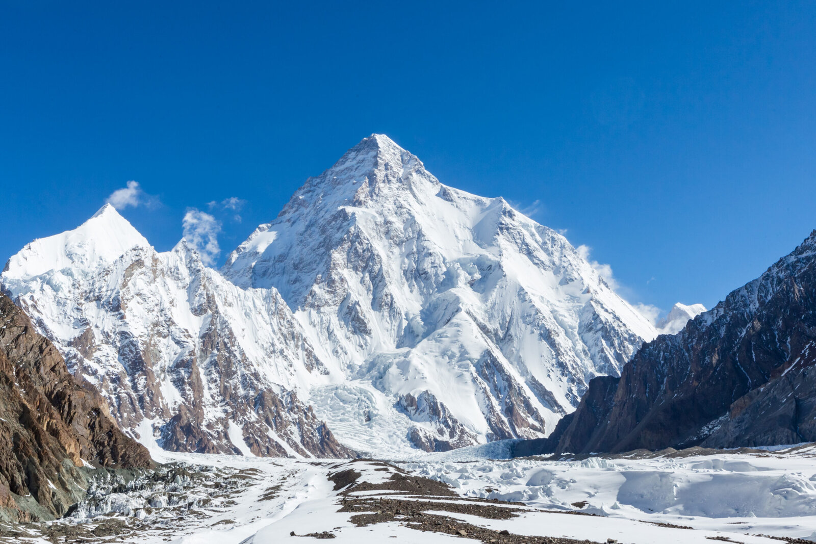
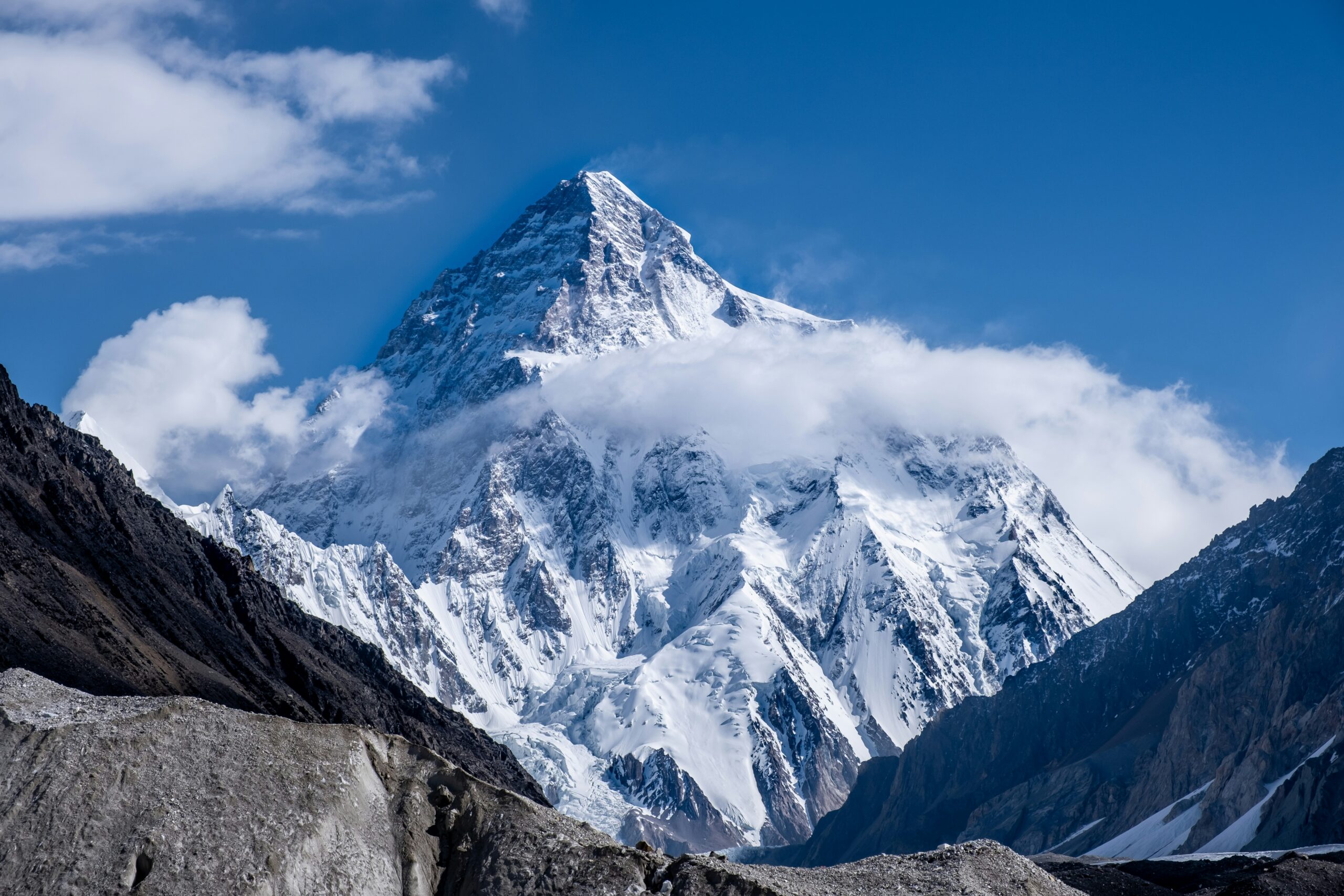
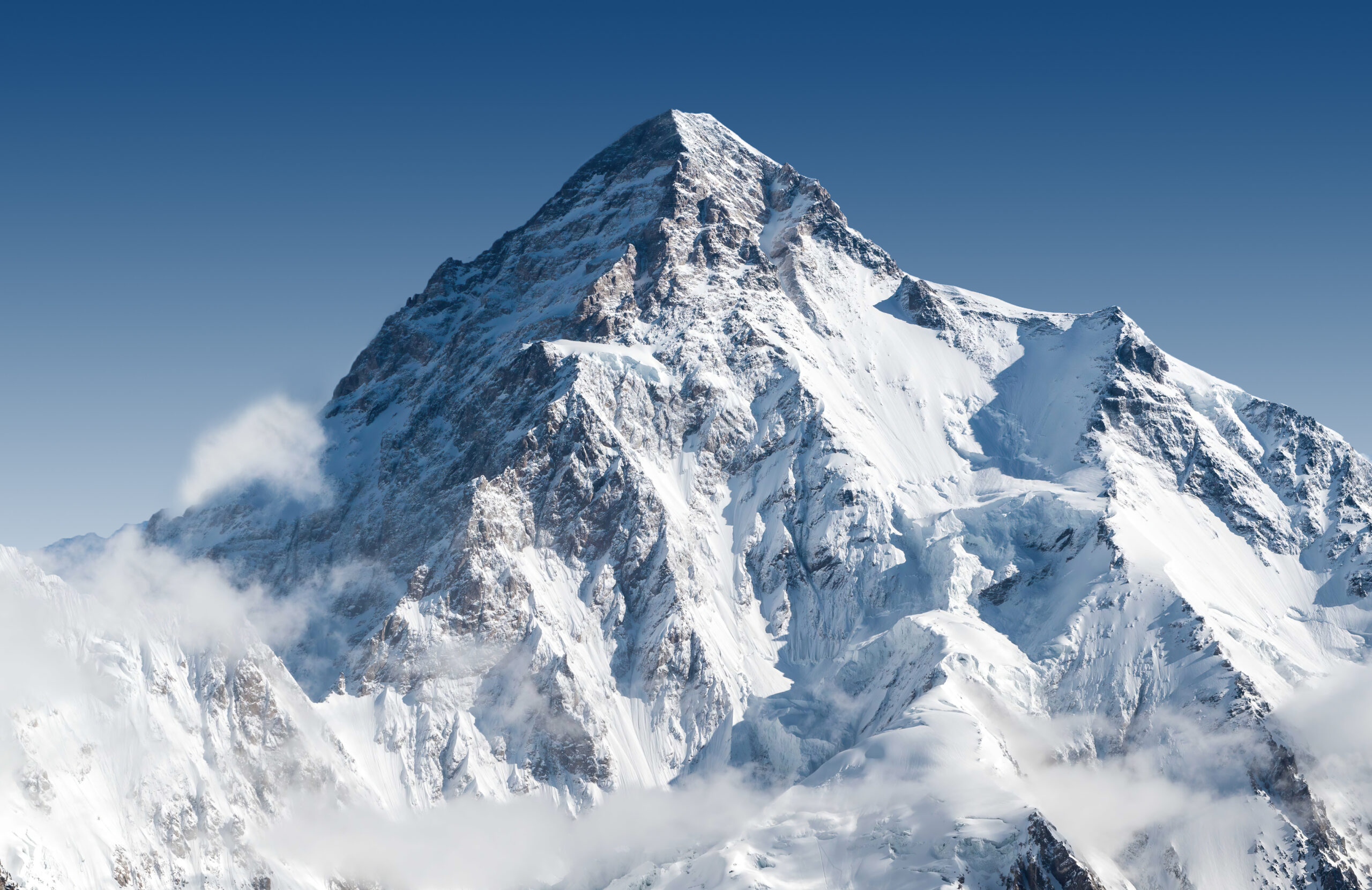
K2 is the second-highest mountain on Earth at 8,611 meters and is widely considered the hardest of the 14 eight-thousanders. The mountain sits at the head of the Baltoro Glacier in the Karakoram range on the Pakistan-China border. Unlike Everest, K2 has no commercial trade route in any meaningful sense — even the standard Abruzzi Spur is graded TD (very difficult) and requires elite-level mountaineering. This guide breaks down every documented K2 climbing route: the Abruzzi Spur normal route, the Cesen alternative, the rarely-climbed North Ridge from China, and the technical lines that have seen only a handful of ascents in mountain history. For the full climbing logistics see our complete K2 climb guide and our K2 route comparison.
Why K2 routes matter more than on most peaks
On most mountains, the route choice is a stylistic preference — easier route for commercial expeditions, harder route for personal-style climbers. On K2, the route choice is closer to a life-or-death decision. The Abruzzi Spur, despite being called “the standard route,” is more technical and dangerous than almost any standard route on any other eight-thousander. The other K2 routes range from “even more dangerous” to “almost never attempted.” Understanding the routes is the first step in understanding why K2 has earned its reputation as the most dangerous of the 14 peaks above 8,000 meters.
The K2 routes reality
K2 has approximately 12 documented routes on its various faces and ridges. Of those, only two see regular ascent traffic (the Abruzzi Spur and the Cesen). Several have seen fewer than 5 ascents in the entire history of the mountain. K2 is not a mountain with a beginner route. Every line on K2 demands elite alpine skills, full 8,000-meter altitude experience, and acceptance of high objective risk. The full historical context is in our 14 eight-thousanders guide.
The standard route: the Abruzzi Spur
The Abruzzi Spur is K2’s southeast ridge and the line followed by virtually all commercial expeditions to the mountain. The route was pioneered in 1909 by Luigi Amedeo, Duke of the Abruzzi (hence the name), and was the line of the first successful ascent by the 1954 Italian expedition led by Ardito Desio. The route ascends from base camp on the Godwin-Austen Glacier through a series of established high camps before the summit push through the deadly Bottleneck.
Camp structure on the Abruzzi Spur:
- Base camp: 5,150 m on the Godwin-Austen Glacier.
- Camp 1: 6,050 m, on the lower ridge above the initial mixed climbing.
- Camp 2: 6,700 m, just above House’s Chimney — the famous rock pitch climbed by William House on the 1938 American expedition.
- Camp 3: 7,400 m, above the Black Pyramid mixed climbing section.
- Camp 4 (the Shoulder): 7,800 m, where climbers stage the summit push.
- The Bottleneck: 8,200-8,400 m, the deadly couloir below the summit serac.
- The summit: 8,611 m, after the Bottleneck and the upper snowfield.
The Abruzzi Spur is climbed using fixed ropes through the technical sections (House’s Chimney, the Black Pyramid, the Bottleneck), with most ascents now relying on rope-fixing teams that establish the route in the lower portions and dedicated guides who climb with summit clients. Despite the support infrastructure, the route is climbed only by climbers with prior 8,000-meter experience and elite-level skills.
The Abruzzi Spur danger profile
The technical climbing on the Abruzzi Spur — House’s Chimney, the Black Pyramid, the Bottleneck — would be challenging at any altitude. At 7,000-8,500 meters, with diminished oxygen and cumulative fatigue, every move on this route requires concentration that climbers struggle to maintain after multi-week expeditions. The Bottleneck alone has killed dozens of climbers from serac fall.
The alternative route: the Cesen / South-Southeast Spur
The Cesen Route, also called the South-Southeast Spur or sometimes the Basque Route, is the secondary commonly-climbed line on K2. The route joins the Abruzzi Spur near the Shoulder camp at approximately 7,800 m, sharing the summit-day terrain through the Bottleneck. Below the join, the Cesen offers a different lower-route option that some climbers consider less dangerous than the Abruzzi due to lower exposure to rockfall in certain sections.
The route’s history is unusual: it was pioneered as a partial line by Slovenian climber Tomo Česen in 1986, who soloed to approximately 8,000 m before retreating. The full route to the summit was completed by a Basque expedition in 1994. The Cesen has since become the secondary commercial route, with several modern expeditions choosing it over the Abruzzi when conditions favor that side of the mountain.
From a practical climbing perspective:
- The Cesen avoids House’s Chimney and the Black Pyramid sections of the Abruzzi, replacing them with a different technical line on the south-southeast face.
- The route joins the Abruzzi at the Shoulder, which means everyone on K2 funnels into the same Bottleneck regardless of which lower route they used.
- Modern commercial expeditions sometimes use the Cesen for ascent and Abruzzi for descent (or vice versa) depending on conditions and crowding.
- The route is graded ED1 rather than TD because of sustained technical climbing on the lower spur, though many climbers consider it less serially dangerous than the Abruzzi.
The north side route: the North Ridge from China
The K2 North Ridge climbs the mountain from the Chinese side via the Shaksgam Valley. The route was first climbed in 1982 by a Japanese expedition. Despite being technically similar in difficulty to the Abruzzi Spur, the North Ridge has seen only a small fraction of total K2 ascents because of the more complex access logistics and the political situation around Chinese-side expeditions.
The North Ridge approach requires:
- Travel into the remote Shaksgam Valley in Xinjiang, China, north of the Karakoram main divide.
- Significantly longer approach march — typically 7-10 days from the nearest road versus 4-7 days for the Pakistan-side Baltoro approach.
- Chinese mountaineering permits, which are more complex and sometimes politically restricted compared to Pakistani permits.
- Less commercial infrastructure — fewer guide services operate Chinese-side K2 expeditions.
From a climbing perspective, the North Ridge avoids the Bottleneck entirely (a meaningful safety advantage), but introduces its own challenges including longer summit-day distances and exposure to north-side weather patterns that can be more variable. Modern North Ridge ascents are typically by alpine-style expeditions with significant prior K2 experience or by national-team-style expeditions from Asian countries. The Chinese-side context for Himalaya/Karakoram peaks generally is discussed in our Everest route comparison for the broader north-side access framework.
The harder technical lines rarely climbed
Beyond the Abruzzi, Cesen, and North Ridge, K2 has been climbed by approximately 9 other documented routes, most of which have seen fewer than 5 total ascents in the history of the mountain. These are not commercial objectives — they are climbed by elite alpine teams pursuing specific style or first-ascent goals. The major harder routes:
The Magic Line is K2’s direct south pillar, climbing straight up the south face of the mountain through the most prominent rib visible from base camp. The route was the dream of the 1986 climbing season — multiple expeditions attempted it that year as the great unclimbed problem of K2 — and was finally completed by a Polish-Slovak team in August 1986. The line has seen only a handful of ascents since. The Magic Line involves sustained technical rock and mixed climbing for over 2,000 meters of vertical at extreme altitude. It is considered one of the hardest climbs in the world.
The K2 West Ridge ascends the mountain’s west side from the Savoia Glacier, climbing a long ridge feature that connects to the upper mountain near 8,000 m. The route was first climbed in 1981 by a Japanese expedition. The West Ridge sees occasional attempts but is not a regular commercial objective. Modern interest in the route has been mixed — some elite climbers view it as a logical alpine-style objective while others note its sustained technical demands at altitude make it impractical for non-elite teams.
The Polish Line is a direct south face line attempted multiple times but never confirmed as fully climbed. The route ascends the central south face of K2 directly to the summit, bypassing the south pillar (Magic Line) to the west. The 1986 Polish expedition that attempted the line lost climbers to avalanche and storm. The route remains essentially unclimbed and represents one of the great remaining problems on K2.
The Northwest Ridge ascends K2 from the Chinese side via the western flank of the North Ridge. The route was first climbed in 1990 by a Japanese expedition and has seen very few ascents since. Like the standard North Ridge, the route avoids the Bottleneck but adds significant technical climbing on the upper ridge.
Route comparison at a glance
| Route | Side | First ascent | Grade | Status |
|---|
| Abruzzi Spur | Pakistan (SE) | 1954 | TD | Standard route, ~95% of ascents |
| Cesen Route | Pakistan (SSE) | 1994 (completion) | ED1 | Secondary commercial route |
| North Ridge | China (N) | 1982 | TD+/ED1 | Rare, complex access |
| Magic Line (South Pillar) | Pakistan (S) | 1986 | ED3 | Elite alpine, very rare |
| West Ridge | Pakistan (W) | 1981 | ED1 | Rarely attempted |
| Northwest Ridge | China (NW) | 1990 | TD+ | Very rare |
| Polish Line (South Face) | Pakistan (S) | Unclimbed | ED4 | Open problem |
| Northeast Ridge | China (NE) | 1978 | ED1 | Rare |
| Various other lines | Multiple | Various | ED1-ED4 | 5 or fewer ascents each |
The Bottleneck: the crux that defines K2
Why the Bottleneck dominates K2 conversation
The Bottleneck is a narrow couloir at 8,200 to 8,400 m on the standard Abruzzi Spur route, directly beneath a hanging ice serac that periodically calves off and produces avalanches. The Bottleneck is the standard summit-day route from the Shoulder camp at 7,800 m. The serac above it has killed many climbers throughout K2’s history, including 11 climbers in the 2008 K2 disaster when a major collapse trapped a large summit-day group on the descent.
The Bottleneck is the single most dangerous section on K2’s standard route. Climbers must traverse beneath the serac in both directions — ascending to the summit and descending after — typically spending 30 to 90 minutes total in the danger zone. The serac is impossible to predict; it can collapse on calm clear days or stay stable through major storms. Modern Abruzzi Spur expeditions accept the Bottleneck as the trade-off for K2 summit success — there is no way to avoid it on the standard route.
The Bottleneck has driven significant exploration of alternative summit-day strategies:
- Earliest possible departure from the Shoulder to minimize time in the danger zone — typically 10 PM to midnight starts.
- Move quickly through the couloir — climbers train specifically for fast Bottleneck passage despite the altitude.
- Alternative summit lines — some climbers have proposed bypassing the Bottleneck via traverses to the east, though these have not become standard.
- North Ridge as the safer alternative — the route avoids the Bottleneck entirely, which is one reason it appeals to climbers who refuse the Abruzzi serac exposure.
K2 routes vs Everest routes
Climbers familiar with Everest often look for the K2 equivalent of the standard South Col or North Ridge commercial routes. The comparison helps frame why K2 is fundamentally different. The full Everest framework is in our Everest route comparison:
| Dimension | Everest standard routes | K2 Abruzzi Spur |
|---|
| Technical grade | PD/AD | TD/ED1 |
| Sustained technical climbing | Limited (Khumbu Icefall, Hillary Step) | Throughout the route |
| Fixed rope infrastructure | Extensive, professionally maintained | Partial, less developed |
| Commercial expedition support | Massive, multi-operator | Limited, fewer operators |
| Rescue infrastructure | Helicopter rescue to ~7,000 m | Limited helicopter access |
| Bottleneck-equivalent hazard | None comparable | The Bottleneck serac |
| Annual successful ascents (standard route) | 500-800 | 10-50 |
| Death rate (per climber on the mountain) | ~1% | ~25% |
| Prerequisite experience | Other 8000m peak or extensive 7000m | Multiple 8000m peaks, elite skills |
The single most important number in this comparison is the death rate. Everest is dangerous but climbed by hundreds annually with a ~1% per-climber fatality rate. K2 is fundamentally more dangerous with a ~25% per-climber fatality rate even on the standard route. This is not a small difference — it reflects K2’s combination of sustained technical climbing, the Bottleneck, the more variable Karakoram weather, and the more limited rescue infrastructure. The death-rate comparison framework is in our death rates by mountain analysis.
When K2 routes are climbed
K2’s climbing season is narrow and unpredictable. The window is essentially the summer monsoon transition period when weather windows open between Karakoram storm cycles:
| Month | Conditions | Activity |
|---|
| May | Approach march begins | Expeditions arrive at base camp |
| June | Acclimatization rotations | Camps established to ~7,000 m |
| Early July | First summit attempts possible | Watch for stable windows |
| Mid-July to early August | Peak summit window | Most summits happen here |
| Mid-August | Window typically closes | Expeditions retreat |
| September | Late attempts rare | Most years no further ascents |
| Winter | K2 winter climbing | Nepali team first winter ascent 2021 |
The narrow summer window is one reason K2 has lower annual summit numbers than Everest — even strong expeditions sometimes go a full season without a viable summit window. Winter K2 was an unclimbed objective until 2021 when an all-Nepali team led by Nirmal Purja completed the first winter ascent. Winter K2 climbing remains extreme — the combination of jet-stream winds, Karakoram cold, and short daylight hours puts it in a different category from summer ascents.
Where K2 routes fit in the broader progression
Climbers attempting K2 routes have completed years of prior progression. The standard pathway:
- First eight-thousander: Cho Oyu, Manaslu, or Dhaulagiri as the introduction to 8000m peak logistics.
- Major Himalayan peaks: Everest, Kangchenjunga, or Makalu as the altitude proving ground.
- Karakoram introduction: Gasherbrum II, Broad Peak, or Gasherbrum I as the Karakoram-specific experience builder. Most K2 aspirants climb at least one of these first.
- K2 attempt: typically after 3-5 prior eight-thousanders, with at least one Karakoram peak among them.
- Beyond K2: the remaining 14 eight-thousanders, K2 winter, K2 alternative routes for elite climbers.
The reason for this long progression is that K2 punishes any gap in alpine skill, altitude tolerance, or expedition experience. Climbers who attempt K2 without the Karakoram-specific preparation often turn around at the lower camps when the technical climbing reveals itself to be harder than they expected. The full eight-thousander progression context is in our 14 Eight-Thousanders collection.
Cost by route honest numbers
| Route | Typical guided cost | Self-supported cost | Notes |
|---|
| Abruzzi Spur (commercial) | $40,000 – $80,000 | $15,000 – $25,000 | Multiple operators available |
| Cesen Route (commercial) | $45,000 – $90,000 | $15,000 – $25,000 | Fewer operators |
| North Ridge (Chinese side) | $70,000 – $130,000 | $30,000 – $50,000 | Limited operators, complex permits |
| Magic Line / South Face | Not commercially offered | $25,000 – $50,000 | Elite expeditions only |
| Permit fee (Pakistan, peak season) | $7,500-12,000 per climber | $7,500-12,000 per climber | Royalty plus base camp fees |
| Permit fee (China, peak season) | $15,000-25,000 per climber | $15,000-25,000 per climber | Higher than Pakistani side |
The total cost for a guided K2 attempt typically lands in the $50,000-$90,000 range, comparable to the higher end of Everest pricing. K2 commercial operators are fewer in number than Everest operators, with major names including Seven Summit Treks (Nepal), Madison Mountaineering, Furtenbach, and a small number of Pakistani-based operators. The economics of K2 climbing are challenging for operators — small client numbers, high failure rates, and high risk make K2 expeditions a niche business compared to the larger commercial Everest market.
★ K2 Master Resources
The complete K2 climbing framework
Route details, climbing logistics, expedition costs, and historical context — everything you need to understand K2 ascents.
K2 climb guide →The bottom line on K2 climbing routes
K2 has approximately a dozen documented climbing routes, but only the Abruzzi Spur and the Cesen Route see meaningful regular ascent traffic. The Abruzzi Spur is the standard normal route used by almost all commercial expeditions, graded TD with sustained technical climbing on rock, ice, and mixed terrain at extreme altitude. The Cesen Route offers an alternative lower-route line that joins the Abruzzi near the Shoulder camp. The North Ridge from China offers the only major non-Pakistan-side option but sees few ascents due to complex access. The harder lines — Magic Line, West Ridge, Polish Line — have seen fewer than 5 ascents each and remain elite alpine objectives rather than commercial routes. Every K2 route requires elite skills, full 8,000-meter experience, and acceptance of objectively dangerous conditions including the deadly Bottleneck serac on the standard route. There is no easy way up K2. The full climbing framework is in our K2 climb guide, with the side-by-side route detail in our K2 route comparison.
Frequently asked questions
How many routes are there on K2?
K2 has approximately a dozen documented climbing routes, though only two are climbed with any regularity in modern commercial expeditions. The standard route is the Abruzzi Spur on the southeast ridge from the Pakistan side, which accounts for the overwhelming majority of all K2 ascents. The Cesen Route (also called the South-Southeast Spur or Basque Route) is the secondary commonly-climbed line. Other documented routes include the North Ridge from China, the Magic Line on the South Pillar, the West Ridge, the Polish Line on the South Face, and several rarely-attempted technical lines that have seen only a handful of ascents in the history of the mountain.
What is the standard route on K2?
The Abruzzi Spur is the standard normal route on K2 and the line followed by virtually all commercial expeditions. The route ascends the southeast ridge of the mountain from a base camp on the Godwin-Austen Glacier in Pakistan, passing through four established high camps before the summit push through the Bottleneck and across the dangerous serac traverse below the summit. The Abruzzi Spur is rated technically difficult (TD on the alpine grading scale) with sustained class 4 and class 5 climbing on rock, ice, and mixed terrain at extreme altitude. It is not an easy route in any sense — it is simply the easiest line on K2.
What is the K2 Abruzzi route?
The Abruzzi route, or Abruzzi Spur, is the southeast ridge of K2 and the standard climbing route. The line was pioneered by an Italian expedition led by Luigi Amedeo, Duke of the Abruzzi, in 1909 and was the line of the first ascent in 1954. The route ascends from base camp at 5,150 meters through House’s Chimney (a famous rock pitch around 6,700 m), the Black Pyramid (a technical mixed climbing section around 7,000 m), the Shoulder camp at approximately 7,800 m, and the Bottleneck below the summit serac at 8,300 m. The Bottleneck is widely considered the most dangerous section of the route due to constant serac fall risk.
What is the K2 Bottleneck?
The Bottleneck is a narrow couloir at approximately 8,200 to 8,400 meters on K2’s Abruzzi Spur route, directly beneath a hanging ice serac that periodically calves off and produces avalanches that have killed many climbers. The Bottleneck is the standard summit-day route from the Shoulder camp and is approximately 100 to 150 meters tall, climbed at a slope of 50 to 60 degrees on hard ice and snow. The 2008 K2 disaster killed 11 climbers when a serac collapse trapped a large summit-day group. The Bottleneck remains the single most dangerous section on K2’s standard route and is the leading cause of K2 fatalities.
Can you climb K2 from the China side?
Yes, K2 can be climbed from the China (Tibet) side via the North Ridge route, but it is rarely done in modern times. The Chinese side requires more complex permit logistics and a longer approach across the Shaksgam Valley, and the political situation has at times limited or closed access for foreign climbers. Historically only a small fraction of K2 ascents have come from the Chinese side. The standard commercial climbing of K2 happens from Pakistan via the Abruzzi Spur. Climbers wanting the China side typically need expedition-level commitment, advanced permits, and acceptance that the route sees almost no commercial support.
What is the easiest route on K2?
The Abruzzi Spur is the easiest route on K2 in relative terms, but this is misleading — there is no easy route on K2. Even the Abruzzi Spur is rated TD (very difficult) on the alpine grading scale, involves sustained technical climbing on rock and ice at extreme altitude, and traverses the deadly Bottleneck couloir below the summit serac. K2 has a historical death rate of approximately 1 in 4 climbers on the standard route. Any K2 ascent requires multi-week expedition logistics, full 8000-meter altitude experience, and elite-level mountaineering skills. The mountain is widely considered the hardest of the 14 eight-thousanders.
How dangerous is K2 compared to Everest?
K2 is dramatically more dangerous than Mount Everest by per-climber death rate. Approximately 1 in 4 climbers who summit K2 die on the mountain (counting deaths on the descent), while Everest’s death rate is closer to 1 in 100. Everest has more total deaths because of the much larger volume of climbers, but the per-climber risk is far higher on K2. The reasons include K2’s much steeper terrain, the deadly Bottleneck serac, more technical climbing throughout, less commercial support and fewer rescue resources, and more unpredictable Karakoram weather compared to the Himalaya. K2 is widely considered the most dangerous of the eight-thousanders.
Thanks for your feedback!