web analytics

Tag: cho oyu

  • Cho Oyu Expedition Update 2026: The Easiest 8000er – When Tibet Is Open

    Cho Oyu, the Turquoise Goddess, rising in gentle snow slopes on the Nepal-Tibet border
    8,188 m (26,864 ft) · Nepal-Tibet border · Sixth-highest on Earth

    Cho Oyu: the easiest 8000er, when Tibet is open

    The Turquoise Goddess is the most accessible and safest of the fourteen 8,000-metre peaks, and the classic first 8000er by the gentle Northwest Ridge from Tibet. But its whole appeal rests on Chinese access, which has closed for most recent seasons. This update covers the route, the access problem, the emerging Nepal side, and an honest readiness view. Heights in metres (feet).

    Research-based updateSafety and medical reviewReviewed each Himalayan seasonOur team has not climbed Cho Oyu

    Updated 27 July 2026 · Compiled by Travis Ludlow · Safety review by Dawson Ludlow · Medical review by Taylor Ludlow, RN

    8,188 mSummit (26,864 ft)
    6thHighest on Earth
    ~1.3%Fatality – lowest 8000er
    NW RidgeStandard route (Tibet)
    Apr-May / Sep-OctSeasons
    1954First ascent, no oxygen

    Single-mountain expedition update, compiled from China Tibet Mountaineering Association access reporting, operator route and pricing information, and published expedition records. Our team has not climbed Cho Oyu; the only first-hand summit anyone on our team claims is Kilimanjaro. This is a planning briefing for experienced climbers, not a how-to and not a substitute for training or a guide.

    The most forgiving 8000er – if you can get to it.

    Cho Oyu earns its reputation: a drive-to base camp, gentle snow slopes, one fixed-roped serac band, the lowest fatality rate of the 8000ers, and the highest success rates in open seasons. It is the classic first 8,000-metre peak and a common step toward Everest. The catch is access. It is climbed almost entirely from Tibet, and China has closed that side to foreign teams for most seasons since the pandemic.

    • Standard route: Northwest Ridge, from Tibet.
    • Safest 8000er: fatality around 1.3 percent.
    • Success: 50 to 90 percent in open seasons.
    • The catch: Tibet access, closed most recent springs.
    • First climbed 1954, without supplemental oxygen.
    The mountain

    What Cho Oyu involves

    The gentlest 8,000-metre climb there is, staged from a road-head, with a single technical obstacle and one large caveat.

    Cho Oyu, the Turquoise Goddess, is the sixth-highest mountain on Earth at 8,188 m, standing on the Nepal-Tibet border about 20 km west of Everest. Its normal route, the Northwest Ridge from the Tibetan side, is the most accessible way up any 8000er: a vehicle reaches Chinese base camp near 4,900 m, advanced base sits at about 5,650 m, and above that the climb is mostly gentle snow near 30 degrees. The one real obstacle is a fixed-roped serac and ice-cliff band near 6,600 m.

    That gentleness, and the lowest fatality rate of the fourteen 8000ers, make Cho Oyu the classic first 8,000-metre peak and a common rehearsal for Everest. But the word easy is relative. This is still a death-zone climb of 30 to 40 days, in temperatures of -15 to -30 C, where the gentle slopes hide real objective danger and people still die. And the whole proposition depends on Chinese access to Tibet, which is where the current story lies. For the full route, permit, and cost detail, see our Cho Oyu climb guide.

    The current story

    The Tibet access problem

    Cho Oyu’s reputation as the easy 8000er assumes you can reach the easy side. Lately, often, you cannot.

    Almost every commercial Cho Oyu ascent uses the Northwest Ridge from Tibet, which means a permit from the China Tibet Mountaineering Association. Since the pandemic, China has kept the Tibetan side closed to foreign commercial expeditions for most seasons, with occasional exceptions such as spring 2023. Spring 2025 was formally closed, along with neighbouring Shishapangma. Autumn has more often opened than spring, but the decision is made by Chinese authorities and can change from one season to the next.

    The closures have two practical effects. First, climbers pursuing the fourteen 8000ers, or a first 8000er, increasingly pivot to Manaslu in Nepal as the accessible alternative. Second, Nepali teams have worked since 2022 to open a commercial route on the Nepal side of Cho Oyu, and a few expeditions have fixed ropes and summited that way. That Nepal-side line is far harder than the Tibetan trade route and is not yet an established commercial option. The single most important planning question for Cho Oyu is therefore not when, but whether: confirm current access with your operator before committing.

    Verify access first

    Do not book flights or gear around Cho Oyu until an operator confirms Tibet access for your specific season. Build in a backup objective, and understand the cost consequences if China closes the peak late.
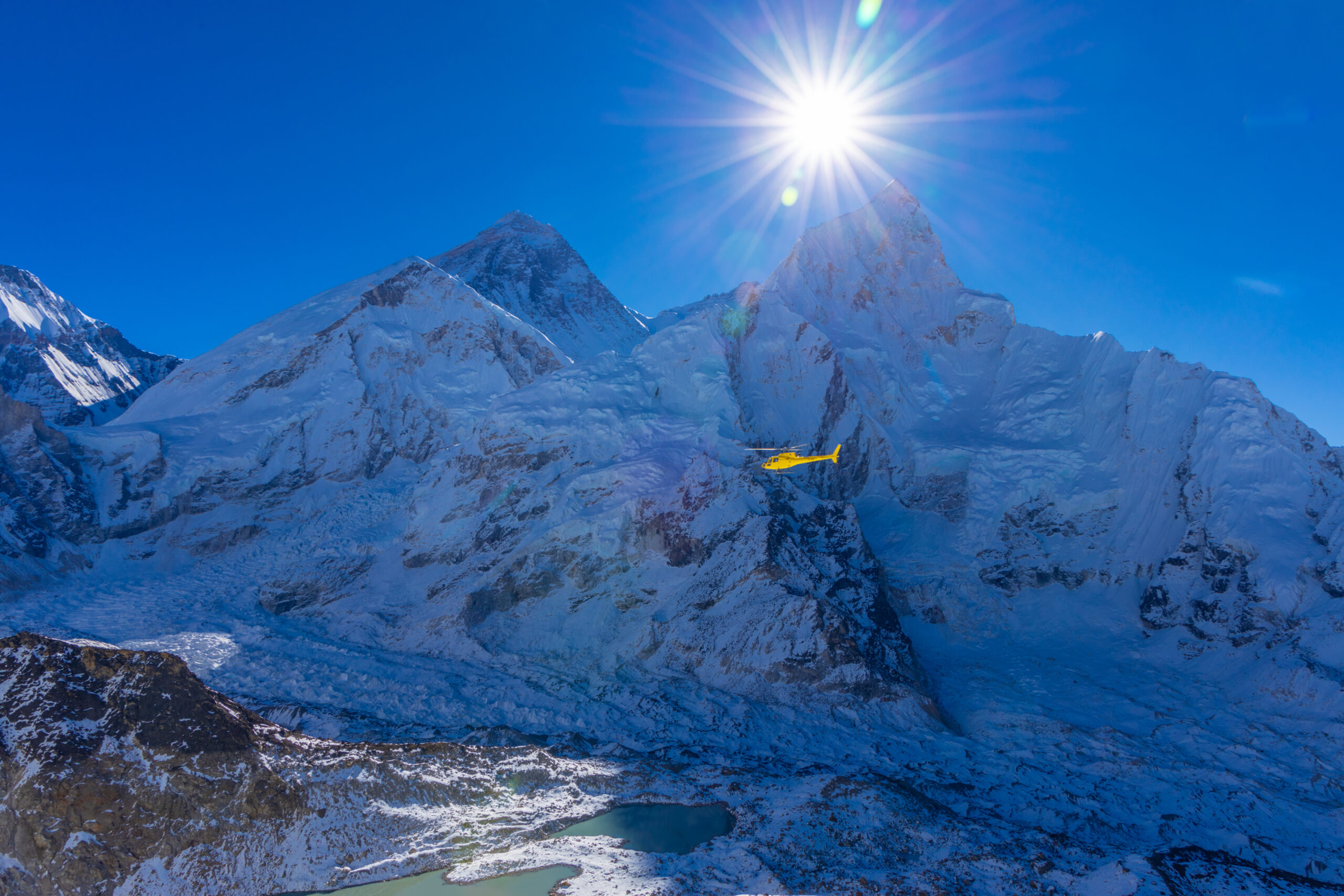
    A helicopter above a high Himalayan glacier, a reminder that rescue is remote

    Gentle is not the same as safe

    Cho Oyu is the safest 8000er by the numbers, but the numbers still record deaths. A serac band that has killed climbers, heavy snow loading after storms, and the simple arithmetic of the death zone all remain. The easy reputation is exactly what makes it easy to push too far.

    Honest self-assessment

    Are you ready for Cho Oyu?

    It is the most forgiving 8000er, not a beginner’s mountain. These are the prerequisites operators expect.

    Altitude record

    Proven Above 6,000 m

    Operators expect prior high-altitude experience. Cho Oyu is a first 8000er, not a first big mountain, and the death zone is unforgiving of gaps.

    Evidence: a solid 6,000 m-plus record.
    Fixed-rope skill

    Up And Down, Alone

    You must move confidently up and down fixed ropes and manage yourself between camps. The route is roped, but no one climbs it for you.

    Evidence: efficient ascender and rappel work.
    Self-sufficiency

    Care For Yourself High

    Eat, drink, manage oxygen, and solve small problems at 7,000 m and above. Guides cannot do everything for a hypoxic client.

    Evidence: prior self-reliance at altitude.
    Access realism

    Plan For Closures

    The single biggest variable is whether Tibet is open. Build flexibility, and a backup objective, into the plan from the start.

    Evidence: a plan that survives a closure.
    RequirementBaselineWhy it matters
    Altitude experiencePrior success above 6,000 mThe death zone punishes anyone who has not tested it lower first.
    Fixed-rope competenceFluent ascender and rappel workThe route is fixed but demands reliable movement while hypoxic.
    Self-careIndependent between campsGuides support, but cannot perform every task for a hypoxic client.
    FitnessStrong for a 30 to 40 day tripThe expedition is long, cold, and cumulative even on gentle ground.
    Access flexibilityA plan that survives a closureTibet access can vanish for a season; a backup protects the trip.
    Turnaround disciplineWilling to descendAn easy reputation makes it easy to push too far in bad conditions.

    If you are building toward this as a first 8000er, our what to climb before Everest progression puts Cho Oyu in context, and the acclimatization guide prepares your body for the death zone.

    The two sides

    The Tibetan trade route and the Nepal side

    One mountain, two very different climbs, separated by a border and a wide gap in difficulty.

    The trade route

    Northwest Ridge – from Tibet

    The normal route and the reason for Cho Oyu’s reputation. A drive-to base camp, an advanced base at 5,650 m, and mostly gentle snow slopes near 30 degrees, with one fixed-roped serac band near 6,600 m as the only technical obstacle. It depends entirely on Chinese access to the Tibetan side.

    • Gentle snow, around 30 degrees
    • One fixed-roped serac and ice-cliff band
    • Drive-to base camp on the Tibetan side
    • Needs Tibet open; closed most recent springs
    Best fit: a first 8000er for experienced high-altitude climbers.
    The hard alternative

    The Nepal Side

    A very different mountain. The Nepal side is technical, rarely climbed, and success is uncommon. Because Tibet keeps closing, Nepali teams have worked since 2022 to fix a commercial route from Nepal, and a few have summited that way, but it remains an expert undertaking rather than a trade route.

    • Technical and rarely climbed
    • An emerging, not established, commercial line
    • Fixed and summited by a few recent teams
    • An expert objective, not the easy 8000er
    Best fit: expert alpinists, or when Tibet is closed.
    FactorNorthwest Ridge (Tibet)The Nepal side
    CharacterGentle snow, one serac bandTechnical and sustained
    AccessDrive-to base camp; needs China openFrom Nepal; no Chinese permit needed
    DifficultyThe easiest 8000erAn expert undertaking
    StatusClosed most recent springsEmerging, not established
    Who it suitsA first 8000er, when openExpert alpinists, or when Tibet is shut

    The Cho Oyu climb guide covers the Northwest Ridge camps, permit, and gear in full.

    Route profile

    The Northwest Ridge, camp by camp

    An overview of the Tibetan trade route, from the road-head to the broad summit plateau. For the full detail, see the climb guide.

    Drive-in

    Chinese Base Camp ~4,900 m

    Reached by vehicle on the Tibetan side, a rare luxury among 8000ers.

    The real start

    Advanced Base Camp ~5,650 m

    A short walk up the moraine; the working base for the climb.

    Camp 1 ~6,400 m

    Onto The Mountain

    Above ABC the route gains the lower slopes toward the serac band.

    The one crux

    Serac Band ~6,600 m

    A fixed-roped ice cliff, the only technical obstacle on the normal route.

    Camp 2 ~7,100 m

    Gentle Snow

    Broad, moderate slopes near 30 degrees lead higher up the ridge.

    Camp 3 ~7,450 m

    Last Camp

    The high camp for the summit push in cold, thin air.

    Summit plateau

    The Broad Top

    A wide summit plateau, deceptively flat, marks the true summit at 8,188 m.

    Descent

    Reverse The Ropes

    Retrace the fixed lines; most incidents happen tired, on the way down.

    The one obstacle

    On a route this gentle, the serac and ice-cliff band near 6,600 m is the single place that demands real care. It is fixed with ropes, but timing and exposure through it are what a good team manages closely.

    How a trip runs

    A Cho Oyu expedition timeline

    A commercial Cho Oyu expedition runs about 30 to 40 days, most of it acclimatization and waiting rather than climbing.

    1

    Kathmandu and permits

    Gather in Kathmandu, complete Tibet visa and Chinese permit formalities, and check gear.

    2

    Cross into Tibet

    Travel to the Tibetan plateau and the drive-to Chinese base camp near 4,900 m.

    3

    Establish ABC

    Move up the moraine to Advanced Base Camp at about 5,650 m, the real start.

    4

    Acclimatization rotations

    Climb to Camps 1 and 2, sleep high, and descend to recover across several rounds.

    5

    Cross the serac band

    Pass the fixed-roped ice cliff near 6,600 m, the route’s one real obstacle.

    6

    Wait for a window

    Rest at base and watch the forecast for a settled summit period.

    7

    Summit push

    Move through the high camps and up the gentle plateau to the summit, then descend.

    8

    Exit to Kathmandu

    Clear the mountain and return across Tibet to Kathmandu.

    Money

    Cost and operators

    Cho Oyu is the affordable 8000er, and the most operator-rich after Everest, but tier choice matters more here than route choice.

    ComponentFigureNote
    Operator fee~$20,000-$45,000Premium Western to budget Nepali; the tier affects success rate.
    All-in trip cost~$35,000-$65,000Adds travel, insurance, gear, and tips; still far below Everest.
    Chinese permit and logisticsIncluded by operatorThe CTMA permit and Tibet logistics are handled by the operator.
    InsuranceOften $90,000+ cover requiredHigh-altitude rescue and evacuation cover is mandatory.
    DurationAbout 30 to 40 daysA full expedition, long even on relatively gentle terrain.

    Compare the field, tier by tier, in our Cho Oyu operators comparison, and see how the numbers are built in summit success rates.

    Choosing a team

    Choosing a Cho Oyu operator

    On Cho Oyu the operator tier affects success more than the route does. These are the questions that separate them.

    Access status

    Tibet, Confirmed

    The first question: is the operator confident of Tibet access for your season?

    Backup plan

    If It Closes

    Ask what happens, and what it costs, if China closes the peak late.

    Sherpa ratio

    Support Up High

    Clarify the climbing-Sherpa ratio and oxygen plan for the summit push.

    Success definition

    How They Count

    Ask which seasons and clients are in their quoted success rate.

    Serac management

    The One Hazard

    How the team manages timing and exposure through the serac band.

    Screening

    Right Experience

    A serious operator checks your altitude record before accepting you.

    How to choose an expedition operator covers the vetting in full, and the Cho Oyu operators comparison ranks the field.
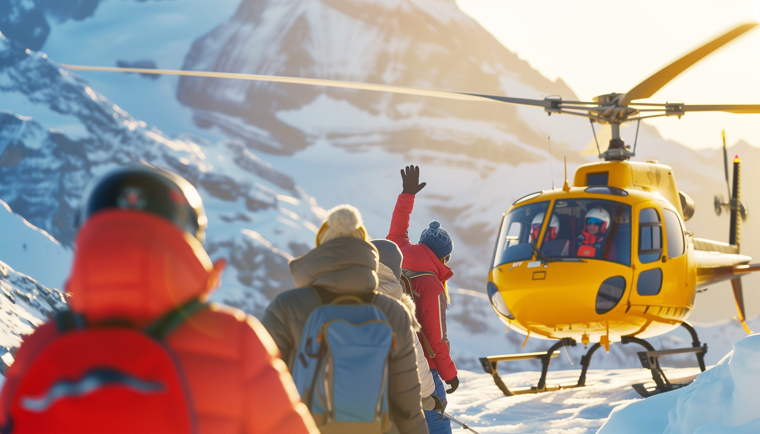
    A rescue helicopter against a cold high-altitude sky

    The safest 8000er is still an 8000er

    A low fatality rate is a statistic, not a guarantee. Above 7,000 m the margins are thin, rescue is slow and weather-bound, and the descent, tired and hypoxic, is when most incidents happen. Treat Cho Oyu with the respect any death-zone peak demands.

    The numbers

    Safety and success, honestly

    Cho Oyu’s figures are the friendliest of the 8000ers, but only when you read what is inside them.

    StatisticWhat it measuresHow to use it
    ~1.3% fatalityLowest of the 8000ersThe safest 8000er, but not a safe mountain.
    50-90% success (open)In good seasonsAmong the highest 8000er success rates when Tibet is open.
    ~35% headlineIncludes closed seasonsLong-run figures fold in the permit closures; read the denominator.
    The serac bandThe recurring killerGentle slopes, but the ice cliff and post-storm snow are real hazards.

    Our summit success rates analysis explains why the headline rate is lower than what open-season operators report.

    Timing

    Season and conditions

    Cho Oyu has two seasons, but access matters more than the calendar in deciding when you can actually go.

    Spring (Apr-May)

    One Window

    Climbed when open, though Tibet has often stayed shut in recent springs.

    Autumn (Sep-Oct)

    The Classic Season

    The traditional Cho Oyu season, and more often open in recent years.

    Access

    The Real Variable

    Whether Tibet is open matters more than the month you choose.

    Cold

    -15 to -30 C

    Thin, cold air makes even routine tasks a serious effort up high.

    Storms

    Snow Loading

    Heavy precipitation raises avalanche risk on the accumulation slopes.

    Live wind and weather for Cho Oyu. Source: Windy.com. For how to read a mountain forecast, see our weather guide.
    Cho Oyu, on the Nepal-Tibet border about 20 km west of Everest. Map: OpenStreetMap contributors.
    History

    A short history of Cho Oyu

    From a lightweight 1954 first ascent to the most-climbed 8000er after Everest.

    Cho Oyu was first climbed on 19 October 1954 by Herbert Tichy, Sepp Joechler, and Pasang Dawa Lama, on a small, lightweight Austrian expedition and without supplemental oxygen. It was one of the earliest 8,000-metre summits, and unusual for its style at a time when the great peaks were being climbed by large siege expeditions. That lightweight ascent set the tone for a mountain that would become known for accessibility rather than extremity.

    Since then Cho Oyu has become the most-climbed 8000er after Everest, with thousands of ascents, most by the Tibetan Northwest Ridge in autumn. Its role as the standard first 8000er is well established, which is why the recent Chinese access closures matter so much: they have disrupted the single most common on-ramp to 8,000-metre climbing, and pushed both climbers and Nepali operators to look for alternatives.

    Questions

    Cho Oyu FAQ

    The questions climbers ask most about the difficulty, the access, the cost, and the season.

    How high is Cho Oyu, and where is it?

    Cho Oyu is 8,188 m (26,864 ft), the sixth-highest mountain on Earth. It sits on the Nepal-Tibet border about 20 km west of Everest, in the Mahalangur Himalaya. Its Tibetan name, Cho Oyu, is usually translated as Turquoise Goddess. Almost all commercial ascents climb the Northwest Ridge from the Tibetan side.

    Why is Cho Oyu called the easiest 8000er?

    Because its normal route asks less of a climber than any other 8,000-metre peak. The Northwest Ridge from Tibet is a mostly gentle snow climb of around 30 degrees, with a drive-to base camp and only one serious obstacle, a fixed-roped serac and ice-cliff band near 6,600 m. It has the lowest fatality rate of the fourteen 8000ers, around 1.3 to 1.4 percent, and the highest success rate. It is the classic first 8000er and a common step toward Everest. Easiest, though, is relative: it is still a death-zone peak.

    Is Cho Oyu open right now?

    That is the central question, and it changes. Cho Oyu is climbed almost entirely from Tibet, and China has kept the Tibetan side closed to foreign commercial expeditions for most seasons since the pandemic, with occasional exceptions such as spring 2023. Spring 2025 was formally closed. Autumn seasons have sometimes opened. Because access is set by the China Tibet Mountaineering Association and can change season to season, verify the current status with an operator before you plan around it.

    Can you climb Cho Oyu from Nepal?

    Yes, but it is a very different and much harder climb. The Nepal side is technical and rarely done, and success is uncommon. Because Tibet access keeps closing, Nepali teams have worked since 2022 to establish a viable commercial route from the Nepal side, and a few expeditions have fixed ropes and summited that way. For now, though, the Nepal side is an expert undertaking, not the accessible trade route that made Cho Oyu famous.

    What is the success rate on Cho Oyu?

    In open seasons with strong operators, summit rates commonly run 50 to 90 percent, among the highest of any 8000er. Headline long-run figures are lower, near 35 percent, because they fold in seasons disrupted or closed by Chinese permit decisions. Operator tier matters: premium teams report higher rates than budget ones. See our summit success rates analysis for how these numbers are built.

    How much does a Cho Oyu expedition cost?

    Operator fees in 2026 commonly run about $20,000 to $45,000, with all-in trip costs often $35,000 to $65,000 once travel, insurance, gear, and tips are included. It is far cheaper than Everest, which is part of its appeal as a first 8000er. Costs include the Chinese permit and Tibet logistics handled by the operator. A trip runs about 30 to 40 days.

    When is the season?

    Both spring (April to May) and autumn (September to October) are climbed, and autumn has long been the classic Cho Oyu season. Access, though, is the bigger variable than the calendar: in recent years the Tibetan side has more often opened in autumn than spring, but this is set by Chinese authorities and must be checked for the year you intend to climb.

    Do you need supplemental oxygen or prior experience?

    Cho Oyu is often climbed with supplemental oxygen on the commercial route, though a fit, experienced minority climb it without. It was first climbed in 1954 without oxygen. Either way, it is not a first big mountain: operators expect prior experience above 6,000 m, competence moving up and down fixed ropes, and the self-sufficiency to look after yourself between camps in the death zone.

    Is Cho Oyu actually safe?

    It is the safest of the 8000ers by fatality rate, but safe is the wrong word for any 8,000-metre peak. Its gentle slopes hide real objective danger: a serac zone that has killed climbers, and heavy snow accumulation that raises avalanche risk after storms. People die on Cho Oyu. Treat it as the most forgiving 8000er, not a guaranteed one.

    Transparency

    How we built this update

    What this page is based on, who reviewed it, and what we do not claim to know.

    Sources

    • China Tibet Mountaineering Association access decisions and current-season reporting.
    • Operator route, itinerary, and 2026 pricing information for the Northwest Ridge.
    • Published expedition records for the 1954 first ascent and Nepal-side attempts.
    • Fatality and success-rate datasets for the fourteen 8000ers.
    • Our own Cho Oyu climb guide and operators comparison for the detail.

    Review and standards

    Compiled by Travis Ludlow and reviewed for safety by Dawson Ludlow, our Climbing and Mountaineering Lead (Wilderness First Aid), whose highest first-hand summit is Kilimanjaro. Health and medical points were reviewed by Taylor Ludlow, RN. We do not fabricate summit experience, quotes, or credentials, and we say plainly when we are reporting rather than recounting.

    What we do not claim to know

    Access and conditions on Cho Oyu change, and no web page can replace a current operator confirmation and forecast. In particular:

    • Tibet access is set season by season by Chinese authorities; confirm it before planning.
    • The Nepal-side route is developing; its status and difficulty may change year to year.
    • Success and fatality figures vary by source, season, and how open seasons are counted.
    • Our team has not climbed Cho Oyu, so we report official access, records, and operator data, not personal experience.
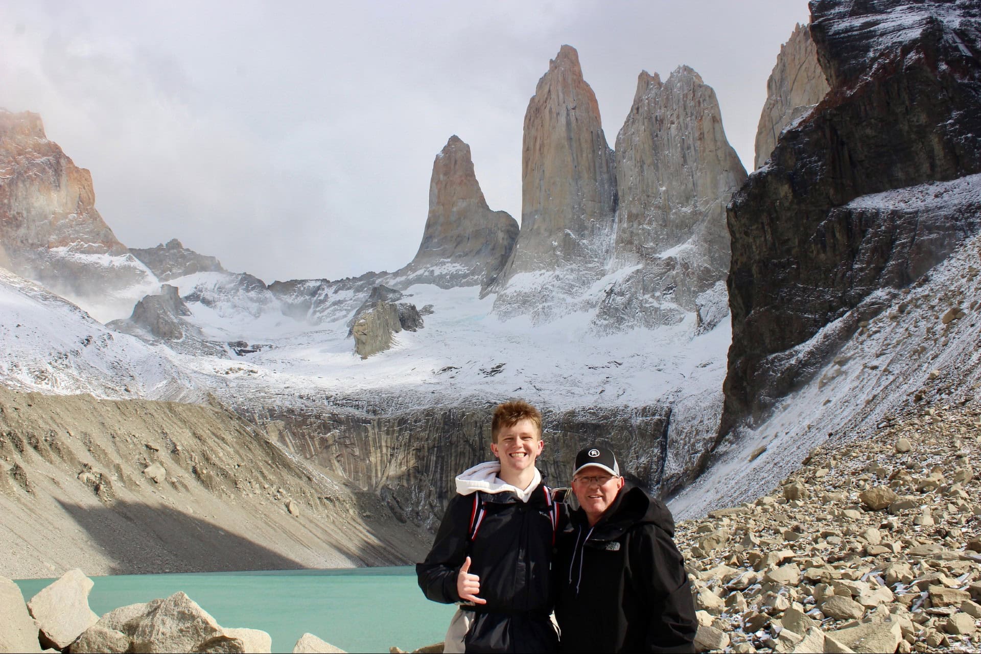
    Global Summit Guide research team

    Global Summit Guide research

    We compile mountain updates from official access decisions, operator data, and published records, review them for safety and medical accuracy, and refresh them each season. We are transparent about what we have and have not climbed, and Cho Oyu is a research-based briefing, not a personal account.

    About our team and standards ->
    Plan your first 8000er

    Confirm access first. Then build the plan.

    Start with the full route in our Cho Oyu climb guide, compare teams in the operators comparison, and weigh the alternative in the Manaslu guide in case Tibet stays shut. Expeditions gather in Kathmandu, so for flights and lodging there, browse travel on Expedia.

    Disclosure: the Expedia link above is a sponsored affiliate link, and we may earn a commission at no extra cost to you. It is the only affiliate link on this page; our route, access, and safety guidance is independent.

    Was this helpful?

    Yes
    No
    Thanks for your feedback!
  • Autumn Himalaya 2026 Preview: The Season, Peaks & Permits

    Ama Dablam, the iconic technical peak of the autumn Himalaya climbing season
    Climbing News · Season Preview · Autumn 2026

    Autumn Himalaya 2026 Preview: The Season, Peaks & Permits

    As the Karakoram season winds down, the Himalaya’s second act is coming into view. Post-monsoon autumn brings stable skies, quieter mountains, and a very different cast of peaks — Manaslu, Cho Oyu, Dhaulagiri, and the technical jewel Ama Dablam. Here’s what the autumn 2026 season looks like and how to plan for it.

    The season, in brief

    Post-monsoon Sept–Nov: Manaslu leads the 8000ers, Ama Dablam owns the technical scene.

    Autumn is Nepal’s second major season. The monsoon clears in late September, October delivers the most stable weather, and November turns cold and clear. Manaslu (8,163 m) is the autumn 8,000er of choice — now the season’s most popular expedition and a common Everest warm-up — while Ama Dablam (6,812 m) is the iconic November technical peak.

    Cho Oyu and Dhaulagiri round out the 8,000m options. Permits vary sharply by peak and a licensed guide is mandatory in Nepal — the full fee-by-peak detail is in our permits & fees guide.

    Sep–NovAutumn season
    8,163 mManaslu (lead 8000er)
    6,812 mAma Dablam (technical)
    OctoberMost stable weather
    2ndOf Nepal’s two seasons

    Autumn 2026 Season Snapshot

    As of Jul 17, 2026 · forward-looking · confirm permits before booking
    Lead 8000er

    Manaslu most popular; Everest prep

    Technical classic

    Ama Dablam November prime window

    Also in season

    Cho Oyu · Dhaulagiri serious 8000m options

    Rule

    Guide mandatory in Nepal since Apr 2023

    When the season runs

    Post-monsoon — the mirror image of spring.

    The autumn season opens as the summer monsoon retreats, usually in late September, and runs through November. October is the sweet spot: the air is washed clean, skies are stable, and the peaks are in good condition. By November the weather stays clear but turns colder with shorter days — perfect for technical peaks like Ama Dablam, tougher for the big 8,000ers as winter approaches. It’s Nepal’s second climbing season, and for several peaks it’s the best one.

    The peaks in play

    A different cast from the spring Everest circus.

    PeakHeightAutumn role
    Manaslu8,163 m (8th)The season’s headline 8,000er — most popular autumn expedition, common Everest prep
    Cho Oyu8,188 m (6th)Traditional autumn 8,000er, mostly from the Tibet side (access can vary year to year)
    Dhaulagiri8,167 m (7th)Serious, quieter, avalanche-exposed — a step up in commitment
    Ama Dablam6,812 mThe technical jewel — “the Matterhorn of the Himalaya,” prime in November

    Autumn Everest and Lhotse attempts do happen but are rare next to the spring season, when most of the commercial machine operates. If spring is about Everest, autumn is about Manaslu and Ama Dablam. See where these peaks rank in our 8,000ers ranked by difficulty and the full 14 eight-thousanders guide.

    Mount Manaslu, the 8,163 m eighth-highest peak and the headline 8000er of the autumn season
    The autumn 8,000er. Manaslu (8,163 m) has become the most popular autumn expedition peak, widely used as an Everest warm-up. Its accessibility relative to Everest and K2 — and an autumn permit far cheaper than Everest’s — make it the anchor of the post-monsoon season.

    Permits & costs

    Wildly different by peak — and a guide is mandatory.

    Autumn permit and cost planning is peak-specific. As a rough guide, expedition royalties run to roughly Cho Oyu ~$5,500, Manaslu ~$1,800, and Annapurna ~$3,600, with Everest at about $11,000 — all separate from guide, operator, and logistics costs. Since April 2023, Nepal has required a licensed local guide for foreign climbers, and major expedition peaks must be booked through registered operators.

    Full fee breakdown lives on the permits page. These are headline figures for orientation only. For the complete, peak-by-peak permit and fee detail — including trekking-peak permits, conservation fees, and the guide rules — see our mountaineering permits & fees guide. Confirm current rates with your operator before booking.

    What to watch in 2026

    Three storylines heading into the season.

    StorylineWhy it matters
    Manaslu crowdsAs the go-to Everest warm-up, Manaslu draws big autumn numbers — expect fixed-rope traffic and a busy Base Camp
    Cho Oyu accessCho Oyu is climbed mainly from Tibet; China-side access and permit conditions can shift year to year, so confirm early
    Ama Dablam volumeNovember’s technical classic keeps growing in popularity — book huts, permits, and guides well ahead
    This is a preview, not a live report. Published mid-July ahead of the season, this page previews what autumn 2026 is shaping up to be. Summit results, conditions, and any permit changes will firm up from September — we’ll refresh as the season opens. Always verify current permits, operator terms, and access with your operator before committing.

    Planning your autumn climb

    Book early, match the peak to your experience.

    Autumn’s popularity means the best operators, guides, and Ama Dablam permits go early — plan several months out. Match the objective honestly to your experience: Manaslu is an accessible-but-serious 8,000er and a logical Everest stepping stone; Ama Dablam is a genuine technical climb despite its lower height; Dhaulagiri is a step up in commitment and objective hazard. Whatever you choose, build the altitude and skills first.

    Planning a Nepal trip? Compare flights and lodging via the Global Summit Guide Expedia travel shop. Disclosure: affiliate link; we may earn a small commission at no extra cost to you. Permits and guides are booked directly with registered Nepali operators.

    Autumn Himalaya FAQ

    The questions people search heading into the autumn season.

    When is the autumn Himalaya season?

    Roughly September to November, after the monsoon. October brings the most stable weather; November is colder and clearer. It’s Nepal’s second major season and prime time for Manaslu and Ama Dablam.

    Which 8000ers are climbed in autumn?

    Mainly Manaslu (the headline peak), Cho Oyu, and Dhaulagiri. Autumn Everest attempts are rare compared with spring. See our 8,000ers ranked by difficulty.

    Why is Ama Dablam so popular in autumn?

    At 6,812 m it offers serious, exposed technical climbing without 8,000m altitude, with November its prime window and stable weather above the Everest trekking route. It’s the season’s iconic technical objective.

    How much do autumn permits cost?

    By peak: roughly Cho Oyu ~$5,500, Manaslu ~$1,800, Annapurna ~$3,600, Everest ~$11,000 — plus guide and logistics. Full detail in our permits & fees guide.

    Is autumn better than spring?

    Different. Spring is the main 8,000m and Everest season; autumn is more stable early, quieter, and ideal for Manaslu and Ama Dablam, but colder heading into winter.

    How we built this preview

    • The standard Himalayan season calendar (post-monsoon timing and weather patterns)
    • Nepal Department of Tourism permit structures and the April 2023 guide requirement
    • Operator reporting on autumn peak popularity and typical itineraries
    • Headline permit figures cross-checked against our permits & fees guide (detailed tables there)
    • Forward-looking preview — to be refreshed with conditions and results from September

    Last updated: July 17, 2026. Next update: season open (September 2026). A planning preview, not a live conditions report — verify permits and access with your operator.

    About the author

    Travis Ludlow · Founder & Head of Research · Research: Walker Ludlow

    Travis leads research at Global Summit Guide, tracking the world’s climbing seasons across the year. This autumn preview complements our live Karakoram summer dispatches — as one season closes, it points you toward the next.

    Read the editorial mission and team background.

    One season ends, the next begins

    As the Karakoram summer closes, the autumn Himalaya opens. Line up your peak, permit, and window now — and follow the season with us as it unfolds.

    Permits & Fees 8,000ers by Difficulty

    Was this helpful?

    Yes
    No
    Thanks for your feedback!
  • The 14 peaks: complete list of all 8,000-meter mountains

    The 14 Peaks: Complete List of All 8,000-Meter Mountains (with Heights and Locations) | Global Summit Guide
    Mountain Lists / Eight-Thousanders

    The 14 peaks: complete list of all 8,000-meter mountains

    14
    Peaks above 8,000m
    8,849 m
    Everest high point
    8,027 m
    Shishapangma low
    < 50
    Climbers completed all 14
    Part of the Eight-Thousanders series This list summary supports our comprehensive 14 Eight-Thousanders complete guide covering routes, history, difficulty, and climbing logistics for every peak. Full guide →

    The 14 peaks — also called the eight-thousanders, the 14 summits, or simply “the 8000ers” — are the mountains on Earth above 8,000 meters in elevation. All 14 are in Asia, distributed across the Himalaya and Karakoram ranges through Nepal, Tibet (China), Pakistan, and the disputed Kashmir region. Climbing all 14 is one of the rarest achievements in mountaineering, accomplished by fewer than 50 climbers in history. This is the complete list with heights, locations, first ascents, and the relative difficulty climbers use to plan their progression. For detailed route guides on individual peaks, see our complete guide to every eight-thousander.

    The 14 peaks in order of height

    1

    Mount Everest

    Location: Nepal / Tibet · Range: Mahalangur Himalaya · First ascent: May 29, 1953 by Edmund Hillary and Tenzing Norgay
    8,849 m
    29,032 ft

    The highest point on Earth and the most-climbed eight-thousander. Standard routes via the South Col (Nepal) and the North Ridge (Tibet) operate as large commercial expeditions during the spring season. See our Everest route comparison.

    2

    K2

    Location: Pakistan / China (Kashmir disputed) · Range: Karakoram · First ascent: July 31, 1954 by Achille Compagnoni and Lino Lacedelli
    8,611 m
    28,251 ft

    “The Savage Mountain.” Second-highest peak in the world but widely considered the hardest of the eight-thousanders. The Abruzzi Spur is the standard route. See our K2 climb guide and K2 route comparison.

    3

    Kangchenjunga

    Location: Nepal / India (Sikkim) · Range: Himalaya · First ascent: May 25, 1955 by George Band and Joe Brown
    8,586 m
    28,169 ft

    The “Five Treasures of the Snow.” Third-highest peak in the world. The first ascent team stopped just short of the true summit out of respect for local religious beliefs — a tradition climbers have continued for decades.

    4

    Lhotse

    Location: Nepal / Tibet · Range: Mahalangur Himalaya · First ascent: May 18, 1956 by Ernst Reiss and Fritz Luchsinger
    8,516 m
    27,940 ft

    Shares the lower portion of Everest’s South Col route — the two peaks are often climbed back-to-back by guided expeditions. See our Lhotse climb guide.

    5

    Makalu

    Location: Nepal / Tibet · Range: Mahalangur Himalaya · First ascent: May 15, 1955 by Lionel Terray and Jean Couzy
    8,485 m
    27,838 ft

    The distinctive four-sided pyramid east of Everest. Considered one of the more technically demanding eight-thousanders despite its standard route. Lower commercial traffic than the nearby Everest-Lhotse-Cho Oyu peaks. See our Makalu permits and cost guide.

    6

    Cho Oyu

    Location: Nepal / Tibet · Range: Mahalangur Himalaya · First ascent: October 19, 1954 by Herbert Tichy, Joseph Jöchler, Pasang Dawa Lama
    8,188 m
    26,864 ft

    Widely considered the easiest of the eight-thousanders and the standard “first 8000er” for climbers progressing toward Everest. The Tibetan north side is the commercial route, though Chinese-side access has varied with geopolitics. See our Cho Oyu climb guide.

    7

    Dhaulagiri I

    Location: Nepal · Range: Himalaya · First ascent: May 13, 1960 by Kurt Diemberger, Peter Diener, Nawang Dorje, Nima Dorje, Albin Schelbert, Ernst Forrer
    8,167 m
    26,795 ft

    “The White Mountain.” Famous for being the first peak ever supported by aerial deposits during a first ascent. Lower commercial popularity than the eastern Nepalese giants but a regular target for serious climbers. See our Dhaulagiri climb guide.

    8

    Manaslu

    Location: Nepal · Range: Himalaya · First ascent: May 9, 1956 by Toshio Imanishi and Gyalzen Norbu
    8,163 m
    26,781 ft

    “Mountain of the Spirit.” Has become the most popular alternative to Cho Oyu as a first eight-thousander since Chinese-side access tightened. The autumn season sees substantial commercial traffic on the standard northeast route.

    9

    Nanga Parbat

    Location: Pakistan · Range: Western Himalaya · First ascent: July 3, 1953 by Hermann Buhl (solo final push)
    8,126 m
    26,660 ft

    “The Killer Mountain.” Westernmost of the eight-thousanders and historically one of the deadliest. The Diamir face is the standard route. See our Nanga Parbat route comparison.

    10

    Annapurna I

    Location: Nepal · Range: Himalaya · First ascent: June 3, 1950 by Maurice Herzog and Louis Lachenal
    8,091 m
    26,545 ft

    The first eight-thousander ever climbed (in 1950) and the one with the highest death rate of all 14 peaks. The standard north face route is heavily exposed to serac fall. Annapurna remains feared even among elite high-altitude mountaineers.

    11

    Gasherbrum I (Hidden Peak)

    Location: Pakistan / China · Range: Karakoram · First ascent: July 5, 1958 by Andy Kauffman and Pete Schoening
    8,080 m
    26,509 ft

    The 11th eight-thousander and the highest peak in the Gasherbrum massif. Climbed via the Japanese Couloir on the southwest face. Often combined with Gasherbrum II as a Karakoram double-summit expedition.

    12

    Broad Peak

    Location: Pakistan / China · Range: Karakoram · First ascent: June 9, 1957 by Marcus Schmuck, Fritz Wintersteller, Kurt Diemberger, Hermann Buhl
    8,051 m
    26,414 ft

    Named for its expansive summit ridge. The standard west face route shares base camp with K2, allowing acclimatization climbs for K2 expeditions. Considered one of the more accessible Karakoram eight-thousanders.

    13

    Gasherbrum II

    Location: Pakistan / China · Range: Karakoram · First ascent: July 7, 1956 by Fritz Moravec, Hans Willenpart, Sepp Larch
    8,035 m
    26,362 ft

    The most-climbed Karakoram eight-thousander and considered the easiest of the four Pakistani 8000ers. Shares the Gasherbrum base camp with GI, making it a logical companion peak for stronger parties.

    14

    Shishapangma

    Location: Tibet (China) · Range: Himalaya · First ascent: May 2, 1964 by Xu Jing and Chinese team of 10
    8,027 m
    26,335 ft

    The 14th and lowest eight-thousander. The only one located entirely in Tibet (China) with no Nepal or Pakistan border. Was the last 8000m peak first-ascended due to Chinese restrictions on foreign climbers. Has a true summit and a slightly lower central summit, which has caused confusion about valid ascents.

    Key facts about the 14 peaks

    The big-picture stats

    All 14 peaks are in Asia. All 14 are in either the Himalaya or the Karakoram. The tallest is Everest at 8,849 m. The shortest is Shishapangma at 8,027 m. The difference between the tallest and shortest is just 822 m. Fewer than 50 climbers have completed all 14. The first to do so was Reinhold Messner in 1986.

    StatisticDetail
    Total number of 8000m peaks14
    TallestMount Everest (8,849 m)
    ShortestShishapangma (8,027 m)
    First climbedAnnapurna I (1950)
    Last first-ascendedShishapangma (1964)
    Highest death rateAnnapurna I
    Considered easiestCho Oyu (with current access limitations: Manaslu)
    Considered hardestK2, Annapurna I, Nanga Parbat (debated)
    First to climb all 14Reinhold Messner (1986)
    Fastest known time all 14Nirmal Purja (6 months, 6 days, 2019)
    Climbers completed all 14Fewer than 50

    Where the 14 peaks are by country

    CountryNumber of 8000ersWhich ones
    Nepal (entirely or partially)8Everest, Kangchenjunga, Lhotse, Makalu, Cho Oyu, Dhaulagiri I, Manaslu, Annapurna I
    Pakistan (entirely or partially)5K2, Nanga Parbat, Gasherbrum I, Broad Peak, Gasherbrum II
    China / Tibet (entirely or partially)9Everest, K2, Lhotse, Makalu, Cho Oyu, Shishapangma, Gasherbrum I, Broad Peak, Gasherbrum II
    India (Kangchenjunga only)1Kangchenjunga (Sikkim side)
    Entirely in one country5Nepal: Dhaulagiri, Manaslu, Annapurna; Pakistan: Nanga Parbat; Tibet: Shishapangma

    The political geography matters because climbing permits, costs, and logistics depend heavily on which country issues the permit. Nepal hosts the most accessible permit regime for foreign climbers, particularly for Everest, Lhotse, Manaslu, and Annapurna. Pakistan offers lower-cost permits for the Karakoram peaks but more complicated visa logistics. Tibet (China) periodically tightens or loosens access for foreign expeditions, with Cho Oyu and Shishapangma typically requiring more advance planning. The full Everest-region context is in our Everest route comparison, and the K2 cost framework is in our K2 climb guide.

    The 14 peaks by climbing difficulty

    The order of difficulty among the eight-thousanders is debated and depends heavily on the chosen route and season. A widely-accepted general ordering for the standard commercial routes, from most accessible to most difficult:

    TierPeakWhy
    Most accessibleCho OyuGentle glaciated slopes, well-established route
    AccessibleManasluStandard commercial route, autumn season
    AccessibleEverest (commercial)Highly resourced but altitude-driven challenge
    ModerateLhotse, Gasherbrum IISolid commercial routes, manageable technical difficulty
    Moderate to hardBroad Peak, DhaulagiriMore objective hazards, less infrastructure
    HardMakalu, Shishapangma, Gasherbrum IGreater technical and route-finding demands
    Very hardKangchenjunga, Nanga ParbatLong, complex routes; high objective danger
    HardestK2, Annapurna IExtreme technical difficulty + high death rate

    This ordering is a general framework, not a strict ranking. Individual seasons can completely change the relative difficulty — a heavy snow year on Annapurna creates much higher avalanche risk, while an unusually dry year on Cho Oyu can expose ice that adds technical difficulty. The cumulative difficulty across all 14 peaks is what makes the full completion such a rare achievement. The broader hardest-mountains context is in our 10 hardest mountains to climb and the death-rate framework is in our death rates by mountain analysis.

    Notable climbers of the 14 peaks

    The list of climbers who have completed all 14 eight-thousanders is short and historically significant:

    • Reinhold Messner (Italy, 1986) — first to complete all 14, and first to do so without supplemental oxygen.
    • Jerzy Kukuczka (Poland, 1987) — second to complete, multiple new routes and winter ascents.
    • Erhard Loretan (Switzerland, 1995) — third to complete, exclusively without supplemental oxygen.
    • Edurne Pasaban (Spain, 2010) — first woman to complete all 14 (verification debated for some ascents).
    • Gerlinde Kaltenbrunner (Austria, 2011) — first woman to complete all 14 without supplemental oxygen.
    • Nirmal “Nims” Purja (Nepal, 2019) — fastest known time, all 14 in 6 months and 6 days. Featured in the documentary “14 Peaks: Nothing Is Impossible.”
    • Kristin Harila (Norway, 2023) — broke Purja’s speed record, all 14 in 92 days.

    The 14 peaks completion list grows slowly. Of those who have attempted it, most expeditions end on the harder peaks — particularly K2, Annapurna, and Nanga Parbat. The combination of cost (potentially over $500,000 USD for a complete tour), time commitment (most completers take 7-15 years), and survival probability (multiple climbers have died on their last few peaks) keeps the achievement rare even as commercial expedition support has expanded. The framework for understanding this scale of objective is in our top 50 technical mountaineering objectives.

    The peaks that just miss the list

    Several mountains exceed 8,000 m in elevation but are not counted in the standard 14 because they are considered subsidiary summits of larger massifs rather than independent peaks. The most commonly discussed of these “near-misses”:

    • Yalung Kang (8,505 m) — western summit of Kangchenjunga.
    • Lhotse Middle (8,410 m) — middle summit of the Lhotse massif.
    • Lhotse Shar (8,383 m) — eastern summit of the Lhotse massif.
    • Kangchenjunga South (8,494 m) — south summit of Kangchenjunga.
    • Kangchenjunga Central (8,482 m) — central summit of Kangchenjunga.
    • Broad Peak Central (8,011 m) — central summit of Broad Peak.

    The line between “independent peak” and “subsidiary summit” depends on topographic prominence — the elevation a peak rises above the lowest col that connects it to a higher peak. The standard threshold for an independent eight-thousander is roughly 500 m of prominence, which excludes the subsidiary summits above. If you used a stricter prominence threshold, the list could be smaller; with a looser threshold, several subsidiary summits would qualify. The 14 peaks list reflects the most widely accepted convention.

    ★ Eight-Thousanders Master Guide

    Routes, history, and difficulty for every peak

    The complete deep guide to all 14 eight-thousanders: route comparisons, first-ascent history, climbing logistics, and the broader Himalaya and Karakoram context.

    Read the full guide →

    How climbers progress toward the eight-thousanders

    The 14 peaks are not entry-level objectives. The standard progression that climbers follow before attempting any eight-thousander typically takes 5-15 years and includes a sequence of progressively harder mountains. The general framework:

    1. Foundational glaciated peaks: Cascade volcanoes (Hood, Rainier), Mexican volcanoes (Pico de Orizaba, Iztaccíhuatl). Framework in our mountaineering for beginners guide.
    2. First 5,000-meter peak: Mount Elbrus or Cotopaxi as the introduction to high-altitude glaciated climbing.
    3. First 6,000-meter peak: Aconcagua or Denali as the next step. See our Aconcagua season guide.
    4. First 7,000-meter peak: typically Aconcagua followed by a Himalayan 7000m peak like Spantik, Khan Tengri, or Mount Manaslu’s lower trekking peaks.
    5. First 8,000-meter peak: usually Cho Oyu or Manaslu. The introduction to true Himalayan expedition climbing.
    6. Everest and beyond: the standard high-volume commercial objective, followed by individual eight-thousanders pursued one at a time based on personal goals.

    Climbers pursuing the full 14 typically have completed several eight-thousanders before formally committing to the all-14 goal. The cost framework, training timeline, and broader expedition planning context that supports this progression is in our full eight-thousanders guide, with the next-step framework in our intermediate climbing guide.

    The bottom line on the 14 peaks

    The 14 eight-thousanders represent the highest mountains on Earth and the highest tier of mountaineering objectives. All 14 are in Asia, distributed across the Himalaya and Karakoram, with Nepal hosting the largest share. The list has been climbed in its entirety by fewer than 50 people in human history, with the first complete ascent by Reinhost Messner in 1986 and the current speed record held by Kristin Harila at 92 days. For climbers building toward 8,000-meter objectives, the standard progression starts with smaller glaciated peaks, builds through 5,000 to 7,000 meter mountains, and graduates to Cho Oyu or Manaslu as the first true eight-thousander. The full route framework, expedition logistics, and historical context for each peak is in our complete eight-thousanders guide.

    Frequently asked questions

    What are the 14 peaks?

    The 14 peaks, also called the eight-thousanders or 14 summits, are the mountains on Earth above 8,000 meters (26,247 feet) in elevation. All 14 are located in the Himalaya and Karakoram ranges of Asia, distributed across Nepal, China (Tibet), Pakistan, and the disputed Kashmir region. The 14 peaks in order of height are: Mount Everest, K2, Kangchenjunga, Lhotse, Makalu, Cho Oyu, Dhaulagiri I, Manaslu, Nanga Parbat, Annapurna I, Gasherbrum I, Broad Peak, Gasherbrum II, and Shishapangma.

    How many 8000m peaks are there?

    There are exactly 14 mountains on Earth above 8,000 meters in elevation. The number is fixed because it depends on the definition of what counts as an independent peak, which is generally measured by topographic prominence. Mountains like Lhotse Middle (8,410 m) or Yalung Kang (8,505 m) exceed 8,000 m in height but are considered subsidiary summits of larger massifs (Lhotse and Kangchenjunga respectively) and are not counted in the standard list of 14.

    Who climbed all 14 eight-thousanders first?

    Reinhold Messner of Italy became the first person to climb all 14 eight-thousanders in 1986 when he summited Lhotse on October 16. Messner climbed all 14 peaks without supplemental oxygen, which remains a defining accomplishment in mountaineering history. The second person to complete the list was Jerzy Kukuczka of Poland in 1987. As of the most recent counts, fewer than 50 climbers have completed the 14 eight-thousanders. The fastest known time for completing all 14 is held by Nirmal Purja, who climbed all 14 in 6 months and 6 days in 2019.

    What is the 14th peak?

    Shishapangma at 8,027 meters (26,335 feet) is the 14th and lowest of the eight-thousanders. Located entirely in Tibet (China), Shishapangma is the only 8000-meter peak not partially in Nepal or Pakistan. It was the last 8000-meter peak to be first ascended, summited by a Chinese team led by Xu Jing in 1964. The mountain has a true main summit and a slightly lower central summit, which has caused historical confusion in determining true ascents of the peak.

    How hard are the 14 peaks to climb?

    The 14 peaks range from technically moderate to extreme depending on route and conditions. The easier eight-thousanders for guided commercial ascents include Cho Oyu, Manaslu, and the trade routes on Everest, Lhotse, and Dhaulagiri. The harder ones for technical difficulty and death rate include K2, Annapurna I, Nanga Parbat, and Kangchenjunga. Annapurna I has the highest death rate of any 8000m peak, while Everest has the largest number of total deaths due to the volume of climbers. All 14 are serious objectives that require multi-week expeditions, significant prior altitude experience, and substantial financial investment.

    Where are the 14 eight-thousanders located?

    All 14 eight-thousanders are located in two adjacent mountain systems in Asia: the Himalaya and the Karakoram. The Himalayan eight-thousanders include Everest, Kangchenjunga, Lhotse, Makalu, Cho Oyu, Dhaulagiri I, Manaslu, Nanga Parbat, Annapurna I, and Shishapangma, distributed across Nepal, Tibet (China), and the western Himalaya in Pakistan. The Karakoram eight-thousanders are K2, Gasherbrum I, Broad Peak, and Gasherbrum II, all located in northern Pakistan and the disputed Kashmir region. No 8000m peaks exist outside this region of Asia.

    How much does it cost to climb an 8000-meter peak?

    Costs for climbing 8000-meter peaks vary dramatically by mountain, country, and service level. Mount Everest from Nepal currently ranges from roughly $45,000 to $130,000 per climber depending on operator and oxygen plan. Less popular peaks like Cho Oyu, Manaslu, and the Pakistani eight-thousanders typically range from $15,000 to $40,000. Permit fees alone range from $250 (Pakistan summer season) to over $11,000 (Everest South Side). Add international flights, equipment, training, and insurance for a full expedition budget.

    Was this helpful?

    Yes
    No
    Thanks for your feedback!
Language »