Complete Altitude Sickness Guide: AMS, HAPE, HACE, Prevention & Treatment
The complete 2026 pillar guide to altitude sickness — Acute Mountain Sickness (AMS), High Altitude Pulmonary Edema (HAPE), and High Altitude Cerebral Edema (HACE). Evidence-based symptoms, prevention strategies, acetazolamide (Diamox) protocols, acclimatization schedules, the Lake Louise Score, and when to descend — drawn from Wilderness Medical Society guidelines and applied across major mountaineering objectives.
This pillar guide synthesizes evidence from authoritative altitude medicine sources including the Wilderness Medical Society (WMS) 2024 AMS/HAPE/HACE consensus guidelines, the UIAA Medical Commission recommendations, the Institute for Altitude Medicine, peer-reviewed research published in High Altitude Medicine & Biology and the New England Journal of Medicine, and the Lake Louise Score consensus papers. No affiliate partnerships influence recommendations. Medication mentions are educational reference, not prescriptions or endorsements. See full methodology and editorial standards below.
📑 On This Page
- What Is Altitude Sickness?
- Altitude Zones Explained
- The 3 Altitude Illnesses
- AMS — Acute Mountain Sickness
- HAPE — Pulmonary Edema
- HACE — Cerebral Edema
- The Lake Louise Score
- Prevention Strategies
- Acetazolamide (Diamox)
- Other Altitude Medications
- Acclimatization Protocols
- Pre-Altitude Preparation
- Acclimatization by Peak
- Common Misconceptions
- When to Descend
- The Altitude Cluster (10 Posts)
- FAQ
- Methodology + Sources
⚡ Quick Answer: Altitude Sickness Essentials
Three conditions: (1) AMS — common, mild (headache + nausea/fatigue) · (2) HAPE — life-threatening fluid in lungs · (3) HACE — life-threatening brain swelling. Risk zone: Above 2,500m for AMS; HAPE/HACE typically above 3,500m.
Prevention: Slow ascent (500m sleeping altitude per day above 3,000m), “climb high, sleep low,” hydration (3-5 L/day), carbohydrate diet, avoid alcohol. Diamox (acetazolamide) 125mg BID for at-risk ascents — gold-standard prevention drug.
Treatment: AMS — rest, hydrate, Diamox 250mg BID; descend if not improving in 24-48 hrs. HAPE/HACE — IMMEDIATE descent of 1,000m+, supplemental oxygen, dexamethasone (HACE), nifedipine (HAPE), emergency evacuation.
How This Pillar Was Built — Multi-Peak Acclimatization Experience
This pillar guide draws on personal acclimatization application across multiple high-altitude mountaineering objectives including Mount Kilimanjaro (Tanzania, 5,895m — Africa’s highest peak), Pico de Orizaba (Mexico, 5,636m — North America’s highest volcano), and Iztaccíhuatl (Mexico, 5,230m). Specifically, the practical recommendations in this guide — graduated sleeping altitude profiles, Diamox protocols, hydration targets, symptom recognition, and decision-making under altitude stress — represent what was actually applied during multi-day expeditions, not theoretical prescription.
Notably, this is a pillar post — designed to anchor the broader Altitude cluster on Global Summit Guide. Each of the major altitude topics will receive dedicated deep-dive coverage in supporting posts (see the cluster structure below). The existing AMS Altitude Sickness Risk Calculator is referenced throughout for personalized risk assessment.
⛰️ The Altitude Sickness Framework
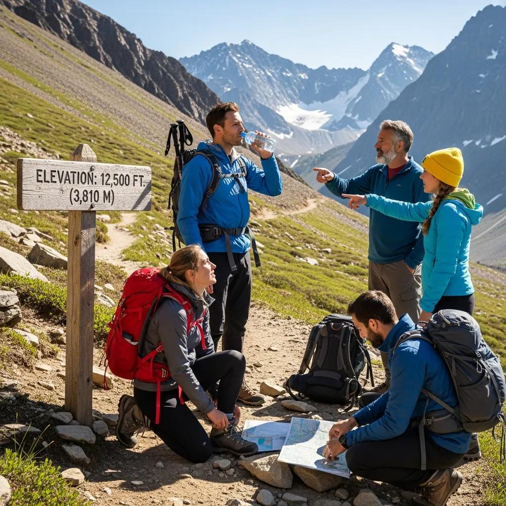
Effective altitude sickness management rests on four core principles validated across decades of mountaineering medicine research. First, graduated ascent: above 3,000m, increase sleeping altitude by no more than 500m per day with rest days every 3-4 days. This is the single most evidence-supported prevention strategy. Second, “climb high, sleep low”: daytime altitude exposure can exceed sleeping altitude and aids acclimatization, but sleep should remain at the lower altitude until ready to progress.
Third, symptom honesty: communicate symptoms openly with your team and self. The social and financial pressure to continue causes preventable deaths. Fourth, immediate descent for serious symptoms: HAPE and HACE require descent of 1,000m+ without delay; hesitation has killed many climbers. Fifth, medication when appropriate: acetazolamide (Diamox) for prevention in at-risk profiles; dexamethasone for HACE treatment; nifedipine for HAPE treatment — all with physician consultation. Notably, fitness does NOT prevent altitude sickness; preparation does.
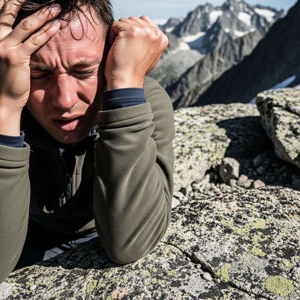
Altitude sickness is the collective term for three distinct medical conditions caused by reduced atmospheric pressure at high elevation: Acute Mountain Sickness (AMS), High Altitude Pulmonary Edema (HAPE), and High Altitude Cerebral Edema (HACE). Generally, the conditions develop because atmospheric pressure decreases with elevation — at 5,500 meters (18,000 ft), atmospheric pressure is approximately 50% of sea level, reducing the partial pressure of oxygen and triggering physiological stress responses including increased breathing rate, increased heart rate, and fluid shifts. Specifically, AMS is the common mild form affecting 25-50% of unacclimatized travelers above 2,500m and is generally self-limiting; HAPE and HACE are life-threatening conditions affecting 1-2% and 0.5-1% of climbers respectively, requiring immediate descent and medical intervention. Notably, altitude sickness affects climbers regardless of age, sex, or physical fitness — individual susceptibility varies dramatically and prior history at altitude is the best predictor of future response.
Key Takeaways
- 3 conditions: AMS (mild common), HAPE (lung emergency), HACE (brain emergency).
- Risk starts ~2,500m; significant ~3,500m; severe ~4,500m+.
- Slow ascent is the gold standard: 500m/day sleeping altitude above 3,000m.
- “Climb high, sleep low” — daytime exposure aids acclimatization.
- Acetazolamide (Diamox) 125mg BID for at-risk ascents (prevention).
- Lake Louise Score: 3+ points = AMS diagnosis.
- Headache is the cardinal AMS symptom — no headache, no AMS by definition.
- HAPE/HACE = immediate descent of 1,000m+; no delays.
- Fitness does NOT prevent altitude sickness.
- Communicate symptoms honestly — hiding symptoms kills.
📊 Altitude Sickness Quick Facts
- AMS Risk Threshold
- ~2,500m (8,200 ft)
- HAPE/HACE Threshold
- ~3,500-4,000m
- AMS Prevalence at 4,500m
- 50%+ unacclimatized
- HAPE Prevalence at 4,500m
- 1-2%
- HACE Prevalence
- 0.5-1% above 4,000m
- Diamox Dose Prevention
- 125 mg BID
- Diamox Dose Treatment
- 250 mg BID
- Dex Dose HACE
- 8mg load + 4mg q6h
- Nifedipine HAPE
- 30mg slow-release
- Safe Sleep Gain
- 500m/day above 3,000m
- Rest Day Frequency
- Every 3-4 ascending days
- Hydration Target
- 3-5 L/day
- Calorie Source
- ~70% carbs above 4,000m
- Sea Level Atmosphere
- ~760 mmHg
- At 5,500m Atmosphere
- ~50% sea level
- At 8,848m (Everest)
- ~33% sea level
- Lake Louise Cutoff
- 3+ points = AMS
- HACE Cardinal Sign
- Ataxia (loss of coordination)
- HAPE Cardinal Sign
- Dyspnea at rest
- Descent Distance
- 1,000m minimum (HAPE/HACE)
✓ Editorial Trust Signals
- First-hand: Multi-peak altitude experience
- Independent: No affiliate sponsorship
- Cross-referenced: WMS, UIAA, peer-reviewed
- Last verified: June 9, 2026
- Review cycle: Quarterly
- Safety review: Dawson Ludlow (WFA)
- Not medical advice: Educational reference
- 700+ source pages: Cross-linked
What Is Altitude Sickness?
Altitude sickness is the collective term for three distinct medical conditions caused by reduced atmospheric pressure at high elevation: Acute Mountain Sickness (AMS), High Altitude Pulmonary Edema (HAPE), and High Altitude Cerebral Edema (HACE). Generally, the conditions develop because atmospheric pressure decreases with elevation — at 5,500 meters (18,000 ft), atmospheric pressure is approximately 50% of sea level, reducing the partial pressure of oxygen and triggering physiological stress. Specifically, AMS is the common mild form affecting up to 50% of unacclimatized travelers at moderate elevations and is generally self-limiting; HAPE and HACE are life-threatening medical emergencies that require immediate descent and medical intervention.
What surprises many climbers is that altitude sickness affects everyone differently, regardless of fitness or experience. Generally, individual susceptibility varies dramatically — some climbers experience severe AMS at 3,000 meters while others tolerate 5,500+ meters without symptoms. Specifically, the best predictor of how you’ll respond at altitude is how you’ve responded before; if you’ve previously experienced AMS, you’re more likely to experience it again, and if you’ve previously climbed high without issues, you’re more likely to do so again. Notably, this individual variability is why graduated ascent and conservative acclimatization remain the gold standard despite all the medications and pre-altitude training available.
Altitude Zones Explained
Altitude medicine distinguishes four broad altitude zones based on the physiological effects and clinical risks. Generally, the zones provide a framework for understanding which preventive strategies and symptom expectations apply at each elevation. Specifically:
| Zone | Elevation | Physiological Effects | AMS Risk |
|---|---|---|---|
| Intermediate altitude | 1,500-2,500m (5,000-8,200 ft) | Mild physiologic adjustments; oxygen saturation 90-95% | Minimal (rare AMS) |
| High altitude | 2,500-3,500m (8,200-11,500 ft) | Noticeable adjustment needed; saturation 85-92% | Possible with rapid ascent |
| Very high altitude | 3,500-5,500m (11,500-18,000 ft) | Substantial adjustment; saturation 80-88%; AMS, HAPE, HACE possible | Common (25-75% AMS) |
| Extreme altitude | 5,500m+ (18,000+ ft) | Cannot fully acclimatize; physiological deterioration; “death zone” above 8,000m | Severe AMS likely without prior acclimatization |
Above approximately 8,000 meters (26,000 ft), the human body cannot acclimatize — atmospheric pressure is so low that physiological deterioration outpaces any recovery. Generally, the death zone is named for this reason. Specifically, climbers in the death zone are using up physiological reserves with every passing hour, and prolonged exposure (more than 1-2 days) leads to inevitable deterioration regardless of acclimatization history. Notably, this is why 8,000m peaks are climbed with brief summit pushes from camps below 8,000m rather than extended stays at altitude.
The 3 Altitude Illnesses
The three altitude illnesses differ dramatically in severity, mechanism, and treatment urgency. Generally, AMS is the mild common form, while HAPE and HACE are life-threatening medical emergencies. Specifically, climbers must understand all three because AMS can progress to HAPE or HACE if ignored, and the symptoms of each must be recognized for safe high-altitude travel.
AMS — Acute Mountain Sickness MILD
The common mild form — headache plus other symptoms, generally self-limiting and treatable in place.
Acute Mountain Sickness (AMS) is the most common form of altitude illness, affecting approximately 25-50% of unacclimatized travelers above 2,500m and over 75% above 4,500m. Generally, AMS is unpleasant but rarely life-threatening when properly managed. Specifically, AMS results from the body’s initial physiological response to reduced oxygen availability and typically resolves within 24-72 hours at a stable altitude.
Symptoms (require headache plus at least one other):
- Headache: Cardinal symptom — required for AMS diagnosis. Typically frontal/bitemporal, throbbing, worse with exertion or bending
- Gastrointestinal: Loss of appetite, nausea, vomiting
- Fatigue/weakness: Beyond what would be expected from exertion
- Dizziness/lightheadedness: Particularly when standing or moving quickly
- Sleep disturbance: Difficulty falling asleep, frequent waking, periodic breathing
Treatment:
- Stop ascending — do not gain altitude until symptoms resolve
- Hydrate aggressively (3-5 L/day)
- Rest and avoid alcohol
- Acetazolamide (Diamox) 250mg BID
- Ibuprofen 400-600mg for headache (not for prevention)
- Descend if symptoms persist or worsen after 24-48 hours
Use our AMS Risk Calculator to estimate your personal risk based on altitude, ascent rate, and history.

HAPE — High Altitude Pulmonary Edema EMERGENCY
Life-threatening fluid accumulation in the lungs — requires immediate descent and supplemental oxygen.
High Altitude Pulmonary Edema (HAPE) is a life-threatening medical emergency involving fluid accumulation in the lungs at altitude. Generally, HAPE affects approximately 1-2% of climbers above 3,500m with significantly higher rates during rapid ascent. Specifically, HAPE typically develops on the second or third night at altitude after an ascent. Notably, HAPE has substantial mortality without treatment but is highly responsive to descent and proper management.
Symptoms:
- Shortness of breath at rest (dyspnea at rest) — the cardinal symptom
- Persistent dry cough progressing to frothy or pink-tinged sputum in late stages
- Decreased exercise performance — climber falls behind expected pace
- Gurgling or crackling sounds in chest (audible without stethoscope in advanced cases)
- Chest tightness or congestion
- Cyanosis (bluish lips, nail beds)
- Elevated heart rate at rest
- Fatigue beyond expected from exertion
Treatment (immediate):
- IMMEDIATE descent of 1,000m or more — the definitive treatment
- Supplemental oxygen 2-4 L/min by mask
- Hyperbaric chamber (Gamow bag) if available
- Nifedipine 30mg slow-release
- Sildenafil or tadalafil (emerging evidence)
- Sit upright; do not let patient lie flat
- Keep patient warm
- Emergency medical evacuation
HACE — High Altitude Cerebral Edema CRITICAL
Life-threatening brain swelling — the deadliest altitude illness; requires immediate descent and medical evacuation.
High Altitude Cerebral Edema (HACE) is the deadliest altitude illness, involving brain swelling at high elevation. Generally, HACE affects approximately 0.5-1% of climbers above 4,000m and is the most lethal of the three altitude illnesses. Specifically, HACE typically develops as a progression from severe AMS that has been ignored — recognition of the transition is critical for survival. Notably, HACE has high mortality without immediate descent.
Symptoms:
- Ataxia (loss of coordination) — cardinal HACE sign. Heel-to-toe walking test: climber cannot walk a straight line
- Severe headache unresponsive to medication
- Confusion, irrational behavior, or altered mental status
- Hallucinations
- Drowsiness progressing to loss of consciousness
- Vomiting (often without nausea)
- Vision changes (blurry vision, double vision)
- Personality changes noticed by team members
Treatment (immediate):
- IMMEDIATE descent of 1,000m or more — the definitive treatment
- Dexamethasone 8mg loading dose then 4mg every 6 hours
- Supplemental oxygen 2-4 L/min by mask
- Hyperbaric chamber (Gamow bag) if available
- Keep patient warm and protected during descent
- Emergency medical evacuation with continued treatment
- HACE patient should never descend alone — requires assistance
The classic field test for HACE is the heel-to-toe walking test. Generally, ask the suspected HACE patient to walk in a straight line placing the heel of each foot directly in front of the toes of the opposite foot. Specifically, a normal climber can perform this test easily; a HACE patient cannot — they will sway, stumble, or be unable to maintain the line. Notably, the heel-to-toe failure is a key indicator that AMS has progressed to HACE and immediate descent is required.
The Lake Louise Score
The Lake Louise Score (LLS) is the standard diagnostic tool for AMS, originally developed at the Lake Louise consensus conference in 1991 and revised in 2018. Generally, the score provides an objective basis for diagnosing AMS and tracking symptom progression. Specifically, the revised 2018 scoring system:
| Symptom | 0 points | 1 point | 2 points | 3 points |
|---|---|---|---|---|
| Headache | None | Mild | Moderate | Severe/incapacitating |
| GI symptoms | Good appetite | Poor appetite or nausea | Moderate nausea or vomiting | Severe nausea/vomiting |
| Fatigue/weakness | Not tired/weak | Mild fatigue | Moderate fatigue | Severe fatigue, incapacitating |
| Dizziness/lightheadedness | None | Mild | Moderate | Severe, incapacitating |
Diagnosis: AMS is diagnosed when the climber has headache present (1+ points) PLUS a total score of 3+ points at elevation ≥2,500m, with recent ascent within the last 6-12 hours typical.
Climbers should self-assess the Lake Louise Score every morning and evening during high-altitude travel. Generally, scores trending upward indicate worsening AMS even if the current score is below 3. Specifically, a score increasing from 2 to 4 over 24 hours is more concerning than a stable score of 4 — the trajectory matters. Notably, communicate scores honestly with your team and guides; hiding symptoms causes preventable injuries and deaths.
Prevention Strategies
Altitude sickness prevention rests on five evidence-based strategies. Generally, these are validated through decades of mountaineering medicine research and consistently recommended by altitude medicine authorities. Specifically:
1. Slow Ascent (Gold Standard)
The single most evidence-supported prevention strategy is graduated ascent. Above 3,000m sleeping altitude:
- 500m maximum daily sleeping altitude gain
- Rest days every 3-4 ascending days
- “Climb high, sleep low” — daytime altitude can exceed sleeping altitude
- 3-4 days at 2,500-3,500m before further ascent if possible
2. Hydration
Increased respiratory water loss and diuretic response to altitude both increase fluid requirements. Generally, target 3-5 liters of water daily at altitude. Specifically, clear urine output indicates adequate hydration; concentrated urine suggests insufficient intake.
3. Carbohydrate-Heavy Diet
Carbohydrates require less oxygen to metabolize than fats or proteins. Generally, above 4,000m, aim for 70%+ of calories from carbohydrates. Specifically, this supports the increased metabolic demands at altitude.
4. Avoid Alcohol and Sleeping Medications
Both depress breathing during sleep when altitude-induced periodic breathing is already a challenge. Generally, avoid alcohol entirely the first 48 hours at any new altitude, and limit thereafter.
5. Medications (When Appropriate)
Acetazolamide (Diamox) and dexamethasone have evidence for AMS prevention in at-risk profiles. See the Diamox section below for protocols.
Acetazolamide (Diamox)
Acetazolamide (brand name Diamox) is the most evidence-supported medication for AMS prevention and a first-line treatment option. Generally, acetazolamide works by causing a metabolic acidosis that stimulates breathing, increasing oxygen delivery and accelerating acclimatization. Specifically, the standard protocols:
| Use Case | Dose | Duration |
|---|---|---|
| AMS Prevention (standard) | 125mg twice daily (BID) | Start 24 hr before reaching 3,000m; continue until 2-3 days at maximum altitude |
| AMS Prevention (higher dose) | 250mg BID | Used for very rapid ascent or high-altitude objectives |
| AMS Treatment | 250mg BID | Continue until symptoms resolve and 2-3 days after |
| HAPE/HACE adjunct | 250mg BID | In addition to primary treatments (descent, oxygen, etc.) |
Common side effects:
- Tingling in fingers/toes (paresthesia) — common, harmless
- Altered taste of carbonated drinks — common
- Increased urination (diuretic effect)
- Mild fatigue
Contraindications:
- Sulfa allergy
- Severe kidney disease
- Severe liver disease
- Pregnancy/breastfeeding (consult physician)
Some altitude medicine specialists recommend a “test dose” of acetazolamide at home 1-2 weeks before the expedition. Generally, this allows the climber to assess tolerance and identify any allergic reactions in a safe environment. Specifically, take a single 125mg dose and observe for 4-6 hours; any rash, severe reaction, or significant side effects should be discussed with a physician before using the medication on expedition. Notably, this practice is not universal but is recommended particularly for climbers with possible sulfa sensitivities.
Dedicated deep-dive coming: “Diamox (Acetazolamide) Complete Guide: Dosing, Side Effects, and Field Use.”
Other Altitude Medications
| Medication | Use | Standard Dose | Notes |
|---|---|---|---|
| Acetazolamide (Diamox) | AMS prevention/treatment | 125mg BID prevention; 250mg BID treatment | First-line for AMS |
| Dexamethasone | HACE treatment; AMS treatment | 8mg load + 4mg q6h (HACE); 4mg q6h (AMS treatment) | Steroid; rebound risk on discontinuation |
| Nifedipine | HAPE treatment and prevention | 30mg slow-release q12h | Calcium channel blocker; lowers pulmonary artery pressure |
| Sildenafil / Tadalafil | HAPE prevention/treatment (emerging) | Sildenafil 50mg q8h; Tadalafil 10mg BID | Phosphodiesterase inhibitors; growing evidence base |
| Ibuprofen | Headache symptomatic relief; possible mild AMS prevention | 400-600mg q6-8h | NOT a primary prevention drug; useful for headache |
| Ondansetron / promethazine | Nausea/vomiting symptomatic relief | Per package | Treats AMS symptoms only, not the condition |
Altitude medications support acclimatization but do not replace it. Generally, climbers should not use medications to enable faster ascent than safe acclimatization profiles allow. Specifically, the gold standard remains slow ascent with proper rest days; medications are adjuncts for at-risk profiles or specific scenarios. Notably, climbers who rely on medications to bypass acclimatization are at higher risk for HAPE and HACE which medications cannot reliably prevent.
Acclimatization Protocols
Acclimatization is the body’s adaptive response to reduced oxygen availability at altitude. Generally, the process takes 7-10 days and involves increased breathing rate (immediate), increased red blood cell production (days to weeks), and improved oxygen utilization (weeks to months). Specifically, proper acclimatization protocols allow climbers to safely reach altitudes that would cause severe illness with rapid ascent.
| Altitude Range | Acclimatization Protocol |
|---|---|
| 2,500-3,000m | 1-2 days at intermediate altitude (2,000-2,500m) recommended; 500m daily sleeping gain |
| 3,000-4,000m | 500m maximum daily sleeping gain; rest day every 3-4 days of ascent |
| 4,000-5,000m | 500m maximum daily sleeping gain; rest days more frequent; consider Diamox |
| 5,000-6,000m | 300-500m daily sleeping gain; multiple rest days; Diamox typical |
| 6,000-7,000m | Established camp rotations; multiple cycles of altitude exposure and descent |
| 7,000m+ | Cannot fully acclimatize; brief summit pushes from camps below 8,000m |
Pre-Altitude Preparation
Pre-altitude preparation can partially prepare climbers for altitude but cannot replace actual altitude exposure. Generally, the most effective preparation is time at moderate altitude before the expedition. Specifically:
Pre-Altitude Camps (Strong Evidence)
Spending 2-4 weeks at 2,500-4,000m in the months before an expedition is the most effective pre-altitude preparation. Generally, this allows substantial acclimatization that persists for several weeks. Specifically, climbers planning major altitude expeditions often spend pre-trip time in Cusco (Peru, 3,400m), Lhasa (Tibet, 3,650m), La Paz (Bolivia, 3,640m), or similar high-altitude cities.
Hypoxic Tents / Altitude Rooms (Limited Evidence)
Hypoxic tents and altitude rooms simulate altitude by reducing oxygen concentration. Generally, the evidence base is mixed and contested. Specifically, peer-reviewed studies show modest benefits at best — far less than actual altitude exposure. Notably, the typical protocol of sleeping at simulated altitude for 8 weeks before an expedition provides some adaptation but not the equivalent of 2-4 weeks at actual altitude.
Iron Stores Optimization (Supportive)
Adequate iron stores support red blood cell adaptation at altitude. Generally, climbers with low ferritin levels may experience slower acclimatization. Specifically, check ferritin 4-8 weeks before a major expedition and supplement if needed (under physician guidance).
Cardiovascular Fitness (Indirect Benefit)
While fitness does not prevent altitude sickness, it does support recovery and provide reserves for safe descent if needed. Generally, this is one indirect benefit of pre-expedition training.
Dedicated deep-dive coming: “Pre-Altitude Training: Hypoxic Tents, Altitude Camps, and What Actually Works.”
Acclimatization by Peak
Acclimatization profiles vary by peak. Generally, the major mountaineering objectives have established standard acclimatization protocols. Specifically:
| Peak | Summit Altitude | Standard Acclimatization Duration | Progression Plan |
|---|---|---|---|
| Mount Kilimanjaro | 5,895m | 5-9 days (route dependent) | Kilimanjaro Plan |
| Mount Rainier | 4,392m | 2-3 days (rapid) | Rainier Plan |
| Mount Elbrus | 5,642m | 5-7 days | Elbrus Plan |
| Mont Blanc | 4,808m | 3-5 days | Mont Blanc Plan |
| Pico de Orizaba | 5,636m | 5-7 days | Orizaba Plan |
| Aconcagua | 6,961m | 12-18 days | Aconcagua Plan |
| Denali | 6,190m | 14-21 days | Denali Plan |
| Mount Everest / 8,000m peaks | 8,000m+ | 45-60+ days | Multiple progressions |
Common Misconceptions
(1) “Fitness prevents altitude sickness” — FALSE. Multiple studies show no correlation between fitness and AMS susceptibility. (2) “Children are more vulnerable” — FALSE. Children at altitude have similar risk profiles to adults. (3) “Older adults can’t go to altitude” — FALSE. Age does not predict altitude tolerance. (4) “Pulse oximetry predicts AMS” — FALSE. SpO2 readings correlate weakly with AMS development. (5) “Diamox prevents HAPE and HACE” — PARTIALLY FALSE. Diamox prevents AMS, but HAPE/HACE require additional medications and primarily descent. (6) “Hypoxic tents fully replace altitude exposure” — FALSE. Evidence base is limited; actual altitude is far more effective. (7) “Ibuprofen prevents AMS” — MIXED. Some evidence for prevention, but not a primary strategy. (8) “You acclimatize in a few hours” — FALSE. Full acclimatization takes 7-10 days minimum. (9) “Sleeping pills help with altitude sleep issues” — DANGEROUSLY FALSE. They suppress breathing and increase AMS risk. (10) “If you don’t get AMS, you never will” — FALSE. Prior altitude success is a predictor but not a guarantee — variability exists.
When to Descend
Descend IMMEDIATELY if: (1) Any HAPE symptoms appear (dyspnea at rest, persistent cough, decreased performance). (2) Any HACE symptoms appear (ataxia, severe headache, confusion, altered consciousness). (3) AMS symptoms worsen rather than improve over 24-48 hours despite rest, hydration, and medication. (4) Lake Louise Score is increasing day-over-day despite no further ascent. (5) Any team member feels they cannot safely continue. Descent amount: 1,000 meters minimum for HAPE/HACE; to last asymptomatic altitude for AMS that doesn’t improve. The decision: When in doubt, descend. The summit will be there next year; serious altitude illness has long-term consequences. Generally, hesitation to descend has killed many climbers — social pressure, financial investment, and proximity to summit all contribute to dangerous decisions.
The Altitude Cluster — 10 Supporting Posts
This pillar post is the anchor of the Altitude cluster on Global Summit Guide. Generally, each of the major altitude topics will receive dedicated deep-dive coverage in supporting posts. Specifically, the cluster includes:
| Cluster Role | Post Title | Status |
|---|---|---|
| PILLAR | Complete Altitude Sickness Guide (this post) | Published |
| Tool (live) | AMS Altitude Sickness Risk Calculator | Live |
| Support 1 | Diamox (Acetazolamide) Complete Guide: Dosing, Side Effects, Field Use | Coming soon |
| Support 2 | AMS Symptoms Recognition: Field Diagnosis Guide | Coming soon |
| Support 3 | HAPE: Signs, Treatment, Prevention Complete Guide | Coming soon |
| Support 4 | HACE: Signs, Treatment, Prevention Complete Guide | Coming soon |
| Support 5 | Acclimatization Schedules by Peak | Coming soon |
| Support 6 | Pre-Altitude Training: Hypoxic Tents and What Actually Works | Coming soon |
| Support 7 | Lake Louise Score Explained: Self-Assessment at Altitude | Coming soon |
| Support 8 | Pulse Oximeter Use at Altitude: What Numbers Mean | Coming soon |
| Support 9 | Iron Stores and Altitude: Ferritin, Hemoglobin, Performance | Coming soon |
| Support 10 | Dexamethasone and Nifedipine: Emergency Altitude Medications | Coming soon |
Frequently Asked Questions About Altitude Sickness
What is altitude sickness?
Altitude sickness refers to three distinct medical conditions that can affect people ascending to high altitude: Acute Mountain Sickness (AMS), High Altitude Pulmonary Edema (HAPE), and High Altitude Cerebral Edema (HACE). Generally, altitude sickness begins to be a risk above 2,500 meters (8,200 feet) and increases significantly above 3,500 meters. AMS is the common mild form affecting up to 50% of unacclimatized travelers; HAPE and HACE are life-threatening medical emergencies affecting 1-2% and 0.5-1% of climbers respectively. Altitude sickness is caused by reduced atmospheric pressure decreasing oxygen availability — it is unrelated to temperature or fitness.
What are the symptoms of AMS?
AMS (Acute Mountain Sickness) symptoms include headache (the cardinal symptom required for AMS diagnosis), gastrointestinal symptoms (nausea, vomiting, loss of appetite), fatigue or weakness, dizziness or lightheadedness, and sleep disturbance. The Lake Louise Score is the standard diagnostic tool — points are assigned for each symptom and a score of 3+ indicates AMS. AMS symptoms typically appear 6-12 hours after arrival at altitude and are most pronounced in the first 24-48 hours. Headache is required — symptoms without headache are not AMS by current diagnostic criteria.
What is the difference between AMS, HAPE, and HACE?
The three altitude illnesses differ dramatically in severity. AMS (Acute Mountain Sickness) is mild and common — headache plus other symptoms, affecting 25-50% of unacclimatized travelers above 2,500m, generally self-limiting and treatable in place. HAPE (High Altitude Pulmonary Edema) is life-threatening fluid in the lungs — shortness of breath at rest, persistent cough, decreased exercise performance, affecting 1-2% above 3,500m. HACE (High Altitude Cerebral Edema) is life-threatening brain swelling — ataxia, severe headache, confusion, altered consciousness, affecting 0.5-1% above 4,000m. HAPE and HACE are medical emergencies requiring immediate descent.
How is altitude sickness treated?
Treatment depends on severity. AMS treatment: stop ascending, rest, hydrate aggressively (3-5 liters daily), consider acetazolamide (Diamox) 250mg twice daily, treat headache with ibuprofen 400-600mg, monitor for improvement. If AMS does not improve in 24-48 hours, descend. HAPE treatment: IMMEDIATE descent of 1,000m or more, supplemental oxygen, hyperbaric chamber (Gamow bag) if available, nifedipine 30mg slow-release. HACE treatment: IMMEDIATE descent of 1,000m or more, dexamethasone 8mg loading dose then 4mg every 6 hours, supplemental oxygen, hyperbaric chamber, emergency medical evacuation. Hesitation to descend has killed many climbers — when in doubt, descend.
How can altitude sickness be prevented?
Prevention rests on five evidence-based strategies. First, slow ascent — above 3,000m, increase sleeping altitude by no more than 500m per day with rest days every 3-4 days (the gold standard). Second, “climb high, sleep low” — daytime altitude exposure can exceed sleeping altitude. Third, hydrate aggressively — 3-5 liters of water daily. Fourth, acetazolamide (Diamox) 125mg twice daily starting 24 hours before reaching 3,000m for those at risk. Fifth, avoid alcohol and sleeping medications during the first 48 hours at any new altitude. Fitness does NOT prevent altitude sickness — many highly fit climbers experience severe AMS while less-fit climbers acclimatize normally.
Should I take Diamox?
Acetazolamide (Diamox) is the most evidence-supported drug for AMS prevention and the recommended choice for climbers at significant risk. The standard preventive dose is 125mg twice daily (BID) starting 24 hours before ascent above 3,000m. Acetazolamide is appropriate when: ascending above 4,500m, ascending faster than recommended rates, prior history of AMS, climbing major altitude peaks like Aconcagua or Denali. Acetazolamide has mild side effects (tingling fingers/toes, altered taste of carbonated drinks, increased urination) but is well-tolerated. Acetazolamide should be discussed with a physician before use — it is contraindicated in sulfa allergy and certain medical conditions.
What is the Lake Louise Score?
The Lake Louise Score (LLS) is the standard diagnostic tool for AMS, originally developed at the Lake Louise consensus conference in 1991 and revised in 2018. The score assigns points based on five symptoms: headache (1-3 points required), gastrointestinal symptoms (0-3), fatigue/weakness (0-3), dizziness/lightheadedness (0-3), and sleep disturbance (0-3 in revised version). A total score of 3+ points with headache present indicates AMS. The 2018 revision removed sleep disturbance from the diagnostic score because it correlated weakly with other symptoms — though sleep disturbance remains a recognized AMS symptom outside the formal diagnostic tool.
Can fitness prevent altitude sickness?
No, fitness does NOT prevent altitude sickness. Multiple peer-reviewed studies have shown no correlation between aerobic fitness and altitude sickness susceptibility — highly fit climbers experience AMS at the same rates as less-fit individuals. This is one of the most common misconceptions in mountaineering. Altitude sickness is caused by reduced atmospheric pressure and individual physiological response to hypoxia, not by physical conditioning. Fitness IS important for high-altitude climbing for other reasons: better cardiovascular reserves, improved recovery, reduced injury risk, and stronger ability to safely descend if AMS develops. But fitness does not provide AMS immunity.
At what altitude does altitude sickness start?
Altitude sickness becomes a clinical risk above 2,500 meters (8,200 feet), increases significantly above 3,500m, and becomes nearly universal above 4,500m for unacclimatized travelers. Altitude zones are: intermediate altitude (1,500-2,500m, minimal AMS risk); high altitude (2,500-3,500m, AMS risk emerges with rapid ascent); very high altitude (3,500-5,500m, AMS common, HAPE and HACE possible); extreme altitude (5,500m+, severe AMS likely without acclimatization, the “death zone” above 8,000m where physiological deterioration outpaces recovery). Individual susceptibility varies — some people experience AMS at 2,500m while others tolerate 4,000m+ without symptoms.
When should I descend from altitude?
Descend immediately if any HAPE or HACE symptoms appear — shortness of breath at rest, persistent cough with frothy sputum, ataxia (loss of coordination), severe headache unresponsive to medication, confusion or altered consciousness, decreased exercise performance, irrational behavior. Descend at least 1,000 meters or to the last altitude where you were asymptomatic. Also descend if AMS symptoms do not improve within 24-48 hours despite rest and medication, or if symptoms worsen rather than improve. Hesitation to descend has killed many climbers — the social pressure to continue, the financial investment in the expedition, and the proximity to summit all contribute to dangerous decisions. When any team member shows serious altitude illness signs, the entire team should consider descent.
Methodology & Editorial Standards
How This Pillar Was Built
1. Primary Source: Applied Altitude Experience
This pillar guide draws on personal acclimatization application across multiple high-altitude mountaineering objectives including Mount Kilimanjaro (Tanzania, 5,895m), Pico de Orizaba (Mexico, 5,636m), and Iztaccíhuatl (Mexico, 5,230m). The practical recommendations represent acclimatization profiles actually applied during expeditions, not theoretical prescription.
2. Authoritative Altitude Medicine Sources
The medical content was cross-referenced with the Wilderness Medical Society (WMS) 2024 AMS/HAPE/HACE consensus guidelines, the UIAA Medical Commission recommendations, the Institute for Altitude Medicine, peer-reviewed research published in High Altitude Medicine & Biology and the New England Journal of Medicine, and the Lake Louise Score consensus papers (1991, 2018 revision).
3. Internal Cross-Reference
This pillar is cross-referenced against Global Summit Guide’s existing AMS calculator, progression plans for major mountaineering objectives, and the Mountaineering Training Pillar covering broader high-altitude preparation.
4. Editorial Independence + Medical Disclaimer
No affiliate partnerships influence recommendations. References to medications (acetazolamide, dexamethasone, nifedipine) are educational, not prescriptions or endorsements. The article generates revenue only through Google AdSense display ads when applicable. Climbers should consult qualified physicians before using any altitude medications and before planning high-altitude expeditions.
5. Update Cycle
This pillar is reviewed quarterly. Next scheduled review: September 2026. Altitude medicine consensus guidelines and research continue to evolve; verify current best practices with the cited organizations and recent peer-reviewed literature.
Sources and References
Numbered Source References
This altitude sickness pillar synthesizes data from authoritative altitude medicine sources combined with applied field experience.
- Wilderness Medical Society (WMS) · https://www.wms.org/ — 2024 AMS/HAPE/HACE consensus guidelines.
- UIAA Medical Commission · https://www.theuiaa.org/medical/ — International mountaineering medicine recommendations.
- Institute for Altitude Medicine · https://altitudemedicine.org/ — Telluride, Colorado-based altitude medicine resource.
- High Altitude Medicine & Biology journal · Peer-reviewed altitude physiology research.
- New England Journal of Medicine · Major altitude medicine review articles.
- The Lake Louise Acute Mountain Sickness Score · 1991 original consensus and 2018 revision papers.
- CDC Yellow Book / Travelers’ Health · https://wwwnc.cdc.gov/travel/ — High altitude travel guidelines.
- British Mountaineering Council (BMC) · https://www.thebmc.co.uk/ — Altitude advice for UK climbers.
- Global Summit Guide AMS Risk Calculator · Personal risk assessment tool.
- Global Summit Guide internal research — Cross-referenced from existing progression plans and applied multi-peak altitude experience.
Methodology note. Quarterly review cycle — next review September 2026. Altitude medicine continues to evolve; verify current best practices with the cited organizations within 6-12 months of major expedition objectives.
About the Author
Use the AMS Risk Calculator
Continue Your Altitude Education
Climb Safely at Altitude
Altitude sickness is the leading medical concern for high-altitude climbers, but it is also one of the most well-understood and manageable. Generally, the science is clear: slow ascent, hydration, awareness of symptoms, and willingness to descend when needed produce safe outcomes for the vast majority of climbers. Specifically, the combination of evidence-based prevention strategies (graduated ascent, Diamox when appropriate, hydration), symptom recognition (Lake Louise Score), and decisive action when problems develop (immediate descent for HAPE/HACE) creates a reliable framework for safe altitude travel.
Calculate Your AMS Risk → Start with Kilimanjaro Plan →