
Last updated September 12, 2026
Musala: hiking the highest peak in Bulgaria and the Balkans
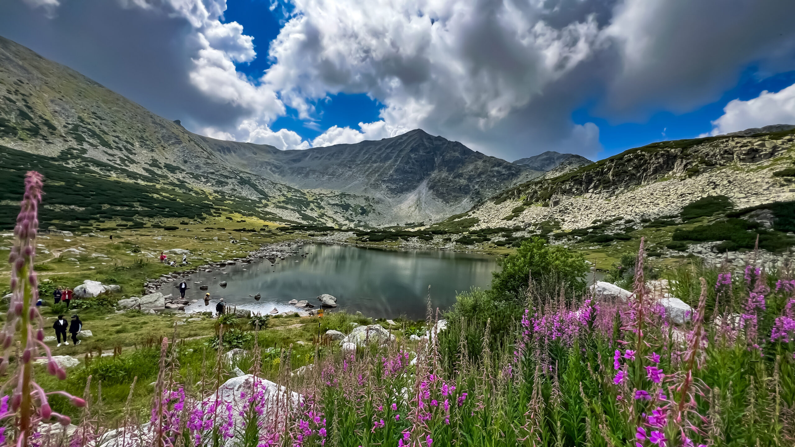
Musala rises to 2,925 m (9,596 ft) in Bulgaria’s Rila Mountains, making it the highest peak in the country, the Balkan Peninsula, and all of Southeastern Europe, the loftiest point on the continent between the Alps and the Caucasus. Unlike most great summits, it is within reach of ordinary fit hikers: a gondola from the resort town of Borovets does much of the climbing, and a well-marked trail carries walkers past mountain huts and glacial lakes to the top. This guide covers the route, the huts, summer and winter conditions, how hard it really is, and how it stacks up against Mount Whitney.
The highest point in the Balkans, and one of the most accessible.
In summer, Musala is a long but non-technical hike, not a climb. Take the Yastrebets gondola from Borovets to about 2,369 m, then follow a well-marked trail past mountain huts and glacial lakes to the 2,925 m summit. Round trip is roughly 8 to 11 hours of walking with real elevation gain, so it rewards good fitness and mountain-weather awareness, but needs no ropes or technical skill.
Winter is a different mountain. Snow, ice, wind, and avalanche terrain turn the summer walk into a serious alpine undertaking that needs proper equipment and experience. Most visitors go between June and October.
Musala at a glance
The essential facts on the roof of the Balkans.
| Elevation | 2,925 m (9,596 ft) |
| Rank | Highest peak in Bulgaria, the Rila Mountains, the Balkan Peninsula, and Southeastern Europe |
| Range | Rila Mountains, within Rila National Park (much of it UNESCO-protected) |
| Location | Bulgaria, about 70 km south of Sofia; coordinates ~42.1794 N, 23.5853 E |
| Name meaning | From Arabic via Ottoman Turkish “Musalla”, a place of prayer |
| Gateway | Borovets ski resort (1,350 m) |
| Standard approach | Yastrebets gondola to ~2,369 m, then hike past Musala Hut and the Ice Lake refuge to the summit |
| Summer difficulty | Long, strenuous, but non-technical hike on a well-marked trail |
| Winter difficulty | Serious alpine conditions – snow, ice, avalanche terrain; experience and gear required |
| Best season | Roughly June through October for hiking |
| Setting | Rila National Park holds more than 120 glacial lakes and abundant alpine wildlife |
The route from Borovets
The standard way up uses the gondola to skip the forested lower slopes, then follows a clear trail past two huts to the summit.
Borovets
The gateway resort, about 70 km and roughly 1.5 hours from Sofia. In summer it is a quiet base of hotels and restaurants; in winter it is Bulgaria’s largest ski resort. The Yastrebets gondola departs from the resort centre.
Yastrebets
The gondola lifts you roughly 1,000 vertical metres to the Yastrebets station, the usual start of the hike. This is the shortcut that turns a very long day into a manageable one. Check the gondola’s operating days and last-down time before you commit, and note the Sitnyakovo chairlift as an alternative on days the gondola does not run.
Musala Hut
A short, easy descent and traverse from the gondola leads to the Musala Hut at the foot of the main climb, set among the first of the glacial lakes. It is a natural rest and refreshment stop and the point where the real ascending begins.
Ice Lake refuge (Ledeno Ezero)
The trail climbs past a chain of lakes to the Ice Lake refuge, the last shelter before the summit. From here the terrain becomes rockier and steeper for the final push.
Musala summit
A rocky final climb reaches the top, marked by a high-altitude research station and sweeping views across Rila, Pirin, the Rodopi, and on a clear day much of southwestern Bulgaria. Turn around in time to catch the last gondola down, or plan a hut night if you are moving slowly.
The mountain huts
Two refuges on the route make Musala flexible: a fast day-hike, or a relaxed two-day trip.
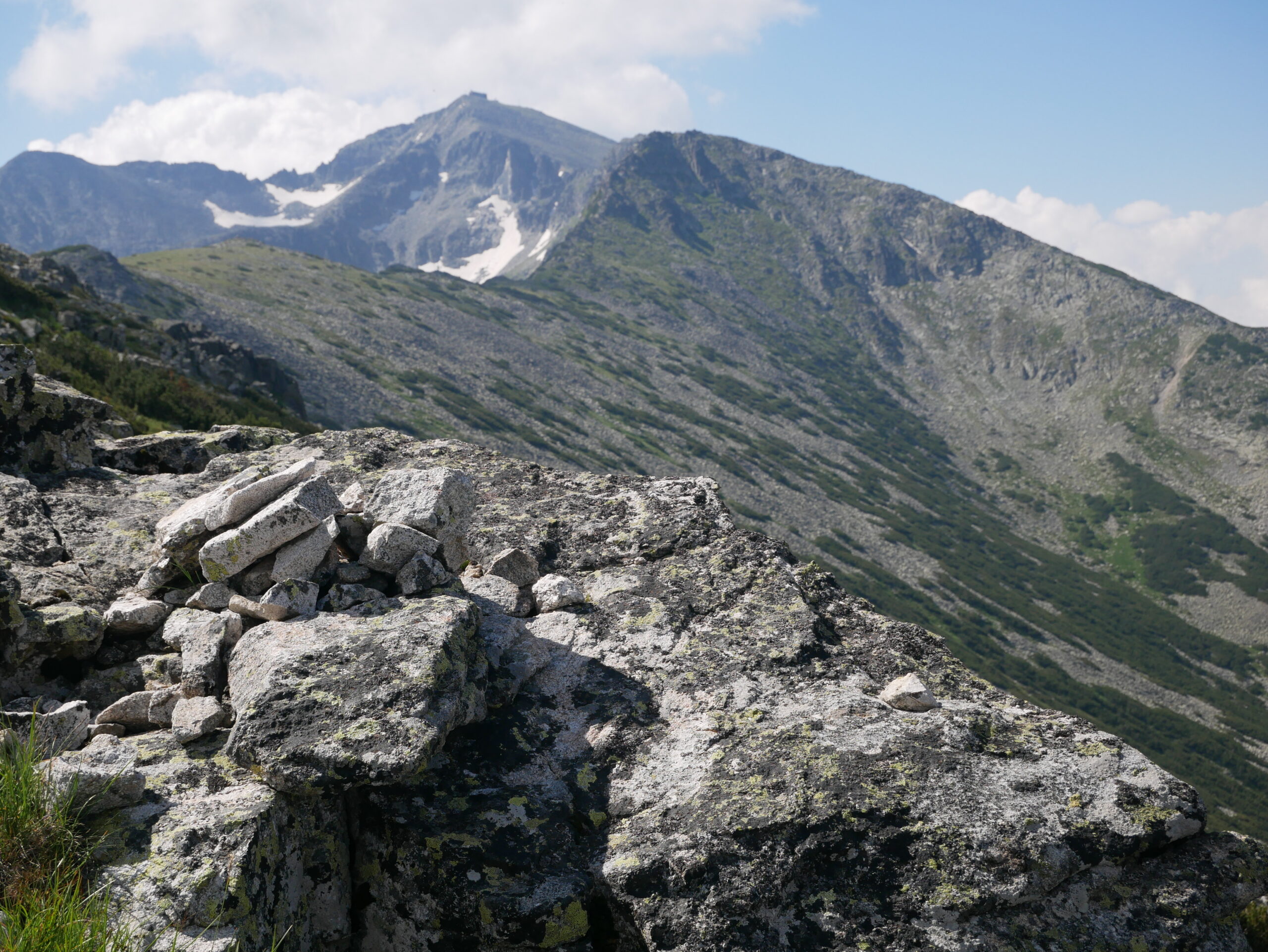
The Musala Hut (2,389 m) sits near the foot of the climb, a short way from the gondola, and is the first place to rest, refill, and grab a hot drink or a snack. Higher up, the Ice Lake refuge (Ledeno Ezero) offers the last shelter before the summit. Between them they let you break the ascent over two days rather than racing the last gondola down, which is worth considering if you are hiking with children, acclimatising, or simply want to enjoy the lakes at a gentler pace. Hut services, opening dates, and overnight availability shift with the season and the weather, so confirm in advance rather than assuming a bed or a meal will be waiting. Even as a day-hiker, knowing the huts are there is part of Musala’s safety margin when the weather turns.
Season & conditions
Musala is two completely different mountains depending on the time of year.
Summer (roughly June to October)
This is the hiking season. The trail is clear and well-marked, the gondola runs, the huts are usually open, and the mountain sees a steady stream of walkers, especially at weekends. Conditions are usually straightforward, but Rila weather changes fast: afternoon thunderstorms, sudden cloud, wind, and a sharp temperature drop toward the summit are all common even in July and August. Carry warm and waterproof layers, start early, and watch the sky.
Winter (roughly November to April)
In winter Musala becomes a serious alpine objective. Deep snow, ice, fierce wind, poor visibility, and avalanche terrain turn the summer walk into a mountaineering route that demands crampons, an ice axe, avalanche awareness and equipment, and the experience to use them, or a qualified local guide. The huts and lifts may operate on reduced schedules. Winter Musala is achievable and popular with experienced Bulgarian mountaineers, but it is not a casual hike and should not be treated as one.
Difficulty & safety
Non-technical does not mean effortless. Musala’s dangers are weather and distance, not exposure.
As a summer hike, Musala involves no technical climbing, no scrambling of note, and no ropes, but it is a big mountain day: real elevation gain, a long distance even with the gondola, and a high, exposed summit where conditions can deteriorate quickly. The main risks are getting caught out by weather, running short of daylight and missing the last gondola, and underestimating the cold and wind up high. Sensible preparation covers almost all of it: warm and waterproof layers, sturdy footwear, enough food and water, a map or GPS track, an early start, and a firm turnaround time. In winter the risk profile changes entirely to snow, ice, and avalanche hazard, which is a different discipline with different equipment and skills.
Most trouble on Musala comes from two things: a fast-moving mountain storm on an exposed summit, and hikers who summit too late to get down before the last gondola or before dark. Check the forecast, start early, set a turnaround time and keep to it, and know the huts as a fallback. The summit will still be there another day.
Getting there
Musala is one of the easiest major summits in Europe to reach from a capital city.
The trip starts in Sofia, Bulgaria’s capital, which is well connected by international flights. From Sofia it is about 70 km and roughly 1.5 hours by road to Borovets (1,350 m), reachable by rental car, taxi, shuttle, or a day tour. Borovets has ample accommodation and restaurants, making it a comfortable base the night before an early start. From the resort centre, the Yastrebets gondola carries hikers up to the trailhead at about 2,369 m. Guided and self-guided day trips from Sofia are widely available if you would rather not arrange the logistics yourself, and many combine Musala with the nearby Seven Rila Lakes for a fuller Rila experience.
Planning a Rila trip?
Pair Musala with the wider region: see how it fits our best hiking regions in the world, brush up on the essentials in mountaineering fitness standards, and read how grades work in the difficulty ratings guide. For flights to Sofia and lodging around Borovets, compare options through the Global Summit Guide Expedia travel shop.
Disclosure: the Expedia link is an affiliate link; we may earn a small commission at no extra cost to you, and it never affects our recommendations.
Best Hiking Regions Pick Your MountainMusala FAQ
The questions hikers ask most.
How high is Musala?
2,925 m (9,596 ft), the highest peak in Bulgaria, in the Rila Mountains, and in the entire Balkan Peninsula and Southeastern Europe, the highest point on the continent between the Alps and the Caucasus. Its name comes from Arabic via Ottoman Turkish, meaning a place of prayer.
How hard is it to hike Musala?
In summer it is a long but non-technical hike on a well-marked trail, not a climb. Using the Yastrebets gondola from Borovets, the round trip takes roughly 8 to 11 hours of walking with real elevation gain, passing mountain huts and glacial lakes. It needs good fitness and mountain-weather awareness but no ropes, crampons, or technical skill. Winter is a serious alpine undertaking requiring snow gear and experience.
How do you get to the start of the hike?
From Borovets (1,350 m), about 70 km and roughly 1.5 hours from Sofia, take the Yastrebets gondola up to about 2,369 m, the usual starting point. The trail then passes the Musala Hut (2,389 m) and the Ice Lake refuge before the final rocky push. Hiking the whole way from Borovets without the gondola adds about 10 km. Always check current gondola days and hours first.
How does Musala compare to Mount Whitney?
Mount Whitney (4,421 m / 14,505 ft), the highest peak in the contiguous United States, is about 1,500 m higher than Musala (2,925 m). Both are non-technical summer walk-ups to a regional high point, but they differ in scale: Whitney involves real high-altitude effort, a much longer day, and a competitive permit lottery, while Musala is lower, more accessible, needs no permit, and can be shortened by a gondola. Musala is the far easier and more casual of the two, though winter changes that.
Can you climb Musala in winter?
Yes, but as a serious winter mountaineering objective rather than a hike. Deep snow, ice, wind, low visibility, and avalanche terrain make it far more demanding and dangerous than the summer walk. Winter attempts need crampons, an ice axe, avalanche gear, the skills to use them, and careful conditions assessment, or a qualified guide. Most visitors climb Musala between roughly June and October.
Are there mountain huts on Musala?
Yes. The route passes the Musala Hut at 2,389 m, near the foot of the main climb, and the Ice Lake refuge (Ledeno Ezero) higher up. They offer shelter, rest, and basic refreshments, and let you split the hike over two days rather than racing the last gondola down. Confirm opening and overnight availability in advance, as hut services vary by season.
Methodology & sources
- Elevation, geography, and the highest-in-the-Balkans ranking from Rila National Park and standard geographic references.
- Route, gondola, hut, and timing detail from Bulgarian mountaineering and trekking operators and current trail reports for the Borovets-Yastrebets-Musala approach.
- The Mount Whitney comparison uses United States Geological Survey elevation data (4,421 m / 14,505 ft).
- Musala is outside our first-hand experience; this page is a research-based synthesis rather than a personal trip report. Safety framing reviewed by Dawson Ludlow.
Published: July 18, 2026 · next review January 2027.
Confidence: High on elevation, the route, and access; Medium on exact hut hours and gondola schedules, which change by season, so confirm locally before you go.The most accessible high point in the Balkans
Musala proves you do not need technical skills to stand on the roof of a region. Take the gondola, respect the weather, keep an eye on the clock, and Bulgaria’s highest summit is a rewarding day out for any fit hiker, and a real mountaineering prize in winter.
Explore Hiking Regions Browse All MountainsMusala & the Peaks of Eastern Europe
The Balkans’ highest point belongs to a wider Eastern-European and Alpine story. Explore the region collection and its neighbouring peaks.
Is the Standard Borovets Route Right for Your Day?
Musala is straightforward in dry summer conditions, but the gondola schedule, exposed upper mountain and fast-changing Rila weather make timing more important than technical skill.
Yastrebets Gondola to Musala Summit
Ride from Borovets to the upper Yastrebets station, then follow the marked route toward Musala Hut, the Musala lakes, Ice Lake refuge and the 2,925 m summit. Return the same way.
Approximately 2,369 m. Gondola access begins in Borovets.
Published route tracks vary slightly depending on exact path, hut detours and GPS recording.
The gondola removes roughly 1,000 vertical metres from the full Borovets ascent.
Allow additional time for huts, weather, summit stops and gondola logistics.
Easier terrain near Yastrebets and Musala Hut becomes rockier and steeper toward Ice Lake and the summit.
No rope or climbing equipment should be required on the standard snow-free route.
Follow Rila National Park rules and stay on marked trails. Park only in designated areas around Borovets / lift access.
July through September normally gives the simplest snow-free hiking; verify shoulder-season snow and lift operation.
Verify the Gondola Before You Leave Borovets.
Checked September 11, 2026: Borovets currently lists the Yastrebets gondola with regular operating hours of 8:30 AM to 6:00 PM.
The currently published last ride is 5:30 PM uphill and 6:00 PM downhill. The regular summer schedule lists the gondola as closed on Mondays and Tuesdays, with occasional special operating dates.
Treat those times as a dated snapshot, not a permanent rule. Lift schedules can change for maintenance, season, weather and special operations.
Your summit time should leave a comfortable descent margin, not merely enough minutes to arrive at the station as the doors close.
Turnaround trigger
Turn around if thunderstorms are building, visibility is deteriorating, the upper trail has snow or ice beyond your equipment and skills, or your pace no longer leaves a comfortable margin for reaching the Yastrebets station before the final gondola. Missing the lift is a logistics problem; pushing into bad weather can become a mountain emergency.
Five Checks Before Hiking Musala
Musala does not require complicated expedition logistics. Most avoidable problems come from leaving Borovets without checking the day’s lift, weather and trail conditions.
Do not assume yesterday’s operating hours or weekly schedule still applies.
The 2,925 m summit can be cold, windy and clouded in while the valley remains warm.
Summer Musala is hiking. Snow and ice can change that classification quickly.
The exposed ridge and summit are poor places to discover that the forecast underestimated wind or precipitation.
Base it on weather, daylight, your actual pace and the final gondola down.
Stay on marked tourist routes, use designated parking areas and do not assume wild camping or off-trail shortcuts are permitted.
Check These on the Day You Hike
Lift operation and park rules can change faster than an evergreen guide can be updated.
Was this helpful?
🏔Related peaks nearby
🧭Explore & compare
Global Summit Guide is an independent mountaineering resource founded in 2026. The team combines first-hand trekking and climbing experience with in-depth research and professional health and nutrition review to help climbers choose objectives, prepare properly, and stay safe.
Health, altitude, and nutrition content is reviewed by Taylor Ludlow (Registered Nurse) and Brigg Hoopes (Nutritionist).
What We Don't Know Yet
Mountain information changes quickly. This box explains the limits of what this page can responsibly promise.
- Permit availability, reservation windows, quotas, and official fee rules may change after this page is updated.
- Weather, snowpack, avalanche risk, road access, and route conditions can change quickly and may be different on your climbing dates.
- Gear requirements can change by season, route variation, weather window, personal cold tolerance, and guide-service requirements.
- Fitness and altitude response vary by person; no guide, itinerary, or training plan can guarantee acclimatization or summit success.
- Comparisons simplify complex decisions; the better mountain depends on current conditions, skills, timing, budget, and risk tolerance.
Verify current conditions with official land managers, guide services, local forecasts, and current route reports before booking or climbing.
Mountaineering, rock and ice climbing, glacier travel, and high-altitude activity are inherently dangerous and can result in serious injury or death. The information on Global Summit Guide is provided for general informational and educational purposes only and is not a substitute for professional instruction, qualified guiding, proper equipment, or your own judgment and experience.
Route conditions, weather, snowpack, permits, regulations, and hazards change constantly and may differ from what is described here. Details may be incomplete, out of date, or contain errors. Always verify current information with local authorities, certified guides, and official sources before making any decision in the mountains.
Nothing on this site is medical, legal, or financial advice. Our fitness, acclimatization, altitude, and nutrition content is general in nature; consult a qualified physician before beginning any strenuous exercise program or exposing yourself to high altitude.
You are solely responsible for your own safety and decisions. To the fullest extent permitted by law, Global Summit Guide and its team accept no liability for any loss, injury, damage, or expense arising from use of, or reliance on, this information. By using this site you acknowledge these risks and accept these terms.
Some links on this site may be affiliate links. If you buy through them we may earn a small commission at no extra cost to you; this never affects our recommendations.
Global Summit Guide recommendation path
Next Best Mountain to Research
Use these recommendations to continue the right planning path instead of stopping on one page.
Use current permit, weather, route, and operator information before booking or climbing.
Explore Travel Options for Your Destination
Once your mountain, dates and route are taking shape, compare flights, hotels and other travel options that fit the trip.
Affiliate link. We may earn a commission at no additional cost to you.