
Last updated October 13, 2026
Carpathian Mountains in Europe: Where They Are & What to Explore.
Discover the 1,500-kilometer mountain arc spanning seven Central and Eastern European countries: its map, geography, highest peaks, wild forests, most beautiful hikes, travel seasons and the routes worth planning.
Where Are the Carpathian Mountains?
The Carpathian Mountains are a great curved mountain system in Central and Eastern Europe. They extend roughly 1,500 kilometers from the northwestern Carpathian region around Czechia, Slovakia and Poland, east through Ukraine, then sweep south across Romania toward the Danube and Serbia.
The seven countries participating in the Carpathian Convention are Czechia, Hungary, Poland, Romania, Serbia, Slovakia and Ukraine. Some broader geographic delineations also include a small Austrian fringe; Austria is not a Carpathian Convention party.
The highest peak is Gerlachovský štít, 2,655 meters (8,711 feet), in Slovakia’s High Tatras. Yet the range is much more than alpine peaks: it contains extensive forests, pastoral landscapes, glacial lakes, wildlife habitat and historic communities.
A Mountain Range That Crosses Borders.
Central & Eastern Europe
The Carpathians form a broad semicircle around much of the Pannonian Basin and Transylvanian region.
Slovak High Tatras
Jagged rock peaks, glacial lakes and rugged mountaineering routes mark the highest portion of the range.
Romanian Carpathians
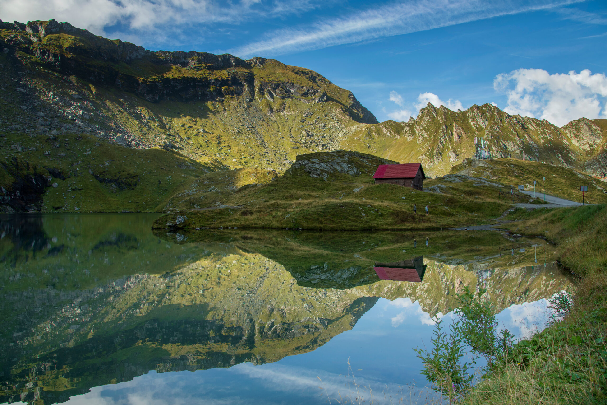
Long ridges, deep valleys, pastoral mountains and major forest habitats dominate Romania’s part of the system.
Carpathian Mountains Map: Follow the Great Arc.
The Carpathians curve across Central and Eastern Europe rather than forming one straight ridge. Zoom and move the map to explore their geography; the diagram underneath describes their broad progression from northwest to southeast.
Regional reference map, not a navigational route. Mountain boundaries depend on the geographic classification being used.
How the Range Travels Across Europe
The southern Carpathians reach the lower Danube near the Balkan region, but the Carpathians and Balkan Mountains are distinct systems. A map of the Romanian Carpathians is not a map of the entire Carpathian chain.
Why the Carpathians Matter to Europe.
The Carpathians are one of Europe’s most important connected mountain landscapes. They are home to significant populations of brown bears, wolves and lynx, along with extensive beech and mixed forests, alpine meadows and rare plants.
Because the range passes across national borders, environmental conservation requires international cooperation. The Carpathian Convention was adopted in 2003 to support protection and sustainable development of the broader region.
The same diversity shapes travel. In the Tatras, visitors encounter rocky alpine summits and established mountain huts. In Romanian areas, they can find far longer pastoral ridges, remote approaches and broad forest valleys.
These differences are why the best Carpathian destination depends on whether you want a scenic lake walk, a guided scramble, a multiday ridge trek, wildlife tourism or a regional cultural journey.
Which Countries Are in the Carpathian Mountains?
Seven states are parties to the Carpathian Convention. Their mountain landscapes differ substantially in altitude, tourism infrastructure and accessibility.
When discussing international conservation, use the seven countries of the Carpathian Convention. When discussing certain broader physical-geography definitions, you may see an eighth country—Austria—listed. We make this distinction explicit instead of mixing two different counting methods.

The Carpathians at Their Most Alpine.
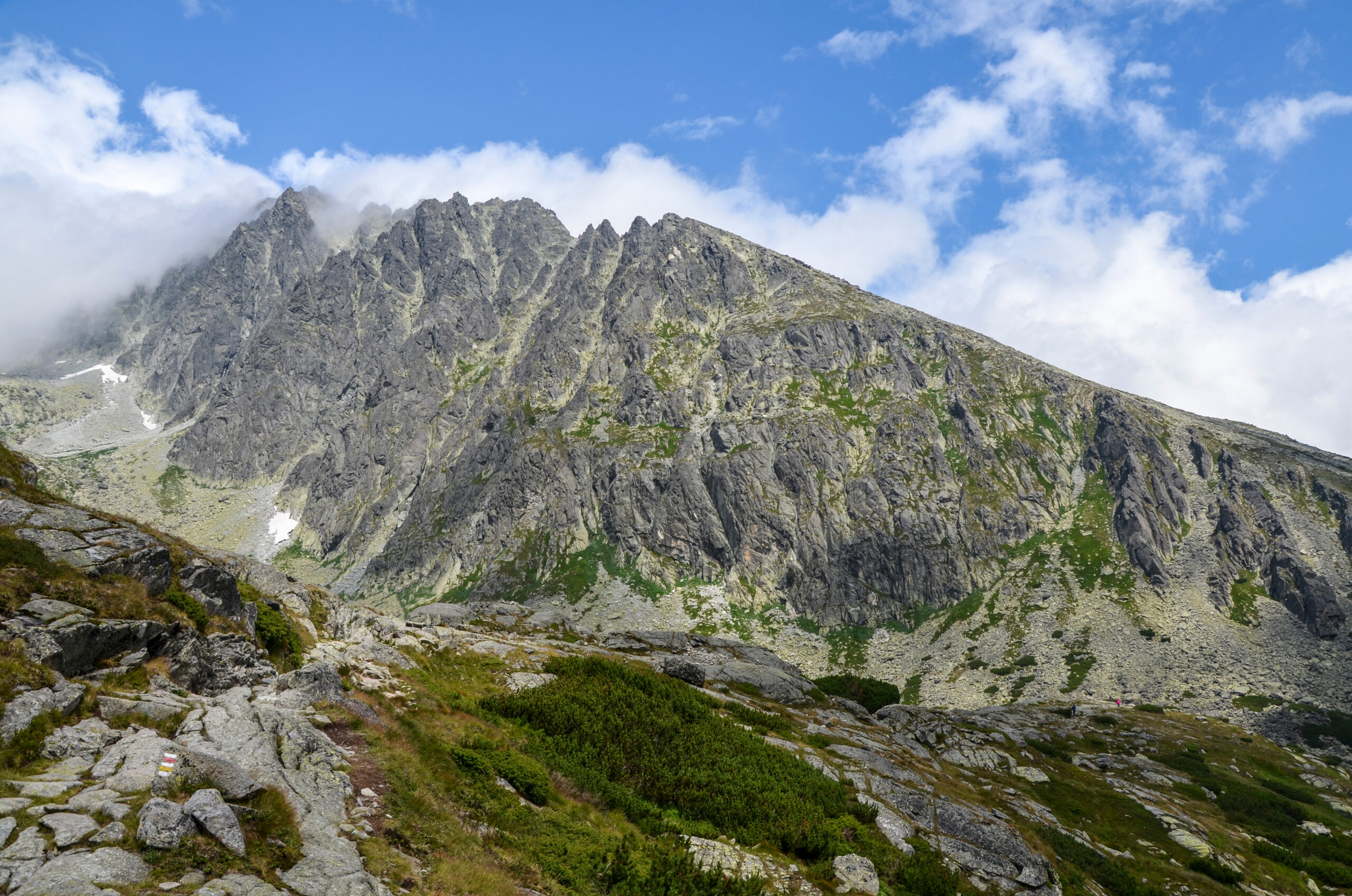
Between Poland and Slovakia, the High Tatras concentrate the range’s most dramatic rocky peaks, mountain lakes and demanding high-level hiking routes.
Photo: kallerna · Wikimedia Commons · CC BY-SA 4.0.
The Main Carpathian Ranges Explained.
The Carpathians are not one continuous ridge with one character. They contain many subranges, divided into overlapping regional and geological classifications.
High Tatras
Countries: Slovakia and Poland.
Character: Jagged granite summits, alpine lakes, mountain huts and challenging hiking and scrambling routes.
Highlights: Gerlachovský štít, Rysy, Kriváň, Morskie Oko and numerous glacial basins.
Low Tatras
Country: Slovakia.
Character: Open ridges, broad mountain views, forests and long-distance trails.
Highlights: Ďumbier, Chopok and sections of the Low Tatras ridge.
Beskids & Bieszczady
Countries: Poland, Czechia, Slovakia and adjoining areas.
Character: Forested summits, grassy ridges, wildlife habitat and less technical mountain hiking.
Highlights: Babia Góra, Babia Góra National Park and the Polish Bieszczady.
Ukrainian Carpathians
Country: Ukraine.
Character: High pastures, the Chornohora ridge, deep forests and national-high-point geography.
Planning: Geographic interest only under current war conditions; not a recreational travel recommendation.
Făgăraș Mountains
Country: Romania.
Character: Long ridges, glacial lakes and some of Romania’s most demanding mountain traverses.
Highlights: Moldoveanu, Negoiu, Bâlea Lake and the famous Transfăgărășan road.
Retezat & Bucegi
Country: Romania.
Character: Glacial lakes, limestone cliffs, varied mountain trails, forests and protected landscapes.
Highlights: Retezat National Park, Peleaga, Omu and established hiking approaches.
Seven Carpathian Peaks Worth Knowing.
This is a curated collection of seven important summits—not a claim that they are the seven highest points in the entire Carpathian range. The actual upper end of the elevation ranking is dominated by peaks in Slovakia’s High Tatras.
| Mountain | Elevation | Country | Subrange | Primary character |
|---|---|---|---|---|
| Gerlachovský štít | 2,655 m | Slovakia | High Tatras | Guided mountaineering / scrambling |
| Moldoveanu | 2,544 m | Romania | Făgăraș | Long mountain hike with exposed terrain |
| Negoiu | 2,535 m | Romania | Făgăraș | Serious ridge hiking and scrambling |
| Rysy | 2,503 m main summit; ~2,499 m Polish high point | Slovakia / Poland | High Tatras | Demanding protected hiking routes |
| Hoverla | 2,061 m | Ukraine | Chornohora | National high point; travel not recommended |
| Ďumbier | 2,043 m | Slovakia | Low Tatras | Long ridge hiking |
| Babia Góra | 1,725 m | Poland / Slovakia | Beskids | Exposed weather-sensitive hike |
Gerlachovský štít is the highest peak in Slovakia and the entire Carpathian Mountains. Lomnický štít and Ľadový štít are also among the highest Carpathian peaks, which is why this seven-mountain selection is not a strict elevation ranking.
How to Choose the Mountain That Fits You.
Gerlachovský štít — The Roof of the Carpathians
The range’s highest point rises over the High Tatras near Poprad. A standard tourist visit involves unmarked technical terrain and is normally undertaken with a qualified mountain guide under the park’s rules.
Best for: Experienced hikers ready for a supervised alpine scramble. This is not an ordinary marked mountain walk; guide qualifications and current access permissions need checking.
Research next: Slovak park regulations, guide availability, current conditions and the appropriate ascent route.
Moldoveanu — Romania’s Highest Mountain
Moldoveanu is a compelling summit goal in the Southern Carpathians, reached through long ridgelines and high mountain landscapes. Approaches include routes from the Valea Rea / Stâna lui Burnei area and longer trekking itineraries associated with the northern Făgăraș ridge.
Important: The long access road through Valea Rea can be damaged by flooding, including in 2026. Check road status and the exact marked ascent with Salvamont before traveling.
Best for: Fit hikers comfortable with long summit days, variable mountain weather and some exposed terrain.
Negoiu — A More Demanding Romanian Ridge Objective
Negoiu sits close to Moldoveanu in height but offers a different mountain experience. The area includes serious ridge terrain around Lake Călțun and the surrounding saddles.
Critical route correction: Strunga Dracului was permanently closed after repeated rockfalls. Do not use it as an open hiking route. The recognized bypass toward Negoiu uses Strunga Doamnei; verify the current markers and conditions.
Best for: Experienced hikers with scrambling confidence and careful route planning.
Rysy — Two Countries, Two Famous Approaches
The Rysy massif contains the highest point of Poland, around 2,499 meters, while its higher main summit is on the Slovak side at about 2,503 meters.
The Polish approach from Morskie Oko is steeper and more exposed, with extensive chain-assisted terrain. The Slovak approach from Štrbské Pleso is generally considered less difficult but is still a demanding high-mountain outing with fixed chains on a rocky section near Chata pod Rysmi.
Best for: Fit, experienced mountain hikers in stable summer conditions—not first-time hikers expecting an easy stroll.
Hoverla — Ukraine’s National High Point
Hoverla is the highest summit in Ukraine and an important landmark of the Eastern Carpathians. In ordinary circumstances it is known for its accessible hiking routes and broad summit views.
Current travel recommendation: Do not plan recreational travel to Ukraine during the ongoing war. The U.S. State Department’s Level 4 advisory says not to travel there for any reason. This peak is retained for geographic completeness, not as an active itinerary suggestion.
Ďumbier — The Low Tatras High Point
Ďumbier offers open ridges, broad views and a strong alternative to the more technical character of the High Tatras. A commonly researched itinerary follows the ridge from the Chopok area.
Best for: Strong day hikers interested in a scenic ridgeline and an achievable summit objective in dry, clear conditions. Winter and late-season conditions require different equipment and judgment.
Babia Góra — Big Weather on a Lower Summit
Babia Góra rises above the surrounding Beskid ranges and is known for expansive views, strong winds and sharply changing conditions.
Several approaches exist, and the more challenging Perć Akademików route has seasonal restrictions and chain-assisted sections. Check the Polish national park’s official route status.
Best for: Hikers interested in Western Carpathian landscapes without pursuing the technical High Tatras.
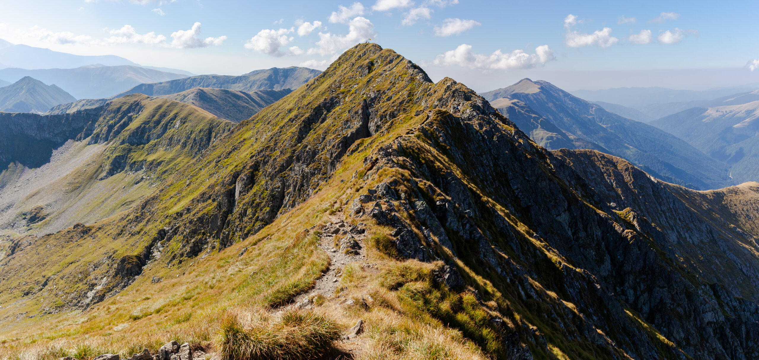
Moldoveanu Is a Long Mountain Journey, Not Just a Summit Number.
Its ridges and remote approaches show a very different face of the Carpathians from the compact alpine terrain of the Slovak Tatras.
Best Carpathian Mountains Hikes for Different Travelers.
The strongest Carpathian itinerary matches the range to the traveler. These seven ideas vary substantially in physical demand, technical exposure and time required.
Morskie Oko
A classic approach to one of the best-known mountain lakes in the Polish Tatras. Suitable for many active visitors on the established route, though distance, crowds and seasonal conditions still matter.
Rysy via Chata pod Rysmi
A substantial summit outing through the Mengusovská valley toward a high mountain hut. It includes secured rocky passages and follows seasonal national-park regulations.
Chopok to Ďumbier
A broad high-level route over the Low Tatras ridge, combining open views and an accessible summit objective for strong walkers.
Bâlea Lake Area
A scenic base for short walks and more demanding Făgăraș ridge objectives. Mountain roads and high trails have pronounced seasonal access constraints.
Făgăraș Ridge Traverse
A multiday mountain undertaking that requires strong endurance, careful navigation, suitable overnight plans and constant attention to weather.
Retezat National Park
A strong destination for hikers seeking alpine lakes, protected landscapes and varied routes rather than a single iconic summit.
Babia Góra
A rewarding summit in good weather, with several approach choices and restrictions that need reviewing at the national park.
Bieszczady Ridges
Rounded grassy mountain tops, quiet valleys and forest trails present a different experience from the rocky Tatras.
Moravian-Silesian Beskids
Accessible forested ridges, village-based walking and a good entry into the Carpathian landscape farther west.
For a first introduction to the range, combine the Polish and Slovak Tatras. For a longer, quieter mountain itinerary, research the Romanian Făgăraș and Retezat regions. For relatively gentle forest-and-ridge travel, consider the Czech or Polish Beskids.

Rysy: Polish Route or Slovak Route?
This is one of the most useful decisions for hikers exploring the Carpathians. Both approaches lead toward the same massif, but they are not equally demanding.
Polish side: The route approaches from Morskie Oko and Czarny Staw, then climbs steep rock with extensive chain-protected sections. Exposure and crowding can make the upper route particularly challenging.
Slovak side: The route approaches from Štrbské Pleso and passes Chata pod Rysmi. It is generally less exposed than the Polish approach but still has fixed-chain sections and demanding alpine terrain.
Neither route should be described as an easy hike. Snow, rockfall, congestion and seasonal closures can change the experience dramatically.
The Low Tatras: Ridgeline Days Without the Highest Peaks.
The Low Tatras offer substantial mountain terrain even though their elevations remain below the High Tatras. Open mountain crests, a series of peaks and long hiking itineraries make them attractive for experienced walkers.
Ďumbier, at about 2,043 meters, is the highest summit in the range. Nearby Chopok is known for mountain infrastructure that can simplify access to the high ridge, although lift operation and trail conditions depend on season and weather.
Compared with a Gerlachovský ascent, a summer Ďumbier itinerary usually emphasizes walking endurance rather than unmarked technical mountaineering. That does not make exposed ridges safe in thunderstorms, winter conditions or poor visibility.

When Is the Best Time to Visit the Carpathians?
June through September is the most practical general window for many high-level summer hikes, but there is no single “Carpathian opening day.” Conditions, national-park rules and snow cover differ by country and route.
| Area | General hiking window | Main considerations |
|---|---|---|
| Slovak High Tatras | Summer into early autumn, on open marked trails | Selected high routes close seasonally; verify current TANAP dates and trail restrictions. |
| Polish High Tatras | Summer and early autumn generally most approachable | Snow can persist on shaded or high routes; check TPN notices and avalanche conditions. |
| Slovak Low Tatras | Late spring to autumn for many nontechnical trails | Ridge weather, wind, thunderstorms, snow and avalanche risk outside summer. |
| Romanian Făgăraș | Summer and early autumn for most high routes | Long ridges, road closures, access-road washouts and snow on exposed traverses. |
| Polish/Czech Beskids | Broad walking season with variable conditions | Rain, mud, strong summit winds, ice and park-specific closures. |
| Ukraine | Not a recommended recreational destination at present | Ongoing armed conflict and Level 4 U.S. travel advisory override ordinary season advice. |
Slovak High Tatras: Do Not Assume Every Trail Opens on June 1.
Current park information distinguishes among trails, high-elevation routes, huts and special cases. Some official sources and older tourism pages quote different closure dates. Always check the exact route against current TANAP notices immediately before departure.
How to Plan a Carpathian Mountains Trip.
Choose Your Regional Gateway.
High Tatras: Consider Poprad on the Slovak side or Zakopane on the Polish side, reached via major regional rail and road connections.
Romanian Carpathians: Brașov, Sibiu and other regional cities serve different mountain areas. You will often need local buses, private transfers or a rental vehicle for remote starts.
Beskids: Many trailheads are accessible through smaller towns and villages, providing flexible hut-based or day-hiking trips.
Mountain Huts, Villages & Cabins.
High Tatra mountain huts can be popular and should be booked well ahead for peak summer dates.
Romanian routes may involve cabins, lodges, authorized campsites or more remote hiking arrangements. Camp restrictions vary by protected area.
Choose where to stay based on the exact trailhead and mountain route, not simply the nearest large city.
Compare the Entire Journey.
For many marked Carpathian trails, there is no substantial guided-climbing fee, although park admission, transport and hut costs may apply.
Technical objectives such as Gerlachovský štít can require paid mountain guiding services. Costs depend on group size, guide, season, accommodation and scope.
Do not compare a self-guided summer hike directly with a guided alpine mountaineering expedition as though they provide equivalent services.
Respect the Real Hazards.
Thunderstorms, fast-changing weather, exposed rock, falls, winter snow, avalanche risk and limited access to rescue services are more relevant than sensational claims about danger.
Large carnivores inhabit parts of the Carpathians, especially in Romania. Follow local guidance on wildlife encounters, food storage and avoiding habituation.
Confirm medical coverage and whether mountain rescue expenses are covered in the countries you plan to visit.
Carpathians vs Alps: Which Is Better for Your Trip?
These two European mountain systems offer different experiences. The Carpathians can be more budget-friendly for some trekking itineraries, while the Alps provide more high-altitude technical routes and extensive mountain infrastructure.
| Factor | Carpathian Mountains | European Alps |
|---|---|---|
| Highest peak | Gerlachovský štít, 2,655 m | Mont Blanc, approximately 4,806–4,810 m depending on snow-cap measurements |
| Terrain | Forested mountains, pasture ridges, alpine Tatras and rocky Romanian summits | More extensive glaciated terrain and substantially higher peaks |
| Typical hiking approach | Day walks, long ridges, huts and selected technical summits | Extensive hut networks, high passes, glacier approaches and varied trekking routes |
| Best for | Wild landscapes, biodiversity, accessible regional hiking and selected alpine challenges | High-altitude mountaineering, glaciers and iconic European alpine routes |
| Costs | Often favorable for independent walking; route and country dependent | Highly variable; popular alpine centers and guided glacier climbs can cost more |
| Infrastructure | Strong in parts of the Tatras; limited on some remote Romanian ridges | Broadly developed across many major Alpine tourism regions |
| Main decision | Choose the subrange that fits the experience you want | Choose altitude, technical level and desired alpine infrastructure |
There is no credible single “the Carpathians are 10 times cheaper” rule. Total cost depends on travel origin, number of days, season, lodging, transport and whether technical guiding is required.
What Gear Do You Need for Carpathian Hiking?
A summer day hike in the Beskids, a protected ascent to Rysy and a guided climb of Gerlachovský štít require different equipment. Use the route and forecast to guide purchasing decisions.
- Supportive hiking footwear appropriate for wet rock and steep terrain.
- Waterproof shell and insulating layers for fast-changing conditions.
- Reliable map, offline navigation and charged communication device.
- Headlamp, food, water and an emergency plan.
- Trekking poles where appropriate on long ascents and descents.
- Helmet and technical equipment only where route and qualified guide require them.
- Winter-specific equipment and skills when snow or ice is present.
Equipment warning: Fixed chains do not make an icy route safe for inexperienced hikers. Summer trails can become mountaineering objectives in cold weather.

Global Summit Guide may earn a commission from qualifying purchases. Advertising does not influence editorial mountain rankings or route assessments.

Why the Forests Are as Important as the Summits.
The Carpathian Mountains contain major habitats for brown bears, wolves, lynx, deer and many other species. Their connected forests and protected areas make the range an important conservation landscape.
UNEP identifies the Carpathians as one of Europe’s great remaining wilderness areas, although that does not mean every trail is remote or undisturbed.
For visitors, responsible behavior matters: maintain distance from wildlife, never feed bears, manage food and garbage properly and follow park notices about restricted habitat or seasonal closures.
Responsible tourism supports rural communities, local guides and accommodation providers while reducing pressure on vulnerable high-mountain environments.
Important: The Ukrainian Carpathians Are Not a Recommended Tourist Trip.
Ukraine: Level 4 — Do Not Travel
The U.S. Department of State’s August 28, 2026 travel advisory says not to travel to Ukraine for any reason due to the Russia–Ukraine war. Hoverla and the Chornohora Mountains remain important to the geography of the Carpathians, but that does not make them appropriate vacation recommendations.
Travel planning should prioritize destinations where legal access and personal security can be properly assessed. See the current advisory before making any decision involving Ukraine.
For travelers looking for forested mountains and accessible summits elsewhere in the Carpathians, consider legal, open routes in Slovakia, Poland, Romania or Czechia instead, with their own park rules and weather checks.
How to Spend Seven Days in the Carpathians.
For an introductory trip focused on established infrastructure, this Slovak–Polish Tatra example reduces long-distance transfers. It is a planning framework, not a promise that high routes are open on your dates.
Make it a separate trip unless you have enough time for long transfers. A sensible Romanian itinerary can concentrate on Brașov and Bucegi or on Sibiu and the Făgăraș region. Combining the High Tatras and deep southern Romania in one short hiking week sacrifices too much time to transport.
Carpathian Mountains FAQ
Where are the Carpathian Mountains located?
The Carpathians form an approximately 1,500-kilometer arc through Central and Eastern Europe, extending across regions of Czechia, Slovakia, Poland, Ukraine, Romania, Hungary and Serbia. Some broader geographic maps also include a small Austrian extension.
How many countries are in the Carpathian Mountains?
Seven countries participate in the Carpathian Convention: Czechia, Hungary, Poland, Romania, Serbia, Slovakia and Ukraine. Some physical-geography definitions additionally count a small Austrian fringe.
What is the highest peak in the Carpathian Mountains?
Gerlachovský štít in Slovakia’s High Tatras is the highest at approximately 2,655 meters or 8,711 feet.
Are the Carpathian Mountains in Romania?
Yes. Romania contains an extensive portion of the Carpathian mountain system, including the Eastern and Southern Carpathians, the Făgăraș Mountains and other major hiking areas. The Carpathians also extend into six other Convention countries.
Are the Tatras part of the Carpathians?
Yes. The High Tatras and Low Tatras are both part of the Western Carpathians. The High Tatras contain the range’s highest mountains.
Are the Carpathians part of the Alps?
No. They are separate European mountain systems. The Alps are generally higher and contain much more extensive glaciated terrain, while the Carpathians have large forests, rolling ridges and compact high-alpine areas in the Tatras.
What is the highest mountain in Romania?
Moldoveanu, approximately 2,544 meters, in the Făgăraș Mountains of the Southern Carpathians.
Is Rysy in Poland or Slovakia?
The Rysy massif straddles the Polish–Slovak border. Its northwestern summit, around 2,499 meters, is Poland’s highest point. The higher main summit, around 2,503 meters, lies in Slovakia.
Is the Slovak route to Rysy easy?
No. It is generally less demanding than the Polish approach but remains a substantial high-mountain hike with fixed chains, rocky terrain, possible exposure and seasonal restrictions.
Do you need a guide for Gerlachovský štít?
The usual ascent for visitors involves routes outside the ordinary marked hiking system, generally undertaken with a qualified mountain guide. TANAP regulations include specific access conditions and exceptions for eligible mountaineering activities; verify your legal route and guide arrangements.
When is the best time to hike the Carpathians?
June through September is a broadly useful summer planning window for many high trails. Exact dates depend on national-park restrictions, snow, local weather and access conditions.
Are there bears in the Carpathian Mountains?
Yes. Brown bears inhabit parts of the Carpathians, particularly extensive forest areas. Follow local wildlife guidance, avoid feeding animals and keep a safe distance.
Is Strunga Dracului open?
No. The Romanian Făgăraș route through Strunga Dracului was permanently closed due to rockfall hazards. Check the current marked alternative through Strunga Doamnei and consult Salvamont.
Is it safe to visit the Ukrainian Carpathians?
The U.S. Department of State currently advises against all travel to Ukraine because of the ongoing war. The Ukrainian Carpathians are included here for geographic information, not as a recommended trip destination.
How We Researched This Guide.
This article is independent desk research informed by international conservation information, national tourism authorities, route descriptions and current travel advice. It does not claim that the editorial team personally completed every route.
Geography & Conservation
Mountain-park regulations, hut operations, weather, road access, insurance requirements and guide availability can change after publication. Check official country-specific sources and current conditions before departure. Prices and difficulty are intentionally not reduced to unsupported universal figures.
Editorial review: October 13, 2026. Image captions identify scenes and provide credits for externally sourced Creative Commons photography.
What Should You Explore After the Carpathians?
Mountain Collections
Compare the Carpathians with other mountain groupings and decide which climbing collection to pursue.
Explore Collections →500-Peak Database
Find peaks by location and difficulty, then connect to planning resources and detailed mountain pages.
Search the Peak Database →Other Great Ranges
Explore the Caucasus, Pyrenees and Dolomites to understand other European hiking and climbing opportunities.
Caucasus →
One Mountain Arc. Hundreds of Different Adventures.
From the rocky High Tatras to Romania’s long mountain ridges, the Carpathians reward travelers who choose the right region, season and level of difficulty. Use the map, compare the peaks and build a plan that fits your experience.
Background: Andrzej Otrębski · Wikimedia Commons · CC BY-SA 4.0.
The Carpathians & Eastern Europe: Peaks & Collections
Eastern Europe’s ranges sit alongside the wider European system. Explore the region’s peaks, or step across to the neighbouring collections.
Was this helpful?
Global Summit Guide is an independent mountaineering resource founded in 2026. The team combines first-hand trekking and climbing experience with in-depth research and professional health and nutrition review to help climbers choose objectives, prepare properly, and stay safe.
Health, altitude, and nutrition content is reviewed by Taylor Ludlow (Registered Nurse) and Brigg Hoopes (Nutritionist).
What We Don't Know Yet
Mountain information changes quickly. This box explains the limits of what this page can responsibly promise.
- Visa, passport, vaccination, border, insurance, and local transportation rules may change before your trip.
- Route conditions, snowpack, closures, and weather can change quickly after this page is updated.
- Permit rules, fees, quotas, and reservation windows may change between review cycles.
- Operator availability, pricing, guide ratios, and cancellation terms can change by season.
- Your fitness, altitude response, risk tolerance, and experience level may change what is safe or realistic.
Verify current conditions with official land managers, guide services, local forecasts, and current route reports before booking or climbing.
Mountaineering, rock and ice climbing, glacier travel, and high-altitude activity are inherently dangerous and can result in serious injury or death. The information on Global Summit Guide is provided for general informational and educational purposes only and is not a substitute for professional instruction, qualified guiding, proper equipment, or your own judgment and experience.
Route conditions, weather, snowpack, permits, regulations, and hazards change constantly and may differ from what is described here. Details may be incomplete, out of date, or contain errors. Always verify current information with local authorities, certified guides, and official sources before making any decision in the mountains.
Nothing on this site is medical, legal, or financial advice. Our fitness, acclimatization, altitude, and nutrition content is general in nature; consult a qualified physician before beginning any strenuous exercise program or exposing yourself to high altitude.
You are solely responsible for your own safety and decisions. To the fullest extent permitted by law, Global Summit Guide and its team accept no liability for any loss, injury, damage, or expense arising from use of, or reliance on, this information. By using this site you acknowledge these risks and accept these terms.
Some links on this site may be affiliate links. If you buy through them we may earn a small commission at no extra cost to you; this never affects our recommendations.
Global Summit Guide recommendation path
Next Best Mountain to Research
Use these recommendations to continue the right planning path instead of stopping on one page.
Use current permit, weather, route, and operator information before booking or climbing.
Explore Travel Options for Your Destination
Once your mountain, dates and route are taking shape, compare flights, hotels and other travel options that fit the trip.
Affiliate link. We may earn a commission at no additional cost to you.