web analytics

Tag: Alps

  • Mont Blanc Expedition Update 2026: Routes, the Permit Reality & the Grand Couloir

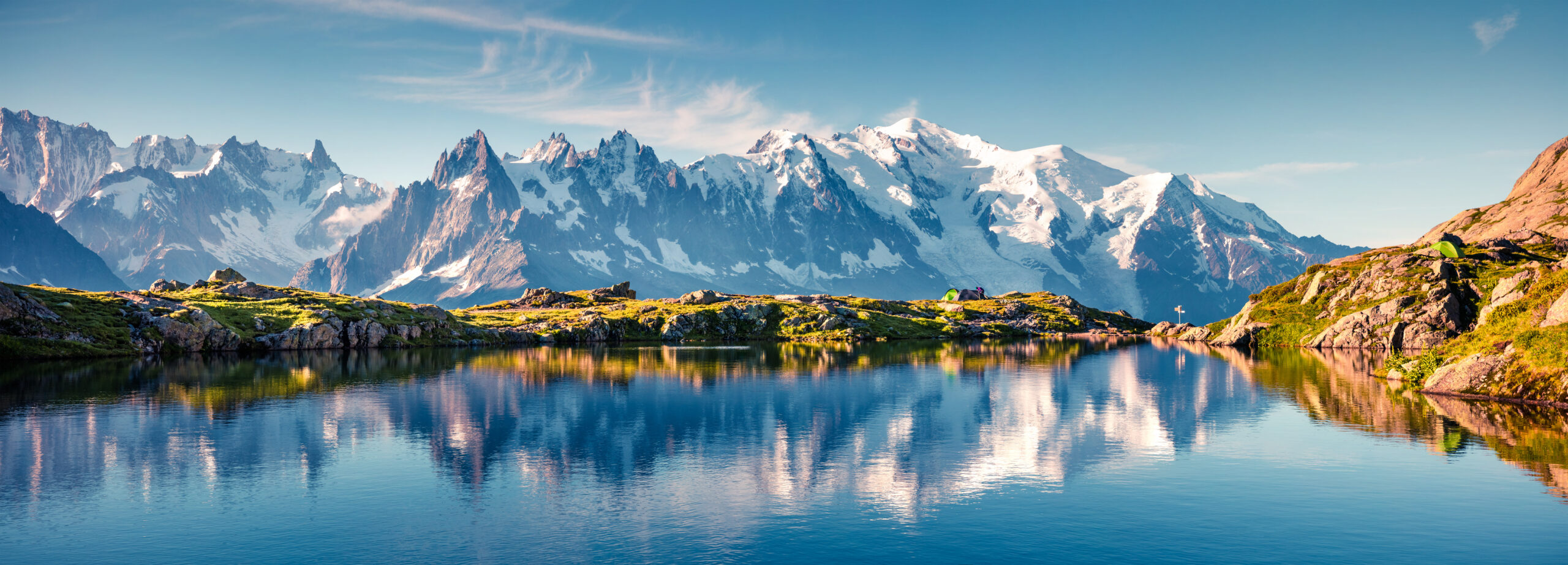
    Mont Blanc, the snow-capped highest peak of the Alps, above Chamonix
    Mont Blanc is about 4,808 m (15,774 ft), the highest peak in the Alps and Western Europe. Its royal-route reputation hides one of the deadliest mountains in Europe.
    Expedition Updates · Alps

    Mont Blanc expedition update

    The most-climbed major peak in the Alps, and one of the most underestimated. This page tracks the permit reality, the two main routes, the Grand Couloir, the cost, and where Mont Blanc fits your progression. A single-mountain page in our Expedition Updates directory. Elevations in metres (feet).

    Current status Summer season 4,808 m (15,774 ft)

    The Voie Royale that kills the unprepared.

    Mont Blanc is the highest mountain in the Alps and Western Europe, and the most climbed, with tens of thousands attempting it each summer. Its normal route is graded PD, low on the alpine scale, and that low grade is exactly the trap: in absolute numbers it is one of the deadliest mountains in Europe.

    There is no permit, but a hut reservation is now a legal requirement to climb the Gouter route with an overnight, checked by the Garde Blanche patrol. And the Grand Couloir, a rockfall gully on that route, has claimed over a hundred lives. For current Grand Couloir status and hut dates, see our Gouter route conditions page.

    4,808 m

    Summit (15,774 ft)

    Highest in the Alps and Western Europe; re-surveyed every couple of years.

    Hut booking

    Required on the Gouter

    No permit, but a mandatory reservation, enforced.

    Jun to Sep

    Prime season

    Timed around the Grand Couloir overnight freeze.

    Mont Blanc, the White Mountain, straddles the border of France and Italy above Chamonix and Courmayeur. It is the birthplace of modern mountaineering, first climbed in 1786, and it remains the great rite-of-passage 4,000 m peak for climbers stepping up from trekking and scrambling. That accessibility is its appeal and its danger. This page owns the mountain-level picture, the permit reality, the routes, and the progression. For live Grand Couloir status, refuge dates, and the 2026 season window, see our Gouter route conditions page, and for the full route detail, the Mont Blanc climb guide.

    Season and status

    A summer mountain, timed as much by temperature as by the calendar.

    Mont Blanc is climbed in summer, roughly late May or June through late September into early October, with the most stable conditions from mid-June to early September. But the calendar is only half the story. Because hot weather sharply increases rockfall in the Grand Couloir, the safe window is really defined by cold, frozen conditions, and heatwaves can make the normal route dangerous even in peak season. Rather than duplicate the live tracking, we keep the current hut opening dates and Grand Couloir status on our Gouter route conditions page.

    The permit reality

    No permit, but not a free-for-all either.

    This is the point most first-timers get wrong. Mont Blanc has no climbing permit; it is technically an open mountain. But to climb the Gouter route with an overnight stay, a hut reservation is now a legal requirement, and a dedicated patrol called the Garde Blanche checks for proof of a booking, usually near Nid d’Aigle or Tete Rousse. Climbers who cannot show a valid reservation can be turned back. Only a single-push speed ascent with no overnight avoids the requirement. In practice, planning a Mont Blanc climb means securing a hut booking months ahead, not simply turning up with crampons.

    What this means for you: book your hut, Tete Rousse or the Gouter Refuge, as far ahead as you can, because the spots are limited and they fill. A proposed climbing deposit or permit has been debated for years but is not in force; the real gate is the hut reservation, not a permit office.

    The two main routes

    The normal route, and the one that avoids the couloir.

    Climbers on a snow ridge high on Mont Blanc in the French Alps
    High on Mont Blanc, above the huts. The normal Gouter route finishes over the Dome du Gouter and the Bosses Ridge; the Trois Monts route reaches the summit from the Aiguille du Midi side.
    The main Mont Blanc routes. All require crampon, ice-axe, and glacier-travel skills.
    RouteStartCharacterMain hazard
    Gouter (normal route)Nid d’Aigle (Mont Blanc Tramway)The most popular and least technical line, hut-based via Tete Rousse and the Gouter Refuge.The Grand Couloir rockfall crossing.
    Trois MontsAiguille du Midi cable carMore committing, crossing Mont Blanc du Tacul and Mont Maudit, and it avoids the Grand Couloir.Serac and avalanche hazard on the Tacul and Maudit slopes.
    Gonella (Italian)The Italian sideQuieter and more physically demanding, a longer and less trafficked approach.Length and remoteness.

    The Gouter is the route most people mean when they say they are climbing Mont Blanc: hut-based, less technical, and busy, but committed to crossing the Grand Couloir. The Trois Monts is the connoisseur’s line from the Aiguille du Midi, more committing and exposed to serac and avalanche hazard over Mont Blanc du Tacul and Mont Maudit, but free of the couloir. Neither is a walk, and both demand the same fundamental skills.

    The Grand Couloir

    The single most dangerous section of the normal route.

    ⚠ The couloir is where the normal route earns its reputation

    The Grand Couloir is a rockfall gully at around 3,340 m, a crossing of roughly 50 m equipped with fixed ropes, between the Tete Rousse and Gouter huts. It must be crossed early, before about 7am, while the overnight freeze still binds the loose rock; once the sun warms the slope, stones come down the gully with little warning. French mountain police recorded 347 rescues, 102 deaths, and 230 injuries here between 1990 and 2017, and hot summers make it markedly worse.

    Cross fast, cross early, wear a helmet, and do not linger. In dangerous heat the authorities have closed the Gouter Refuge to discourage the route entirely. Check the current status on our Gouter route conditions page before you go. This page is educational and is not a substitute for a guide.

    Cost and guiding

    Affordable by 4,000 m standards, with IFMGA guides the norm.

    A guided Gouter climb, usually three days and two nights with some acclimatization, runs roughly 1,200 to 2,000 euros or more, using an IFMGA-certified guide, the required standard in the Alps. On top of the guiding fee, budget the hut fees, the Mont Blanc Tramway to Nid d’Aigle, any gear rental, and travel to Chamonix. Climbing independently is cheaper, but it assumes you already have the crampon, glacier, and route-finding skills a guide would otherwise supply, and it still requires the same hut booking. Weigh the choice in our guided versus independent climbing guide, and vet teams with how to choose an operator.

    Altitude and difficulty

    Low grade, high seriousness.

    Mont Blanc is graded PD, non-technical by alpine standards, but that grade describes the moves, not the mountain. At about 4,808 m the altitude is a real factor, and climbers who arrive without acclimatization often struggle on the long summit day. Add crevasses on the glaciers, the Grand Couloir on the Gouter, and the notorious speed of Alpine weather, and a low-grade climb becomes a serious one. It is often a climber’s first 4,000 m peak, and it rewards proper acclimatization and fitness more than technical skill. Read our acclimatization guide and check your base against our fitness standards, and gauge your altitude risk with the AMS risk calculator.

    Weather and timing

    The live picture over the massif.

    Alpine weather changes fast, and Mont Blanc’s summit can be in cloud and high wind while Chamonix sits in sunshine. Summit day depends on catching a calm, cold window, which also keeps the Grand Couloir safer. The live map below shows current conditions; rely on the Chamonix mountain forecast and your guide or hut staff for the actual call.

    Live wind and weather for Mont Blanc. Source: Windy.com. For how to read a mountain forecast, see our weather guide.
    Mont Blanc, on the France-Italy border above Chamonix and Courmayeur. Map: OpenStreetMap contributors.

    Where Mont Blanc fits your progression

    The classic first big Alpine 4000er.

    For most climbers Mont Blanc is the first serious 4,000 m peak, the altitude and glacier milestone before more technical objectives. The natural step up in the Alps is the Matterhorn, which trades Mont Blanc’s altitude for sustained technical rock, and our Mont Blanc versus Matterhorn comparison lays out the difference. Track current conditions on the next objective in our Matterhorn expedition update, and see the wider range in our Alps Classics collection.

    Go or no-go checklist

    Work through these before you commit.

    Before you go

    • Book the hut early – a Tete Rousse or Gouter reservation is a legal requirement and the spots fill months ahead.
    • Acclimatize first – the altitude near 4,808 m turns back climbers who arrive straight from sea level.
    • Have the skills – crampons, ice axe, glacier travel, and roped movement, or climb guided.
    • Plan the Grand Couloir – cross before 7am, wear a helmet, and check the current status before you go.
    • Watch the heat – hot spells raise rockfall risk; a cold, frozen window is safer than a warm one.
    • Respect the PD grade – low technical difficulty does not mean low risk on this mountain.

    Mont Blanc update FAQ

    The questions climbers ask most about permits, routes, and the Grand Couloir.

    Do you need a permit to climb Mont Blanc?

    There is no climbing permit, but this is where people go wrong. To climb the Gouter route with an overnight stay, a hut reservation is now a legal requirement, and a patrol called the Garde Blanche checks for proof of a booking near Nid d’Aigle and Tete Rousse. If you cannot show a valid reservation, you can be turned back. Only a single-push speed ascent with no overnight avoids the booking requirement. So while Mont Blanc is technically an open mountain, the practical answer is that you plan around a mandatory hut reservation, not a free-for-all.

    What is the Grand Couloir?

    The Grand Couloir is the notorious rockfall gully on the Gouter route, at around 3,340 m, a crossing of roughly 50 m equipped with fixed ropes. It must be crossed early, before about 7am, while the overnight freeze still holds the loose rock in place; once the sun warms the slope, rockfall increases sharply. French mountain police recorded 347 rescues, 102 deaths, and 230 injuries in the couloir between 1990 and 2017. It is the single most dangerous section of the normal route. For its current status, see our Gouter route conditions page.

    Which Mont Blanc route should I climb?

    The Gouter, or normal, route is the most popular and least technically demanding, but it crosses the Grand Couloir. The Trois Monts route from the Aiguille du Midi avoids the couloir but is more committing, with serac and avalanche hazard over Mont Blanc du Tacul and Mont Maudit. The Italian Gonella route is quieter and longer. All of them require crampon and ice-axe skill, glacier travel, and roped movement; none is a walk-up.

    Is Mont Blanc dangerous?

    In absolute terms it is one of the deadliest mountains in Europe, though not because it is technically hard. It is graded PD, relatively low on the alpine scale, but it is climbed by huge numbers of people who underestimate it. The Grand Couloir rockfall, the altitude at 4,808 m, crevasses, and fast-changing weather are what cause accidents. The low technical grade and the Voie Royale nickname hide a serious high-altitude climb.

    When is the Mont Blanc climbing season?

    Summer, roughly late May or June through late September into early October, with the most stable conditions from mid-June to early September. Because hot weather sharply increases rockfall in the Grand Couloir, timing around cooler, frozen conditions matters as much as the calendar. Our Gouter route conditions page tracks the current 2026 hut opening and route dates.

    How much does it cost to climb Mont Blanc with a guide?

    A guided Gouter climb, typically three days and two nights including some acclimatization, runs roughly 1,200 to 2,000 euros or more, using an IFMGA-certified guide, which is the required standard in the Alps. On top of the guiding fee, budget hut fees, the Mont Blanc Tramway, gear rental if needed, and travel to Chamonix. Going independently is cheaper but assumes you bring the skills a guide would otherwise provide.

    How hard is Mont Blanc, and do I need experience?

    It is graded PD, meaning non-technical by alpine standards, but it is a serious undertaking. You need to be fluent with crampons and an ice axe, comfortable on a rope for glacier travel, fit enough for a long summit day, and able to handle the altitude near 4,808 m. Most first-timers climb it guided or after completing a mountaineering course. It is often a climber’s first serious 4,000 m peak.

    How high is Mont Blanc and where is it?

    Mont Blanc is about 4,808 m (15,774 ft), the highest mountain in the Alps and in Western Europe, on the border of France and Italy above Chamonix and Courmayeur. Its snow-capped summit is re-surveyed every couple of years, so the exact figure shifts slightly. It was first climbed in 1786 by Jacques Balmat and Michel-Gabriel Paccard, the ascent widely seen as the birth of modern mountaineering.

    📋 How this update is built

    This page is compiled by Travis Ludlow, Founder and Head of Research at Global Summit Guide, from Saint-Gervais and prefecture access rules, French mountain-police accident records, and IFMGA guiding information, with sources named below. It was reviewed for safety by Dawson Ludlow, our Climbing and Mountaineering Lead (Wilderness First Aid), whose highest first-hand summit is Kilimanjaro.

    Our team has not climbed Mont Blanc, so we report official rules and route records rather than personal experience, and we review this page through the Alpine season. Access rules and conditions change, so confirm the current hut-reservation requirement and Grand Couloir status on our conditions page and with the authorities before you commit.

    Planning a Mont Blanc climb?

    Start with our Mont Blanc climb guide, check the live Gouter route conditions, and compare it with the step up in Mont Blanc versus Matterhorn. Most climbers stage through Chamonix via Geneva, so for flights and lodging, browse travel on Expedia.

    Disclosure: the Expedia link above is a sponsored affiliate link. We may earn a commission at no extra cost to you.

    Was this helpful?

    Yes
    No
    Thanks for your feedback!
  • Matterhorn Expedition Update 2026: Season, Hörnli Ridge, Huts & Conditions

    The Matterhorn, a sharp rock pyramid rising above the Swiss Alps
    The Matterhorn is 4,478 m (14,692 ft) on the Swiss to Italian border above Zermatt. This page tracks its season, with live weather below.
    Expedition Updates · Alps

    Matterhorn expedition update

    Where the Matterhorn stands this season, plus the Hoernli Ridge, the hut departure order that shapes summit day, acclimatization needs, and why the descent is the danger. A single-mountain page in our Expedition Updates directory. Elevations in metres (feet).

    Current status In season 4,478 m (14,692 ft)

    In season now. The summer window is open.

    The Matterhorn’s climbing window runs early July to mid-September, when the summit ridges clear of snow and allow fast movement on rock. Late July sits in the heart of it, and the Hoernli Ridge is being climbed daily out of Zermatt.

    This is technical alpine climbing, not a scramble: graded AD with short UIAA III moves, 1,220 m (4,000 ft) of exposed ground above the hut, and 8 to 12 hours round trip. The mountain rewards preparation and punishes improvisation.

    4,478 m

    Summit (14,692 ft)

    A near-perfect rock pyramid on the Swiss to Italian border.

    Jul to Sep

    Climbing season

    In season now; early July to mid-September is the window.

    03:30

    Hut departure

    The Hoernli Hut start order puts Zermatt guides on the ridge first.

    The Matterhorn stands alone above Zermatt, and its shape is the reason every edge of it is exposed: four ridges rise to a small summit, with nothing to shelter a climber caught out. This page is the update view, covering where the mountain sits in its season, the normal route, and the practical rules that shape a summit day. For the full how-to on operators, gear, cost, and preparation, see our Matterhorn climb guide, and for the wider picture across ranges, the Expedition Updates dashboard.

    Current status and the season

    Where the mountain is today, and how the window works.

    Right now the Matterhorn is in season. Zermatt guides are running Hoernli Ridge ascents daily and the huts are open and busy. The window depends on the ridges drying out: in high summer the rock clears of snow, which lets teams move quickly over ground that would otherwise demand slow, careful mixed climbing. Early in the season the route holds more snow and ice, and from mid-September the huts wind down and conditions grow serious again. Because summit day is long and the weather in the Valais can turn quickly, most programmes build in spare days rather than betting on a single forecast window.

    Planning horizon. Book huts and a guide well ahead for the July and August peak, and plan five to seven days of acclimatization before your attempt. Start with altitude acclimatization and our fitness standards.

    The Hoernli Ridge

    The normal route, and the main alternative.

    Hoernli Ridge (normal route)

    The line of the 1865 first ascent, climbed from Zermatt. A lift to Schwarzsee and a walk of roughly two hours reach the Hoernli Hut at 3,260 m (10,700 ft). From there summit day climbs about 1,220 m (4,000 ft) of exposed mixed rock, snow, and ice, graded AD with short UIAA III moves, in 8 to 12 hours round trip. Route-finding on the complex face matters as much as the climbing itself.

    Lion Ridge and the harder lines

    The Lion Ridge on the Italian side is the main alternative, slightly harder and approached from the Carrel Hut, and it can be linked with a Hoernli descent to traverse the peak. The Zmutt and Furggen ridges and the north face are serious undertakings for experienced alpinists. For the full route breakdown, see the Matterhorn climb guide.

    A climber on an exposed rocky alpine ridge in the Swiss Alps
    The Hoernli Ridge is sustained mixed ground rather than a walk-up, and fixed ropes assist only on short sections of the upper mountain.

    Huts and the departure order

    One local rule shapes the whole summit day.

    The Hoernli Hut is the launch point for nearly every Hoernli Ridge attempt, and it enforces a departure order at around 03:30: Zermatt-based guides and their clients leave first, guides from elsewhere second, and unguided teams last. On a ridge this narrow, position in that order decides whether you climb in clear air or spend the morning queuing behind slower parties, and it is the main practical reason climbers hire a Zermatt-based guide rather than an outside one. Book hut places early for the July and August peak, and expect half-board pricing typical of Swiss high-alpine huts.

    What summit day looks like

    • Day before – lift to Schwarzsee, then roughly two hours on foot to the Hoernli Hut.
    • 03:30 start – departure in the hut’s set order, climbing by headlamp on the lower ridge.
    • Upper mountain – steeper mixed ground with fixed ropes on short sections to the summit.
    • 8 to 12 hours – round trip from hut to summit and back down; the descent takes most of it.

    If fixed ropes are new to you, read fixed lines and jumars explained before you go, and weigh your options in guided vs independent climbing.

    Weather and conditions

    A narrow peak with nowhere to hide. Here is a live read.

    The Matterhorn’s isolation and sharp profile make it exposed on every side, and storms build fast over the Valais on summer afternoons. Fresh snow or verglas on the ridge turns fast rock climbing into slow, serious mixed ground, which is why guides call off attempts on forecasts that would look tolerable elsewhere. The live map below shows current wind and conditions for the massif; use it as a starting point and rely on your guide, the hut wardens, and a dedicated alpine forecast for any real decision.

    Live wind and weather for the Matterhorn massif. Source: Windy.com. For how to read it, see our mountain-weather guide.
    The Matterhorn, on the Swiss to Italian border above Zermatt. Map: OpenStreetMap contributors.

    For a fuller explanation of reading an alpine forecast, see mountain weather for climbers.

    Acclimatization and readiness

    The preparation that decides most summit days.

    The Matterhorn is not a peak to arrive at cold. Guides commonly build five to seven days of climbing at 4,000 m first, on peaks such as the Breithorn, Pollux, Castor, or the Allalinhorn, both to acclimatize and to prove that a climber can move efficiently on alpine ground. Attempts made without that build-up have low success rates, and the failures tend to show up as slow movement on the ridge rather than dramatic incidents. Fitness matters as much as technique here: the ability to keep climbing carefully for 8 to 12 hours is what gets people up and down.

    Where the Matterhorn fits. Many climbers reach it after Mont Blanc or a season of Alpine 4000ers, and neighbours like the Dent Blanche and the Eiger sit at a comparable or higher level of commitment.

    Safety and the descent

    The mountain’s oldest lesson, still true.

    More than 500 people have died on the Matterhorn since 1865, typically three to five a year, and the pattern is consistent: most fatalities happen on the way down. Climbers are tired, the day is warming, rockfall increases, and the elation of the summit competes with the concentration the descent demands. The 1865 first ascent set the template when four of Whymper’s seven-strong party died descending. The practical defences are unglamorous: acclimatize properly, move efficiently so you are not late, keep to turn-around times, and climb with someone who will call it off.

    ⚠ The summit is halfway

    On the Matterhorn the descent is the dangerous half, and the record has said so since 1865. Being fit and fast enough to reverse the route in good order matters more than being able to reach the top. This page is not medical or safety advice; build your plan with an IFMGA-certified guide, and read guided vs independent climbing before deciding to go unguided.

    The Matterhorn at first light above the surrounding alpine valley
    Four ridges rise to a small summit, which is why the Matterhorn is exposed on every side and why weather windows matter so much.

    Matterhorn by the numbers

    The context behind a single season, from grounded records.

    1865

    First ascent

    Whymper’s party on July 14; four of the seven died descending.

    500+

    Deaths since

    Typically three to five climbers a year, mostly on the descent.

    1,220 m

    Summit-day gain

    4,000 ft of exposed ground above the Hoernli Hut.

    Guided ascents run roughly $3,000 to $8,000 depending on the programme and how much acclimatization is included, with IFMGA-certified Zermatt guides at the upper end. For how to weigh those options, read how to choose an expedition operator and compare teams in our operator directory.

    Matterhorn update FAQ

    The questions climbers ask most about timing, guides, and conditions.

    When is the Matterhorn climbing season?

    Early July to mid-September, and the mountain is in season now. High summer is when the summit ridges clear of snow and allow faster movement on rock. Outside that window the route holds snow and ice, the huts close, and conditions turn far more serious.

    What is the normal route on the Matterhorn?

    The Hoernli Ridge from Zermatt, the line of the 1865 first ascent. From the Hoernli Hut at 3,260 m (10,700 ft) it climbs about 1,220 m (4,000 ft) of exposed mixed rock, snow, and ice to the 4,478 m summit. It is graded AD with short UIAA III moves, and summit day runs roughly 8 to 12 hours round trip. The Lion Ridge on the Italian side is the main alternative.

    How hard is the Matterhorn to climb?

    It is technical alpine climbing, not a scramble. The Hoernli Ridge demands sustained movement on mixed ground, route-finding on a complex face, and the fitness to keep moving for 8 to 12 hours at altitude. Climbers arriving without alpine technical experience have a documented pattern of failure and rescue on this peak.

    Do I need a guide for the Matterhorn?

    A guide is not legally mandatory, but most climbers hire one, and hiring a Zermatt-based guide carries a practical advantage: the Hoernli Hut enforces a departure order at about 03:30, with Zermatt guides leaving first, outside guides second, and unguided teams last. Starting earlier means less queuing on the ridge. Guided ascents run roughly $3,000 to $8,000 depending on the program.

    How much acclimatization do I need first?

    Effectively a week of 4,000 m climbing before the attempt. Guides commonly build on the Breithorn, Pollux, Castor, or Allalinhorn, with five to seven days of acclimatization climbs. Direct summit attempts without that preparation have low success rates.

    How dangerous is the Matterhorn?

    It is one of the most consequential peaks in the Alps. More than 500 deaths have been recorded since 1865, typically three to five a year, and most happen on the descent when climbers are tired. Four of the seven climbers on Whymper’s 1865 first ascent died coming down, which set the mountain’s reputation from the start.

    📋 How this update is built

    This page is compiled by Travis Ludlow, Founder and Head of Research at Global Summit Guide, from Zermatt guide and hut information, Swiss Alpine Club sources, and published mountaineering records, with sources named below. It was reviewed for safety by Dawson Ludlow, our Climbing & Mountaineering Lead (Wilderness First Aid), whose highest first-hand summit is Kilimanjaro. Where our team has no first-hand ascent of the Matterhorn, we report the cited records rather than personal anecdote, and we flag figures that shift year to year, such as guiding prices and hut rates.

    Sources and further reading

    • Zermatt Bergfuehrer and the Hoernli Hut – season dates, hut booking, and the departure order.
    • Swiss Alpine Club (SAC) – hut network and route information for the Valais 4000ers.
    • IFMGA-certified guide services operating from Zermatt – 2026 programs and pricing.
    • Published mountaineering records – the 1865 Whymper first ascent and subsequent fatality records.
    • Our own Matterhorn climb guide for full route, gear, and operator detail.
    • We report published figures and named sources rather than posting unverified live conditions.

    Planning a Matterhorn climb?

    Start with the full Matterhorn climb guide, build the acclimatization plan with altitude acclimatization, and read how to choose an expedition operator before you book. For flights and lodging around Zurich, Geneva, and Zermatt, browse travel on Expedia.

    Disclosure: the Expedia link above is a sponsored affiliate link. We may earn a commission at no extra cost to you.

    Was this helpful?

    Yes
    No
    Thanks for your feedback!
  • Mont Blanc Conditions This Week: Grand Couloir Heat & Rockfall Watch

    Mont Blanc, the highest peak in Western Europe, above the Chamonix valley
    🇫🇷 Mont Blanc · Conditions Watch · Jul 2026

    Mont Blanc Conditions This Week: Grand Couloir Heat & Rockfall Watch

    The Goûter route is open and busy — but mid-summer heat is loading the dice in the Grand Couloir, the most dangerous section of the normal route. Here’s where conditions stand this week, why the heat matters, and exactly what to do about it.

    Conditions watch · Jul 12, 2026

    The Goûter route is in peak season and open — and this is exactly the window when heat drives rockfall. Mid-July sits in the busiest, warmest part of the Mont Blanc season, and warm, dry spells sharply raise the risk in the Grand Couloir, the route’s notorious “corridor of death.” Refuge dismantling work on the old Goûter hut continues through the summer but does not close the route.

    The dominant hazard right now isn’t technical difficulty — it’s timing and temperature. Teams are crossing the couloir in the pre-dawn cold and moving fast. On hot days, the risk climbs through the morning and afternoon, and during past heatwaves the prefecture has asked climbers to postpone the ascent entirely.

    This is a dated watch. Alpine conditions change day to day — always confirm the latest with the Chamonix Office de Haute Montagne and the Haute-Savoie prefecture before you go. We refresh this page through the season.

    📌 This is the this-week watch — the full guide is the pillarThis page covers the current picture. For the complete, evergreen reference — 2026 season dates, refuge reservations, cost, cable status, and the camp-by-camp route — see our Mont Blanc Goûter route conditions guide, with the full itinerary in the Goûter route expedition breakdown.
    4,808 m
    Summit (15,774 ft)
    3,340 m
    Grand Couloir crossing
    Before 06:00
    Cross the couloir
    ~May–Oct
    2026 season

    Where it is

    The highest point in Western Europe, above Chamonix and Saint-Gervais.

    Mont Blanc rises to 4,808 m on the France–Italy border, above the Chamonix valley. The standard Goûter route starts from Saint-Gervais / Les Houches, climbs via the Nid d’Aigle, the Tête Rousse hut (3,167 m), across the Grand Couloir at about 3,340 m, up to the Goûter Refuge (3,835 m), then along the Bosses Ridge to the summit. The couloir crossing sits early on summit day — which is why where you sleep the night before decides when you cross it.

    Summit: Mont Blanc (4,808 m) Grand Couloir: ~3,340 m crossing Base: Chamonix / Saint-Gervais

    Why heat is the story this week

    Warm days don’t just make you sweat — they bring the mountain down.

    The Grand Couloir is a natural funnel for falling rock, and what holds that rock in place is ice and permafrost. When a warm, dry spell hits — exactly the mid-summer pattern — that frozen glue melts, and the couloir starts shedding stones, sometimes day and night. Research on the couloir found that the majority of rockfall happens through the middle of the day, which is why the entire safety strategy is built around crossing before the rock warms up.

    This isn’t theoretical. Hot summers have produced the worst conditions on record: during the 2015 heatwave the Goûter hut was temporarily closed by prefectural order, and in other dry years the authorities have publicly asked climbers to postpone. A hot forecast, in other words, is a direct rockfall signal — and the reason a “conditions this week” check matters more on Mont Blanc than on almost any peak in the Alps.

    Climbers on the snow slopes of Mont Blanc high on the Goûter route
    Timing beats fitness here. The Goûter route is graded PD — not technically hard — but the Grand Couloir turns the ascent into a problem of when, not whether. The strongest climbers on the mountain are the ones across the couloir before first light.

    The Grand Couloir, by the numbers

    One of the deadliest spots in the Alps — and unavoidable on the normal route.

    The couloir’s reputation is earned. French mountain police recorded 347 rescue operations, 102 deaths, and 230 injuries in the Grand Couloir between 1990 and 2017 — a toll that has made “couloir de la mort” a genuine local name, not tabloid hyperbole. A 2020 Petzl Foundation study even examined whether an alternative path could replace the crossing and concluded any alternative would be more dangerous. The couloir is the route.

    The hazardFalling rock funnelled down a ~40 m-wide gully; a single stone can be fatal.
    The driverHeat and drought melt the permafrost binding the rock — warm afternoons are worst.
    The defenceCross before dawn, move fast (2–5 minutes), helmet on, never linger.
    The alternativeThe Trois Monts route avoids the couloir entirely — more technical, but no couloir.

    Mont Blanc’s overall toll is part of why it ranks among the most dangerous mountains in Europe despite its modest grade — context we cover in our death rates by mountain analysis.

    What to do this week

    If you’re climbing in the next few days, this is the checklist.

    None of this replaces a qualified guide or the official advisory, but it’s the discipline that keeps climbers alive in the couloir during the hot months:

    1 · Sleep low, cross earlyStart from the Tête Rousse hut so you cross the couloir in the pre-dawn cold, ideally before 06:00.
    2 · Read the forecast as a rockfall gaugeHot, dry days = higher risk. If a heatwave is forecast, consider postponing or switching routes.
    3 · Check the official advisoryOffice de Haute Montagne (Chamonix) and the Haute-Savoie prefecture publish current conditions and any closures.
    4 · Consider the Trois MontsIf the Goûter is shedding, the Aiguille du Midi / Cosmiques approach avoids the couloir.
    5 · Helmet, crampons, speedHelmet non-negotiable; crampons required from the Goûter upward all season; cross fast and don’t stop.
    🎒 Prepare properly (deep-dive guides)

    Live conditions & heat watch

    On this route, the temperature forecast is a safety forecast.

    The 7-day outlook below is modelled data for the Mont Blanc / Chamonix region — a general indicator, not a summit-day forecast. Read it as a rockfall gauge: warm, dry days push the Grand Couloir risk up, cool spells and fresh snow settle it down. For summit-day planning, pair this with a dedicated alpine forecast and the Office de Haute Montagne bulletin.

    Mont Blanc / Chamonix region

    Loading live data…
    Fetching the latest forecast…
    Read heat as risk. This is valley-and-massif model data; the freezing level and how hot the rock gets matter as much as the summit temperature. When it’s warm, cross the couloir earlier and be ready to turn back.

    Planning to climb this season?

    Beyond this week — the full picture for a Mont Blanc attempt.

    If Mont Blanc is on your list for this summer, the conditions watch is only the starting point. Get the season logistics and the honest difficulty from the guides below, and see where Mont Blanc sits among Europe’s great peaks:

    🏔️ Your Mont Blanc planning shelf

    Mont Blanc is one of 500+ peaks in our mountain database — compare it, and find your next objective.

    Frequently asked questions

    Is Mont Blanc safe to climb this week?

    The Goûter route is open and in peak season, but mid-summer heat drives Grand Couloir rockfall — the route’s biggest hazard. Whether it’s advisable on a given day depends on temperature and the current advisory. Cross before dawn, check the Office de Haute Montagne and prefecture, and be ready to turn back. Full detail in our Goûter conditions guide.

    Is the Goûter route open right now?

    Yes — the 2026 season runs roughly late May to early October, and mid-July is peak window. Old-hut dismantling work continues through summer but doesn’t close the route. Confirm refuge bookings and any short-notice closures with FFCAM and the prefecture.

    What time should I cross the Grand Couloir?

    Before dawn — ideally before 06:00, when the rock is coldest and rockfall is lowest. Most rockfall happens through the middle of the day. Starting from Tête Rousse lets you cross in the dark.

    Does heat really increase rockfall?

    Yes, sharply. Heat and drought melt the permafrost binding the rock above the couloir. Hot summers have produced the worst conditions on record, and in 2015 the Goûter hut was closed during a heatwave.

    Can I avoid the couloir?

    The Trois Monts route (via the Aiguille du Midi and Cosmiques hut) avoids the Grand Couloir entirely. It’s more technical but sidesteps the rockfall — the usual alternative when the Goûter is in poor shape.

    How dangerous is the Grand Couloir?

    It’s one of the deadliest spots in the Alps: 347 rescues, 102 deaths, and 230 injuries between 1990 and 2017. The danger is objective — falling rock in a narrow gully — so timing and discipline matter most.

    How we compiled this

    This watch draws on the Chamonix Office de Haute Montagne, the Haute-Savoie prefecture, FFCAM refuge information, and published rockfall research (UIAA, the Petzl Foundation, and the EDYTEM–ISTerre study), cross-checked against our own Goûter route conditions guide. Conditions are described in general, dated terms rather than as day-specific guarantees.

    Alpine conditions change quickly. This page is an educational planning aid, not a substitute for the official advisory — always confirm the current situation with the Office de Haute Montagne and the prefecture, and climb with a qualified guide if you lack alpine experience.

    Travis Ludlow

    Founder & Head of Research, Global Summit Guide

    Travis leads research at Global Summit Guide, where the team tracks conditions on the world’s major peaks and maintains guides to more than 500 mountains, with safety content reviewed by Taylor Ludlow, RN. This is a dated conditions watch; for full route and planning detail, it points you to our evergreen Mont Blanc guides.

    Climb it in the right window

    The Goûter route rewards good timing more than raw strength. Get the full season picture and the camp-by-camp plan before you go — and cross the couloir before the sun hits the rock.

    Full Goûter conditions → The expedition breakdown →

    Was this helpful?

    Yes
    No
    Thanks for your feedback!
Language »