
Last updated September 30, 2026

Mount of the Holy Cross Hike: North Ridge, Half Moon Pass & Camping
The Class 2 grade hides a demanding day: hike over Half Moon Pass, drop into East Cross Creek, climb the North Ridge to 14,007 feet, then regain the pass on your tired legs. This guide explains the route, the return-navigation trap, overnight options and how to plan a realistic Holy Cross summit.
Mount of the Holy Cross rises above the Eagle River valley in Colorado’s northern Sawatch Range. Its name comes from a cross-shaped snow feature on the northeast face, a landmark popularized by nineteenth-century explorers, photographers and artists. Reaching the summit is a different undertaking from viewing that famous cross: the standard hike approaches from Half Moon and climbs the opposite side of the mountain.
The North Ridge is officially a Class 2 route, yet it has moderate route-finding and exposure, considerable commitment, and more cumulative elevation gain than many Colorado fourteeners. The defining challenge is geography: the trail crosses Half Moon Pass, descends roughly 1,000 feet to East Cross Creek, and then climbs to the summit. Every foot lost on that approach must be regained after you come down from the mountain.
For hikers considering Holy Cross after shorter fourteeners, the useful question is not just “Can I climb 5,600 feet?” It is whether you can descend complex, rocky alpine terrain with enough daylight, energy, weather margin and navigation discipline left for a final uphill climb out of the basin.
Coverage and membership terms vary. Verify the activities and altitude your own plan includes.
Class 2 Terrain. A Serious Full-Day Commitment.
The standard North Ridge is 11.25 miles round trip with approximately 5,600 feet of cumulative ascent. Trailhead elevation is around 10,320 feet; the summit is 14,007 feet. It crosses Half Moon Pass both ways, so the trail’s early descent creates a significant, mandatory re-ascent on your way out.
Consider it an endurance-and-navigation objective in dry conditions rather than an entry-level fourteen-er. Early-season snow, icy rock, thunderstorm exposure or the longer Halo Ridge variation can make the mountain substantially more serious.
The Summit Is West of the Pass. The Effort Is on Both Sides.
Holy Cross is in Eagle County inside Holy Cross Wilderness. From the Half Moon Trailhead you climb to Half Moon Pass, drop to East Cross Creek and climb the North Ridge. A simple line on a map understates the cumulative gain.
Half Moon → East Cross Creek → Holy Cross
Summit: approximately 39.46683°N, 106.48169°W.
Standard trailhead: Half Moon Trailhead, near the end of Tigiwon Road (Forest Road 707), southwest of Minturn.
Most important waypoint: the North Ridge / return line near Angelica Couloir; mark the correct descent in your offline map before leaving the creek.
The shaded map is an overview. Download the authoritative GPX and route images; do not rely on a summit marker alone for a complex descent.

Tigiwon Road Is Part of Your Time Budget.
From I-70, take US 24 toward Minturn. South of Minturn, turn west onto Tigiwon Road and continue roughly 8.5 miles up the dirt road to Half Moon Trailhead. The road is rough and conditions change; a cautious driver in a passenger car may make it when dry, but recent hikers have reported rocky stretches that favor extra clearance.
Seasonal access: Tigiwon has a managed seasonal gate. Typical guides describe a summer opening and late-fall closure, but 2026 opening was earlier than the usual calendar. Confirm the actual gate status with the Eagle–Holy Cross Ranger District rather than assuming a fixed June date.
Before leaving pavement: save offline driving directions, check recent road reports, account for a slow 8.5-mile ascent and confirm you have parking space and enough fuel for the return.
Six Stages, Including the Climb You Still Owe After Summiting
Approximate elevations below identify terrain changes—not GPS turn-by-turn instructions. The route needs downloaded mapping and current ground confirmation, particularly above treeline and during descent.
Half Moon Trailhead to Half Moon Pass
Start on the signed Halfmoon Trail and climb roughly 1.5 miles to the pass, near 11,300 feet. Take note of the saddle and trail direction: you will climb back to this exact pass after the summit.
Drop to East Cross Creek
From Half Moon Pass, descend west about 1,000 feet into the East Cross Creek basin. The forested approach includes the designated campsite area. Cross the creek at the established trail crossing; check flow and footing rather than assuming late-summer water levels.
Climb Out of the Basin to Treeline
After the creek, climb west and south through rocky forest sections. The trail gains the lower North Ridge around treeline. Maintain a conservative pace: the route is only beginning to repay the elevation you lost after the pass.
Follow the North Ridge and Large Cairns
Above 12,000 feet, the terrain becomes predominantly talus and alpine rock. Stay on the established, cairned North Ridge line. Around 13,400 feet the route changes direction; study 14ers.com images of this section before traveling in either direction.
Navigate Near Angelica Couloir, Then Finish to the Summit
Near 13,700 feet, the route reaches a notch at the top of Angelica Couloir. Do not invent a straight summit shortcut here: follow the established cairns to the right before turning toward the final rocky summit rise.
Retrace the North Ridge, Then Climb Over Half Moon Pass Again
Descend by the same marked North Ridge to East Cross Creek, locate the established creek crossing, and budget energy for about 1,000 feet of climb back over Half Moon Pass. From the pass, descend the final roughly 1.5 miles to the vehicle.
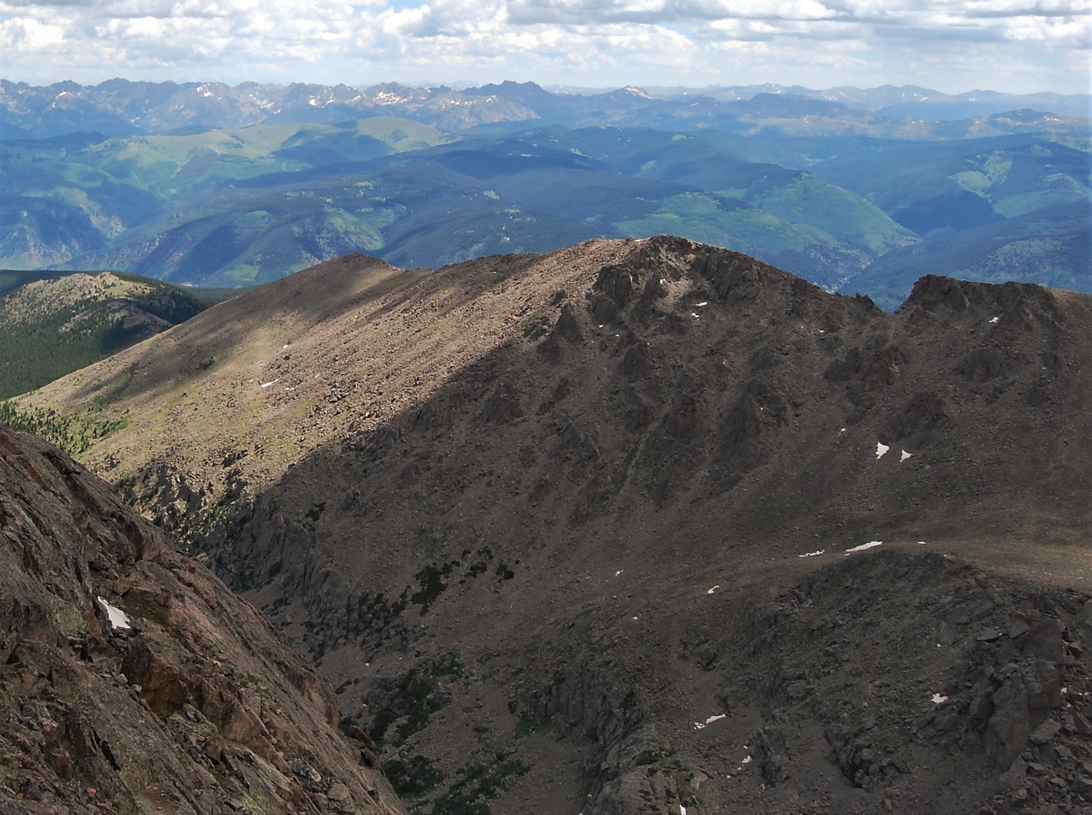
The Summit Is Not the Navigation Finish Line.
North Ridge terrain looks different in reverse. Confirm the intended descent line before leaving the summit and avoid the temptation to follow an attractive but incorrect drainage or ridge.
Photo: Wikimedia Commons · creator and licenseMark the Return Turn Before Ascending.
Above East Cross Creek, the established route works up the North Ridge. On descent, the temptation to follow a continuing ridge or a descending gully can lead far away from the creek and Half Moon Pass. The correct return line is the same cairned North Ridge you used to climb, passing back through the terrain near the top of Angelica Couloir.
Take a waypoint or an offline-map note at the key ridge turn during your ascent. Turn and photograph the terrain behind you so you recognize it when returning tired and in changed light. Do not rely only on footprints, a phone signal or an arbitrary straight line to the trailhead.
If the ridge, cairns and downloaded track disagree: stop, compare terrain and your map, and retrace the last known correct point rather than descending blind.

Camping Changes the Daily Effort—Not the Mountain’s Rules
The creek basin is the natural place to split the standard route, but it has stricter regulations than casual dispersed camping. The U.S. Forest Service makes those details explicit.
One Long Round Trip
Carry a day pack, start early and complete the approach, summit and return in one push. This option avoids overnight equipment but requires a large, continuous effort and disciplined timing.
- 11.25 miles and about 5,600 feet of ascent
- Late-day 1,000-foot regain over Half Moon Pass
- Considerable commitment despite Class 2
- No overnight registration needed for day use
East Cross Creek Base Camp
Backpack over Half Moon Pass and sleep at one of ten designated sites near East Cross Creek. Summit from camp the following morning, then pack up and hike out over the pass.
- Free self-issue overnight registration at the trailhead
- First-come-first-served sites; be prepared to share if full
- Camping outside designated East Cross Creek sites is prohibited
- Campfires are prohibited at these sites
Why the Return Feels Harder Than the Approach
Elevation loss is not free. Unlike an out-and-back that descends continuously after summiting, Holy Cross sends hikers back up a pass after they are most fatigued.
Lost Height
Walking down from Half Moon Pass feels fast in the morning, but the same trail is an uphill effort late in the day. Include that climb when estimating your true total gain.
Slow Rock
Talus, cairns and route choices can slow travel even when the grade remains Class 2. Your movement speed on polished alpine boulders may be far below your training pace.
Weather and Fuel
Getting off the highest rock is only one milestone. Afternoon storms, heat in the basin and the climb out must all fit inside the available forecast window.
Dry Summer Conditions Simplify the Rock—but Not the Commitment.
The normal nontechnical planning window is often mid-summer into early autumn, depending on snow and road opening. A recent late-September 2026 North Ridge report described dry trail but morning frost on upper rock, illustrating why current conditions override the month.
Lingering Snow Changes the Route
Snow may persist on the pass descent, forest slopes and high ridge. A nominally Class 2 route may require winter travel skills, traction or a change of objective.
Typical Dry-Rock Window
Often the practical North Ridge season once the road and trail dry out. Start early for thunderstorms and expect exposed alpine conditions above treeline.
Cooler Starts, Shorter Margin
Fall can deliver excellent conditions, but morning frost, a first snowfall, shorter days and seasonal road uncertainty demand a wider safety margin.
Long-Day Systems: Feet, Weather, Navigation and Emergency Margin
For dry conditions, you normally need a strong alpine hiking system rather than ropes and harnesses. If continuous snow or technical snow features are present, reassess the route and skills before treating summer gear as sufficient.
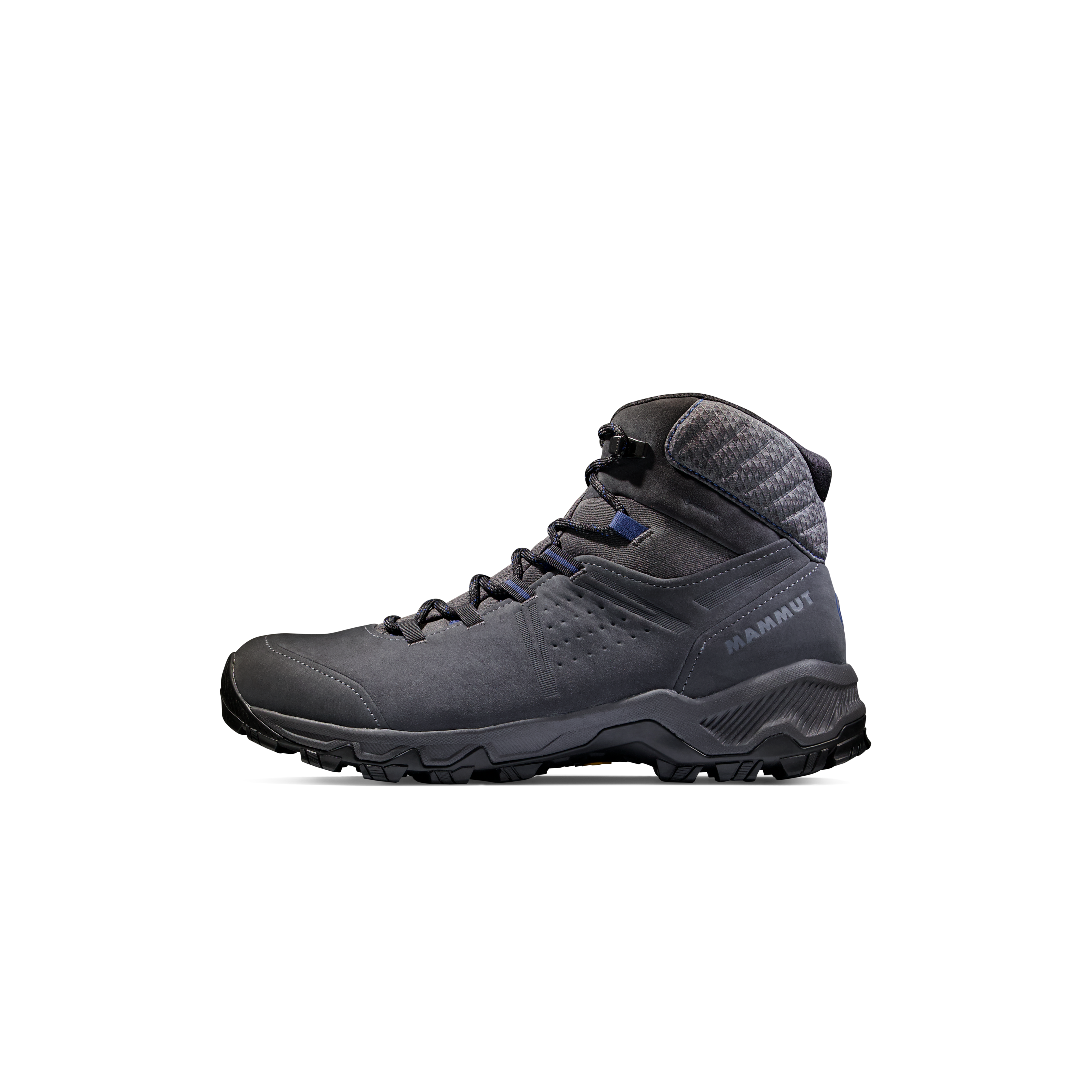
Proven Boots / Trail Shoes
Rocky ridge travel plus a full day of hiking reward stability and a fit you have tested before a 5,600-foot-gain objective.
Trekking Poles
Poles can help on the long trail descents and final climb out, but stow them appropriately during boulder movement.
Headlamp and Offline GPS
Carry extra power and route images. A route loaded onto a device is only useful if you know the key return waypoints.
Layering System
Bring insulated layers, gloves and a waterproof shell, even when the forecast is warm near Minturn.
Food, Water and Filter
Pack for the whole day and the late climb over the pass. Treat East Cross Creek water before drinking; do not assume water above treeline.
Emergency Essentials
Carry first aid, navigation backup, weather protection and a communication plan. Do not assume reliable cell reception across the route.
Mount of the Holy Cross: Long-Day Essentials
- MerrellMerrell Moab 3 Ready Zip Hiking Shoe – Women'sFrom $69.98
$139.95Check price at Back Country (opens in a new tab)



We may earn a commission if you buy through these links, at no extra cost to you. Affiliate disclosure
Early Starts and Overnight Options
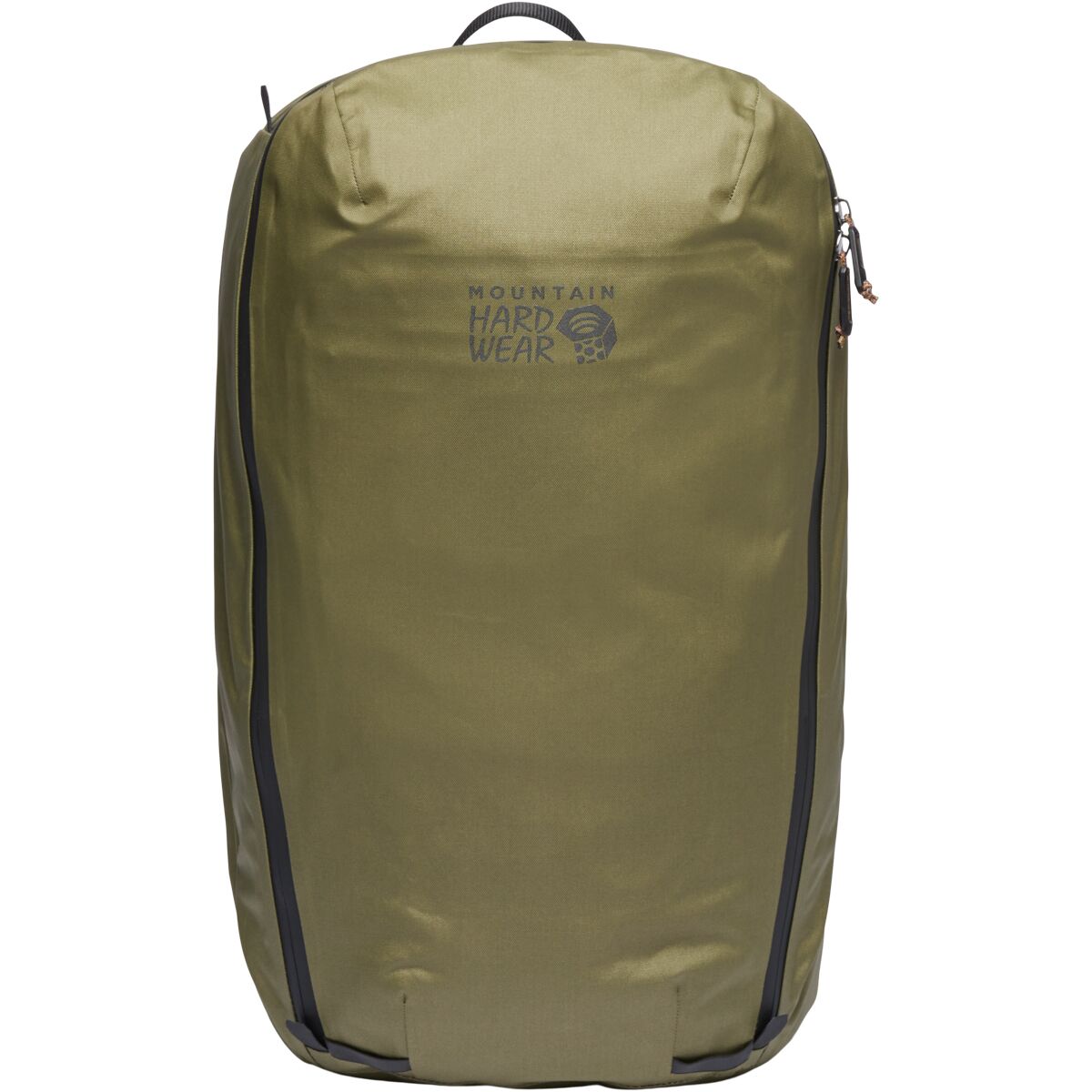
- Mountain HardwearMountain Hardwear Simcoe 28L Backpack$107.99
$179.99Check price at Back Country (opens in a new tab)


Do Not Mix Up North Ridge, Halo Ridge and Cross Couloir.
The cross-shaped snow feature is on the northeast face. It is a photographic landmark and, in seasonal snow conditions, part of a technical mountaineering objective—not the standard route’s crux.
| Route | Current published figures | Principal difference | Best planning question |
|---|---|---|---|
| North Ridge Standard hike | 11.25 mi · 5,600 ft · Class 2 | Pass descent and regain, moderate navigation/exposure; considerable commitment | Can you preserve strength and navigation discipline for the return? |
| Halo Ridge Higher-commitment ridge | 15.0 mi · 5,210 ft · Difficult Class 2 (full Halo route) | Longer high ridgeline with considerable exposure, route-finding and high commitment | Do you have a strong forecast and hours of sustained alpine travel capacity? |
| Cross Couloir Seasonal snow route | 12.25 mi · 5,600 ft · steep Class 3 snow route | Requires steep-snow technique and careful seasonal snowpack evaluation | Do you have the technical skills, tools and conditions required for a snow climb? |
The Mountain From Three Different Perspectives
These views explain the difference between the ridge you hike and the eastern face that gave the mountain its name. Do not navigate from photos alone.



Why the Snowy Cross Became Famous
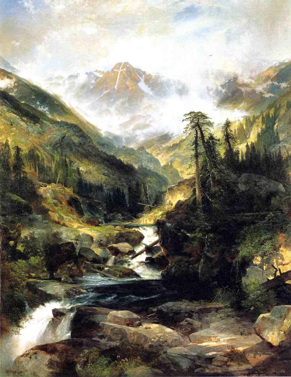
The mountain’s northeast face contains intersecting snow-filled gullies that can form a prominent white cross. Photographer William Henry Jackson documented the feature from the Notch Mountain area during the 1873 Hayden Survey. The image helped make the mountain a recognizable subject in western photography, art and later religious pilgrimages.
Painter Thomas Moran popularized the scene for people who might never visit the Sawatch Range. Later, the area became a national monument before eventually returning to national-forest management; today it is within Holy Cross Wilderness.
For modern hikers: the defining face is not displayed head-on from the standard North Ridge climb. If the objective is to photograph the cross, research the separate Notch Mountain viewpoint and its longer approach rather than assuming the Holy Cross summit hike includes it.
Protect the East Cross Creek Basin.
Halfmoon and East Cross Creek are heavily visited. Restrictions are specific because the creekside terrain is sensitive and the camping footprint is limited.
Free Overnight Self-Issue
Required if you camp overnight in Holy Cross Wilderness. The land manager states day users do not need this registration.
Ten Designated Sites
Only the marked East Cross Creek sites may be used along the restricted Halfmoon Trail corridor. Share sites if all ten are occupied.
No Fires at the Creek
Campfires are prohibited in the restricted camping area. Pack out trash and human waste per current USFS guidance.
Keep Pets Leashed
Leashes protect wildlife, other visitors and dogs on rocky terrain.
Not in Wilderness
The Forest Service prohibits drones taking off, landing or operating within designated Holy Cross Wilderness.
Check Exact Rules
Outside the specially restricted creek corridor, use previously impacted sites and keep at least 100 feet away from trails, lakes and streams.
Three Skills This Particular Route Tests
These are supporting safety and skill resources—not competing Mount of the Holy Cross destination pages.
Plan Holy Cross Within the Larger Fourteener Progression.
This guide owns the Holy Cross North Ridge, Tigiwon access, East Cross Creek camping and route-specific decisions. The parent and sibling pages own broad Colorado comparisons, easier progression climbs and the technical step beyond trail hiking.
Check These Sources Before Your Trip.
This is a research-based guide, not a claim of first-hand Holy Cross summit experience. Route, access and rules can change, especially with storms, snow, road management and seasonal closures.
Holy Cross Wilderness — Forest Service
Overnight self-registration, ten East Cross Creek sites, camping restrictions, no fires in the restricted area, leash and drone rules.
Check official wilderness rules →14ers.com North Ridge
Current LiDAR 14,007 ft elevation, Class 2 grade, 11.25 miles, 5,600 feet of total gain, trailhead directions and critical ridge imagery.
Detailed standard route →Road and Peak Conditions
Check the Ranger District for actual gate conditions and recent 14ers.com reports for frost, snow and creek-crossing information.
Read condition reports →Mount of the Holy Cross Questions Answered
These answers summarize the standard North Ridge trip and distinguish its day-use and overnight rules.
How difficult is Mount of the Holy Cross?
The standard North Ridge is Class 2, but 14ers.com lists 11.25 miles round trip, about 5,600 feet of cumulative gain, moderate exposure and route-finding, and considerable commitment. The return includes roughly 1,000 feet of uphill climbing over Half Moon Pass.
How long does the North Ridge hike take?
Plan for a strenuous full day. The time varies greatly with altitude response, trail conditions and experience; a conservative planning window is often roughly 10–14 hours, rather than treating the Class 2 grade as a short hike.
Do you need a permit to hike Mount of the Holy Cross?
The Forest Service does not require trailhead registration for a day hike. Overnight wilderness camping requires free self-issued registration at the trailhead. Camping near East Cross Creek is limited to ten designated, first-come-first-served sites.
Can you camp at East Cross Creek?
Yes, but use only the ten designated sites. They are first come, first served; if they are occupied the Forest Service instructs new parties to share. Fires are prohibited in this designated camping area.
When does Tigiwon Road open?
Tigiwon Road is seasonal and generally has a late-spring or early-summer opening and late-fall closure, but actual gates vary with weather and maintenance. Check the Eagle–Holy Cross Ranger District before driving.
Can you see the famous snowy cross from the summit route?
The best-known cross appears on the northeast face. It is not generally visible as the complete cross from the standard North Ridge. Notch Mountain is a historic viewpoint, but visiting it adds substantial distance and difficulty.
Is Halo Ridge the same as the standard route?
No. The standard North Ridge is Class 2 and approximately 11.25 miles with 5,600 feet of gain. The Halo Ridge variation is listed as difficult Class 2 and is longer, more exposed, and a higher-commitment mountaineering objective.
Is the Cross Couloir a hiking alternative?
No. Cross Couloir is a steep seasonal snow-climb route with different skills, tools and hazards. It should not be confused with the dry-weather Class 2 North Ridge hike.
Images and Sources
Mount-specific photos used under their individual Wikimedia Commons licensing terms. Open each source page for the original author, license and download. Other imagery is drawn from the Global Summit Guide site’s own licensed media library.
Mount of the Holy Cross and neighboring Notch Mountain seen from the northeast — Sue Reynolds · CC BY-SA 2.0. View original, license and full attribution.
Notch Mountain with Mount of the Holy Cross beyond, Colorado — dog4aday · CC BY 2.0. View original, license and full attribution.
Notch Mountain seen from high on Mount of the Holy Cross — Wikimedia Commons · photographer and license on source page. View original, license and full attribution.
Mount of the Holy Cross alpine face in summer — Wikimedia Commons · photographer and license on source page. View original, license and full attribution.
Notch Mountain and Mount of the Holy Cross ridge terrain — Wikimedia Commons · photographer and license on source page. View original, license and full attribution.
Steep snow at the entrance to the Cross Couloir; technical route, not North Ridge — Wikimedia Commons · photographer and license on source page. View original, license and full attribution.
Thomas Moran historic depiction of Mount of the Holy Cross — Thomas Moran · historical work; source and terms on Commons. View original, license and full attribution.
Compass and topographic map used for mountain route planning — Global Summit Guide media library.
Was this helpful?
🏔Related peaks nearby
🧭Explore & compare
Global Summit Guide is an independent mountaineering resource founded in 2026. The team combines first-hand trekking and climbing experience with in-depth research and professional health and nutrition review to help climbers choose objectives, prepare properly, and stay safe.
Health, altitude, and nutrition content is reviewed by Taylor Ludlow (Registered Nurse) and Brigg Hoopes (Nutritionist).
What We Don't Know Yet
Mountain information changes quickly. This box explains the limits of what this page can responsibly promise.
- Visa, passport, vaccination, border, insurance, and local transportation rules may change before your trip.
- Route conditions, snowpack, closures, and weather can change quickly after this page is updated.
- Permit rules, fees, quotas, and reservation windows may change between review cycles.
- Operator availability, pricing, guide ratios, and cancellation terms can change by season.
- Your fitness, altitude response, risk tolerance, and experience level may change what is safe or realistic.
Verify current conditions with official land managers, guide services, local forecasts, and current route reports before booking or climbing.
Mountaineering, rock and ice climbing, glacier travel, and high-altitude activity are inherently dangerous and can result in serious injury or death. The information on Global Summit Guide is provided for general informational and educational purposes only and is not a substitute for professional instruction, qualified guiding, proper equipment, or your own judgment and experience.
Route conditions, weather, snowpack, permits, regulations, and hazards change constantly and may differ from what is described here. Details may be incomplete, out of date, or contain errors. Always verify current information with local authorities, certified guides, and official sources before making any decision in the mountains.
Nothing on this site is medical, legal, or financial advice. Our fitness, acclimatization, altitude, and nutrition content is general in nature; consult a qualified physician before beginning any strenuous exercise program or exposing yourself to high altitude.
You are solely responsible for your own safety and decisions. To the fullest extent permitted by law, Global Summit Guide and its team accept no liability for any loss, injury, damage, or expense arising from use of, or reliance on, this information. By using this site you acknowledge these risks and accept these terms.
Some links on this site may be affiliate links. If you buy through them we may earn a small commission at no extra cost to you; this never affects our recommendations.
Global Summit Guide recommendation path
Next Best Mountain to Research
Use these recommendations to continue the right planning path instead of stopping on one page.
Use current permit, weather, route, and operator information before booking or climbing.