
Climbing Kyajo Ri: The Complete 2026 Khumbu Region Routes, NMA Trekking Peak Permits & 2002 Franco-British First Ascent Guide
Kyajo Ri rises to 6,186 m (20,296 ft) on the southern ridge between the Thame and Gokyo valleys in the Khumbu region of eastern Nepal, just north of Namche Bazaar. The peak is the highest trekking peak on this particular ridge system and represents one of the most recently opened climbing objectives in the entire Khumbu — the Nepal Ministry of Tourism opened Kyajo Ri to climbing only in 2002, decades after the original 1970s and 1980s climbing era that opened most other Khumbu peaks.
The first official ascent took place the same year as the 2002 opening, completed by a joint Franco-British team. The team approached the peak via Machhermo, traversed the Kyajo Glacier, and climbed the Southwest Ridge to the summit. The Franco-British line became the standard commercial route that all subsequent guided expeditions have followed. In 2003 a French team repeated the route as acclimatization preparation for an attempt on the difficult North Face of Machhermo peak. A Dutch team also climbed the Southwest Ridge in 2003 after failing on an attempt at the east face. In 2005 an American team established the more difficult Southeast Ridge — only the second documented route on the peak.
Kyajo Ri is classified as a Group A trekking peak by the Nepal Mountaineering Association, which makes the permit less expensive and less complicated to obtain than full expedition peak permits. However, the trekking peak classification significantly understates the climbing difficulty. Kyajo Ri is often described as Ama Dablam’s little brother due to the similar mixed rock, snow, and ice character of the climbing. The peak is shorter and technically easier than Ama Dablam at 6,812 m, but requires multiple camps above base camp rather than a single quick summit push. The standard route involves a 15-hour return summit journey over a glacial ridge with mixed rock and ice pitches up to 60 degrees and a pointy exposed summit described as a narrow wedge of snow.
The approach to Kyajo Ri is uniquely scenic among Khumbu peaks. Rather than following the standard Everest Base Camp trail, climbers reach base camp through the Gokyo valley, over the Renjo La Pass at 5,340 m — one of the three high passes of the Khumbu — down to Thame village, then through Mende to the hidden valley of Kyajo Trangka (also called Kyajo Kharka). The route provides exceptional cultural depth through traditional Sherpa villages plus stunning views of Everest, Lhotse, Makalu, and Cho Oyu from Gokyo Ri viewpoints during the approach.
This complete 2026 guide covers verified route descriptions, current Nepal Mountaineering Association trekking peak permit requirements, Sagarmatha National Park access rules, gear lists, hazard analysis, seasonal timing, cost tiers reflecting the substantially lower trekking peak permit fees compared to expedition peaks, and the modern climbing history that has developed since 2002. Every detail reflects 2026 conditions confirmed through May 2026.
Live Kyajo Ri Operations Center
Real-time location intelligence and Thame-Mende region weather conditions
Kyajo Ri occupies a distinctive position among Khumbu climbing peaks as one of the most recently opened climbing objectives in the entire region. The Nepal Ministry of Tourism opened the peak to climbing only in 2002 — decades after the original 1970s and 1980s climbing era that opened most other Khumbu peaks. The 6,186 m summit sits on the southern ridge between the Thame and Gokyo valleys, just north of Namche Bazaar.
The first official ascent took place the same year as the 2002 opening, completed by a joint Franco-British team via the Southwest Ridge. The Franco-British line approached the peak via Machhermo, traversed the Kyajo Glacier, and climbed through to the summit. The route became the standard commercial line that all subsequent guided expeditions have followed. The 2002 opening came at a moment when much of the Khumbu had already been climbed and re-climbed for decades, making Kyajo Ri’s modern climbing history compressed into just over twenty years of accumulated experience.
Kyajo Ri’s NMA Group A trekking peak classification keeps permit costs and complications lower than full expedition peaks like neighboring Taboche or Cholatse. However, the technical difficulty significantly exceeds typical trekking peak character. The peak is widely described as Ama Dablam’s little brother — shorter and technically easier than Ama Dablam at 6,812 m but requiring multiple camps above base camp rather than a single quick summit push. The standard Southwest Ridge involves a 15-hour return summit journey over a glacial ridge with mixed rock and ice pitches up to 60 degrees and a pointy exposed summit described as a narrow wedge of snow.
The Kyajo Ri approach offers exceptional scenic and cultural depth compared to standard Khumbu trekking peak approaches. Rather than following the busy Everest Base Camp trail, climbers reach base camp through the Gokyo valley, over the Renjo La Pass at 5,340 m, down to Thame village, then through Mende to the hidden valley of Kyajo Trangka. The approach passes traditional Sherpa villages including the home village of many world-class Sherpa climbers, with stunning views of Everest, Lhotse, Makalu, and Cho Oyu from Gokyo Ri viewpoints during the acclimatization phase.
For climbers seeking a Khumbu trekking peak with genuine technical character — and a sense of climbing a peak that retains the wild character of less-trafficked objectives — Kyajo Ri offers an appealing combination of accessibility, technical demand, and scenic depth. The peak provides excellent preparation for Ama Dablam or for harder Himalayan objectives while offering substantially lower cost and commercial commitment than the iconic technical Khumbu peaks.
The Southwest Ridge serves as the standard route on Kyajo Ri and accounts for the vast majority of confirmed ascents since the 2002 Franco-British first ascent. The route is considered the safest line on the mountain, with fewer objective hazards from rockfall or avalanche than other aspects. Climbers establish base camp at approximately 4,500-4,550 m, Camp 1 at 5,300-5,350 m, and Camp 2 at 5,700 m before the summit push. The climbing involves snow and ice slopes up to 50-55 degrees graded Scottish II, one notable rock section, and a final narrow wedge summit. The Southeast Ridge — established by an American team in 2005 — provides a more difficult alternative for elite teams seeking harder climbing on the peak.
Despite Kyajo Ri’s NMA Group A trekking peak classification, the technical demands significantly exceed typical trekking peak character. The climb is steeper, more sustained, and more committing than Island Peak or Lobuche East. Multiple operators describe Kyajo Ri as Ama Dablam’s little brother — the same mixed rock, snow, and ice climbing character with similar technical demands but at a lower elevation. Climbers should have prior 6,000 m experience or comparable peaks before attempting Kyajo Ri. The 50-55 degree slopes, mixed rock pitches, and the 10-12 hour summit day require confident technical climbing capability. Most experienced operators recommend prior Island Peak, Mera Peak, or comparable experience as preparation rather than treating Kyajo Ri as a first 6,000 m climb.
This guide consolidates information from the Nepal Mountaineering Association (NMA), Nepal Ministry of Tourism, Sagarmatha National Park authorities, and active Nepali expedition operator information including Trek Himalayan, Dream Himalaya Adventures, Xtreme Climbers Treks, Highland Expeditions, Climbalaya, Wild Yak Expeditions, Himalaya Alpine Guides, Nepal Peak Adventure, Annapurna Foot-hills Treks, and Himalayan Expedition. Coordinates verified through PeakVisor topographic data. Every elevation, route grade, cost figure, and permit requirement reflects 2026 conditions confirmed through May 2026. The 2002 climbing-permit opening date and the Franco-British first ascent details are corroborated across multiple authoritative operator sources.
At a Glance: Kyajo Ri Essentials
Kyajo Ri presents a distinctive technical challenge in a Khumbu trekking peak permit category, offering substantially lower cost than expedition peaks while requiring genuine technical climbing skills. The following statistics summarize the key parameters every climber must understand before planning an expedition. Each figure below reflects 2026 conditions verified through the Nepal Mountaineering Association and active operators.
Eight Reasons Climbers Choose Kyajo Ri
Kyajo Ri holds a unique position among Khumbu peaks. The reasons climbers target this peak combine technical challenge, cost advantages from the trekking peak classification, the recent opening that gives the mountain a wild character, and the scenic depth of the Renjo La Pass approach through traditional Sherpa villages. Each motivation carries an associated responsibility for safe execution at altitude on serious terrain.
Ama Dablam’s Little Brother
Kyajo Ri is widely described as Ama Dablam’s little brother for the similar mixed rock, snow, and ice character of the climbing. Climbers seeking Ama Dablam-style technical experience without Ama Dablam’s commercial commitment and cost find Kyajo Ri provides comparable climbing satisfaction at a substantially lower price point and with smaller base camp crowds.
Recently Opened in 2002
Kyajo Ri’s 2002 opening means the peak retains the wild character of less-trafficked objectives despite being located in the most accessible mountaineering region in Nepal. Climbers join a relatively small fraternity of alpinists who have summited a peak with just over twenty years of accumulated climbing history rather than the multi-decade history of most other Khumbu peaks.
Lower Trekking Peak Cost
The NMA Group A trekking peak classification makes Kyajo Ri permits less expensive and less complicated to obtain than full expedition peak permits for neighboring summits like Taboche or Cholatse. Climbers get genuine technical climbing experience at a substantially lower per-person cost — typically USD 5,500 to 13,000 versus USD 13,000 to 26,000 for expedition peaks.
Spectacular Renjo La Pass Approach
The Kyajo Ri approach traverses the Renjo La Pass at 5,340 m — one of the three high passes of the Khumbu — providing exceptional scenic depth beyond the standard EBC trail. The pass offers panoramic views of Everest, Lhotse, Makalu, and Cho Oyu and represents a genuine acclimatization milestone before reaching base camp.
Thame Village Cultural Depth
The approach passes through Thame village — home of many world-class Sherpa climbers and one of the most traditional Sherpa settlements in the Khumbu. Climbers gain cultural immersion that the busier Lukla-Namche-Tengboche corridor cannot match, with quieter village atmospheres and authentic Sherpa hospitality.
Hidden Valley Base Camp
Kyajo Ri base camp sits in the hidden valley of Kyajo Trangka — a quiet isolated valley accessed via Mende village. The setting contrasts dramatically with the commercial base camps of Island Peak or Mera Peak. Climbers experience genuine wilderness in the heart of the most commercialized climbing region in Nepal.
Multi-Camp Expedition Style
Unlike single-camp trekking peaks like Island Peak, Kyajo Ri requires multiple camps above base camp — typically Camp 1 at 5,300-5,350 m and Camp 2 at 5,700 m before the summit push. The expedition-style logistics provide a genuine Himalayan climbing experience without the cost commitment of full expedition peaks.
Excellent Progression Peak
Kyajo Ri serves as ideal preparation for harder Himalayan objectives. The mixed rock, snow, and ice climbing builds the specific skills needed for Ama Dablam, Pumori, or technical 7,000 m peaks. Climbers seeking to progress from accessible trekking peaks to elite expedition objectives find Kyajo Ri provides the logical intermediate step.
Who Can Climb Kyajo Ri
Kyajo Ri requires solid 6,000 m climbing experience and substantial technical credentials despite its trekking peak permit classification. The Southwest Ridge standard route demands prior Himalayan or Andean peak experience, competent crampon and ice axe technique on steep terrain, comfort with mixed rock and ice climbing, fixed rope familiarity, and tolerance for sustained 6,000 m exposure. Climbers should have completed prior peaks such as Island Peak, Mera Peak, or comparable Andean objectives before attempting Kyajo Ri.
The standard route involves boulder slopes with roped pitches to gain a small glacier, sustained climbing through snow and ice at 50-55 degree slope angles graded Scottish II, one notable rock section, and a final narrow wedge of snow at the summit. Modern expeditions follow the 2002 Franco-British first-ascent line with experienced climbing Sherpa support handling fixed-rope installation on the most technical sections. The peak requires expedition-style logistics with multiple camps above base camp rather than a single quick summit push.
The 10-12 hour summit day from Camp 2 demands solid technical climbing capability combined with the patience and conservative decision-making appropriate for 6,000 m terrain. Hard turnaround times must be established and honored regardless of summit proximity. The peak’s pointy, exposed summit — a narrow wedge of snow — adds psychological exposure to the technical demands of the upper route.
For climbers building toward harder Himalayan objectives, Kyajo Ri provides exceptional preparation for technical 6,000 m peaks like Ama Dablam or for 7,000 m peaks like Pumori. The peak’s combination of accessible trekking peak logistics with genuinely demanding climbing creates a productive learning environment for serious alpine progression. Many Kyajo Ri summiteers progress to harder Khumbu objectives within one or two subsequent seasons.
Multiple Nepali operators consistently describe Kyajo Ri as more challenging than Island Peak or Lobuche East — peaks frequently used as first 6,000 m objectives. The technical character resembles Ama Dablam’s mixed climbing rather than the snow-walking character of standard trekking peaks. Operators uniformly emphasize that climbers should view Kyajo Ri as a step up from typical trekking peaks toward expedition-style climbing. The 15-hour return summit journey, multi-camp logistics, and 60-degree mixed sections require capability beyond typical trekking peak experience. Climbers who arrive at Kyajo Ri base camp without prior 6,000 m experience consistently struggle with the technical demands, and most operator turnarounds occur at the upper rock section rather than at altitude.
Kyajo Ri in the Khumbu Context
Kyajo Ri occupies a position in the western Khumbu distinct from the better-known peaks on the eastern side of the region. The peak sits on the southern ridge between the Thame valley to the west and the Gokyo valley to the east, just north of Namche Bazaar. The mountain is part of the series of peaks continuing all the way to Cho Oyu (8,201 m) on the Nepal-Tibet border. The western Khumbu position keeps Kyajo Ri away from the high-traffic EBC trail but places the peak in close proximity to traditional Sherpa villages including Thame and Mende.
The Khumbu region as a whole hosts some of the most iconic mountaineering peaks in the world. Mount Everest (8,848 m) dominates the broader range, with Lhotse (8,516 m), Cho Oyu (8,201 m), and Makalu (8,463 m) completing the 8,000 m group. Below the 8,000 m peaks, the region contains classic technical 6,000 m and 7,000 m objectives including Ama Dablam (6,812 m), Thamserku (6,608 m), Kangtega (6,685 m), Cholatse (6,440 m), Taboche (6,501 m), Pumori (7,161 m), and numerous others. Most Khumbu peaks share base infrastructure including Lukla airport, Namche Bazaar, and the established lodge system.
For climbers planning regional progressions, Kyajo Ri pairs naturally with several Khumbu peaks. Island Peak (6,189 m) provides accessible acclimatization with similar elevation. Mera Peak (6,476 m) offers a slightly higher acclimatization option. Ama Dablam (6,812 m) provides the natural technical progression after Kyajo Ri success. Lobuche East (6,119 m) offers comparable trekking peak experience. The Kyajo Ri approach often incorporates Gokyo Ri (5,357 m) viewpoint hike and the Renjo La Pass crossing — both of which provide additional acclimatization and scenic value during the trip.
The Khumbu Region Companion Peaks
Kyajo Ri shares the Khumbu region with several iconic climbing peaks. All six peaks below provide alternative or progression objectives accessible from the same Lukla-Namche approach infrastructure.
Kyajo Ri History: From 2002 Opening to Modern Era
Kyajo Ri’s climbing history is unusually compressed compared to most Khumbu peaks. The Nepal Ministry of Tourism opened the peak to climbing only in 2002, decades after the original 1970s and 1980s climbing era that opened most other Khumbu peaks. The mountain’s entire modern climbing record fits within just over twenty years, with a small but significant number of established ascents and route additions during this compressed timeframe.
Pre-2002: Closed to climbing
Through the major Khumbu climbing era of the 1950s, 1960s, 1970s, 1980s, and 1990s, Kyajo Ri remained closed to international climbing. The Nepal Ministry of Tourism issued no permits for the peak during this period, despite the mountain’s prominent visual presence on the southern ridge between the Thame and Gokyo valleys. The pre-2002 status meant that Kyajo Ri remained one of the few accessible Khumbu peaks unclimbed by international teams while neighboring peaks like Ama Dablam, Cholatse, Taboche, and others received multiple ascents.
2002: Opening to climbing and Franco-British first ascent
The Nepal Ministry of Tourism opened Kyajo Ri to climbing in 2002. The first official ascent took place the same year, completed by a joint Franco-British team. The team approached the peak via Machhermo on the eastern Gokyo valley side, traversed the Kyajo Glacier, and climbed the Southwest Ridge to reach the summit. The 2002 Franco-British line became the standard commercial route that all subsequent guided expeditions have followed, establishing the foundational expedition pattern for the peak.
2003: French repeat and Dutch attempt
In 2003 a French team repeated the Southwest Ridge route as acclimatization preparation for an attempt on the difficult North Face of neighboring Machhermo peak. The 2003 French ascent followed the original Franco-British line without deviation, confirming the route’s reliability for repeat climbs. Also in 2003, a Dutch team climbed the Southwest Ridge after failing on an earlier attempt at the east face. The Dutch experience illustrated that the Southwest Ridge represents the reliable commercial line while other aspects of the peak present greater difficulty.
2005: American Southeast Ridge — second established route
In 2005 an American team climbed the more difficult Southeast Ridge, establishing only the second documented route on Kyajo Ri. The Southeast Ridge is significantly more technical than the Southwest Ridge standard line and provides an alternative for elite teams seeking harder climbing on the peak. The Southeast Ridge can also be accessed via the northeast face. The 2005 American ascent confirmed Kyajo Ri’s potential for first-ascent attempts on harder aspects and added genuine technical depth to the peak’s small route catalog.
2006-2010s: Commercial expansion
Through the late 2000s and 2010s, commercial expedition operators expanded their Kyajo Ri programs, establishing the standard 26-30 day expedition timeline that combines a Gokyo valley acclimatization trek with the Renjo La Pass crossing and the actual climbing phase. The commercial expansion meant Kyajo Ri became accessible to a growing pool of international climbers seeking technical 6,000 m experience without the higher cost of expedition peaks. Operators developed specific Sherpa relationships for fixed-rope installation and base camp logistics.
2010s-2020s: Continued moderate traffic
Kyajo Ri has maintained moderate traffic through the 2010s and 2020s as a recognized alternative to higher-profile commercial trekking peaks like Island Peak and Lobuche East. The peak’s reputation as Ama Dablam’s little brother has attracted climbers seeking genuine technical experience without Ama Dablam’s commercial commitment and cost. The combination of trekking peak permit advantages with serious technical climbing has positioned Kyajo Ri as a popular intermediate objective.
Current 2026 status
Kyajo Ri in 2026 remains a recognized commercial trekking peak with moderate annual climbing traffic. The Southwest Ridge serves as the standard route for essentially all guided expeditions. The Southeast Ridge and other aspects see occasional attempts by experienced alpine teams. The peak’s reputation as a technical step up from typical trekking peaks while remaining substantially less expensive than expedition peaks ensures continued international interest. Multiple registered Nepali operators offer Kyajo Ri programs ranging from group expeditions to premium small-team services with experienced Sherpa support.
Climbing Routes on Kyajo Ri
Kyajo Ri’s route catalog reflects the peak’s compressed modern climbing history. The Southwest Ridge — the 2002 Franco-British first-ascent line — serves as the standard route and accounts for essentially all commercial expeditions. The Southeast Ridge, established by an American team in 2005, provides the second documented route. Other aspects of the peak see only occasional attempts. All routes require Nepal Mountaineering Association trekking peak permits, Sagarmatha National Park permits, and registered Nepali operator coordination.
| Route | First Ascent | Grade | Length | Aspect | Frequency |
|---|---|---|---|---|---|
| Southwest Ridge (Standard) | Franco-British team 2002 | Alpine PD+ / Scottish II | Multi-day | Southwest | Most ascents |
| Southeast Ridge | American team 2005 | More technical mixed | Variable | Southeast | Occasional |
| Northeast Face Access | 2005 alternative access | Technical | Variable | Northeast | Rare alternative |
| East Face Attempt | Dutch team 2003 (unsuccessful) | Difficult mixed | Unknown | East | Failed attempt |
Southwest Ridge — 2002 Franco-British First Ascent Line
The Southwest Ridge route serves as the standard approach on Kyajo Ri and accounts for essentially all guided ascents since the 2002 Franco-British first ascent. The route is considered the safest line on the mountain, with fewer objective hazards from rockfall or avalanche than other aspects. Modern expeditions follow the 2002 first-ascent line with experienced Sherpa support handling fixed-rope installation on the most technical sections.
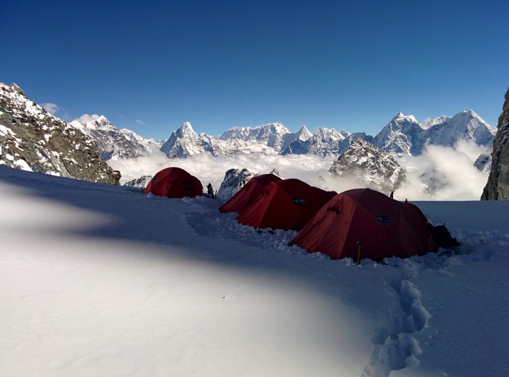
Approach: Climbers begin from Kathmandu with a flight to Lukla (2,800 m), then trek through Phakding to Namche Bazaar (3,440 m). From Namche, the trail enters the Gokyo valley through Dole, Machhermo, and Gokyo (4,790 m), with a Gokyo Ri viewpoint hike (5,357 m) for acclimatization. The route then crosses the Renjo La Pass (5,340 m) into the Thame valley, descends to Thame village (3,820 m), continues through Mende village (3,740 m), and reaches Kyajo Ri base camp at approximately 4,500-4,550 m in the hidden valley of Kyajo Trangka.
Climbing phase: From base camp, climbers establish Camp 1 at 5,300-5,350 m at the base of the Kyajo Ri Glacier — an excellent location on level ground with great views and easy access to water flowing from the frozen glacier. The route then ascends to Camp 2 at approximately 5,700 m on a broad col at the base of the Southwest Ridge. From Camp 2 the climbing follows snow slopes at 50-55 degree angles graded Scottish II under typical conditions, traverses one notable rock section that climbers must overcome, and ends at the pointy exposed summit described as a narrow wedge of snow.
Summit day: The summit push from Camp 2 typically takes 10-12 hours including descent. The 15-hour return journey from camp to camp involves the technical climbing through the rock section, sustained 50-55 degree slopes, and the exposed pointy summit. Most parties descend back to Camp 2 the same day before returning to base camp the following day. The route is climbed in expedition style using fixed ropes installed by climbing Sherpas.
Southeast Ridge — American 2005 Second Established Route
The Southeast Ridge route was climbed by an American team in 2005, establishing only the second documented route on Kyajo Ri three years after the Franco-British first ascent. The Southeast Ridge is significantly more difficult than the Southwest Ridge standard line and represents the elite alternative for teams seeking harder climbing on the peak. The route can also be accessed via the northeast face for variations on the approach.
The Southeast Ridge offers sustained technical climbing with greater objective character than the Southwest Ridge. Modern attempts on the Southeast Ridge remain rare due to the relatively limited commercial demand for the harder line — most guided expeditions target the established Southwest Ridge. Elite teams seeking a Kyajo Ri objective with more technical character than the standard route consider the Southeast Ridge an attractive option.
The 2005 American Southeast Ridge ascent confirmed Kyajo Ri’s potential for elite alpine climbing beyond the commercial Southwest Ridge route. The line provides a meaningful technical step up from the standard route while remaining within reasonable expedition timeframes for capable teams.
East Face Attempt — 2003 Dutch Team Unsuccessful
In 2003 a Dutch team attempted the east face of Kyajo Ri before retreating and switching to the Southwest Ridge for a successful summit. The east face attempt is included here for historical completeness — the route saw essentially no subsequent serious attention. The Dutch experience illustrates that the eastern aspect of the peak presents greater difficulty than the established Southwest Ridge, and most modern teams seeking harder climbing have targeted the Southeast Ridge rather than the east face.
Modern climbers considering east-aspect Kyajo Ri objectives should consult recent operator intelligence — current beta on the east face is limited compared to other aspects of the peak. The combination of limited modern attempts and the established Southwest Ridge alternative means the east face remains essentially unexplored as a modern climbing objective.
Kyajo Ri Access & Permits 2026
Kyajo Ri access requires multiple permits combining Nepal Mountaineering Association trekking peak permissions with Sagarmatha National Park entry permits and local municipal access permits. The NMA Group A trekking peak classification keeps permit costs significantly lower than full expedition peaks like neighboring Taboche or Cholatse — a meaningful financial advantage for climbers seeking technical experience at lower cost.
The NMA Group A trekking peak classification means Kyajo Ri permits are less expensive and less complicated to obtain than full expedition peak permits. The trekking peak system does not require Liaison Officer assignment, reducing total expedition costs. Climbers can apply through registered Nepali operators with approximately 1-2 months advance lead time rather than the 2-3 months typical for expedition peaks. Despite the simpler permit process, the technical climbing demands remain serious — the trekking peak classification refers to administrative procedure rather than climbing difficulty.
Required documentation for 2026
- NMA trekking peak permit: Nepal Mountaineering Association Group A trekking peak permit specifying Kyajo Ri
- Sagarmatha National Park permit: Forest department permit issued at park checkpoints
- Khumbu Pasang Lhamu Rural Municipality permit: Local government permit for the climbing region
- Lukla VDC entrance permit: Issued on arrival at Lukla
- Registered operator coordination: Mandatory for all expedition logistics
- High-altitude insurance: Mandatory minimum coverage including helicopter rescue
- Nepali visa: Tourist visa with extension for full expedition duration
- Medical certificate: Required from registered medical practitioner
- Garbage management deposit: Environmental compliance fee
2026 Permit cost breakdown
- NMA trekking peak fee: USD 350-500 per climber for foreign nationals depending on season
- Sagarmatha National Park entry fees: NPR 3,000 per climber (approximately USD 25)
- Khumbu local government permit: NPR 2,000 per climber (approximately USD 15)
- Lukla VDC entrance permit: Minimal fee on arrival
- Garbage management deposit: USD 150-300 per expedition (partially refundable)
- Registered operator base fees: USD 4,000-11,000 per climber depending on services
- High-altitude insurance: USD 800-1,500 per climber minimum
- Climbing Sherpa wages and equipment: Included in operator packages
Access logistics from Kathmandu
Kyajo Ri is accessible from Kathmandu via the standard Khumbu approach with a Gokyo valley extension. Climbers fly from Kathmandu to Lukla (2,800 m) — typically a 30-minute scheduled flight on a small aircraft, though peak-season flights now sometimes operate from Ramechhap. From Lukla, the trail follows the classic Everest Base Camp route to Phakding (2,640 m), Namche Bazaar (3,440 m) with acclimatization rest, then diverges into the Gokyo valley through Dole, Machhermo (4,470 m), and Gokyo (4,790 m). A Gokyo Ri viewpoint hike (5,357 m) provides acclimatization before the Renjo La Pass crossing (5,340 m) into the Thame valley. After descending to Thame (3,820 m) and Mende (3,740 m), the route enters the hidden valley of Kyajo Trangka to Kyajo Ri base camp at 4,500-4,550 m. Total Kathmandu to base camp logistics take 10-12 days including the Gokyo valley acclimatization. The standard expedition runs 26-30 days from Kathmandu through climbing and return.
Kyajo Ri Climbing Costs in 2026
Kyajo Ri expedition costs are substantially lower than expedition peaks like Taboche or Cholatse thanks to the trekking peak permit classification. Fully guided programs run USD 5,500-13,000 per person — roughly half the cost of comparable expedition peak programs. The peak’s growing popularity means multiple operators offer Kyajo Ri programs with documented expedition history. All costs reflect 2026 conditions verified through active Nepali operators including Trek Himalayan, Dream Himalaya Adventures, Xtreme Climbers Treks, Highland Expeditions, Climbalaya, Wild Yak Expeditions, and Himalaya Alpine Guides.
Group Guided Kyajo Ri Expedition (4-6 climbers)
The most affordable Kyajo Ri expedition option involves group climbs with 4-6 climbers per registered Nepali operator. Costs include NMA Group A trekking peak permits, Sagarmatha National Park permits, Pasang Lhamu Rural Municipality permits, Lukla VDC entrance permits, garbage deposits, registered operator services, climbing Sherpa support, fixed ropes for the Southwest Ridge route, food, and base camp logistics. This tier provides excellent value for clubs and larger teams attempting the standard Southwest Ridge route and represents the most popular Kyajo Ri service level for cost-conscious climbers.
Standard Guided Expedition (3-4 climbers)
Most international climbers select the standard guided expedition format for the Southwest Ridge route. This tier provides personalized attention with experienced Sherpa guides who have specific Kyajo Ri knowledge. The cost includes complete logistics from Kathmandu reception through expedition completion. This represents the typical cost for serious Kyajo Ri attempts and offers good balance of cost, group size, and individual attention. Most successful Kyajo Ri ascents come from teams at this service level.
Premium Small Team with Elite Sherpa Leadership
Premium expeditions feature elite Sherpa guides with 8,000 m credentials as leaders. This tier includes priority weather forecasting, premium hotel accommodations in Kathmandu and Namche Bazaar, enhanced base camp facilities, and the highest guide-to-client ratios available. The premium option suits climbers seeking optimal support for personal Kyajo Ri success or those using Kyajo Ri as preparation for harder Himalayan objectives with the same elite operator.
Combined Kyajo Ri + Ama Dablam Expedition
Multi-peak expeditions combining Kyajo Ri with Ama Dablam (6,812 m) provide excellent technical progression in a single Khumbu trip. Kyajo Ri serves as preparation for Ama Dablam’s harder mixed climbing. Both peaks share initial Lukla-Namche approach infrastructure though Kyajo Ri’s Gokyo valley/Renjo La approach diverges from Ama Dablam’s direct Tengboche/Pangboche approach. The 45-55 day extended timeline allows separate summit attempts on both peaks. This option provides ideal preparation for climbers ultimately targeting harder Himalayan objectives.
Custom Southeast Ridge Expedition
Custom expeditions for teams attempting the more difficult Southeast Ridge — first climbed by the American team in 2005 — require operators with specific experience on the harder line. The Southeast Ridge sees only occasional attempts and offers elite teams a more challenging Kyajo Ri objective beyond the standard Southwest Ridge. Custom expeditions can also include alternative northeast face access variations or first-ascent attempts on subsidiary lines. Custom expedition operators with documented elite-team experience are essential.
Essential Gear for Kyajo Ri Expedition
Gear requirements for Kyajo Ri reflect the peak’s serious technical 6,000 m demands despite the trekking peak permit classification. The Southwest Ridge’s mixed rock, snow, and ice character requires specific technical equipment beyond standard high-altitude gear. The pointy exposed summit and 50-55 degree slope angles demand confident technical climbing capability. Climbers should bring quality gear suitable for 26-30 day expedition conditions.
High-Altitude Boots (Mandatory)
- 6,000 m mountaineering boots rated for -20°C minimum
- La Sportiva G2 Evo, Scarpa Phantom 6000, or similar double-boot construction
- Compatible with 12-point automatic crampons
- Broken in thoroughly before the expedition
Technical Ice Tools (Mandatory)
- Two technical ice tools with curved or reverse-curve picks
- Petzl Quark, Black Diamond Viper, or Grivel Tech Machine
- Suitable for mixed rock and ice climbing on the rock section
- Spare pick components for the long route
Crampons and Personal Hardware (Mandatory)
- 12-point automatic crampons (Petzl Sarken or equivalent)
- Vertical or semi-mono front points for steep ice
- Climbing harness with adjustable leg loops
- Ascender, descender, multiple locking carabiners
Ropes & Protection (Mandatory)
- 60-meter dynamic ropes (8.5-9 mm), 2 ropes minimum
- Ice screws (6-8 in lengths from 13-22 cm)
- Snow pickets for upper ridge anchors
- Rock protection for the rock section pitches
Down Suit and Insulation
- Heavy down jacket plus pants for summit day
- 800-fill or higher down rating
- Synthetic backup insulation layer
- Down booties for camp use
Sleeping System
- Sleeping bag rated to -20°C minimum
- Closed-cell foam pad plus inflatable
- Sleeping bag liner for warmth
- Vapor barrier liner for high camps
Navigation and Safety
- GPS device with offline Khumbu maps
- Topographic maps of Mahalangur Himal
- Headlamp with multiple battery sets
- Garmin InReach recommended for emergency communication
Personal and Medical
- Comprehensive expedition first aid kit with HAPE/HACE medications
- Diamox for altitude prophylaxis
- Sunscreen SPF 50+ and glacier glasses with category 4 lenses
- Personal prescription medications for full duration plus buffer
Hazards on Kyajo Ri
Kyajo Ri presents hazards typical of technical 6,000 m Himalayan peaks combined with specific risks created by the mixed rock and ice character of the standard Southwest Ridge. The Southwest Ridge route is considered safer than other aspects with fewer objective hazards from rockfall or avalanche, but climbers must still assess each hazard category honestly before any Kyajo Ri expedition.
Sustained 50-55 degree slope climbing
The Southwest Ridge involves sustained climbing at 50-55 degree slope angles graded Scottish II. Climbers must maintain competent front-pointing technique through extended periods at altitude. The combination of sustained technical climbing with 6,000 m altitude means climbers operate slower than at sea level, requiring conservative time management. The 10-12 hour summit day demands physical and mental endurance.
The rock section
The Southwest Ridge crosses one notable rock section that climbers must overcome. The mixed rock and ice character at altitude creates technical demands beyond typical snow-and-ice trekking peak climbing. Most operator turnarounds occur at the upper rock section rather than at altitude, illustrating how this technical feature defines the route’s commitment level.
Exposed pointy summit
The Kyajo Ri summit is described as a pointy and exposed narrow wedge of snow. The psychological exposure on the final approach adds to the technical demands. Climbers must maintain disciplined technique through the final summit approach where slip recovery would be difficult on the narrow ridge crest.
Renjo La Pass acclimatization
The 5,340 m Renjo La Pass crossing during the approach provides crucial acclimatization but represents a serious altitude milestone on its own. Climbers must complete the pass safely before reaching base camp. Weather on the pass can deteriorate rapidly and the crossing requires solid trekking fitness combined with adequate acclimatization from the Gokyo valley days.
Unpredictable Khumbu weather
The Khumbu region experiences variable weather with monsoon-bracketed climbing windows. Clear morning skies can deteriorate to whiteout conditions within hours. Wind speeds on the upper ridge can become dangerous, particularly on the exposed summit ridge. Weather monitoring throughout the expedition is essential.
Lukla flight reliability
The Lukla airport is notorious for weather-related delays and cancellations. Expedition timelines must include buffer time for both the inbound and outbound flights. Helicopter alternatives exist but at substantial cost. Climbers caught at Lukla by weather can lose days from the climbing window — a non-trivial planning consideration for Kyajo Ri expeditions with the extended Gokyo valley approach.
Cold weather and exposure
Temperatures on Kyajo Ri drop dramatically with altitude. Summit-zone temperatures can drop to -20°C or lower during pre-dawn summit pushes. Frostbite risk is significant, especially during the long technical climbing sections where climbers cannot move quickly to generate body heat. Proper layering, vapor barriers, and aggressive temperature management throughout the climb are essential.
Safety Protocols for Kyajo Ri
Successful Kyajo Ri expeditions depend on conservative decision-making and disciplined technical execution at altitude. The trekking peak permit classification should not lead climbers to underestimate the climbing demands — the technical character significantly exceeds typical trekking peak difficulty, and operators uniformly describe the climb as a step up from Island Peak or Lobuche East. Climbers should establish hard turnaround times and honor them regardless of summit proximity, particularly during the long 10-12 hour summit day from Camp 2.
File detailed itineraries with both your registered Nepali operator and your home country embassy. Carry comprehensive satellite communications including Garmin InReach. The trekking peak permit system does not assign a Liaison Officer, so climbers should coordinate directly with their operator for emergency response. Knowing intermediate ice climbing, crampon work, fixed-rope techniques on steep terrain, and self-arrest with ice axe can mean the difference between minor incidents and serious outcomes at altitude on the technical Southwest Ridge.
When to Climb Kyajo Ri
Seasonal timing on Kyajo Ri follows the monsoon-bracketed pattern typical of the Nepal Himalaya. Two distinct climbing windows operate annually, with both providing viable conditions for the Southwest Ridge.
Pre-monsoon (March-May)
March through May provides the primary climbing season for Kyajo Ri. April and May offer the most stable weather with manageable temperatures for sustained technical climbing. The spring window also provides the warmest base camp temperatures of the climbing season. Most modern guided expeditions target the April-May window specifically.
Mid-monsoon (June-August)
June through August is not suitable for Kyajo Ri climbing due to heavy precipitation and dangerous snow conditions. The Nepal monsoon brings sustained heavy rainfall to the Khumbu with snow at altitude, creating impossible climbing conditions and dramatically increased avalanche risk on the technical terrain.
Post-monsoon (September-November)
September through November represents the secondary Kyajo Ri climbing season. Stable high-pressure systems often bring excellent climbing conditions with colder but drier weather. The Southwest Ridge typically presents harder ice conditions during this window compared to spring, which can favor or disadvantage climbers depending on personal preferences. Many modern expeditions target October specifically as a balance between cold temperatures and sufficient daylight.
Winter (December-February)
Winter conditions effectively close Kyajo Ri to expedition activity. Extreme cold, severe weather, and limited daylight combine to make climbing impractical. The technical nature of the Southwest Ridge makes winter attempts especially dangerous. Winter expeditions on Kyajo Ri remain rare and require exceptional cold-weather expertise.
Notable Expeditions and Climbs
Kyajo Ri’s climbing history is concentrated in just over twenty years since the 2002 opening. Each notable expedition contributed essential knowledge to subsequent climbs and shaped the peak’s current commercial expedition pattern.
Nepal Ministry Permit Opening
Climbing OpenedThe Nepal Ministry of Tourism opened Kyajo Ri to climbing in 2002, decades after the original Khumbu climbing era opened most other peaks in the region. The opening enabled the first official ascent the same year.
Franco-British First Ascent
First AscentA joint Franco-British team made the first ascent of Kyajo Ri in 2002 via the Southwest Ridge. The team approached the peak via Machhermo on the Gokyo valley side, traversed the Kyajo Glacier, and climbed the Southwest Ridge to the summit. The 2002 line became the standard commercial route.
French Repeat for Machhermo Prep
Second AscentA French team repeated the Southwest Ridge in 2003 as acclimatization preparation for an attempt on the difficult North Face of neighboring Machhermo peak. The ascent followed the original Franco-British line without deviation, confirming the route’s reliability.
Dutch Team East Face Attempt
Failed, Switched RoutesA Dutch team attempted the east face of Kyajo Ri in 2003 before retreating and successfully climbing the Southwest Ridge. The Dutch experience illustrated that the eastern aspect presents greater difficulty than the established Southwest Ridge.
American Southeast Ridge
Second Established RouteAn American team climbed Kyajo Ri’s more difficult Southeast Ridge in 2005, establishing only the second documented route on the peak. The route can also be accessed via the northeast face and represents the elite alternative for teams seeking harder climbing than the standard Southwest Ridge.
Commercial Expansion Era
Commercial EstablishmentThrough the late 2000s and 2010s, commercial expedition operators expanded their Kyajo Ri programs, establishing the standard 26-30 day expedition timeline combining a Gokyo valley acclimatization trek with the Renjo La Pass crossing and the actual climbing phase. Kyajo Ri became accessible to growing numbers of international climbers seeking technical 6,000 m experience.
Planning Your 2026 Kyajo Ri Expedition
Kyajo Ri planning combines logistics, training, and conditioning across multiple months. The trekking peak permit classification simplifies some planning compared to expedition peaks, but the technical climbing demands still require substantial preparation. The following planning categories cover every essential element climbers must address.
Kyajo Ri Frequently Asked Questions
How tall is Kyajo Ri?
Kyajo Ri stands at 6,186 m (20,296 ft) in the Khumbu region of eastern Nepal. The peak is the highest trekking peak on the southern ridge between the Thame and Gokyo valleys, just north of Namche Bazaar. Kyajo Ri sits in the Mahalangur Himal subrange, part of the series of peaks continuing all the way to Mount Cho Oyu on the Nepal-Tibet border. Despite its modest elevation compared to neighboring 7,000 m and 8,000 m peaks, Kyajo Ri offers genuinely technical mixed climbing on rock, snow, and ice.
Where is Kyajo Ri located?
Kyajo Ri rises in the Khumbu region of Solukhumbu District in eastern Nepal, at approximately 27.91°N, 86.67°E. The peak sits between the Thame valley to the west and the Gokyo valley to the east, north of Namche Bazaar. Access requires a flight from Kathmandu to Lukla at 2,800 m, then a trek through Namche Bazaar, the Gokyo valley, over the Renjo La Pass at 5,340 m, down to Thame at 3,820 m, then through Mende village to the base camp at approximately 4,500-4,550 m in the hidden valley of Kyajo Trangka or Kyajo Kharka.
Who first climbed Kyajo Ri?
Kyajo Ri was opened to climbing in 2002 by the Nepal Ministry of Tourism, and the first official ascent was made the same year by a joint Franco-British team. The first-ascent team approached the peak via Machhermo, traversed the Kyajo Glacier, and climbed the Southwest Ridge. This Southwest Ridge route became the standard commercial line that all subsequent guided expeditions have followed. In 2003 a French team repeated the route as acclimatization for an attempt on the difficult North Face of Machhermo peak, and a Dutch team also climbed the Southwest Ridge in 2003 after failing on an attempt at the east face.
How difficult is Kyajo Ri compared to Ama Dablam?
Kyajo Ri is often described as Ama Dablam’s little brother due to the similar mixed rock, snow, and ice character of the climbing. Kyajo Ri is shorter and technically easier than Ama Dablam at 6,812 m, but requires multiple camps above base camp rather than being a quick hit from a high camp. The Kyajo Ri standard route involves a 15-hour return summit journey over a glacial ridge with mixed rock and ice pitches up to 60 degrees. The peak is steeper, more sustained, and more committing than Island Peak or Lobuche East. For climbers seeking a Khumbu trekking peak with genuine technical character without Ama Dablam’s commercial commitment, Kyajo Ri provides a logical step.
How difficult is climbing Kyajo Ri?
Kyajo Ri grades alpine PD+ or AD- on the standard Southwest Ridge route. The climb involves glacier travel, steep snow and ice slopes up to 50-55 degrees graded Scottish II, mixed rock pitches, and a pointy exposed summit described as a narrow wedge of snow. Summit day typically requires 10-12 hours including descent. The peak is more sustained and committing than Island Peak or Lobuche East but technically easier than Ama Dablam. Climbers need prior mountaineering experience including proficiency with ice axe, crampons, fixed ropes, and steep snow and ice technique. Most operators require prior 6,000 m experience or comparable peaks before Kyajo Ri.
What was the 2005 American Southeast Ridge ascent?
In 2005 an American team climbed Kyajo Ri’s more difficult Southeast Ridge, establishing only the second documented route on the peak. The Southeast Ridge is significantly more technical than the standard Southwest Ridge first-ascent line and is sometimes also accessed via the northeast face. The 2005 American ascent confirmed Kyajo Ri’s potential for harder lines beyond the commercial Southwest Ridge route and established a second viable route for elite teams seeking more demanding climbing on the peak.
Do I need a permit to climb Kyajo Ri?
Yes, all Kyajo Ri climbers must obtain a Nepal Mountaineering Association (NMA) Group A trekking peak permit. Climbers also need Sagarmatha National Park entry permits and a Khumbu Pasang Lhamu Rural Municipality permit for the local region. A Lukla VDC entrance permit applies on arrival. A garbage management deposit applies. The trekking peak classification under NMA Group A makes Kyajo Ri permits less expensive and less complicated to obtain than full expedition peak permits. The permit application typically requires 1-2 months advance lead time through registered Nepali expedition operators.
What is the best time to climb Kyajo Ri?
The optimal climbing seasons run pre-monsoon March through May and post-monsoon September through November. The spring window provides warmer temperatures and longer days. Autumn offers stable post-monsoon high pressure with colder but drier conditions. Mid-monsoon June through August is not suitable due to heavy precipitation and dangerous snow conditions. Winter ascents from December through February are extremely rare due to extreme cold and limited daylight that would compound the technical demands of the Southwest Ridge.
How much does it cost to climb Kyajo Ri in 2026?
Kyajo Ri expeditions cost USD 5,500 to 13,000 per person for fully supported programs in 2026, substantially less expensive than expedition peaks like Taboche or Cholatse due to the trekking peak permit classification. Group expeditions with 4 to 6 climbers reduce per-person costs to USD 4,500 to 7,000. Standard guided expeditions with experienced Sherpa support run USD 6,500 to 9,000 per climber. Premium small-team programs with 1:2 Sherpa-to-client ratios cost USD 9,000 to 13,000 per climber. All costs include NMA trekking peak permits, Sagarmatha National Park permits, Pasang Lhamu Rural Municipality permits, registered Nepali operator services, climbing Sherpa support, and base camp logistics.
What gear do I need for Kyajo Ri?
Kyajo Ri requires full technical 6,000 m mountaineering equipment including 12-point automatic crampons, two technical ice tools for the mixed rock and ice climbing, climbing harness with adjustable leg loops, ascender, full-length glacier ropes, ice screws, and snow pickets. The pointy exposed summit and the 50-55 degree slope angles demand confident technical climbing capability. Climbers also need expedition-grade down suit or heavy down jacket and pants, sleeping bag rated to minus 20 to minus 25 Celsius, and complete cold-weather clothing systems for the 28-30 day expedition.
Sources & Verified References
This Kyajo Ri climbing guide consolidates information from the Nepal Mountaineering Association (NMA), Nepal Ministry of Tourism, Sagarmatha National Park authorities, PeakVisor topographic data, and active Nepali expedition operator information including Trek Himalayan, Dream Himalaya Adventures, Xtreme Climbers Treks, Highland Expeditions, Climbalaya, Wild Yak Expeditions, Himalaya Alpine Guides, Nepal Peak Adventure, Annapurna Foot-hills Treks, and Himalayan Expedition. The 2002 climbing-permit opening date and the joint Franco-British first ascent details are corroborated across multiple authoritative operator sources. The 2005 American Southeast Ridge ascent and the 2003 Dutch east face attempt are similarly documented across multiple commercial expedition descriptions. Every elevation, route grade, cost figure, and permit requirement reflects 2026 conditions confirmed through May 2026.
- Nepal Mountaineering Association (NMA) — Group A trekking peak permits and coordination
- Nepal Ministry of Tourism — 2002 climbing peak opening
- Sagarmatha National Park — Park entry permits and environmental rules
- PeakVisor topographic data — Coordinates and elevation verification
- Multiple Nepali operators — Trek Himalayan, Dream Himalaya, Xtreme Climbers, Highland, Climbalaya, Wild Yak, Himalaya Alpine Guides, Nepal Peak Adventure, Annapurna Foot-hills, Himalayan Expedition
Related Himalaya Climbing Guides
Plan Your 2026 Kyajo Ri Expedition with Confidence
Get personalized route advice, current NMA trekking peak permit guidance, and connections to registered Nepali operators with documented Kyajo Ri experience for your 2026 attempt. Our planning specialists understand the difference between Kyajo Ri’s serious technical demands and standard trekking peaks like Island Peak, plus the unique Renjo La Pass approach logistics through Thame and Mende villages.