
Last updated September 24, 2026

Uinta Mountains Hiking Guide: Best Hikes, Peaks & Wilderness Trails.
The Uinta Mountains are Utah’s high-country wilderness range: hundreds of alpine lakes, long backpacking routes, exposed 11,000-foot summits and every 13,000-foot peak in the state. Start with the Mirror Lake corridor and Bald Mountain, progress into overnight lake-basin trips, then move toward Kings Peak, the Uinta Highline Trail and the remote Utah 13ers.
The Uintas at a Glance
What Are the Best Hikes in the Uinta Mountains?
The best Uinta hike depends on whether you want an easy alpine day, a first high summit, a backpacking trip or a serious wilderness peak.
For a first visit, the Mirror Lake Highway corridor gives the fastest access to classic Uinta scenery: alpine lakes, exposed quartzite mountains and trailheads already near or above 10,000 feet.
Bald Mountain is the strongest first major summit. Naturalist Basin, Amethyst Basin and Red Castle move the experience into longer lake-basin hiking and backpacking. Kings Peak is the signature state-high-point objective.
The Uinta Highline Trail is the range-scale wilderness trek, while the Utah 13ers become a much more advanced peakbagging project involving remote terrain and longer approaches.
The Uintas Stretch East–West Across Northeastern Utah.
Unlike the north–south Wasatch, the Uinta Mountains form a major east–west-trending high range. Most visitors experience them through the western Mirror Lake corridor or the much more remote High Uintas wilderness farther east.
Mirror Lake Highway → High Uintas → Kings Peak
The western Uintas offer the shortest alpine hikes and easiest paved access. The central and eastern High Uintas hold the larger wilderness basins, long trails and Utah’s highest summits.
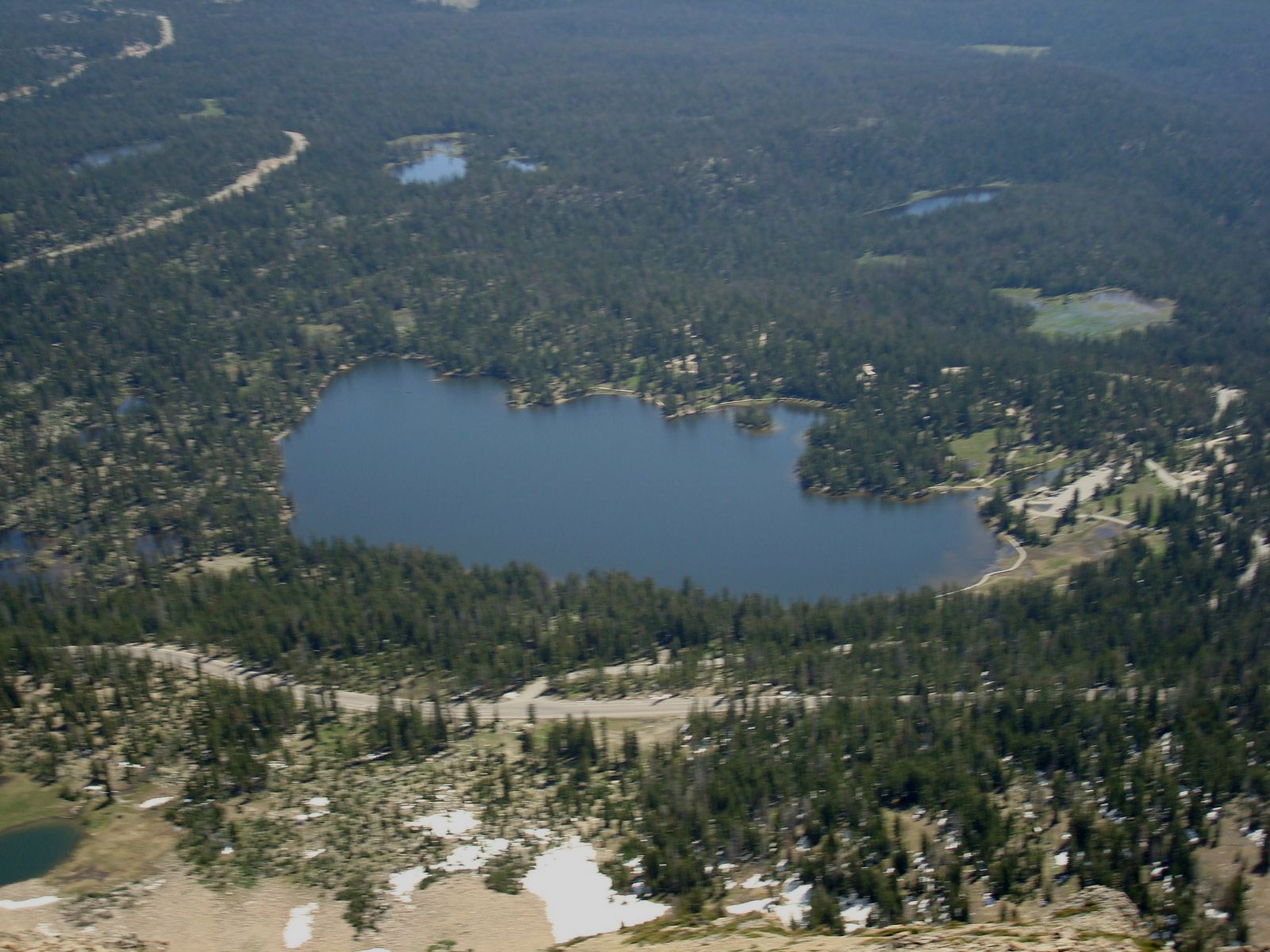
Mirror Lake Highway Makes High Alpine Utah Surprisingly Accessible.
The western Uintas allow hikers to drive into terrain above 10,000 feet before the first step. That makes this corridor the simplest introduction to the range—but altitude, weather and lightning still deserve respect.
Mirror Lake, Uinta Mountains · Wikimedia CommonsBest Uinta Mountains Hikes & Backpacking Trips
The Uintas are too large for a single ranking to explain them well. A two-hour summit, an overnight basin and a week-long traverse solve completely different hiking problems.
| Objective | Trip style | Best for | Commitment | Main issue |
|---|---|---|---|---|
| Bald Mountain | High summit hike | First Uinta summit | Short day | Altitude + lightning |
| Mirror Lake Corridor | Day hikes / lakes | First visit | Flexible | Altitude + seasonal access |
| Naturalist Basin | Long day / backpack | Alpine basin scenery | Long day or overnight | Distance + weather |
| Amethyst Basin | Backpack | Classic overnight | 1–2 nights | Vertical gain + storms |
| Red Castle | Backpack | Big wilderness scenery | 2–3 nights | Distance + remoteness |
| Kings Peak | State-high-point backpack | Major summit objective | 2–3+ days | Distance + altitude |
| Uinta Highline Trail | Long-distance trek | Range-scale wilderness | Multi-day | Navigation + logistics |
| Utah 13ers | Remote peakbagging | Experienced climbers | Multi-trip project | Off-trail terrain + remoteness |
Start With a Summit, a State High Point or a Wilderness Crossing.
These three objectives explain the range better than a generic list of ten trails: Bald Mountain introduces the elevation, Kings Peak introduces the wilderness, and the Highline introduces the true scale of the Uintas.

Bald Mountain
Bald Mountain reaches 11,943 feet yet begins from a trailhead already above 10,000 feet. It is one of Utah’s best introductions to high-elevation summit hiking.
Bald Mountain · Wikimedia Commons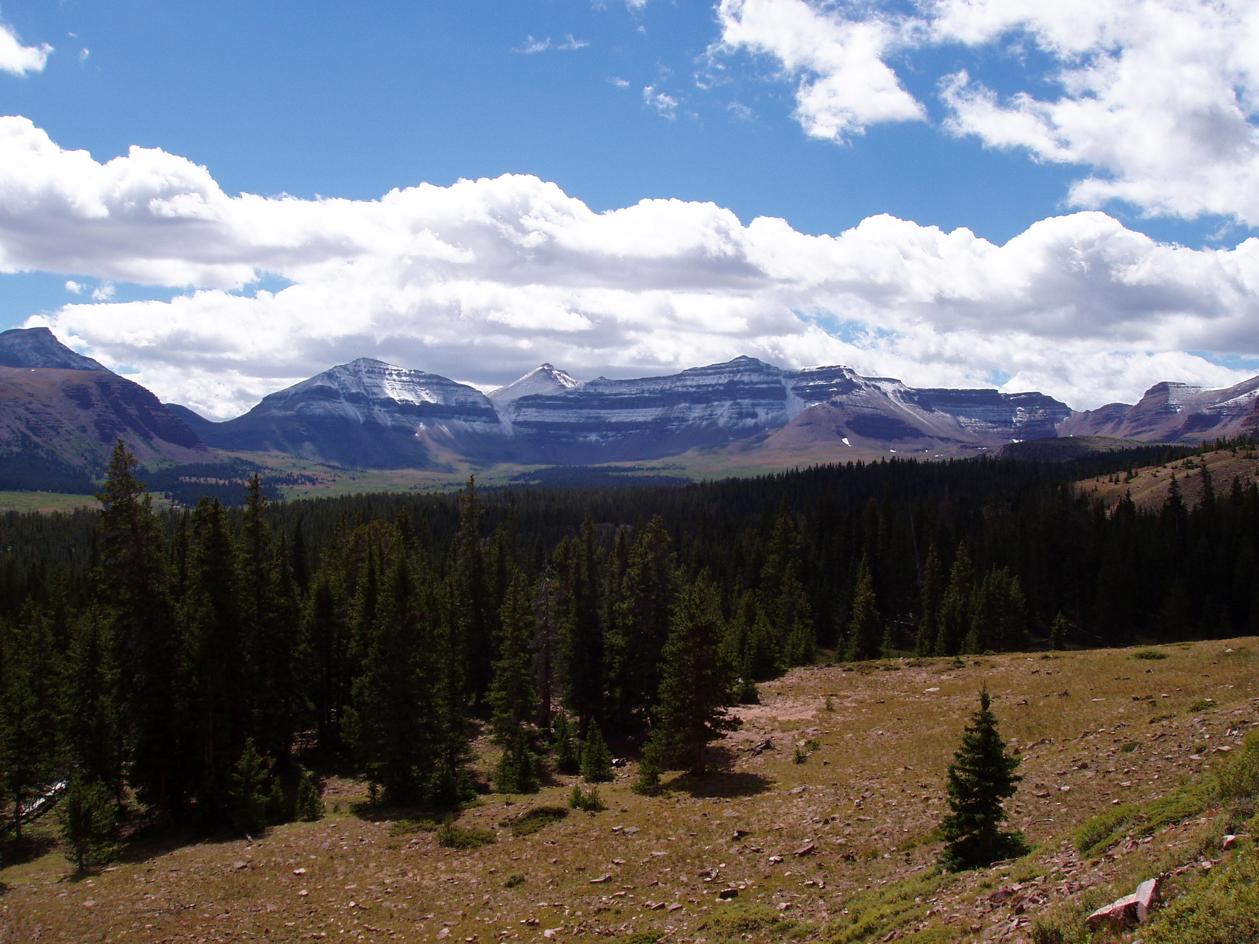
Kings Peak
Kings Peak reaches 13,528 feet and turns Uinta hiking into a true multi-day mountain objective. The approach is long, the summit ridge is rocky, and weather matters long before the top.
Kings Peak and Henrys Fork Basin · Wikimedia Commons
Uinta Highline Trail
The Highline crosses remote basins and exposed passes along the spine of the range. Forest Service materials describe more than 90 miles of Highline Trail through the High Uintas.
High Uintas from Anderson Pass · Wikimedia CommonsUinta Alpine Lakes Can Be the Entire Trip.
Glacial basins, lakes and broad high valleys define much of the Uinta landscape. For many hikers, a lake-basin backpack is a better first wilderness experience than immediately committing to Kings Peak.
Mirror Lake
The easiest place to understand the western Uinta landscape and connect into nearby high-elevation day hikes.
Naturalist Basin
A strong transition from roadside alpine hiking into longer, quieter high-country travel.
Amethyst Basin
A sustained approach into a high basin that rewards backpackers with lakes, peaks and a much stronger wilderness feel.
Red Castle
One of the strongest scenery-first backpacking destinations in the range without requiring a major summit.

The Uintas Get Bigger When the Road Disappears.
Short hikes reveal the western edge of the range. Backpacking reveals the real Uintas: long glacial valleys, isolated lakes, broad passes and mountain objectives separated from the nearest road by many miles.
Red Castle · Wikimedia CommonsA Practical Uinta Mountains Hiking Progression
The Uintas allow hikers to add altitude, distance, backpacking systems and wilderness navigation one layer at a time rather than learning everything on the same trip.
Uinta Access Changes Dramatically From West to East.
The range does not have one central trailhead. A short Bald Mountain hike from Mirror Lake Highway and a multi-day Kings Peak approach are completely different transportation and access problems.
Best Time to Hike the Uinta Mountains
Summer arrives late in the High Uintas and autumn can end quickly. High passes may hold snow long after lower Utah trails are dry.
Usually Too Early High Up
Many high-elevation roads, trailheads, passes and lake basins may still be affected by snow and runoff.
Transition to High Country
More routes open, but lingering snow, mosquitoes, stream crossings and frequent afternoon storms can shape the trip.
Core Backpacking Season
Often the strongest broad window for Kings Peak, lake basins and long High Uintas routes.
Cooler and Less Forgiving
Excellent when stable, but freezing nights, shorter days and early snow become increasingly realistic.
Uinta Weather Can Matter More Than the Trail Rating.
Large sections of the range sit near or above treeline. A technically easy route can become serious when lightning, hail, cold rain or strong wind arrives on an exposed ridge or pass.
Cross High Terrain Early
Build itineraries around being off summits and exposed passes before afternoon convection becomes established.
Summer Can Still Be Cold
Camps above 10,000 feet can be dramatically colder than Salt Lake City or the Wasatch Front.
Retreat Can Take Hours
Many Uinta trips lack the quick road exits common to Wasatch canyon hiking. Weather margin matters more as remoteness increases.

Many Uinta Trips Begin Where Other Mountain Days Nearly End.
Chepeta Lake sits around 10,600 feet. Bald Mountain Pass reaches roughly 10,687 feet. High trailheads make alpine scenery accessible, but they also mean thinner air, colder nights and less margin for people arriving directly from low elevation.
Chepeta Lake · Andrey Zharkikh / Wikimedia CommonsWilderness Rules Matter More as You Leave the Road Behind.
The High Uintas Wilderness covers roughly 456,705 acres across Ashley and Uinta-Wasatch-Cache National Forest lands. Check current Forest Service orders before every trip.
14 People Maximum
Forest Service wilderness guidance limits groups to no more than 14 people and 15 head of stock.
Use the 200-Foot Rule
Camps should remain more than 200 feet from designated trails, water sources and occupied campsites where required.
No Mechanized Shortcuts
Motorized and mechanized travel is prohibited inside designated wilderness except authorized administrative use.
Protect Fragile Basins
Alpine vegetation recovers slowly. Use durable surfaces, established camps and responsible waste practices.
Our Kings Peak Trip Gives This Guide a Real Wilderness Baseline.
Global Summit Guide has completed the Henrys Fork approach to Kings Peak as a three-day backpack.
That trip is useful context for the entire Uinta range because Kings Peak demonstrates what changes once a mountain cannot be reached in a single convenient day: pack weight matters, weather decisions compound, altitude is sustained rather than brief, and every summit decision must account for the walk back to camp.
Our Uinta coverage separates that firsthand experience from researched regional information. We use our own Kings Peak trip where it applies and official land-management and geographic sources elsewhere.
Go From the Regional Guide to the Exact Objective.
This page owns broad Uinta Mountains hiking and trip-selection intent. The individual mountain, trek and peakbagging pages own detailed route-specific planning.
Kings Peak Guide
Plan Utah’s highest mountain, the Henrys Fork route, summit ridge and multi-day logistics.
Uinta childBald Mountain Hiking Guide
Plan the range’s most accessible major high-elevation hiking summit.
Long-distance childUinta Highline Trail Guide
Plan the major east-west wilderness trek across the spine of the High Uintas.
Peakbagging dataUtah 13ers
Explore the dedicated list of Utah’s 13,000-foot summits without mixing list intent into this regional guide.
Where This Guide Gets Its Uinta Facts.
Geography and summit elevations change slowly. Road conditions, closures, fire restrictions, weather and recreation rules can change quickly and should be checked again immediately before a trip.
Uinta Mountains Hiking FAQ
Use these answers to choose the right kind of Uinta trip. Once you select an objective, move to the dedicated guide.
What are the best hikes in the Uinta Mountains?
Bald Mountain is an excellent first high summit, while the Mirror Lake corridor is ideal for a first visit. Naturalist Basin, Amethyst Basin and Red Castle are stronger hiking and backpacking objectives. Kings Peak and the Uinta Highline Trail are major multi-day trips.
What is the highest mountain in the Uinta Mountains?
Kings Peak is the highest mountain in the Uintas and the highest point in Utah at 13,528 feet.
What is a good first summit in the Uintas?
Bald Mountain is one of the strongest first choices because the Mirror Lake Highway reaches roughly 10,700 feet before the hiking even begins.
How long is the Uinta Highline Trail?
Forest Service materials describe the Highline Trail as extending more than 90 miles. Exact through-hike mileage depends on the selected eastern and western endpoints.
When is the best time to hike the Uinta Mountains?
July through September is the main high-country hiking window. Snow can linger into summer, while freezing nights and early snow become increasingly possible later in September.
Are the Uinta Mountains good for beginners?
Yes, when the route matches the hiker. Mirror Lake-area trails and Bald Mountain provide accessible introductions. Kings Peak, the Highline Trail and remote 13ers require substantially more endurance and wilderness experience.
Why do the Uinta Mountains run east-west?
The Utah Geological Survey explains that the range’s unusual orientation is connected to ancient structural weakness in the continental crust that influenced later uplift and faulting.
How many 13ers are in Utah?
Global Summit Guide’s Utah 13ers project uses a defined prominence threshold and currently identifies 19 Utah summits above 13,000 feet. They are all in the Uinta Mountains.
Can you camp anywhere in the High Uintas?
No. Wilderness regulations and current Forest Service orders apply. Camping setbacks, group-size rules and other restrictions should be checked before each trip.
Do you need to worry about altitude in the Uintas?
Yes. Many Uinta trailheads and camps are already above 9,000 feet, and major routes regularly travel between 10,000 and 13,000 feet. Visitors from low elevation should account for altitude when choosing mileage and pace.
Put the Uintas Into the Larger Utah Hiking System.
These three pages answer the next broader decision: where the Uintas fit among Utah hiking, Utah mountains and statewide range-highpoint objectives.
Best Hikes in Utah
Compare the Uintas with the Wasatch, Zion, Bryce, Moab, Capitol Reef and Utah’s other major hiking regions.
Deep Recovery · Utah mountainsBest Mountains in Utah
Compare Kings Peak and Bald Mountain with Utah’s strongest summit objectives statewide.
Deep Recovery · PeakbaggingUtah Range High Points
Move from Kings Peak as the Uinta high point into Utah’s larger range-highpoint challenge.
The Uintas Are Not One Hike. They Are a Progression.
Start around Mirror Lake. Climb Bald Mountain. Carry a backpack into an alpine basin. Then decide whether the next trip should be Kings Peak, the Highline Trail or a quieter corner of the wilderness.
Was this helpful?
Global Summit Guide is an independent mountaineering resource founded in 2026. The team combines first-hand trekking and climbing experience with in-depth research and professional health and nutrition review to help climbers choose objectives, prepare properly, and stay safe.
Health, altitude, and nutrition content is reviewed by Taylor Ludlow (Registered Nurse) and Brigg Hoopes (Nutritionist).
What We Don't Know Yet
Mountain information changes quickly. This box explains the limits of what this page can responsibly promise.
- Visa, passport, vaccination, border, insurance, and local transportation rules may change before your trip.
- Route conditions, snowpack, closures, and weather can change quickly after this page is updated.
- Permit rules, fees, quotas, and reservation windows may change between review cycles.
- Operator availability, pricing, guide ratios, and cancellation terms can change by season.
- Your fitness, altitude response, risk tolerance, and experience level may change what is safe or realistic.
Verify current conditions with official land managers, guide services, local forecasts, and current route reports before booking or climbing.
Mountaineering, rock and ice climbing, glacier travel, and high-altitude activity are inherently dangerous and can result in serious injury or death. The information on Global Summit Guide is provided for general informational and educational purposes only and is not a substitute for professional instruction, qualified guiding, proper equipment, or your own judgment and experience.
Route conditions, weather, snowpack, permits, regulations, and hazards change constantly and may differ from what is described here. Details may be incomplete, out of date, or contain errors. Always verify current information with local authorities, certified guides, and official sources before making any decision in the mountains.
Nothing on this site is medical, legal, or financial advice. Our fitness, acclimatization, altitude, and nutrition content is general in nature; consult a qualified physician before beginning any strenuous exercise program or exposing yourself to high altitude.
You are solely responsible for your own safety and decisions. To the fullest extent permitted by law, Global Summit Guide and its team accept no liability for any loss, injury, damage, or expense arising from use of, or reliance on, this information. By using this site you acknowledge these risks and accept these terms.
Some links on this site may be affiliate links. If you buy through them we may earn a small commission at no extra cost to you; this never affects our recommendations.
Global Summit Guide recommendation path
Next Best Mountain to Research
Use these recommendations to continue the right planning path instead of stopping on one page.
Use current permit, weather, route, and operator information before booking or climbing.