
Last updated September 25, 2026

Best Hikes in Greenland & Subarctic 2026: 6 Wild Routes From Icefjord to Lapland
Arctic hiking is not one experience. Greenland offers a remote 160-kilometer wilderness trail, marked walks beside the Ilulissat Icefjord and settlement-to-settlement trekking through South Greenland. The Faroe Islands trade ice for sea cliffs and grass-covered ridges, Svalbard adds polar-bear risk to genuine Arctic mountain hiking, and Lapland combines long summer daylight with one of northern Europe’s strongest hut-and-trail networks.
Where Should You Hike in Greenland & the Subarctic?
Choose the Arctic Circle Trail for a true self-supported wilderness trek. Choose Ilulissat for the easiest combination of spectacular Arctic scenery and accessible day hiking. Choose South Greenland for multi-day trekking between farms, fjords, Norse sites and small settlements. Choose the Faroe Islands for dramatic sea-cliff hiking without expedition logistics. Choose Svalbard for guided Arctic mountain hiking where wildlife safety fundamentally changes the rules. Choose Lapland for the strongest combination of long trails, huts, national parks and relatively straightforward northern logistics.
The key decision is not simply which landscape looks best. These destinations differ radically in remoteness, wildlife risk, navigation, access fees, hut systems and whether independent hiking is sensible.
Outside inhabited areas, polar-bear safety is a core travel requirement, not an optional precaution. Visit Svalbard recommends professional local guides for visitors heading into the wilderness. Current rules also require minimum separation from polar bears and place additional responsibilities on anyone camping or travelling outside settlements.
Several popular routes require mandatory payment or guided access. The official Faroe Islands hiking-fee page also notes that sustainable tourism legislation is changing the access framework. The Mykines lighthouse path is currently listed as closed because of landslide risk. Check the exact hike again immediately before travel.
Six Very Different Ways to Hike the Arctic & Subarctic
Start by deciding whether you want an expedition-style trek, a comfortable day-hiking base, cultural trekking, sea cliffs, guided polar wilderness or a hut-supported long trail.
Arctic Circle Trail
Greenland’s signature long-distance trek runs between Kangerlussuaq and Sisimiut through tundra, lakes, low mountains and open backcountry. Infrastructure is minimal and self-sufficiency matters.
Arctic Circle Trail Guide →Ilulissat
Marked routes and a boardwalk lead from town toward Sermermiut and the UNESCO-listed Icefjord. This is the strongest choice for hikers who want extraordinary Arctic scenery without an expedition.
Ilulissat Hiking Guide →South Greenland
Green valleys, sheep farms, Norse ruins, ice-filled fjords and jagged granite mountains create Greenland’s most varied settlement-to-settlement hiking region.
South Greenland Trekking →Faroe Islands
Short distances hide steep terrain, wind exposure and rapidly changing weather. The reward is a dense network of dramatic island hikes around cliffs, waterfalls, villages and narrow ridges.
Faroe Islands Hiking Guide →Svalbard
Longyearbyen gives access to mountains, glaciers and moraine terrain, but polar-bear safety means visitors should not approach hiking here as ordinary independent trail travel.
Svalbard Hiking Guide →Lapland
Swedish and Finnish Lapland combine long daylight, open fells, national parks and established mountain infrastructure. Kungsleden is the best-known long-distance benchmark.
Lapland Hiking Guide →If this is your first northern hiking trip, do not automatically choose the most remote route.
Ilulissat, the Faroe Islands and established Lapland routes provide an easier introduction to northern weather and terrain. The Arctic Circle Trail and independent South Greenland trekking demand stronger self-sufficiency, while Svalbard introduces wildlife hazards that change the entire operating model.

Some of Greenland’s Greatest Hiking Starts Within Walking Distance of Town.
Ilulissat is the counterpoint to the Arctic Circle Trail. You can follow a boardwalk to Sermermiut or use marked Blue and Yellow routes along the Icefjord without committing to an eight-day wilderness crossing.
Photo: Christoph Strässler / Wikimedia Commons · CC BY-SACompare the Best Hikes in Greenland & the Subarctic
This table is designed for trip selection. The individual child guide should own exact route mileage, transport, current closures and the final packing list.
| Region | Location | Best hiking style | Typical commitment | Core season | Best for | Main planning issue |
|---|---|---|---|---|---|---|
| Arctic Circle Trail | West Greenland | Remote backpacking | ~160 km · 8+ days | Jun–Sep | Solitude + wilderness | Self-sufficiency, wet ground, weather, no resupply |
| Ilulissat | Disko Bay, Greenland | Day hiking | Hours to full days | Summer | Icefjord scenery | Weather, slippery rock, trail choice |
| South Greenland | Kujalleq, Greenland | Multi-day trekking | Day hikes to 4–5+ days | Jun–Sep | Farms + fjords + Norse history | Navigation, boat transfers, limited services |
| Faroe Islands | North Atlantic | Day hiking | 1–7 days | Late spring–early autumn | Sea cliffs + waterfalls | Wind, fees, closures, private land |
| Svalbard | High Arctic Norway | Guided mountain hiking | Half day to full day | Summer / shoulder seasons | True High Arctic terrain | Polar bears, glaciers, regulations |
| Lapland | Sweden / Finland | Hut trekking + day hiking | Day hikes to multi-week | Summer / early autumn | Long trails + huts | Weather, insects, river/lake crossings, distance |
Where the Six Hiking Areas Are
These destinations are spread across a huge part of the North Atlantic and northern Scandinavia. They belong in one research cluster, not one single road-trip itinerary.
The Six Essential Greenland & Subarctic Hiking Guides
Each child page owns the detailed trail, logistics, weather, safety, accommodation and navigation questions for one destination.
Arctic Circle Trail
The official trail and Visit Greenland describe the route as roughly 160 km between Kangerlussuaq and Sisimiut. The current official guidance recommends at least eight days and emphasizes that the trail is narrow, rough, wet and sometimes difficult to follow.
Visit Greenland lists eight basic huts, but they are simple, first-come shelters rather than a Scandinavian-style serviced hut network. Hikers should expect to carry a tent, food and the equipment required to remain self-sufficient between the two towns.
Ilulissat Hiking Guide
Ilulissat is one of the simplest places in Greenland to build a self-guided hiking day around a world-class landscape. Visit Greenland identifies the boardwalk toward Sermermiut plus the marked Yellow and Blue routes along the Icefjord.
The Blue Route continues farther along the Icefjord before returning toward town through rocky hills and lakes. The Yellow Route combines views toward Disko Bay and the Icefjord with easier access from town.
South Greenland Trekking
South Greenland replaces much of the bare tundra image of Greenland with sheep farms, green valleys and settlement trails backed by ice fjords and steep mountains. Qassiarsuk and Igaliku are especially useful bases for independent hikers.
Visit Greenland describes a classic approximately 60 km route from Qassiarsuk to Narsaq, while Igaliku supports marked day hikes and a longer 4–5 day connection toward Qaqortoq. Nanortalik is the gateway to the far more dramatic Tasermiut Fjord.
Faroe Islands Hiking Guide
Faroese hiking is concentrated, scenic and deceptively serious. Routes such as Kallur, Trælanípa, Villingadalsfjall and village-to- village paths deliver enormous visual payoff without multi-day backpacking.
Access must be checked hike by hike. The official tourism site lists mandatory fees on several famous paths and warns that the access framework is changing under new sustainable-tourism legislation. Some routes also require guides or can close because of erosion, landslides or nesting wildlife.
Svalbard Hiking Guide
Longyearbyen is surrounded by mountains, glaciers, moraine systems and broad Arctic valleys. Popular guided objectives include Sarkofagen and Trollsteinen, while longer days reach farther into the High Arctic landscape.
The defining issue is polar-bear safety. Visit Svalbard states that visitors can walk independently within the established town limits, but outside inhabited areas the risk of encountering polar bears exists year-round. Organized local guiding is the appropriate default for most visitors.
Lapland Hiking Guide
Lapland offers the most developed trail infrastructure in this cluster. The Swedish Tourist Association describes Kungsleden from Abisko to Hemavan as just over 450 km, with 16 mountain huts on the route and multiple logical one-week sections.
Finnish Lapland adds a different network of national parks and wilderness areas. Summer brings very long daylight; September brings the ruska autumn-color season and cooler nights.

Short Trails Can Still Demand Serious Weather Judgment.
Faroese hikes are often measured in hours rather than days, but exposed cliffs, fog, rain and powerful wind make route conditions more important than mileage.
Photo: Ekrem Canli / Wikimedia Commons · CC BY-SA 4.0Best Time to Hike Greenland & the Subarctic
Summer is the common denominator, but the edges of the season behave very differently in Greenland, Svalbard, the Faroes and Lapland.
Arctic Circle Trail · Jun–Sep
Visit Greenland identifies June through August as summer, with mosquitoes and wet ground, while August and September bring cooler temperatures and the possibility of overnight mountain snow.
Ilulissat · Summer
Long daylight makes summer the simplest walking season. Marked routes are near town, but rock, rain and changing Arctic weather still call for proper footwear and layers.
Jun–Sep
Visit Greenland identifies June through September as the main hiking and sailing season around Igaliku and the southern settlements.
Late Spring–Early Autumn
Longer daylight and milder temperatures help, but wind and rain can interrupt plans in any month. Build flexibility rather than treating every day as a guaranteed hiking day.
Summer Hiking
Summer opens more snow-free terrain around Longyearbyen, but guided products vary by glacier and ground conditions. Shoulder-season snow changes both equipment and route choice.
Jun–Sep
Summer provides long daylight and open huts. Visit Finland highlights September as the classic ruska period, with autumn colors and cooler nights returning to northern Lapland.

In Svalbard, Wildlife Safety Is Part of Route Planning.
The mountains around Longyearbyen are real hiking objectives, but the usual hiking questions sit behind a more important one: who is managing polar-bear risk outside the settlement?
Photo via Wikimedia CommonsThe Most Useful Hiking Bases in Greenland & the Subarctic
Lodging strategy matters more here because transportation is often by flight, boat or limited regional transfer rather than a rental car.
Kangerlussuaq
The inland gateway for the Arctic Circle Trail and a useful place for shorter hikes toward the surrounding tundra and ice-sheet region.
Sisimiut
The coastal end of the Arctic Circle Trail and a genuine hiking base in its own right, with shorter marked routes behind town.
Ilulissat
The strongest base for travelers who want hotels, restaurants and multiple Icefjord walks directly from town.
South Greenland
Narsarsuaq, Qassiarsuk, Igaliku, Narsaq and Qaqortoq support different segments of the southern trekking network.
Tórshavn
The transport and lodging hub for the Faroe Islands, though many of the strongest hikes require driving, ferries or island transfers.
Longyearbyen
The essential Svalbard hiking base, with local operators organizing mountain, glacier and wilderness trips.
Abisko
One of the strongest gateways to Swedish Lapland and the northern Kungsleden, with direct access to multi-day mountain trekking.
Rovaniemi / Fell Resorts
Rovaniemi is a major Finnish Lapland gateway; deeper hiking trips generally benefit from moving onward to a national-park or fell base.

Greenland’s South Is Where Farms, Norse History and Ice-Filled Fjords Meet.
South Greenland is less about following one famous named trail and more about linking settlements, valleys, old routes and boat transfers into a coherent trekking journey.
Photo: Camilla Hey / Visit Greenland / Wikimedia Commons · CC BYHow to Plan a Greenland & Subarctic Hiking Trip in Six Steps
The safest way to plan this cluster is to decide the level of independence first, then build the transport and route around it.
Choose expedition, base hiking or hut trekking
Decide whether you want to carry several days of food, return to a hotel each night, move between settlements, hike with a guide or use an established hut system.
Match the destination to the northern season
Summer creates the broadest access window, but mosquitoes, wet tundra, residual snow, wind and early autumn storms vary by region.
Confirm trail access and local rules
Check Faroe Islands fees and closures, Svalbard regulations, Greenland transport and the operating dates of huts or local services before committing to flights.
Build transport around the trailhead
Arctic travel frequently depends on boats, domestic flights, limited buses or prearranged transfers. The nearest airport rarely solves the whole approach.
Match safety equipment to remoteness
Offline maps, emergency communication, adequate insulation and realistic evacuation planning become more important as you move away from towns and staffed huts.
Recheck weather and conditions immediately before departure
Wind, precipitation, fog, river levels, snow and ferry or flight disruption can change an Arctic hiking plan quickly.
The Same Packing List Does Not Work Across This Cluster
Each destination creates a different primary hazard: remoteness, exposed cliffs, difficult navigation, wildlife or long-distance self-sufficiency.
Arctic Circle Trail
Carry navigation, shelter and enough food for a route with no normal resupply. Official trail guidance warns that the footpath can disappear in boggy ground and conditions can stay wet for days.
Ilulissat
The marked routes are far more accessible, but wet rock, snow patches, cold wind and the temptation to move too close to steep shoreline terrain still require normal mountain judgment.
South Greenland
Some routes use old tracks or broad terrain rather than a continuous obvious footpath. Offline mapping and the ability to navigate in poor visibility become important on longer journeys.
Faroe Islands
Stay on permitted paths, respect private land and treat wind near cliffs as a serious hazard. Official guidance asks hikers to protect trails, wildlife and navigational cairns.
Svalbard
Polar bears can occur anywhere in Svalbard year-round. Current official guidance recommends that visitors use professional local guides outside settlements and follow all deterrent, distance and camping requirements.
Lapland
Better trail infrastructure does not remove mountain weather. River crossings, lake transport, insects, cold rain and long distances between services still matter on multi-day routes.

Lapland Is the Most Forgiving Place in This Cluster to Learn Multi-Day Northern Trekking.
Established trails, staffed mountain stations and huts reduce some of the logistical uncertainty found on remote Greenland routes while still delivering tundra, open fells and long northern days.
Photo via Wikimedia CommonsRemoteness Often Matters More Than Elevation
These are not high-altitude trekking destinations in the Himalayan sense. Their difficulty comes from weather, isolation, exposure, navigation and environmental hazards.
Arctic Circle Trail
Low elevations do not make an eight-day route easy when the trail is wet, services are absent and bad weather can persist.
Ilulissat
The best starting point for hikers who want Arctic scenery without committing to expedition-style backcountry travel.
South Greenland
Route-finding, boat transfers and limited services can matter more than any one steep climb.
Faroe Islands
Trails may be short, but strong wind and cliff exposure can make an otherwise simple walk inappropriate.
Svalbard
The terrain is only part of the challenge. Polar-bear precautions, glaciers and High Arctic conditions change what “independent hiking” means.
Lapland
The hut system lowers logistical complexity, but full-route mileage and prolonged northern weather still demand endurance and planning.
Do not judge Arctic difficulty by summit height.
A 400-meter hill in fog, wind and cold rain can demand better decisions than a much higher trail in stable weather. Exposure time and the distance to shelter are often the better measures.
How This Greenland & Subarctic Guide Was Checked
Official destination, trail and tourism organizations are prioritized because access rules and safety requirements can change quickly in northern environments.
Greenland & Subarctic Hiking FAQ
Short answers to the questions that usually determine which northern hiking destination actually fits the trip.
What are the best hikes in Greenland and the Subarctic?
Strong choices include the Arctic Circle Trail, Ilulissat Icefjord trails, South Greenland trekking, the Faroe Islands, Svalbard and Lapland. They range from hotel-based day hiking to remote self-supported wilderness travel.
How long is the Arctic Circle Trail?
Current official sources describe the trail as approximately 160 km between Kangerlussuaq and Sisimiut, with at least eight days recommended for most hikers.
Can you hike independently in Ilulissat?
Yes. Marked routes and the boardwalk toward Sermermiut make Ilulissat one of Greenland’s easiest destinations for independent day hiking. The Blue and Yellow routes provide longer Icefjord options.
Where is the best trekking in South Greenland?
Qassiarsuk and Igaliku are excellent bases for cultural and settlement trekking, while Nanortalik gives access to the dramatic mountains and fjords around Tasermiut.
Do you have to pay to hike in the Faroe Islands?
Some popular Faroese hikes require mandatory fees or guided access, while others remain free. The rules differ by route and are evolving, so check the official hiking-fee page for the exact trail.
Can you hike alone in Svalbard?
Independent walking is possible within established Longyearbyen town limits. Outside inhabited areas, polar-bear risk exists year-round and official tourism guidance recommends professional local guides for visitors heading into the wilderness.
What is the best hike in Lapland?
Kungsleden is the best-known long-distance route in Swedish Lapland, running just over 450 km between Abisko and Hemavan. Many hikers complete one section rather than the entire trail.
When is the best time to hike in Greenland?
June through August provides the broadest summer hiking window, while August and September can bring cooler temperatures and early mountain snow. Exact timing depends on the region and route.
Do I need a satellite communicator in Greenland?
It is a sensible safety tool on remote multi-day routes where normal cellular service is absent or unreliable. It is far less important on short walks directly around towns such as Ilulissat.
Which Arctic hiking destination is easiest for a first trip?
Ilulissat, established Faroe Islands day hikes and hut-supported Lapland routes generally require less expedition logistics than the Arctic Circle Trail or remote South Greenland trekking.
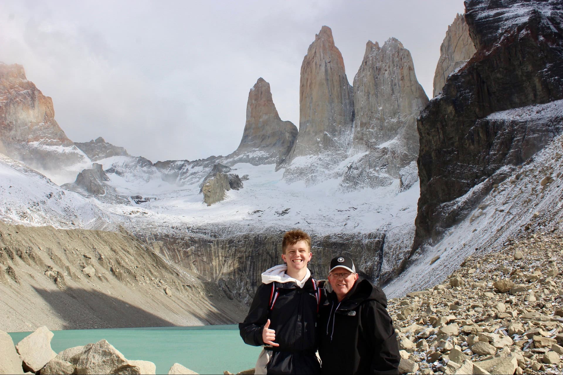
About this research
Travis Ludlow leads Global Summit Guide’s mountain, hiking and expedition-planning research. Safety review is by Dawson Ludlow. This page separates established route characteristics from changing access, weather and local safety requirements. Read the Global Summit Guide editorial approach.
Choose the Level of Wilderness Before You Choose the View.
Start with Ilulissat, the Faroe Islands or established Lapland trails if you want easier logistics. Move toward South Greenland or the Arctic Circle Trail when you are ready for greater independence. Treat Svalbard as its own wildlife-managed Arctic hiking environment.
Was this helpful?
Global Summit Guide is an independent mountaineering resource founded in 2026. The team combines first-hand trekking and climbing experience with in-depth research and professional health and nutrition review to help climbers choose objectives, prepare properly, and stay safe.
Health, altitude, and nutrition content is reviewed by Taylor Ludlow (Registered Nurse) and Brigg Hoopes (Nutritionist).
What We Don't Know Yet
Mountain information changes quickly. This box explains the limits of what this page can responsibly promise.
- Visa, passport, vaccination, border, insurance, and local transportation rules may change before your trip.
- Route conditions, snowpack, closures, and weather can change quickly after this page is updated.
- Permit rules, fees, quotas, and reservation windows may change between review cycles.
- Operator availability, pricing, guide ratios, and cancellation terms can change by season.
- Your fitness, altitude response, risk tolerance, and experience level may change what is safe or realistic.
Verify current conditions with official land managers, guide services, local forecasts, and current route reports before booking or climbing.
Mountaineering, rock and ice climbing, glacier travel, and high-altitude activity are inherently dangerous and can result in serious injury or death. The information on Global Summit Guide is provided for general informational and educational purposes only and is not a substitute for professional instruction, qualified guiding, proper equipment, or your own judgment and experience.
Route conditions, weather, snowpack, permits, regulations, and hazards change constantly and may differ from what is described here. Details may be incomplete, out of date, or contain errors. Always verify current information with local authorities, certified guides, and official sources before making any decision in the mountains.
Nothing on this site is medical, legal, or financial advice. Our fitness, acclimatization, altitude, and nutrition content is general in nature; consult a qualified physician before beginning any strenuous exercise program or exposing yourself to high altitude.
You are solely responsible for your own safety and decisions. To the fullest extent permitted by law, Global Summit Guide and its team accept no liability for any loss, injury, damage, or expense arising from use of, or reliance on, this information. By using this site you acknowledge these risks and accept these terms.
Some links on this site may be affiliate links. If you buy through them we may earn a small commission at no extra cost to you; this never affects our recommendations.
Global Summit Guide recommendation path
Next Best Mountain to Research
Use these recommendations to continue the right planning path instead of stopping on one page.
Use current permit, weather, route, and operator information before booking or climbing.