
Last updated September 30, 2026

Vía de la Plata: The Complete Camino Pilgrimage Guide
The Vía de la Plata is the great southern Camino: roughly 1,000 kilometres from Seville toward Santiago through Andalucía, Extremadura and western Castilla y León before the Santiago-bound route turns onto the Camino Sanabrés. It combines Roman roads, medieval pilgrimage, enormous open landscapes and some of Spain’s greatest historic cities—but its heat, long service gaps and sheer length demand more planning than the busiest Camino routes.
What Is the Vía de la Plata Camino?
For a modern pilgrim walking from Seville to Santiago, the Vía de la Plata is best understood as a southern Camino corridor followed by a route choice in Zamora province. From Seville, walkers travel north through Mérida, Cáceres, Salamanca and Zamora.
At Granja de Moreruela, the Santiago-focused route normally turns northwest onto the Camino Sanabrés, continuing through Puebla de Sanabria and into Galicia toward A Gudiña, Ourense and Santiago.
A second historic option continues north toward Astorga, where the walker joins the Camino Francés for the final journey west. Both are legitimate Camino histories, but they are not the same itinerary.
Long stretches of Andalucía and Extremadura can be exposed, hot and relatively sparse in services. Water, food and the location of the next open accommodation need to be solved before leaving each morning.
Pilgrimage rules, albergues, route variants and local closures can change. Use this guide to build the plan, then confirm the relevant stage with the current regional or Cathedral authority.
Three Routes Are Often Collapsed Into One Name
Understanding the terminology prevents the most common planning error on the Vía de la Plata.
The Ancient Vía de la Plata
The historic Roman road connected Emerita Augusta—modern Mérida—with Asturica Augusta, modern Astorga. Surviving bridges, milestones and road sections still anchor the journey.
Ruta Vía de la Plata
Spain’s modern heritage route extends the north-south idea beyond the ancient core, linking Seville toward the Cantabrian north through western Spain.
Seville → Santiago
Pilgrims begin in Seville, use the Vía de la Plata corridor north, then reach Santiago either through the Camino Sanabrés or by joining the Camino Francés at Astorga.
This guide uses the Santiago-focused interpretation.
When we say “walk the full Vía de la Plata,” we mean the Seville → Granja de Moreruela → Camino Sanabrés → Santiago pilgrimage unless a section specifically discusses the Astorga option.

The Roman Road Is Not Background Scenery. It Is the Spine of the Journey.
Mérida makes the route’s historical depth tangible: the pilgrim crosses a landscape shaped long before the medieval Camino, where Roman roads, bridges and cities became the corridor later walkers inherited.
Photo: G41rn8 / Wikimedia Commons · CC BY-SA 4.0Camino Sanabrés or Continue to Astorga?
This decision determines the identity of the final third of the pilgrimage.
Option A: Camino Sanabrés
Turn northwest at Granja de Moreruela toward Tábara, Puebla de Sanabria and Galicia.
- Crosses the Sanabria region before entering Galicia.
- Continues toward A Gudiña.
- Galicia offers Laza and Verín route variants.
- The routes converge before continuing toward Ourense.
- From Ourense the Camino continues north toward Santiago.
This is the route used as the main itinerary in this guide.
Option B: Astorga + Camino Francés
Continue north through western Castilla y León toward Astorga, preserving the ancient Roman-road direction.
- Reaches Astorga, the northern Roman terminus.
- Joins the Camino Francés.
- Introduces much denser pilgrim infrastructure.
- Shares the famous Francés corridor west toward Santiago.
Choose this version when the Roman-road continuity or a combined Plata–Francés journey matters more than the direct Sanabrés finish.

The Vía de la Plata Alternates Empty Walking With Monumental Cities.
The rhythm is one of the route’s defining characteristics: long open stages through dehesa and farmland, followed by places such as Mérida, Cáceres, Salamanca and Zamora where history changes the pace of the day.
Photo: Rafax / Wikimedia Commons · CC BY-SA 4.0The Vía de la Plata in Six Walking Arcs
Exact daily stages should move with lodging, weather and fitness. These larger arcs are more stable than a rigid 40-day schedule.
Seville → Sierra Morena
Leave Seville through the lower Guadalquivir landscape, pass the Itálica area and move gradually toward the more rural Camino through Castilblanco and Almadén de la Plata.
Monesterio → Mérida
The Camino settles into dehesa, small towns and broad rural tracks before reaching Mérida and the most concentrated Roman heritage on the pilgrimage.
Mérida → Cáceres → Béjar
Historic cities punctuate some of the route’s most open walking. As the Camino approaches the Sistema Central, elevation and weather begin changing the character of the journey.
Béjar → Salamanca → Zamora
The Camino crosses the Salamanca countryside, reaches one of Spain’s great university cities and then continues north through the cereal country toward Zamora.
Granja de Moreruela → Puebla de Sanabria → A Gudiña
The direct Santiago route turns northwest, becomes more rolling and eventually more mountainous, and crosses into Galicia through the high country near A Mezquita and A Gudiña.
A Gudiña → Ourense → Santiago
Route variants through Laza or Verín eventually converge around Ourense. The pilgrimage then continues north through Galicia toward the final approach to Santiago de Compostela.

The Camino Enters Salamanca Across a Bridge That Carries the Vía de la Plata.
Few long pilgrimages tie their route identity to visible infrastructure this old. The Roman bridge across the Tormes still gives the arrival into Salamanca a physical connection to the ancient corridor beneath the Camino.
Photo: Josep Maria Viñolas Esteva / Wikimedia Commons · CC BY 4.0How Hard Is the Vía de la Plata?
Its difficulty comes from accumulation: long mileage, repetitive days, heat, sparse services and finally more climbing on the Sanabrés.
Generally Straightforward
Much of the route uses farm roads, historic road corridors, dirt tracks and ordinary walking paths rather than technical mountain trail.
The Real Commitment
Nearly 1,000 km makes small problems cumulative: blisters, tendon soreness, poor shoes, excessive pack weight and inadequate recovery matter more after several weeks.
Southern Spain Changes the Day
Andalucía and Extremadura can become dangerously hot. In warm conditions, early departures are a route-management strategy rather than simply a preference.
Plan Before Leaving Town
Do not assume the service density of the Camino Francés. Confirm the next water, food and lodging opportunities before walking into long rural sections.
The Terrain Gets Hillier
Sanabria and Galicia introduce stronger climbing, including the approach toward the high country around A Canda and later Galician hills.
Waymarking Helps—Offline Maps Still Matter
Yellow arrows and Camino markers are part of the route, but a quiet Camino with long gaps deserves a downloaded track or map as backup.

North of Zamora, the Question Changes From “How Far?” to “Which Camino?”
Granja de Moreruela lies ahead. From there the pilgrim chooses between continuing toward Astorga or turning onto the Sanabrés for the direct journey through Galicia to Santiago.
Photo: José Luis Filpo Cabana / Wikimedia Commons · CC BY-SA 4.0Best Time to Walk the Vía de la Plata
For a Seville start, temperature management matters more than chasing one theoretically perfect weather month.
| Period | Southern route | North / Galicia | Planning verdict |
|---|---|---|---|
| March–April | Cooler and greener; occasional wet weather | Can still be cold and wet farther north | Strong full-route window with layers |
| May | Warm but often manageable with early starts | Spring conditions improve | Excellent if prepared for heat |
| June | Heat becomes a larger southern issue | Generally favorable farther north | Start very early; heat margin required |
| July–August | Potentially severe heat and exposure | Warmer northern conditions | Poor choice for most full Seville starts |
| September | Can remain hot early in the month | Good walking conditions | Improves as autumn approaches |
| October | Milder southern walking | Cooler, wetter and shorter days | Strong option with weather flexibility |
| Winter | Cooler south | Cold, wet and possible snow on higher sections | Requires more lodging and weather research |
If a hot forecast is unavoidable, shorten stages, leave before sunrise when appropriate, know water locations and be willing to stop early.
Water, Food & Long Service Gaps
The next village exists on the map. That does not guarantee an open café, shop or fountain when you reach it.
Know the Next Reliable Water
Begin each stage knowing the distance to the next confirmed source, especially through hot southern sections.
Carry an Emergency Meal
Bread, nuts, cheese, fruit or another simple calorie reserve can turn a closed village shop from a crisis into an inconvenience.
Do Not Ration Water to Save Weight
The Vía’s southern stages are exactly where carrying too little water creates the greatest risk.
Credencial, Stamps & the Compostela
The credential is not merely a souvenir. It records the journey and is part of the Cathedral’s completion system.
Get an Authorized Credencial
The Cathedral’s Pilgrim Office says official credentials are issued by the Cathedral and authorized churches, confraternities and Camino associations.
Collect Sellos
Churches, albergues and other Camino institutions can provide stamps. Over the final qualifying distance, follow the Cathedral’s current stamping requirements carefully.
100 km on Foot
The traditional Compostela requires at least the final 100 km on foot or horseback, or 200 km by bicycle, on an officially recognized route.
Two Per Day in the Final 100 km
The Pilgrim Office instructs walkers to collect at least two stamps per day during the final 100 km used to qualify.
The Compostela Is a Pilgrimage Certificate
The Cathedral ties the Compostela to Christian or spiritual pilgrimage motivation and arrival at the Tomb of the Apostle.
Pilgrim Reception Office
The final Cathedral stamp and qualifying certificates are handled at the Pilgrim Reception Office in Santiago.
The credential can structure the pilgrimage, but the Roman road, churches, solitude, people, prayer, reflection and weeks of repeated walking are the journey. Learn the certificate rules—then let them remain rules rather than the meaning of the Camino.
Where Do Pilgrims Sleep?
Accommodation exists across the route, but the Vía does not reward the assumption that every village has multiple open beds.
Albergues
Municipal, religious and private pilgrim accommodation can keep the route affordable and preserve the social rhythm of Camino walking.
Hostales & Pensiones
Useful for recovery nights, couples, light sleepers or sections where the pilgrim-hostel network is thin.
Hotels
Seville, Mérida, Cáceres, Salamanca, Zamora, Ourense and Santiago are logical places for a private room or rest day.
Book selectively—not necessarily every night.
Reserve the first night, major-city recovery nights and any stage where lodging is unusually limited. Preserve flexibility elsewhere when the season and local conditions allow it.
What Gear Does the Vía de la Plata Actually Need?
This is a long walking pilgrimage, not an alpine expedition. Low pack weight and dependable foot care matter more than technical gear.
Comfort Before Maximum Support
Use broken-in trail shoes or light hiking footwear that works for repeated hard-surface and dirt-road mileage.
Keep the Load Small
A light pilgrimage pack is easier on feet, knees and shoulders over several consecutive weeks than an expedition-style backpack.
Optional South · More Useful North
Trekking poles can help with repetitive walking, tired knees and the hillier Sanabrés/Galicia portion.
Hat + Sunscreen + Water
These are core safety equipment on the exposed southern route, not luxury items.
Light Waterproof Layer
The Camino eventually reaches wetter and cooler country. Pack for the entire journey, not only Seville’s starting weather.
Deal With Hot Spots Early
Tape, blister treatment and dry socks weigh almost nothing compared with the cost of ignoring a foot problem for another 25 kilometres.
Lightweight Gear for Long Camino Days
If you are replacing worn footwear or adding poles before the walk, compare lightweight options rather than buying expedition equipment for a non-technical pilgrimage.
Gear for long Camino days
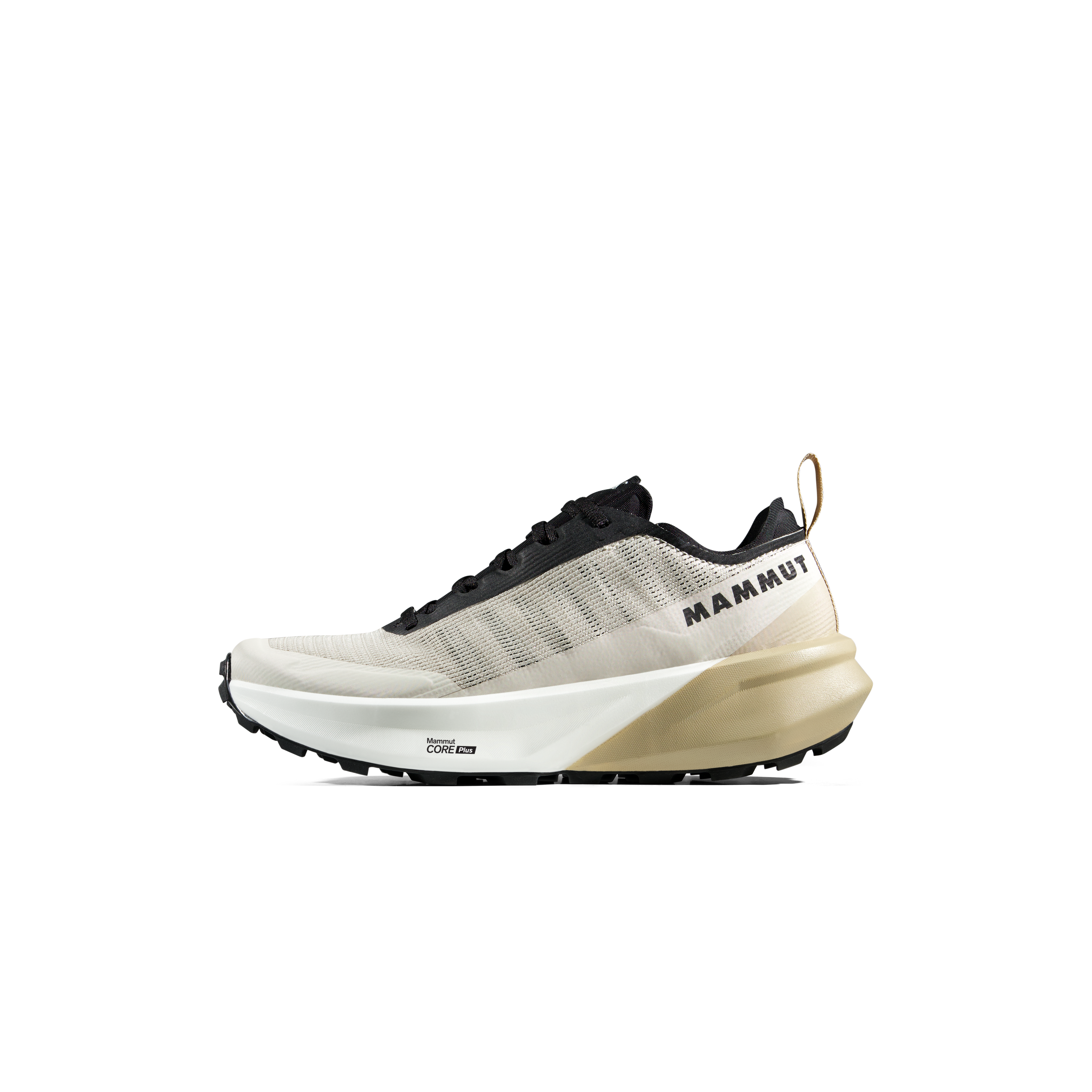

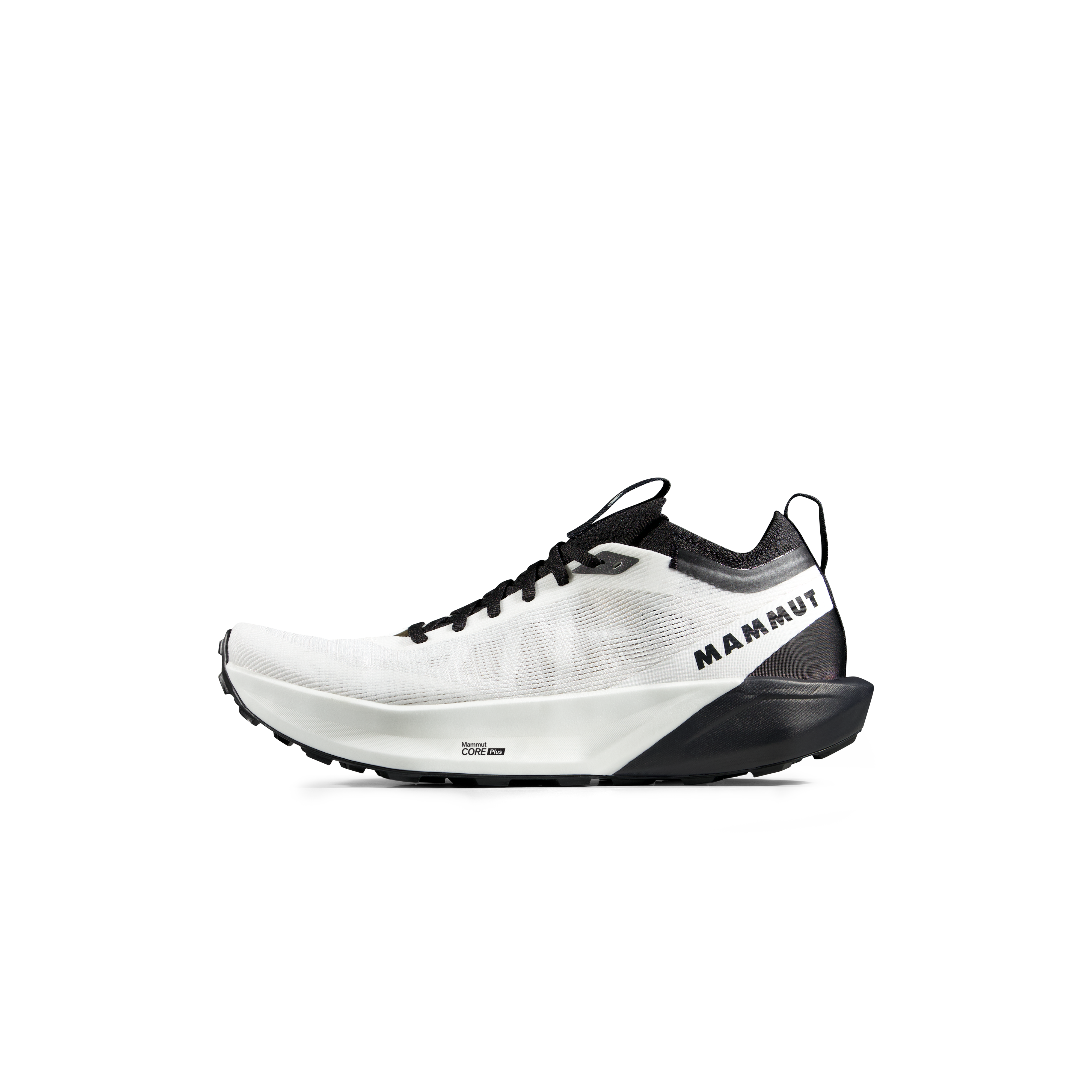

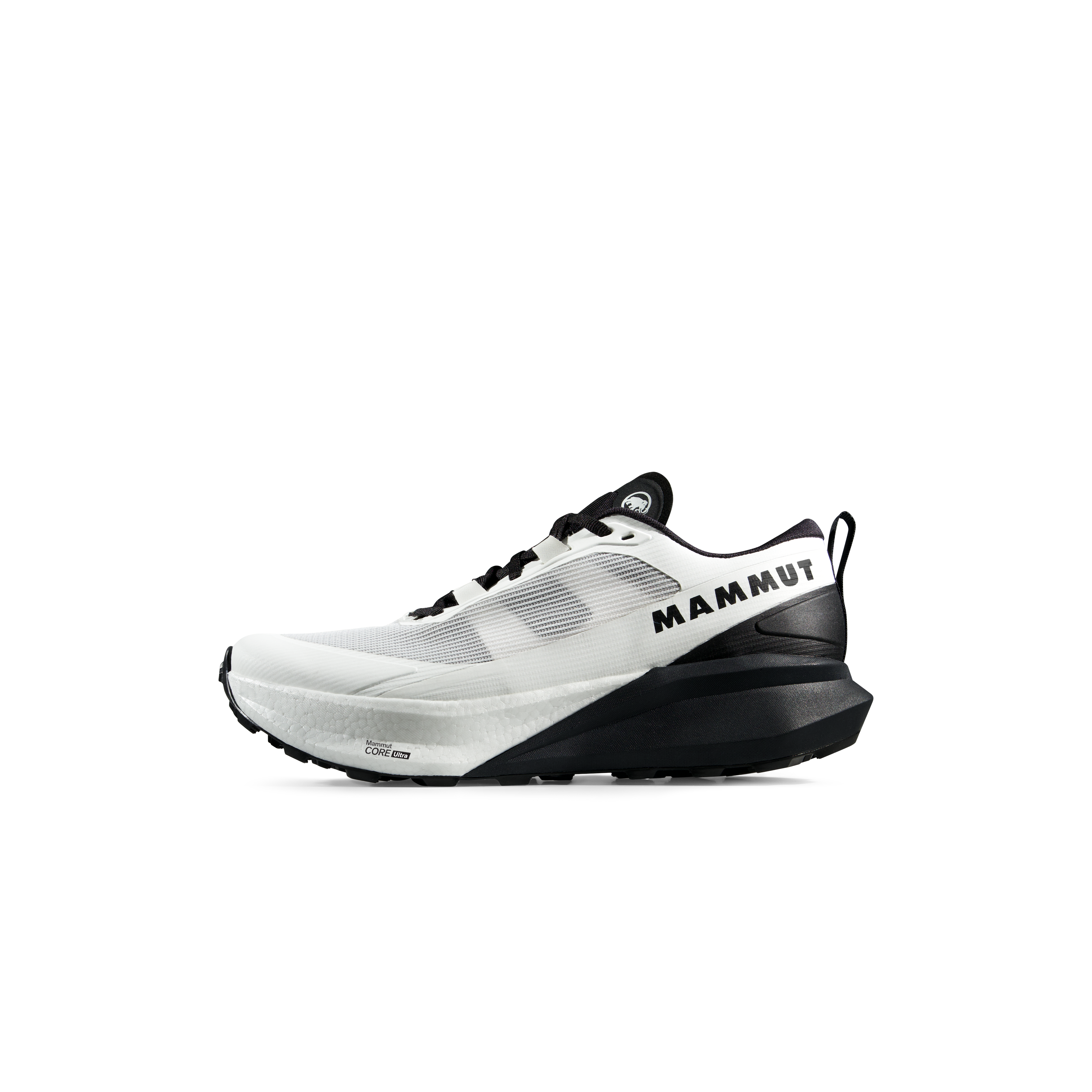
We may earn a commission if you buy through these links, at no extra cost to you. Affiliate disclosure
Vía de la Plata Pilgrimage Map
This orientation map shows the main city sequence and the Sanabrés turn toward Santiago. It is not a substitute for a navigation-grade Camino track.
Why Walk the Vía de la Plata?
The route’s greatest difference from the Francés may be what is absent: crowds, constant services and a large moving Camino community.
Long Hours With the Road
Fewer pilgrims and larger spaces create more uninterrupted walking time than on Spain’s busiest Camino corridors.
Walk Inside Multiple Eras
Roman infrastructure, medieval pilgrimage, churches, Islamic-era history and modern rural Spain occupy the same northward corridor.
Santiago Still Gives the Road Direction
Whatever a modern walker’s personal motivation, the Christian pilgrimage tradition and the Apostle’s tomb explain why the Camino moves toward Compostela.

After Nearly a Thousand Kilometres, the Destination Is Not Abstract.
The Vía de la Plata ultimately becomes a Camino because the road ends at Santiago. The cathedral and the Tomb of the Apostle give weeks of south-to-north walking a destination inherited from centuries of pilgrims.
Photo: Sudzie / Wikimedia Commons · CC BY-SA 4.0Official Vía de la Plata & Camino Sources
Use these authorities to recheck route variants, pilgrim rules, accommodation and current access before travel.
Albergues close, roads alter approaches, weather changes surfaces and route authorities may revise local guidance. The official regional authority should finish the planning process immediately before each section is walked.
Vía de la Plata FAQ
The questions most likely to determine whether this is actually the right Camino.
How long is the Vía de la Plata from Seville to Santiago?
Plan on roughly 980 to 1,000 kilometres for the Santiago-focused journey from Seville via the Vía de la Plata and Camino Sanabrés. Exact totals vary with route variants and stage choices.
Where does the Vía de la Plata start?
The modern southern Camino pilgrimage commonly begins in Seville. The historical Roman Vía de la Plata itself is most closely associated with the corridor between Mérida and Astorga.
Does the Vía de la Plata go directly to Santiago?
Not as one single historical road. Near Granja de Moreruela, Santiago-bound pilgrims can turn northwest onto the Camino Sanabrés, which continues through Sanabria and Galicia to Santiago.
What happens at Granja de Moreruela?
It is the key route decision. Pilgrims may continue north toward Astorga and join the Camino Francés or take the Camino Sanabrés northwest toward Santiago.
How many weeks does the full Vía de la Plata take?
A full Seville-to-Santiago pilgrimage is generally a multi-week journey on the scale of roughly five to seven weeks, depending on daily distance, rest days and route variant.
Is the Vía de la Plata harder than the Camino Francés?
It is not necessarily more technical, but its greater total distance, hotter southern climate, quieter stages and wider service gaps can make planning and cumulative fatigue more demanding.
What is the best time to walk the Vía de la Plata?
Spring and autumn are the strongest general windows for a full Seville start. Midsummer heat can be severe in Andalucía and Extremadura.
Can I walk the Vía de la Plata alone?
Many experienced pilgrims do, but the route is quieter than the Francés. Carry offline navigation, know water and lodging gaps and maintain a communication plan appropriate for long solitary stages.
Do I need a pilgrim credential?
An official or Cathedral-authorized Credencial records Camino stamps, supports access to pilgrim hospitality and is used when applying for the Compostela.
How many stamps do I need for the Compostela?
The Pilgrim Reception Office currently requires at least two stamps per day during the final 100 kilometres for walkers and horseback pilgrims using that distance to qualify.
Is the Vía de la Plata actually a Roman road?
Its historical core follows the great Roman north-south corridor associated with Emerita Augusta, modern Mérida, and Asturica Augusta, modern Astorga. The modern Santiago pilgrimage extends and branches beyond that original Roman alignment.
Do I need hiking boots for the Vía de la Plata?
Heavy mountaineering boots are unnecessary for most pilgrims. Comfortable broken-in trail shoes or light hiking footwear are generally more appropriate for repeated long-distance walking unless personal support needs dictate otherwise.
Choose the Vía de la Plata When You Want the Camino to Feel Long Again.
It asks for more planning than the Francés and gives less constant company in return. You cross Roman bridges, dehesa, university cities, open farmland, Sanabria and Galicia before Santiago finally replaces the yellow arrow as the destination in front of you. Carry less, leave room for heat and recovery, understand the fork at Granja de Moreruela—and give the road enough time to become a pilgrimage rather than a schedule.
Was this helpful?
🏔Related peaks nearby
🧭Explore & compare
Global Summit Guide is an independent mountaineering resource founded in 2026. The team combines first-hand trekking and climbing experience with in-depth research and professional health and nutrition review to help climbers choose objectives, prepare properly, and stay safe.
Health, altitude, and nutrition content is reviewed by Taylor Ludlow (Registered Nurse) and Brigg Hoopes (Nutritionist).
What We Don't Know Yet
Mountain information changes quickly. This box explains the limits of what this page can responsibly promise.
- Route conditions, trailhead access, crevasse exposure, stream crossings, and rescue access may vary from published planning guidance.
- Visa, passport, vaccination, border, insurance, and local transportation rules may change before your trip.
- Route conditions, snowpack, closures, and weather can change quickly after this page is updated.
- Permit rules, fees, quotas, and reservation windows may change between review cycles.
- Operator availability, pricing, guide ratios, and cancellation terms can change by season.
Verify current conditions with official land managers, guide services, local forecasts, and current route reports before booking or climbing.
Mountaineering, rock and ice climbing, glacier travel, and high-altitude activity are inherently dangerous and can result in serious injury or death. The information on Global Summit Guide is provided for general informational and educational purposes only and is not a substitute for professional instruction, qualified guiding, proper equipment, or your own judgment and experience.
Route conditions, weather, snowpack, permits, regulations, and hazards change constantly and may differ from what is described here. Details may be incomplete, out of date, or contain errors. Always verify current information with local authorities, certified guides, and official sources before making any decision in the mountains.
Nothing on this site is medical, legal, or financial advice. Our fitness, acclimatization, altitude, and nutrition content is general in nature; consult a qualified physician before beginning any strenuous exercise program or exposing yourself to high altitude.
You are solely responsible for your own safety and decisions. To the fullest extent permitted by law, Global Summit Guide and its team accept no liability for any loss, injury, damage, or expense arising from use of, or reliance on, this information. By using this site you acknowledge these risks and accept these terms.
Some links on this site may be affiliate links. If you buy through them we may earn a small commission at no extra cost to you; this never affects our recommendations.
Global Summit Guide recommendation path
Next Best Mountain to Research
Use these recommendations to continue the right planning path instead of stopping on one page.
Use current permit, weather, route, and operator information before booking or climbing.