Last updated October 30, 2026
Windom Peak: Chicago Basin Climbing Guide
Windom Peak (14,089 feet) rises above Colorado’s remote Chicago Basin in the Needle Mountains. Its standard West Ridge route is roughly 18 miles round trip from the Needleton train stop, or about 6 miles round trip from a Chicago Basin camp. Above Twin Lakes, the mountain becomes a genuine scramble: the updated 14ers.com route is graded Easy Class 3.
The challenge isn’t just the final summit blocks. You must arrange wilderness access, backpack into camp, follow an unmarked rocky ridge, and descend before afternoon storms. This guide explains every decision in that sequence.
Research updated October 2026 · Planning guidance, not a real-time route or weather report.

Is Windom Peak hard to climb?
Short answer: Windom is a demanding wilderness backpacking trip with a serious rocky finish.
Windom is often introduced as the more approachable of Chicago Basin’s major fourteeners, but that does not mean it is a beginner’s walk. You climb about 3,000 vertical feet from a typical high camp, scramble among large granite blocks, and navigate a remote West Ridge with exposure and rockfall hazards. Many hikers will use hands for balance; the safest line near the summit can involve Class 3 moves.
Is it technical?
The standard dry-weather route is a scramble, not roped technical climbing for competent parties. Incorrect lines, snow, wet rock or exposure can increase the challenge considerably.
Where do you start?
Most hikers take the seasonal Durango & Silverton train to Needleton, then backpack roughly six miles into Chicago Basin. A much longer road-access approach starts near Purgatory.
How much time?
Plan three to four days for a comfortable train-based trip, with a dedicated summit morning and flexible return train timing. Aggressive two-day itineraries leave little weather buffer.
Windom Peak quick facts and route comparison
| Question | Planning answer | Important context |
|---|---|---|
| Summit elevation | 14,089 ft / about 4,294 m (LiDAR) | Previous maps commonly list 14,082 ft; NGS published a somewhat different updated vertical-datum figure. |
| Location | La Plata County, Colorado; Needle Mountains | San Juan National Forest / Weminuche Wilderness; highest point in La Plata County. |
| Standard climb | West Ridge via Twin Lakes | Current 14ers.com route description grades its upper scrambling Easy Class 3. |
| Summit mileage from Chicago Basin | Approximately 6 mi / 9.7 km round trip | About 3,000 ft of elevation gain from high camp; camp location changes totals. |
| Full trip from Needleton | Approximately 18 mi / 29 km round trip | About 6,000 ft of cumulative elevation gain; excludes optional summits. |
| Needleton approach to Chicago Basin | Roughly 6–7 mi each way | About 2,800–3,000 ft gain on ascent with an overnight pack. |
| Train access | Seasonal wilderness-access service by advance phone reservation | Published 2026 season and train rules; reconfirm for future years. |
| Alternative access | Purgatory Creek / Animas River trail system | Considerably longer backpacking outing, avoiding train dependence. |
| Common dry-season window | Typically mid-July to September | Depends on snow, thunderstorms, early storms and current trail reports. |
| Wilderness camping | Chicago Basin on durable permitted sites | No camping at Twin Lakes; no wood campfires in Needle Creek drainage. |
Reference points: 14ers.com, Colorado Fourteeners Initiative, Colorado Mountain Club. Figures are approximate route-planning references, not a GPX navigation track.
How to reach Windom Peak: Needleton train vs. Purgatory approach
Windom has no drive-up summit trailhead. The standard Chicago Basin itinerary begins with a backpack. Most parties use the narrow-gauge railroad to reach Needleton in the Animas River canyon, then climb the Needle Creek Trail into the high valley. This train connection saves significant foot mileage but adds a hard transportation deadline.
Option A — Needleton train (most popular)
Book the Durango & Silverton Narrow Gauge Railroad wilderness access service in advance. The train does not operate its wilderness stops year-round, and 2026 rules require phone booking rather than the regular online excursion checkout. From Needleton, hike about six to seven miles to an appropriate Chicago Basin campsite.
Option B — Purgatory Creek (no train)
Start near the Purgatory Resort corridor, descend to the Animas drainage, connect with Needleton/Needle Creek trails, and then climb to Chicago Basin. The added mileage, cumulative climbing, footbridges and stream conditions make this a significant backpacking project rather than a convenient substitute for a missed train.
Needleton to Chicago Basin
The train deposits backpackers at a remote flag stop, not a visitor center with supplies. From there you cross into the Needle Creek drainage and begin the climb toward Chicago Basin. The main trail is generally easier to follow than the summit routes but is still steep with a heavy pack. Expect streamside forest, occasional muddy tread, altitude gain and mountain weather.
The train’s official trip guidance describes the Needle Creek route as about seven miles into the basin. The updated 14ers.com approach route lists closer to six miles depending on the chosen camp. Rather than treating these as contradictory, plan for a 6–7 mile ascent and verify actual mapped distance to your campsite.
There are no convenient highway exits in Chicago Basin. Allow time for the return trek to the train, and do not rely on a last-minute hike-out after a long summit day.

Map marker: Windom Peak near 37.62123, −107.59191. This is a location map, not a plotted summit route; use detailed offline topography and a current route description.
Camping in Chicago Basin: where you can and cannot stay
Chicago Basin is the practical base camp for Windom Peak. Most climbers carry overnight equipment into the upper Needle Creek drainage, select an appropriate durable campsite in the basin, and climb Windom as a day trip from camp. Expect an alpine wilderness rather than a reservable developed campground with toilets, water treatment or staffed check-in.
Chicago Basin camping
Use existing durable sites outside prohibited lake/stream setbacks and avoid damaging vegetation. Forest Service rules generally require camping at least 100 ft from water except specified designated areas.
Twin Lakes: no camping
The delicate high basin around Twin Lakes is specifically posted as a no-camping area. Treat the lakes as a climb-through landmark, not a tent location.
Needle Creek: no wood fires
The Needle Creek drainage, including Chicago Basin, prohibits wood fires. Use a suitable permitted stove and confirm any additional temporary fire restrictions before departure.
The Weminuche wilderness also has group-size, sanitation, stock, pet and length-of-stay requirements. Food and scented items should be secured against animals. Pack out litter and toilet paper; use established sanitation guidance, and follow any additional pack-out requirements or closure notices posted at the trailhead. The U.S. Forest Service Weminuche page is the place to recheck regulations for your dates.

Choosing an efficient camp location
A lower camp reduces the effort of hauling a full pack but increases summit-morning walking. A site higher in the legal camping zone can shorten the ascent, provided it is on durable ground and outside stream, lake and designated protection setbacks. The climb toward Twin Lakes and the upper basin becomes much more exposed above tree line.
After arriving, identify your route junction, water source, bear-storage plan and turnaround time in daylight. Sleeping at elevation may help logistics but does not eliminate altitude illness. Avoid framing the area as an easy walk-up: the backpack-in is a substantial part of the climb.
Windom Peak standard West Ridge route: step by step
The West Ridge is the normal dry-season ascent. From Chicago Basin, follow the Twin Lakes path, ascend into the broad upper basin, and gain the saddle between Windom and Peak 18 before following Windom’s rocky west ridge toward the top. The route description below is a planning overview—not a substitute for an up-to-date topo, actual route photos, or sound navigation decisions on the mountain.
Chicago Basin to the Twin Lakes junction
Leave camp early on the main trail toward the head of Chicago Basin. Near 11,200 feet, turn onto the marked Twin Lakes trail. In darkness, check the junction against your stored offline map instead of following anonymous footprints.
Climb to Twin Lakes around 12,500 feet
Ascend through the last trees, slabs and stream crossings toward the striking lakes. Snow or ice on the upper approach may add difficulty. Twin Lakes are a navigation landmark—camping is not allowed in the lakes basin.
Traverse the upper basin toward Peak 18
Stay right/east on the Windom side rather than taking the distinct Sunlight ascent. Cairns split and stop being continuous; review the actual guide images and identify the saddle between Windom and Peak 18. Avoid going straight up unstable gullies simply because they appear shorter.
Gain the Windom–Peak 18 saddle around 13,450 feet
A combination of angled granite slabs, talus and intermittent tread leads to the saddle. Evaluate the snow and rock conditions. Approximately 650 vertical feet remain, with the ridge steepening and exposure increasing.
Follow the West Ridge to the summit blocks
Work generally along the left/south side of the west ridge on the current 14ers.com line, passing a notch around 13,800 feet. Navigation around large blocks and final moves may require Easy Class 3 scrambling. Test holds, avoid pulling unstable rock, and reverse the exact line you can confidently descend.
Descend by the same standard route
Do not improvise a steep, direct northwest-face descent to reach Sunlight. Backtrack to the saddle and descend via the planned basin route. Keep enough daylight, water and weather margin for the full descent to Chicago Basin.
Why the summit is harder than the approach suggests
Much of the uphill work to Twin Lakes is trail hiking. Beyond that, the character changes: there is no continuous trail to the summit, only changing cairns, slabs, blocks and terrain features. The west ridge’s summit rocks require judgment about friction, holds, loose fragments and how to reverse the moves.
A confident Class 2 hiker may be surprised by the final scrambling. Poor visibility can make even the return to the 13,450-foot saddle confusing. Carry independent navigation, check weather and establish a turnaround time before committing to the ridge.
Review annotated West Ridge route images and GPX on 14ers.com →

Windom Peak itinerary: three days or four?
Windom works best when the train access, camp arrival, summit weather and train pickup are treated as separate pieces of the schedule. Extra flexibility matters in a basin that can see afternoon thunderstorms and unexpected snow. These examples presume a summer season with the train running and established campsite access.
3 days / efficient
Day 1: Booked train to Needleton; 6–7 mile backpack to legal Chicago Basin camp.
Day 2: Pre-dawn start, Windom West Ridge, return to camp.
Day 3: Break camp and return to the correct train pickup with ample buffer.
4 days / best planning buffer
Day 1: Needleton to Chicago Basin.
Day 2: Windom summit attempt.
Day 3: Weather buffer, rest, or carefully chosen second objective if conditions allow.
Day 4: Pack out and meet train.
No-train approach / advanced
Purgatory access: Avoid dependence on a train, but carry food for additional miles and elevation changes. Build a longer itinerary and verify the correct Animas/Needle Creek trail connections; not a simple day hike from a road.
Summit-day time budget
Allow ample time for a roughly six-mile round-trip summit day with about 3,000 feet of climbing, route-finding and boulder scrambling. Individual speeds vary enormously with fitness, altitude, snow and conditions. Leave early enough to be below exposed ridges before typical afternoon storms.
Train return-day strategy
Do not treat the pickup time as a flexible shuttle. Check the exact departure and pickup instructions from the railroad, your ticket, where to flag the train, and any restrictions. Keep a margin for slow hiking, creek crossings and gear repacking.

Why a rest or weather day is valuable
Windom’s remoteness magnifies small errors. An early thunderstorm can stop a summit push; a delayed train can affect the first-day hike; an unexpected snow patch may require a safer reroute or turnaround. With a fourth day, you’re less tempted to force a summit at a poor time.
Even an experienced hiker may need to adjust to camping above 10,000 feet. Bring an itinerary your body and weather forecast can support, rather than choosing the shortest calendar possible. Never force a combined Windom–Sunlight day to satisfy a rigid checklist.
Windom vs. Sunlight Peak vs. Mount Eolus
Chicago Basin’s famous fourteeners share an approach but diverge sharply in summit requirements. Their reputations can be misleading: being in the same valley does not make the climbs interchangeable. The following are current 14ers.com classifications for commonly used dry-season standard routes, not universal grades for every possible line.
| Peak | Common standard-route grade | Practical decision |
|---|---|---|
| Windom Peak | West Ridge: Easy Class 3 | Route-finding to the ridge and summit block scrambling; commonly the less technical objective, but still exposed. |
| Sunlight Peak | South Face: Class 4 | More consequential final summit block and exposed moves; know your risk tolerance and exact descent. |
| Mount Eolus | Northeast Ridge: Class 3 | Sustained scrambling, exposed catwalk and careful route-finding; a different kind of challenge. |
| North Eolus | South Ridge: Class 3 | Usually approached in the Eolus group, with short additional scrambling; assess conditions and exposure. |


Plan the entire Chicago Basin trip, not only the first summit
If you’re adding a second peak, study the Windom peak group and the other mountain route descriptions before arriving. For a broader Colorado comparison, continue with Global Summit Guide’s Colorado 14ers hub.
Windom Peak weather, altitude, rockfall and turnaround decisions
Even when the West Ridge is dry, the mountain exposes climbers to risks that are not captured by the Yosemite Decimal System grade. Remoteness, fatigue from the backpack approach, early starts and afternoon thunderstorms all change how the summit should be evaluated.
Lightning & storms
July and August can bring convective afternoon storms. Check hourly forecasts before committing; if thunder or threatening clouds build while on the ridge, descend promptly. Avoid exposed summit blocks during lightning risk.
Loose rock & route finding
Cairns and social paths diverge above Twin Lakes. Large blocks can shift, and climbers above you can dislodge rocks. Keep groups spaced, wear a helmet if conditions warrant, and confirm the return line.
Snow & ice
Snow in shaded gullies can persist into summer and return in autumn. A dry-route grade does not apply to hard snow or mixed rock/ice. Traction devices alone do not substitute for technical snow skills.
October 2026 conditions are not summer-route conditions.
A report dated October 5, 2026 described substantial new snow on the West Ridge after a storm. By late October the dry summer route should not be assumed. For current conditions consult recent Windom condition reports, National Weather Service, and local land-management notices. Winter and shoulder-season ascents require substantially greater risk management.
Acclimatization
Sleeping in Chicago Basin can make an early start convenient but does not guarantee acclimatization. Recognize altitude-illness warning signs. If symptoms worsen or neurologic symptoms develop, descend and seek medical help rather than pushing for the summit.
Communication & rescue
Cell signal is unreliable in the wilderness. Carry offline maps, a backup navigation method, and a communication plan. A satellite communicator can help emergency contact but is not a promise of immediate rescue in weather or complex terrain.
What to pack for a Windom Peak and Chicago Basin trip
The route combines a heavy-pack forest approach, a high-elevation camp and a rocky summit push. Build two systems: an overnight backpacking kit that works for the whole trip, and a lean summit-day kit for the ridge. Snow and weather conditions may change the technical equipment required.
| Category | What to carry | Why it matters |
|---|---|---|
| Overnight approach | Backpack, tent, properly rated sleep system, stove, water treatment | Comfortable fit and pack weight matter over 6–7 uphill miles. |
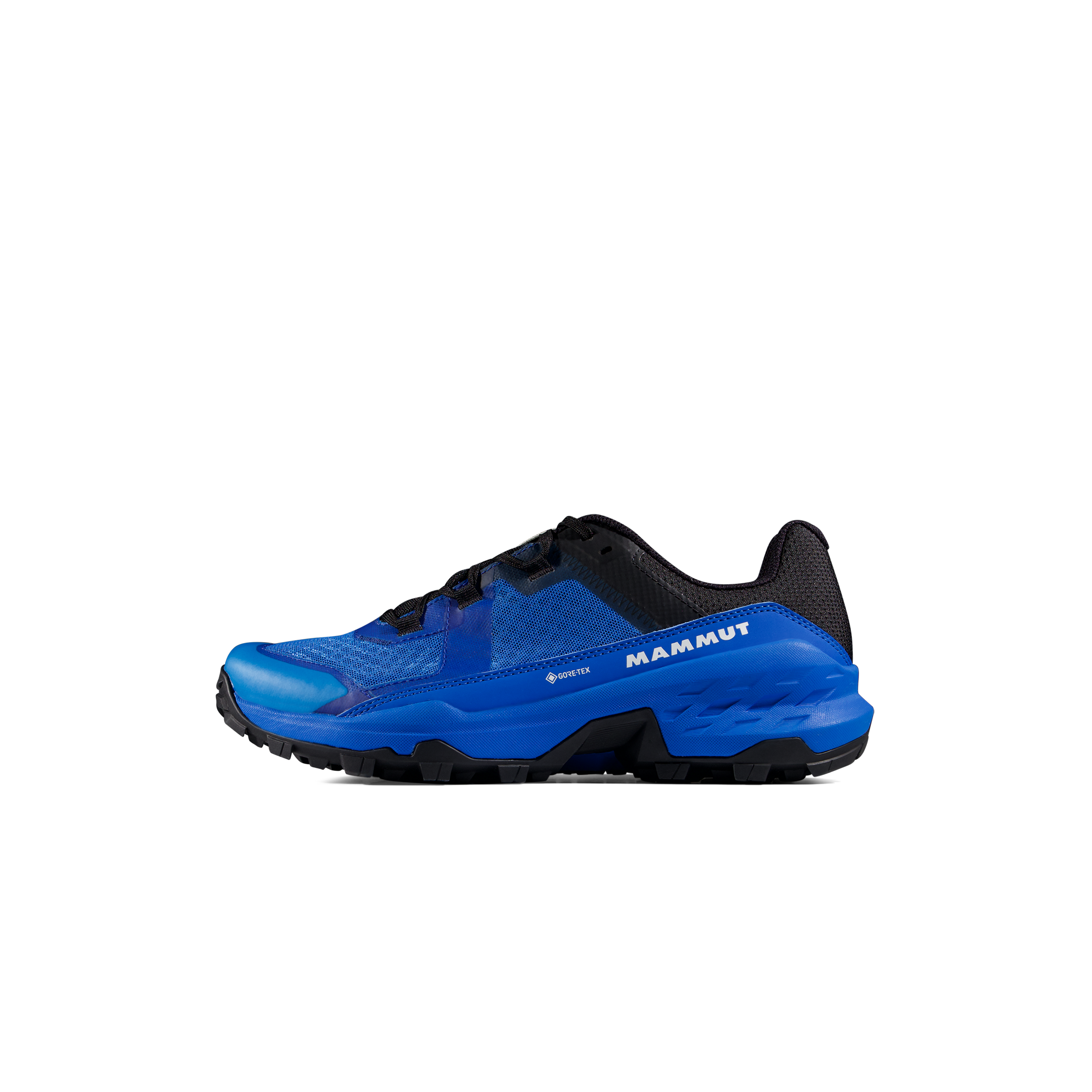
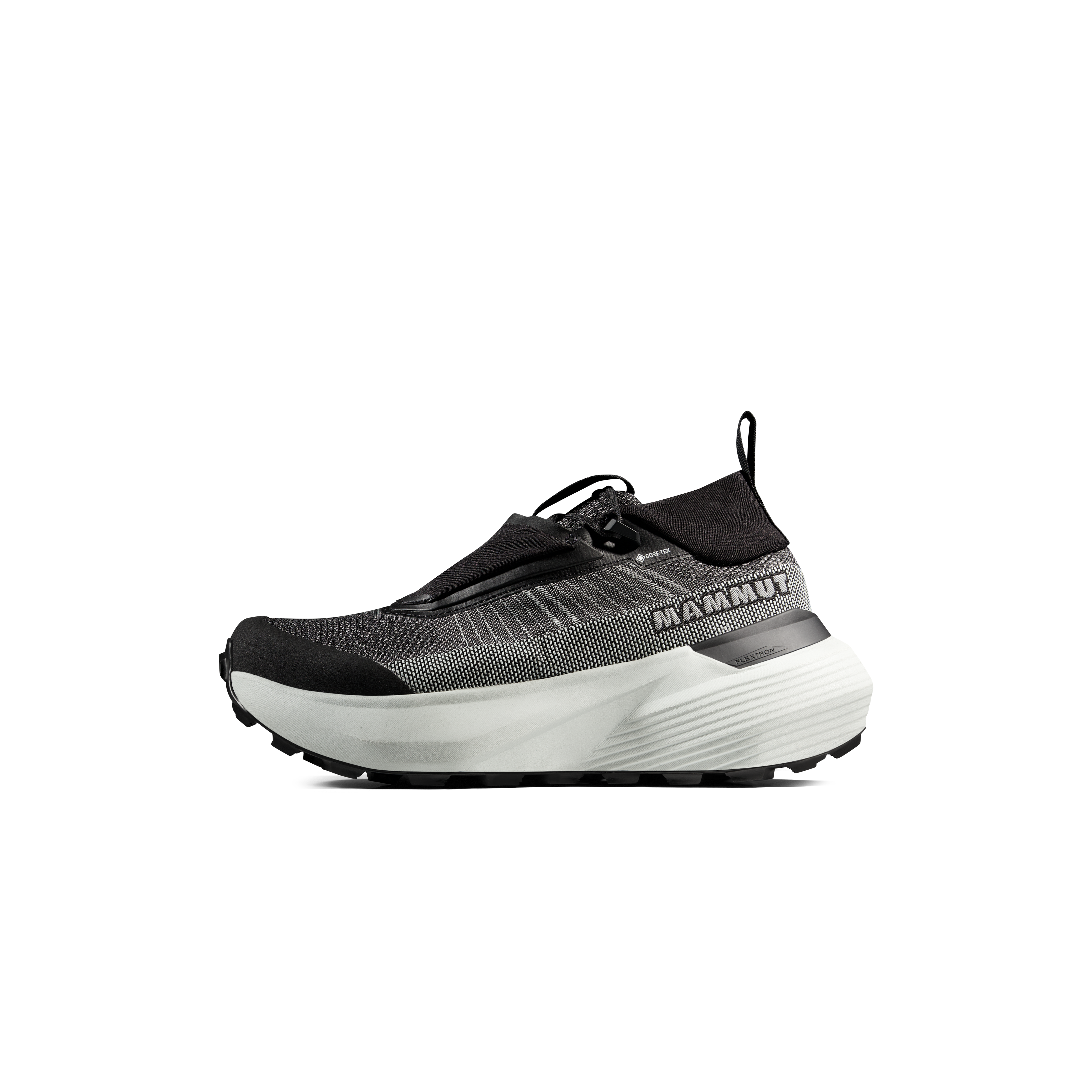
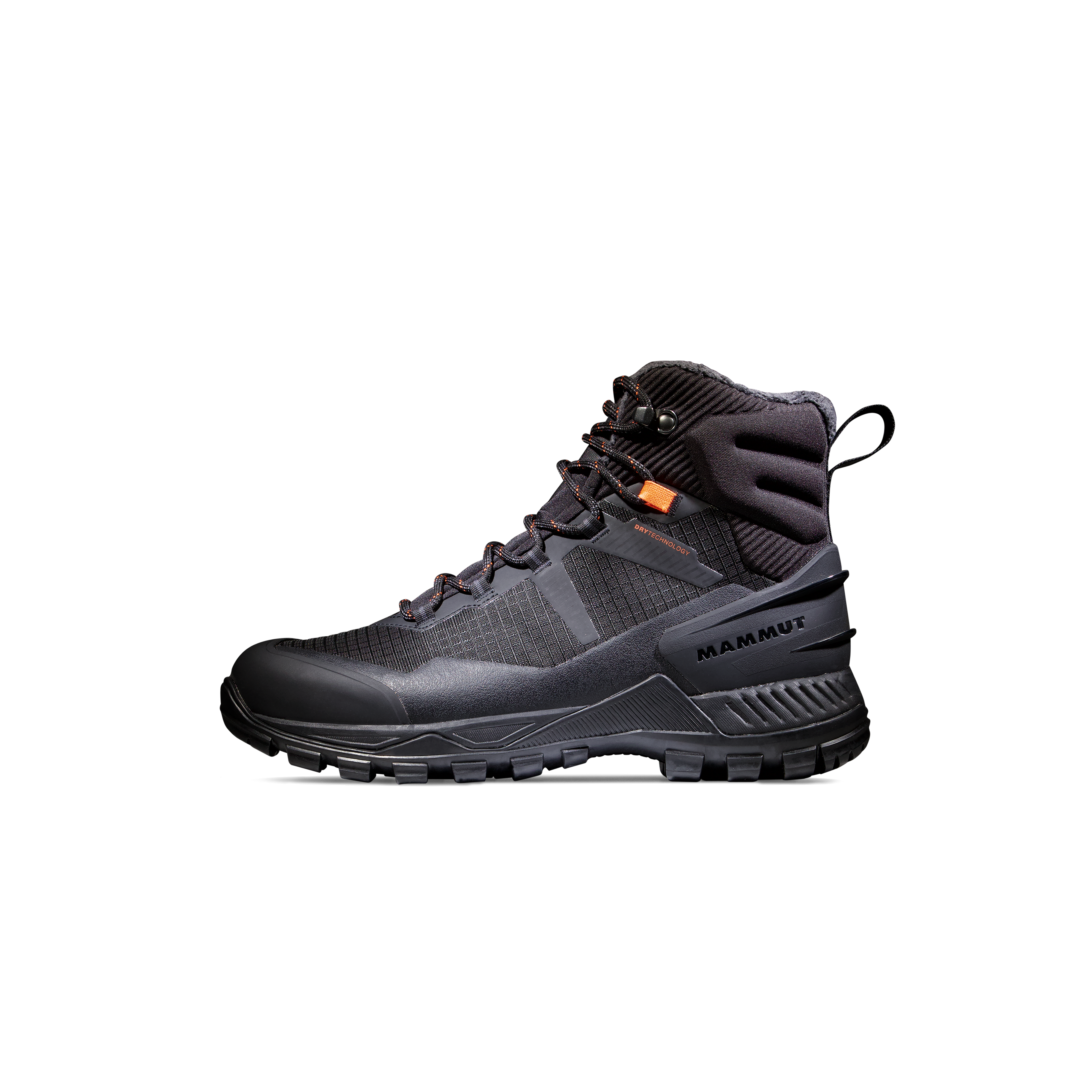
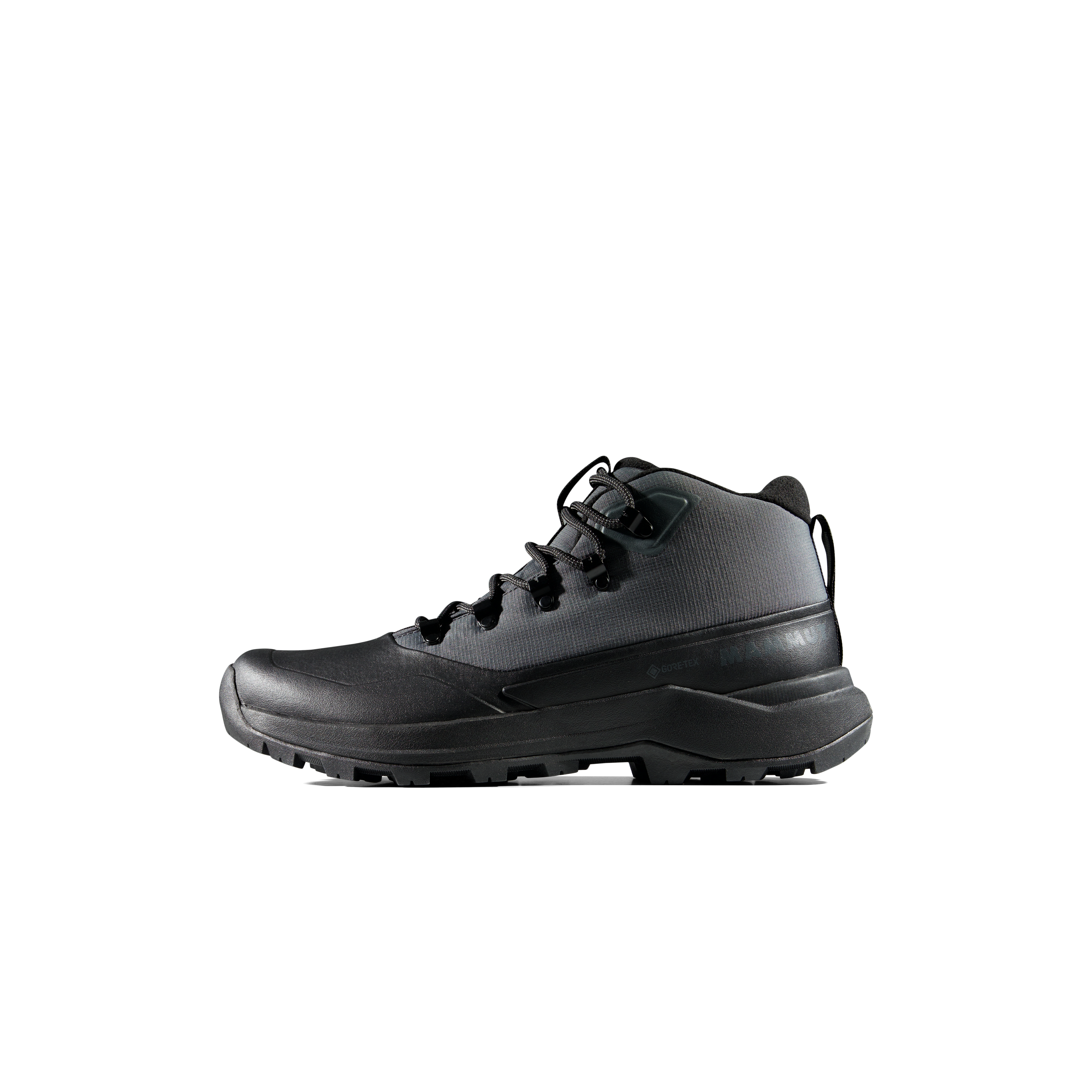
| Summit footwear | Broken-in grippy hiking or approach footwear appropriate to conditions | Assess how soles grip dry and wet granite; fit matters more than branding. |
| Weather protection | Rain shell, insulating layer, gloves, sun protection | Sunny camp weather can change quickly above 13,000 ft. |
| Navigation | Offline topo/GPS, power bank, compass/map backup, headlamp | The upper route is not continuous trail; learn the line before dawn. |
| Emergency | First aid, extra food/water capacity, emergency insulation, communication plan | Plan for slow descent, snow, injury and the missed-train scenario. |
| Rockfall / seasonal snow | Helmet often prudent; snow tools only with needed skills | Never assume microspikes make steep icy terrain safe. |
For a deeper gear decision, see our mountaineering gear guide and satellite communicators comparison. Pick equipment for the actual forecast and your experience; the standard summer route generally does not justify treating this as a glacier expedition.
Hiking Footwear for Long Colorado 14er Approaches
Windom Peak geology and naming history
Windom Peak is a high point of the Needle Mountains, whose old, resistant granite contrasts with much of the younger volcanic San Juan landscape. Huge granite blocks and steep glacially carved basins give Windom a distinct character from smoother trail-oriented fourteeners. The large fractured blocks near the summit are part of why route-finding and scrambling matter more than the short distance from the saddle suggests.
Why is it called Windom Peak?
The U.S. Geological Survey named the mountain while mapping the Needle Mountains in 1902. The peak is generally associated with William Windom (1827–1891), who served as a U.S. senator and Secretary of the Treasury. The location in modern La Plata County is also notable because the peak is a county high point and a ranked Colorado fourteener.
Elevation figures differ between historical maps and modern measurements. 14ers.com currently reports 14,089 ft based on LiDAR, while the National Geodetic Survey’s updated reference lists approximately 14,087 ft. Rather than combining vertical datums, this guide consistently uses the current 14ers.com summit figure for route context.

Windom Peak FAQ
How high is Windom Peak?
14ers.com currently lists Windom Peak at 14,089 feet using LiDAR. Older maps may say 14,082 ft, and the National Geodetic Survey uses a different vertical reference.
How difficult is Windom Peak?
The standard West Ridge is currently rated Easy Class 3 by 14ers.com (updated in 2026). Some older club listings call it Difficult Class 2. Expect exposed rock scrambling, route-finding and substantial wilderness commitment.
How far is Windom Peak from Needleton?
Approximately 18 miles round trip, including the backpack to Chicago Basin and a roughly 6-mile summit outing. Exact distances depend on your campsite and route.
Do you need a train to climb Windom Peak?
No, but the Durango & Silverton Narrow Gauge Railroad to Needleton is the common access. You can approach via Purgatory Creek on foot, adding substantial mileage and climbing.
Can you buy Needleton wilderness train tickets online?
The railroad’s published 2026 wilderness-access instructions say bookings must be made by phone. That differs from standard sightseeing tickets. Confirm the current season, cutoff dates and pickup policy directly.
Can you camp at Twin Lakes below Windom?
No. Camping in the Twin Lakes basin is prohibited to protect sensitive alpine terrain. Choose an appropriate site in Chicago Basin under current federal wilderness rules.
Are campfires allowed in Chicago Basin?
Wood campfires are prohibited in the Needle Creek drainage, including Chicago Basin. Check current Forest Service restrictions for your trip and use a suitable stove instead.
What is the best time to climb Windom Peak?
Often mid-July through September for a mostly dry summer route, but snowpack, storms and early fall snow vary significantly. Verify current conditions before booking travel.
Can you climb Windom and Sunlight in one day?
Experienced parties sometimes combine them from Chicago Basin, but Sunlight has a harder Class 4 standard route and the direct northwest descent from Windom is hazardous. Check both route descriptions and use a safe basin crossover.
Is Windom Peak suitable as a first Colorado 14er?
Generally not an ideal first fourteener. The remote backpack approach, route-finding and summit scrambling make it better after experience with strenuous high-altitude hikes and appropriate scrambling.
Do you need a permit for the Weminuche Wilderness?
Standard entry has traditionally not required an advance general wilderness permit, but commercial guiding and other activities have different rules and conditions can change. Verify San Juan National Forest requirements for your specific trip.
What happens if I miss the train at Needleton?
Needleton is a remote flag stop with no highway pickup. Know the railroad’s scheduled pickup rules, the correct signaling location, and an emergency backup plan before your trip.
Sources, research method and photo credits
- 14ers.com Windom West Ridge, route updated August 2026
- 14ers.com Windom summit data and group comparison
- Colorado Fourteeners Initiative — Windom access and stewardship
- Colorado Mountain Club — West Ridge and Chicago Basin trip data
- Durango & Silverton Railroad — official wilderness access and 2026 train restrictions
- USFS — Weminuche Wilderness regulations and area updates
- 14ers.com — latest Windom condition reports
- National Geodetic Survey — updated mountain elevations
Research policy: We consulted primary land-management and transport sources, established route references and recent reports. This article does not claim GSG staff climbed Windom. Its October 2026 update is not a real-time weather report. Route grades, snowpack, campsite conditions and transport service can change. Image captions identify the exact peak or nearby subject rather than passing off related mountains as Windom.
Photography and licensing
Photos shown are subject-specific Windom Peak and clearly identified Chicago Basin / Needle Mountains images from Wikimedia Commons. Each photograph has a credited author, license and file link in its own caption. Honor CC BY-SA attribution and share-alike terms if adapting or recompressing images. Verify the final image URLs inside WordPress before publication.
Was this helpful?
🏔Related peaks nearby
🧭Explore & compare
Global Summit Guide is an independent mountaineering resource founded in 2026. The team combines first-hand trekking and climbing experience with in-depth research and professional health and nutrition review to help climbers choose objectives, prepare properly, and stay safe.
Health, altitude, and nutrition content is reviewed by Taylor Ludlow (Registered Nurse) and Brigg Hoopes (Nutritionist).
What We Don't Know Yet
Mountain information changes quickly. This box explains the limits of what this page can responsibly promise.
- Route conditions, trailhead access, crevasse exposure, stream crossings, and rescue access may vary from published planning guidance.
- Visa, passport, vaccination, border, insurance, and local transportation rules may change before your trip.
- Route conditions, snowpack, closures, and weather can change quickly after this page is updated.
- Permit rules, fees, quotas, and reservation windows may change between review cycles.
- Operator availability, pricing, guide ratios, and cancellation terms can change by season.
Verify current conditions with official land managers, guide services, local forecasts, and current route reports before booking or climbing.
Mountaineering, rock and ice climbing, glacier travel, and high-altitude activity are inherently dangerous and can result in serious injury or death. The information on Global Summit Guide is provided for general informational and educational purposes only and is not a substitute for professional instruction, qualified guiding, proper equipment, or your own judgment and experience.
Route conditions, weather, snowpack, permits, regulations, and hazards change constantly and may differ from what is described here. Details may be incomplete, out of date, or contain errors. Always verify current information with local authorities, certified guides, and official sources before making any decision in the mountains.
Nothing on this site is medical, legal, or financial advice. Our fitness, acclimatization, altitude, and nutrition content is general in nature; consult a qualified physician before beginning any strenuous exercise program or exposing yourself to high altitude.
You are solely responsible for your own safety and decisions. To the fullest extent permitted by law, Global Summit Guide and its team accept no liability for any loss, injury, damage, or expense arising from use of, or reliance on, this information. By using this site you acknowledge these risks and accept these terms.
Some links on this site may be affiliate links. If you buy through them we may earn a small commission at no extra cost to you; this never affects our recommendations.
Global Summit Guide recommendation path
Next Best Mountain to Research
Use these recommendations to continue the right planning path instead of stopping on one page.
Use current permit, weather, route, and operator information before booking or climbing.