Last updated November 2, 2026
Mount Mitchell: summit, hikes & current access.
Reach the highest point east of the Mississippi River—whether you want a short walk from summit parking or a demanding 3,700-foot climb through the spruce-fir forest.
Compare the paved observation-deck walk, Mount Craig, Balsam Nature Loop, and the full Mount Mitchell Trail. Then check the Blue Ridge Parkway closures that can change the entire approach.
Independently researched · Updated November 2026 · Official trail and road statuses can change daily.
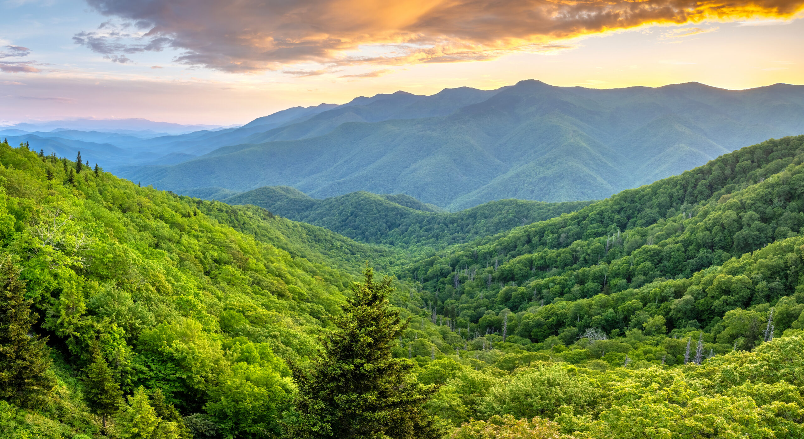
How do you get to Mount Mitchell?
To visit the summit with little hiking, drive to the Mount Mitchell State Park summit parking area and follow the paved, uphill path for roughly a quarter mile to the observation deck. The walk is short, but it is not flat. People using mobility aids should review the park’s current accessibility provisions.
To hike the whole mountain, start at Black Mountain Campground (subject to Forest Service access and trail status), take the Mount Mitchell Trail, and expect approximately 5.6 miles of continuous climbing each way with about 3,600–3,700 feet of elevation gain.
Either option can be disrupted by Blue Ridge Parkway weather closures. The park currently directs road visitors to approach from the Asheville side; the route north of Mount Mitchell is closed for Hurricane Helene repairs.

Which Mount Mitchell hike is right for you?
Choose according to effort, experience, and the actual open trailhead. All distance figures are approximate; some trail guides use different starting points or measure connecting paths differently.
| Route | Distance | Difficulty | Best for | Important detail |
|---|---|---|---|---|
| Summit observation deck | ~0.25 mi uphill each way | Short, steep paved walk | Views, families, highpoint visitors | Must drive to summit parking; seasonal ice |
| Balsam Nature Loop | 0.7 mi loop | Moderate | Forest ecology, short hike | Roots and wet footing; check trail signs |
| Mount Craig / Deep Gap segment | ~2 mi round trip to Mount Craig | Moderate–strenuous | Ridgeline hiking | Rocky uneven footing; weather exposure |
| Old Mitchell Trail | 2 mi one way on official listing | Moderate in listing; hilly | Longer state-park walk | Partially closed in current park alert; verify |
| Mount Mitchell Trail | 5.6 mi one way (~11.2 mi RT) | Strenuous | Fit summit hikers | ~3,600–3,700 ft gain; Pisgah access check |
| Black Mountain Crest Trail | 11.3 mi one way | Very strenuous | Experienced ridge hikers | Shuttle/exit plan required for full traverse |
Drive + summit deck
Choose this if you want the highest peak and a broad view without a full-day climb. Arrive early enough to park, walk safely, and leave before park gates close.
Mount Craig
Walk the ridge toward North Carolina’s second-highest summit. You gain mountain terrain and views without climbing 3,700 feet from the valley.
Mount Mitchell Trail
Earn the summit from the South Toe River side, with substantial uphill mileage, changing forest zones, and a demanding descent.
Blue Ridge Parkway closures and parking in 2026–27
Approach from Asheville—not Little Switzerland
The National Park Service currently lists MP 344.2–355.3, from NC 80 to Mount Mitchell State Park, as closed due to Helene damage. It prohibits recreation in the closed road section. The park directs traffic up the Parkway from the Asheville side toward NC 128 and the state-park entrance near MP 355.3.
Do not route to the park from the northern Parkway and assume a navigation app’s ETA proves the road is open. Weather may also close the otherwise open southern approach, especially from late fall through early spring.
Parking, entry, and facilities
Mount Mitchell State Park currently charges no day-use admission fee. The summit parking area and paved trail are distinct from the Black Mountain Campground trailhead far below. The park has no visitor shuttle between the two.
As published in early November 2026, the restaurant is closed for the year; concession service may be available on the posted schedule. Do not depend on summit food or drinking water for a long hike.
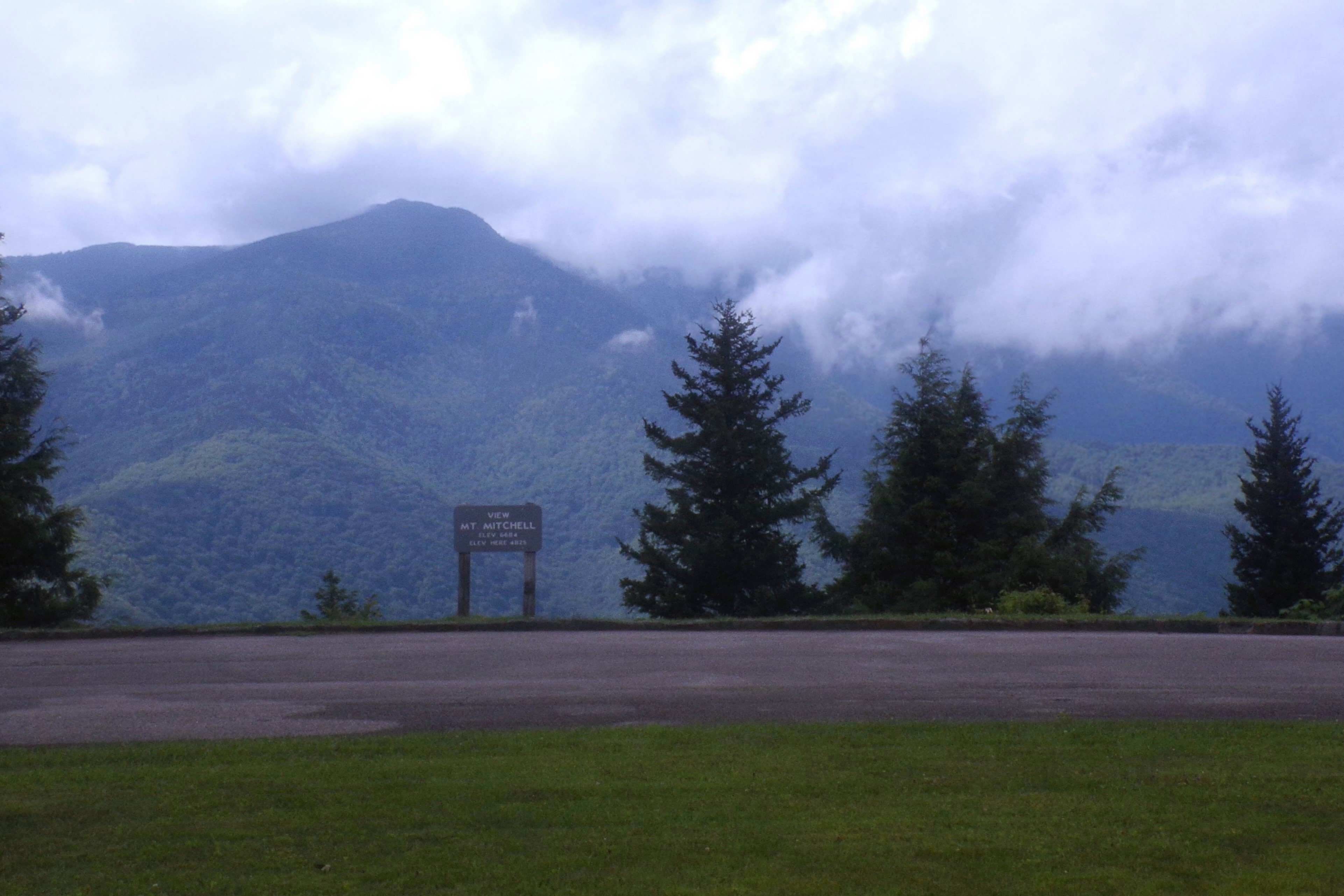
The paved observation-deck trail

The summit walk rises from the parking area on pavement to a stone overlook with panoramic views in clear weather. The walk is roughly 0.25 mile each way, but the grade matters more than the mileage for anyone with mobility or heart/lung limitations.
Plan 20–45 minutes for a typical visit including photography, slower movement, or cloud breaks. This is a planning estimate, not an official walking-time guarantee.
In wet or freezing weather, treat the path as a high-elevation surface: ice, wind, fog and sudden temperature drops can make a short trip hazardous. The summit is no place to assume Asheville weather applies.
For accessible parking and assistance, consult the park’s current services rather than assuming every part of the paved trail is uniformly accessible for every mobility device.
Mount Mitchell Trail: Black Mountain Campground to summit
The mountain’s signature strenuous hike begins beside Black Mountain Campground in Pisgah National Forest, then climbs toward the 6,684-foot summit. Strong hikers should plan a full day, not a casual two-hour summit stroll.
- Start at the Black Mountain Campground areaCheck current Pisgah trail access, campground-area parking, and roads before setting out. Do not assume that a state-park summit opening guarantees the lower Forest Service trail is open.
- Climb the lower forestCross steep wooded slopes, shaded streams and switchbacking trail. This section may feel humid while the summit remains cold.
- Enter the upper mountainThe grade, rocky footing and growing fatigue increase. Stay on marked trail and check for trail damage or detours following storms.
- Reach Commissary Ridge and summit approachThe higher forest shifts toward spruce and Fraser fir. Navigation may be harder in cloud, fog, or snow.
- Summit, then descendVisit the observation deck only if daylight and conditions allow. The descent retraces the same long trail unless you have independently arranged transport—and state parks explicitly do not provide a shuttle.

Trail facts: NC State Parks trail list; compare the specialist route account from HikingGuy for practical trailhead context. These sources may use slightly different mileage totals.
Mount Craig and the Black Mountain Crest Trail
Mount Craig: the best shorter ridge hike
From the Mount Mitchell summit area, the Deep Gap / Black Mountain Crest route heads north over rocky forested terrain toward Mount Craig (about 6,647 feet). The state park’s official map gives 1 mile one way to Craig; allow approximately two miles for the out-and-back, plus any connectors.
The ridge is not a paved continuation of the observation deck. Expect roots, rock, mud and more exposure to wind. Turn around early if clouds settle onto the crest.
Full Black Mountain Crest traverse
The state park lists 11.3 miles one way for its Black Mountain Crest Trail. This is a strenuous, remote route with substantial gain and loss, limited water and a separate exit plan. It is not a casual extension for families visiting the summit deck.
Weather permitting, the Deep Gap segment offers a longer goal, but the trail’s full distance and hiking direction depend on where you begin and end.
Check current Park and Pisgah National Forest conditions before linking multiple trail segments into a traverse.

Balsam Nature Loop, Old Mitchell and family walks
Balsam Nature Loop
Explore the high-elevation spruce–fir ecosystem with a moderate short loop. This has uneven trail surfaces; choose the paved summit path instead for a more accessible route.
Old Mitchell Trail
The park lists a moderate historic route, but its latest alerts identify a partial closure. Do not plan the complete route without confirming exactly which section is open.
Commissary Trail
An easier rated connecting trail, but trailhead selection and the return matter. It is not a substitute for the very short observation-deck walk.
At the summit, plaques and views explain the changing Black Mountains forest. For children, a short summit outing combined with a nature loop often makes a better experience than attempting the full Mount Mitchell Trail. Keep pets leashed to no more than six feet and out of park buildings.
An easy drive can become a serious weather problem.
Wind and cold
At 6,684 feet, Mount Mitchell may be much colder and windier than Asheville or Burnsville. Bring insulating layers for every season.
Road ice and snow
Winter closures can begin unexpectedly. Turn around rather than crossing a gate, driving a closure or walking an icy exposed road.
Thunderstorms and fog
Summer afternoon storms can reach the ridge quickly. Leave open viewpoints in thunder and do not navigate by road signs alone in thick fog.
For every trip: check the park conditions page and Blue Ridge Parkway road closures. For longer hikes, consult weather forecasts at summit elevation, carry a paper/offline map, and pack enough clothing for sudden deterioration.
Best time to visit Mount Mitchell
| Season | What to expect | Best approach |
|---|---|---|
| Spring (March–May) | Variable freeze/thaw, lingering ice at altitude, rapid changes | Check same-day road and summit weather; bring layers |
| Summer (June–August) | Green spruce-fir forests, cooler summit air, storms and clouds | Early starts for long hikes; avoid thunderstorm exposure |
| Fall (September–October) | Lower mountain foliage, cool high ridge, shorter daylight | Popular window; plan morning parking and early return |
| Winter (November–February) | Frequent icy Parkway closure, deep cold, snow and wind | Do not assume vehicle access; verify the park and NPS |
For a one-day summit visit, clear summer and early-autumn days usually make logistics easier than midwinter. For the 11-mile hiking route, choose dry conditions, sufficient daylight and a group fit enough to finish well before dark.
Mount Mitchell camping, lodging and costs

State-park camping: 2026 closure matters
Mount Mitchell State Park has nine walk-in tent sites, but the park’s reservation operator reports the campground closed for all of 2025 and 2026 due to water-line work. It currently displays a closure extending through April 30, 2027. Do not treat an amenities list as proof of available reservations.
Backcountry camping in nearby Pisgah National Forest is governed by Forest Service rules, not state-park campsite rules. The state park permits some overnight parking for backpackers with required vehicle registration, subject to gates and official instructions.
Where to stay instead
For a short summit visit, consider accommodation around Asheville, Burnsville or nearby towns. Pick a base based on your actual approach from Asheville during the northern Parkway closure. Long-distance hikers should select camping and shuttle plans around the correct trailhead.
Affiliate disclosure: GSG may earn a commission if you book through the tracked accommodation link below, at no additional cost to you.
Choose your Mount Mitchell day
Short summit visit
Drive from Asheville when open, park at the summit, walk to the observation deck, take photos and leave before the gate closure. Add a short nature loop if footing allows.
Summit + Mount Craig
Reach the summit deck and continue toward Mount Craig if the ridge trail is open and conditions are dry. Retrace your steps; do not let an ambitious outing cross the closing time.
Black Mountain Campground hike
Verify lower-trail status, start early with gear and food, summit if the weather permits, and descend the long 5.6-mile trail before dark.
Example timetable for the long day hike
| Planning point | Illustrative time | Decision |
|---|---|---|
| Trailhead check | 6:00 a.m. | Confirm trail open, weather stable, vehicle exit plan and daylight |
| Begin ascent | 6:30 a.m. | Carry water, snacks, headlamp and weather layers |
| Mid-climb assessment | 9:30–10:30 a.m. | Turn around if pace/weather does not support a safe descent |
| Potential summit window | Late morning–early afternoon | Summit timing is highly variable; do not force the schedule |
| Return to car | Mid–late afternoon | Allow ample time for the downhill trail |
These are planning examples, not guaranteed hiking times or real-time trail conditions.
Gear checklist and turnaround rules
For the summit walk
Warm/windproof layer, traction appropriate to conditions, water, phone, sun protection, and awareness of the park gate time.
For Mount Craig
Sturdy footwear, extra layer, map, headlamp, water, snacks and ability to retrace a wet rocky ridge.
For Mount Mitchell Trail
Hiking shoes, substantial water, food, rain shell, insulation, offline map, first aid, backup light and a defined turnaround time.
For footwear considerations, see GSG’s hiking boots guide. Trail advice here is independent of any gear advertising and should be adjusted to current conditions.
Why Mount Mitchell matters
Elisha Mitchell and the eastern highpoint
Mount Mitchell rises to 6,684 feet in the Black Mountains, the tallest summit east of the Mississippi River. It was named for university professor Elisha Mitchell, who worked to establish its elevation and died in 1857 during an expedition associated with his measurements. His grave is at the summit.
The mountain became North Carolina’s first state park in 1915 and remains a highpoint destination for visitors who may never otherwise experience Appalachian subalpine terrain.
A fragile spruce–fir island
These elevations support Southern Appalachian red spruce and Fraser fir communities, which have faced major damage from introduced pests and other stresses. Stay on established trail and avoid trampling thin soil and plants around overlooks.

Mount Mitchell location and trail maps
Map pin: Mount Mitchell summit. This orientation map is not a substitute for a trail-navigation map, current access notice or an offline GPX route.
Mount Mitchell hiking FAQ
These answers use published park and National Park Service guidance. Verify time-sensitive closures, services and campsite availability immediately before travel.
How tall is Mount Mitchell?
Mount Mitchell is 6,684 feet (2,037 meters) above sea level, the highest mountain east of the Mississippi River.
Can you drive to the top of Mount Mitchell?
When the Blue Ridge Parkway and state-park road are open, you can drive to summit parking, then walk roughly a quarter mile uphill on a paved path to the observation deck.
How long is the Mount Mitchell summit walk?
The observation deck walk is about 0.25 mile each way from summit parking. It is paved but steep, and ice or wind can make it harder.
How long does the Mount Mitchell Trail take?
Experienced hikers may finish in 5–7 hours of moving time; a safer full-day budget for many parties is 7–10 or more hours including breaks, conditions and descent.
What is the elevation gain on Mount Mitchell Trail?
Published hiking guides commonly report about 3,600–3,700 feet of ascent from the lower Black Mountain Campground area.
Is Mount Mitchell open after Hurricane Helene?
The state park reopened in 2025, but North Parkway road sections remain closed for repairs and short-notice weather closures may affect access. Check official pages on the day of travel.
Can you get to Mount Mitchell from Little Switzerland?
Not by the northern Blue Ridge Parkway approach while the currently published MP 344.2–355.3 section remains closed. Use the Asheville-side approach when open.
Is there an entrance fee?
The state park currently has no day-use entrance fee. Camping or facility bookings can carry separate fees.
Is Mount Mitchell harder than Mount Craig?
The paved Mount Mitchell summit walk is much easier than the rocky Mount Craig ridge route. The long Mount Mitchell Trail from Black Mountain Campground is harder than both.
How far is Mount Craig from Mount Mitchell?
The official park trail map lists approximately one mile one way along the ridge, or about two miles out and back, excluding parking connectors.
Is the Old Mitchell Trail open?
The park has flagged the Old Mitchell Trail as partially closed. Check which exact section is open before relying on it.
Is Mount Mitchell camping open in 2026?
The reservation operator says the state-park campground is closed through 2026 due to water-line work. Verify the status and possible 2027 opening before booking.
Can you camp in Pisgah National Forest?
Backpacking options exist on surrounding federal land where permitted. Forest Service regulations differ from state-park rules; check site-specific camping and fire requirements.
Can dogs hike Mount Mitchell?
Pets are allowed in the park but must remain on an attended leash no longer than six feet and are not permitted inside buildings.
What is the best time to visit?
Summer and early autumn often offer easier road access, but clouds, storms and rapid temperature changes occur year-round. Check the forecast and Parkway status.
Does it snow on Mount Mitchell?
Yes. Snow and ice can occur in the colder months, and winter road closures can prevent access entirely.
Is the summit trail wheelchair accessible?
The state describes accessible features, including a paved route and designated parking, but it is steep. Travelers with specific mobility needs should review park guidance and assistance availability.
Are there restrooms at the summit?
Park facilities may include summit-area restrooms, but individual facilities can close due to weather, maintenance or season. Confirm before traveling.
Do you need a permit to day hike Mount Mitchell?
No standard day-use permit is required for ordinary state-park hiking under the published general rules. Special events, camping and some activities can involve permits or reservations.
Is the Mount Mitchell Trail the same as Black Mountain Crest Trail?
No. Mount Mitchell Trail climbs about 5.6 miles one way from the lower campground area; Black Mountain Crest Trail is a longer ridge traverse.
What are the closest places to stay?
Asheville, Burnsville and surrounding towns offer lodging. Choose based on the currently open Asheville-side approach and your planned trailhead.
Is the restaurant open at Mount Mitchell?
The state park said the restaurant was closed for the year in its early-November 2026 access notice; concession operating hours can change. Carry your own provisions.
Official sources and route references
North Carolina State Parks
National Park Service
Route detail and booking
Guidance reviewed November 2026. Conditions, road statuses and park facilities can change without notice. This is a researched planning guide, not a claimed firsthand ascent.
Explore the parent and related mountain guides
Best Mountains in North Carolina
Compare Mount Mitchell with other North Carolina mountain objectives and choose your next climb.
Explore North Carolina mountains →50 U.S. State Highpoints
See how Mount Mitchell compares with every other state highpoint by elevation and hiking commitment.
Explore all 50 highpoints →500 Mountains Master List
Find Mount Mitchell (#235) within the GSG mountain database and discover peaks worldwide.
Explore 500 mountains →Also useful: State highpoints ranked by difficulty · Mountain ranges in the USA · Mountain guide hub.
Choose the right route. Respect the conditions.
Whether your Mount Mitchell day is twenty minutes or ten hours, the best plan starts with the actual open trail and road.
Was this helpful?
🏔Related peaks nearby
🧭Explore & compare
Global Summit Guide is an independent mountaineering resource founded in 2026. The team combines first-hand trekking and climbing experience with in-depth research and professional health and nutrition review to help climbers choose objectives, prepare properly, and stay safe.
Health, altitude, and nutrition content is reviewed by Taylor Ludlow (Registered Nurse) and Brigg Hoopes (Nutritionist).
What We Don't Know Yet
Mountain information changes quickly. This box explains the limits of what this page can responsibly promise.
- Route conditions, trailhead access, crevasse exposure, stream crossings, and rescue access may vary from published planning guidance.
- Visa, passport, vaccination, border, insurance, and local transportation rules may change before your trip.
- Route conditions, snowpack, closures, and weather can change quickly after this page is updated.
- Permit rules, fees, quotas, and reservation windows may change between review cycles.
- Operator availability, pricing, guide ratios, and cancellation terms can change by season.
Verify current conditions with official land managers, guide services, local forecasts, and current route reports before booking or climbing.
Mountaineering, rock and ice climbing, glacier travel, and high-altitude activity are inherently dangerous and can result in serious injury or death. The information on Global Summit Guide is provided for general informational and educational purposes only and is not a substitute for professional instruction, qualified guiding, proper equipment, or your own judgment and experience.
Route conditions, weather, snowpack, permits, regulations, and hazards change constantly and may differ from what is described here. Details may be incomplete, out of date, or contain errors. Always verify current information with local authorities, certified guides, and official sources before making any decision in the mountains.
Nothing on this site is medical, legal, or financial advice. Our fitness, acclimatization, altitude, and nutrition content is general in nature; consult a qualified physician before beginning any strenuous exercise program or exposing yourself to high altitude.
You are solely responsible for your own safety and decisions. To the fullest extent permitted by law, Global Summit Guide and its team accept no liability for any loss, injury, damage, or expense arising from use of, or reliance on, this information. By using this site you acknowledge these risks and accept these terms.
Some links on this site may be affiliate links. If you buy through them we may earn a small commission at no extra cost to you; this never affects our recommendations.
Global Summit Guide recommendation path
Next Best Mountain to Research
Use these recommendations to continue the right planning path instead of stopping on one page.
Use current permit, weather, route, and operator information before booking or climbing.