
Last updated September 28, 2026

Cerro El Plomo Climbing Guide: Route, Season, Access & Summit Planning
Rising above Santiago’s eastern skyline, Cerro El Plomo combines a comparatively straightforward normal route with serious 5,000-meter altitude, a long multi-day approach, rapidly changing glacier terrain and one of the most important Inca high-mountain sanctuaries in Chile.
Is Cerro El Plomo Difficult to Climb?
The normal route is technically modest by high-mountain standards, but Cerro El Plomo should not be treated as an easy hike. The summit reaches 5,424 meters, the approach is long, the summit day is demanding, water can be unreliable at high camp, and snow, ice, wind and glacier conditions change through the season.
Andeshandbook describes the normal route as a clear, generally straightforward route with glacier terrain and about 2,400 vertical meters between Piedra Numerada and the summit. Most climbers should plan the mountain as a high-altitude expedition rather than a simple Santiago day hike.
Santiago’s High-Altitude Mountain.
Cerro El Plomo is one of the defining high peaks of Chile’s Metropolitan Region. Its proximity to Santiago makes the logistics unusually accessible for a 5,000-meter mountain, but that convenience should not be confused with low consequence.
High Andes Objective
A large Central Andes mountain with high-altitude trekking, snow and glacier terrain rather than sustained technical climbing on the normal route.
Fit Climbers Building Altitude Experience
Strong hikers and developing mountaineers can use El Plomo as a serious introduction to multi-day climbing above 5,000 meters, provided they arrive acclimatized and equipped for current conditions.
More Than a Summit
The mountain is culturally significant, visually prominent above Santiago and closely tied to Inca sacred geography and the high-altitude sanctuary near its summit.
Cerro El Plomo is the 5,424-meter mountain immediately associated with Santiago. Nevado El Plomo is a different and higher mountain farther northeast near the Chile–Argentina frontier.

Close to Santiago Does Not Mean Low Altitude.
Few major world capitals sit this close to a mountain exceeding 5,400 meters. That proximity simplifies the gateway logistics but also makes it easy to underestimate how abruptly the climb enters genuine high-altitude terrain.
Photo: David Pozo · Wikimedia Commons · CC BY-SA 3.0The Standard Climb Is a Long High-Altitude Journey.
The southwest-side normal route is the usual summit line. The main climbing burden comes from distance, cumulative elevation gain, altitude and current snow or ice conditions rather than sustained technical pitches.

From the Ski Areas Into a Full Mountain Expedition.
The most common approaches come from Valle Nevado or La Parva. Climbers move through the upper valleys toward Piedra Numerada, continue to Federación or La Hoya for high camp, then climb the upper mountain toward the Inca sanctuary area and summit.
Andeshandbook’s current normal-route record describes approximately 2,400 meters of vertical gain from Piedra Numerada to the summit and categorizes the route as straightforward walking with glacier terrain.
That classification describes technical difficulty. It does not reduce the physiological consequence of moving above 5,000 meters.
Route photo: Tijs Michels · Wikimedia Commons · CC BY-SA 3.0
There Is No Single Cerro El Plomo Trailhead.
The west side can be approached from several ski-area corridors. Access rules depend on the route chosen, the ski operation and seasonal road or mountain restrictions.
Valle Nevado
The traditional approach follows Valle Nevado toward Tres Puntas and then onward toward Piedra Numerada.
Valle Nevado currently requires visitors undertaking summer trekking or mountaineering to complete its mountaineer registration.
La Parva
La Parva provides another common gateway, with access toward Piuquenes or the upper ski terrain depending on current road, lift-area and mountain conditions.
Cancha de Carreras
Another approach reaches the Federación area through Cancha de Carreras. Exact access and route conditions should be verified locally before departure.
Valle Nevado’s current summer access page specifically references Cerro El Plomo and requires mountaineer registration. It also states that motorized recreational access into the mountain is prohibited because the terrain lies within the protected Yerba Loca sanctuary. The normal assumption should therefore be foot access after the authorized parking / resort area.
Free mountain access does not mean unregulated access.
Andeshandbook’s September 2026 mountain record describes Cerro El Plomo as having free access. At the same time, individual approach corridors impose registration and operational rules. Global Summit Guide did not identify a universal standalone summit-permit fee for the normal route during this review.
Three Days Is Common. Four Days Gives More Margin.
A compact itinerary can work for acclimatized climbers, but the mountain becomes much more reasonable when the schedule allows slower elevation gain and a separate summit-and-descent day.
| Day | Typical Movement | Purpose | Main Planning Issue |
|---|---|---|---|
| Day 1 | Santiago → ski-area access → Piedra Numerada | Approach and first mountain night | Registration, start time, water and pack weight |
| Day 2 | Piedra Numerada → Federación / La Hoya | Move into high camp | Acclimatization and water availability |
| Day 3 | High camp → summit → descent | Summit day | Very long day if returning all the way toward Santiago |
| Optional Day 4 | High camp / Piedra Numerada → Santiago | Split the descent | Better recovery and acclimatization margin |
The fourth day can reduce pressure to combine summit day with a complete exit and can create a more conservative acclimatization profile for climbers who have not already spent several nights high.
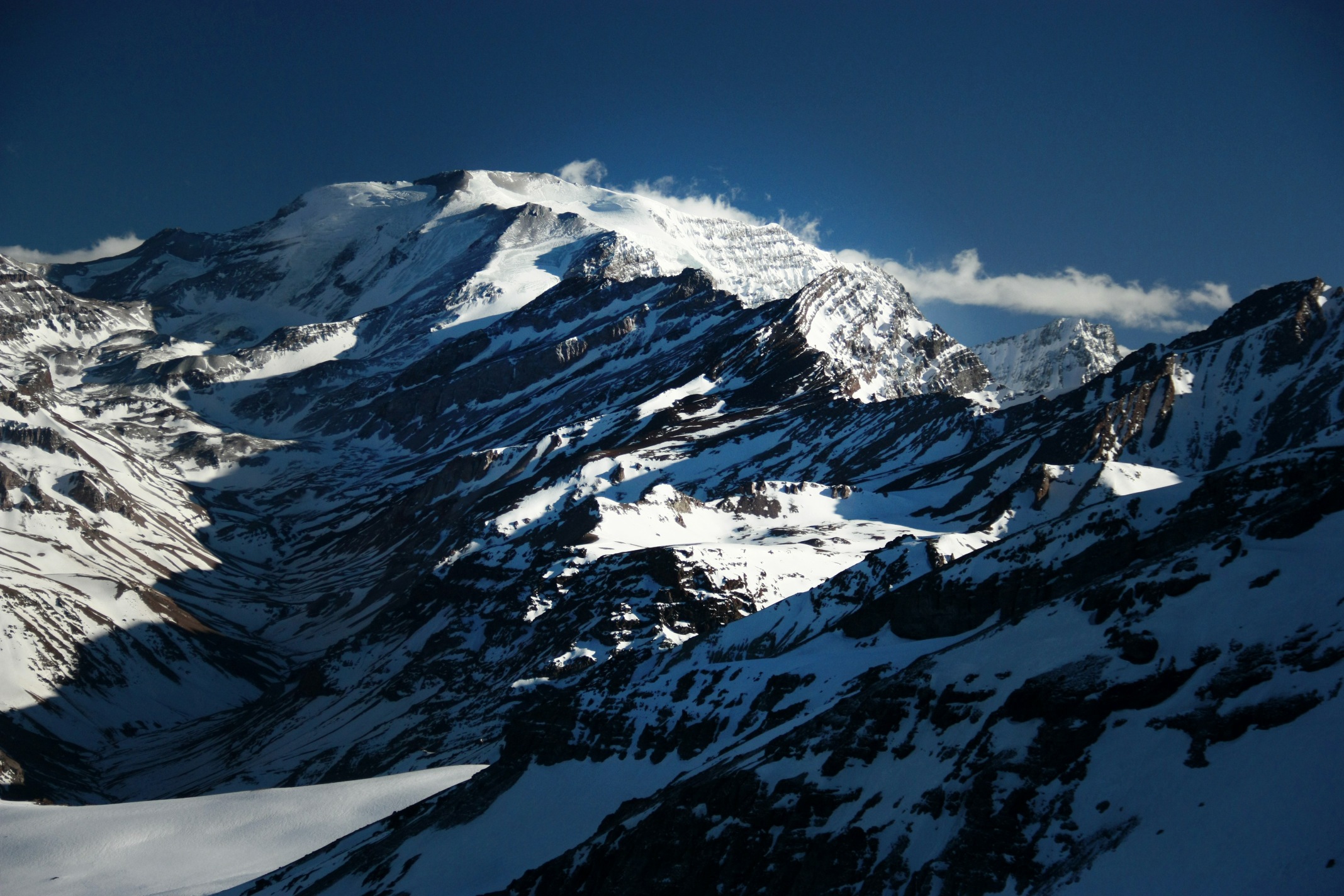
November to March Is the Broad Window.
Andeshandbook describes November through March as the standard season and identifies January through March as the traditional sweet spot, when the approach generally carries less snow and the weather is often more stable.
Early-season snow can make the approach considerably more demanding. Late-season warmth can simplify snow travel while increasing melt-related instability and changing glacier conditions.
Cerro El Plomo route gallery · Andeshandbook. Check current route reports before relying on any historical image.The Normal Route Is Technically Modest. The Summit Is Not.
At 5,424 meters, Cerro El Plomo belongs firmly in high-altitude mountaineering. Fitness helps you move, but it does not prevent altitude illness.
Long Uphill Days
Train for repeated hours of uphill movement with a pack and enough reserve to descend safely after the summit.
Arrive With Evidence
Prior nights above 3,000–4,000 meters and previous experience near 5,000 meters provide much better planning information than sea-level fitness alone.
Turn Around Early
A nontechnical route can encourage climbers to push too far because the terrain still appears walkable. Symptoms, wind, timing and deteriorating surface conditions must override summit ambition.
Use the Global Summit Guide altitude acclimatization guide to design sleeping elevations and identify where the Cerro El Plomo itinerary may be too aggressive for your prior altitude exposure.
The Glacier Is Changing Fast Enough That Old Descriptions Can Mislead.
Route equipment should be chosen from current mountain observations, not from an old guidebook sentence or a photograph taken a decade ago.
One recent normal-route ascent reported a completely melted glacier crossing.
An April 2026 Andeshandbook track report stated that crampons were not required on that specific ascent because the normal-route glacier passage was completely melted. The same report said there was no liquid water at Federación and the team had to melt snow.
That is a snapshot, not a permanent equipment recommendation. Snowfall, refreeze, seasonal timing and route changes can make the upper mountain very different on another date.
17% ± 6% Area Loss Since 2000
A 2025 peer-reviewed study estimated the combined area of Cerro El Plomo’s three largest debris-free glaciers had fallen by about 17% ± 6% between 2000 and 2025.
~29% ± 14% Area Loss
The same study estimated a larger loss for the Cerro El Plomo hanging glacier itself and documented increasingly negative mass balance during the recent Central Andes megadrought.
A Photograph Is Not a Current Route Report.
The visible glacier geometry on Cerro El Plomo has changed substantially. Treat historical images as landscape context and obtain current local information for the actual climbing line.
Photo: Tijs Michels · Wikimedia Commons · CC BY-SA 3.0Why a Straightforward Route Can Still Become Serious.
El Plomo’s normal route has limited technical complexity compared with steeper Andean climbs, but multiple moderate problems can combine into a consequential summit day.
Altitude
The summit exceeds 5,400 meters. Poor acclimatization can stop an otherwise strong climber well before the terrain becomes difficult.
Wind & Cold
Strong Central Andes wind can sharply increase cold stress and turn exposed upper slopes into a much harder descent.
Snow & Ice Variability
The same crossing may be dry, icy, snow-covered or melt-affected depending on timing and recent weather.
Moraine Instability
Glacier retreat, thawing ground and meltwater can alter old paths and increase rock, moraine and sinkhole hazards.
Water
Do not assume running water at Federación. Carry enough capacity and know whether current conditions require melting snow.
Long Descent
Reaching the summit is only the midpoint of summit day. Fatigue, dehydration and altitude remain during the entire descent.
Pack for the Conditions You Expect—and the Conditions You Could Get.
Cerro El Plomo is a good example of why a static gear list can become obsolete. Upper-mountain snow and ice equipment should be chosen only after checking current conditions.
| System | Typical Need | Planning Note |
|---|---|---|
| Mountaineering footwear | Warm, supportive mountain boots | Match footwear to snow, cold and current upper-route conditions. |
| Crampons | Condition dependent | Do not assume April 2026’s crampon-free conditions will repeat. |
| Ice axe | Condition dependent | Useful when snow or firm upper slopes make self-arrest relevant. |
| Trekking poles | Highly useful | Long approach and descent make poles valuable. |
| Warm summit layers | Essential | Wind and pre-dawn temperatures can be severe at 5,000+ m. |
| Sun protection | Essential | High UV exposure, snow reflection and dry air. |
| Navigation | Map / GPS / offline backup | Do not rely solely on an old track if glacier retreat has changed the line. |
| Water capacity | High priority | High-camp water can be seasonal or absent. |
El Plomo Was Sacred Long Before Modern Mountaineering.
The summit ridge is not simply recreational terrain. Cerro El Plomo is one of the Andes’ important high-altitude archaeological and ceremonial landscapes.

The Mountain Was an Inca Apu and Capacocha Site.
Chile’s National Museum of Natural History describes Cerro El Plomo as the site of an Inca Capacocha ceremony more than five centuries ago. A child approximately eight years old was placed in a high-altitude burial structure near 5,400 meters.
The remains were discovered in 1954 and became one of Chile’s most important archaeological finds. The original body is conserved by the National Museum of Natural History and is not displayed to the public; the museum uses a replica in keeping with conservation and ethical considerations.
The National Monuments Council identifies the high-altitude sanctuary as a heritage site of international significance. Climbers should treat archaeological structures and artifacts as protected cultural material: observe them without touching, climbing on, moving or collecting anything.
Photo: Tijs Michels · Wikimedia Commons · CC BY-SA 3.0

The Summit Plateau Is a Landscape, Not Just a GPS Point.
Cerro El Plomo’s upper mountain includes a broad high-elevation environment, archaeological structures and changing snow and ice. Move carefully and give cultural sites the same respect you would give objective mountain hazards.
Photo: Camptocamp Association · Wikimedia Commons · CC BY-SA 3.0Price Depends More on Program Depth Than on the Mountain Name.
Cerro El Plomo is sold as everything from a compact local 3–4 day expedition to a longer international program that includes substantial acclimatization and logistical support.
| 2026–27 Published Example | Program Style | Published Price | What the Price Demonstrates |
|---|---|---|---|
| AllMountain Chile | Local 3-day full expedition | CLP $460,000–$1,200,000 per person, depending on group size | Group size strongly changes the local guided cost. |
| AllMountain Chile | 4-day programs | Multiple basic / full formats published | An extra acclimatization day does not necessarily imply an international-expedition budget. |
| Adventure Consultants | 10-day international program | US$4,100 at 1:2–1:3; US$6,600 at 1:1 | Longer, internationally packaged programs are not directly comparable to local summit-only logistics. |
Price snapshot reviewed September 2026. Recheck the operator’s current inclusions, dates, guide ratio, transport, food, porter or mule support, technical equipment and cancellation terms before booking.
A local 3-day program and a 10-day international expedition solve different problems. Ask what acclimatization is included, where the program begins, whether group equipment and food are covered and what happens if access or weather changes.
Cerro El Plomo · Central Andes, Chile
The summit lies northeast of Santiago in the high Andes above the Farellones–Valle Nevado–La Parva corridor.
A Useful 5,000-Meter Progression Peak—If You Respect the Altitude.
Cerro El Plomo can fit extremely well between high-altitude trekking and larger Central Andes expeditions, but only when the itinerary matches the climber’s altitude history.
Experienced High-Altitude Hiker
You already know how you move and recover above 4,000 meters and want a first or early 5,000-meter multi-day objective.
Fit Hiker New to Mountaineering
A qualified local guide and appropriate acclimatization can bridge some technical gaps, but not the physiological consequences of ascending too quickly.
Direct From Sea Level on a Tight Schedule
A short schedule that depends on rapid ascent from Santiago removes exactly the acclimatization margin this mountain needs.
Use El Plomo as Part of a Bigger Progression.
Compare the mountain with other Andes objectives by altitude burden, glacier exposure, technical requirement and expedition scale.
Recheck the Mountain You Are Actually Going to Climb.
El Plomo’s access, water, snow and glacier conditions can change enough that a months-old plan deserves one final verification pass.
Registration
Confirm whether your chosen Valle Nevado, La Parva or other approach requires registration or has parking / entry restrictions.
Snow, Ice & Water
Recheck whether crampons or an axe are needed and whether liquid water is available at the camps you plan to use.
Wind & Descent
Build the summit decision around the complete ascent and descent window, not merely the forecast at the top.
Cerro El Plomo Frequently Asked Questions
The most important planning questions concern altitude, access, timing and the rapidly changing snow-and-glacier environment.
How high is Cerro El Plomo?
Global Summit Guide uses 5,424 meters (17,795 feet), matching the current Andeshandbook record and the Chilean IGM elevation cited in its mountain description.
Is Cerro El Plomo technically difficult?
The normal route is comparatively straightforward and is commonly described as walking / easy snow-and-glacier terrain rather than sustained technical climbing. The mountain remains serious because of its 5,424-meter summit, long approach, weather and changing upper-mountain conditions.
How many days does Cerro El Plomo take?
Three days is a common compact itinerary. Four days provides more acclimatization and allows climbers to separate summit day from the complete exit to Santiago.
What is the best time to climb Cerro El Plomo?
The broad traditional season is November through March. January through March usually provides less snow on the approach and more stable summer conditions, although current weather and route conditions must still be checked.
Do I need crampons for Cerro El Plomo?
Not on every ascent. An April 2026 report described a completely melted glacier crossing and no crampon use, but that is not a permanent rule. Snowfall, refreeze and seasonal conditions can change the requirement. Check immediately before climbing.
Do I need a permit to climb Cerro El Plomo?
The current sources reviewed do not show a universal standalone summit-permit fee for the normal route, and Andeshandbook lists the mountain as free access. Individual approaches still impose rules. Valle Nevado currently requires mountaineer registration for summer mountain access.
Can Cerro El Plomo be climbed from Santiago?
Santiago is the normal gateway, but the climb should not be treated as a simple city day trip. Most summit plans require travel through Farellones toward Valle Nevado or La Parva and multiple days in the mountains.
Why is Cerro El Plomo culturally important?
The mountain was an important Inca sacred peak and high-altitude sanctuary. A child associated with a Capacocha ceremony was found near 5,400 meters in 1954, making Cerro El Plomo one of Chile’s most significant high-mountain archaeological sites.
Primary Sources Used for This Guide
- Andeshandbook — Cerro El Plomo mountain record · elevation, access status, routes and 2026 activity.
- Andeshandbook — Cerro El Plomo Normal Route · route architecture, season, access and itinerary.
- Valle Nevado — Ingreso a la Montaña · current mountaineer registration and vehicle-access rules.
- Museo Nacional de Historia Natural de Chile · Niño del Cerro El Plomo and Capacocha context.
- Consejo de Monumentos Nacionales de Chile · high-altitude sanctuary heritage context.
- Frontiers in Earth Science (2025) · Cerro El Plomo glacier retreat research.
- AllMountain Chile · current 2026–27 local guided-program examples.
- Adventure Consultants · current 2026–27 international-program pricing example.
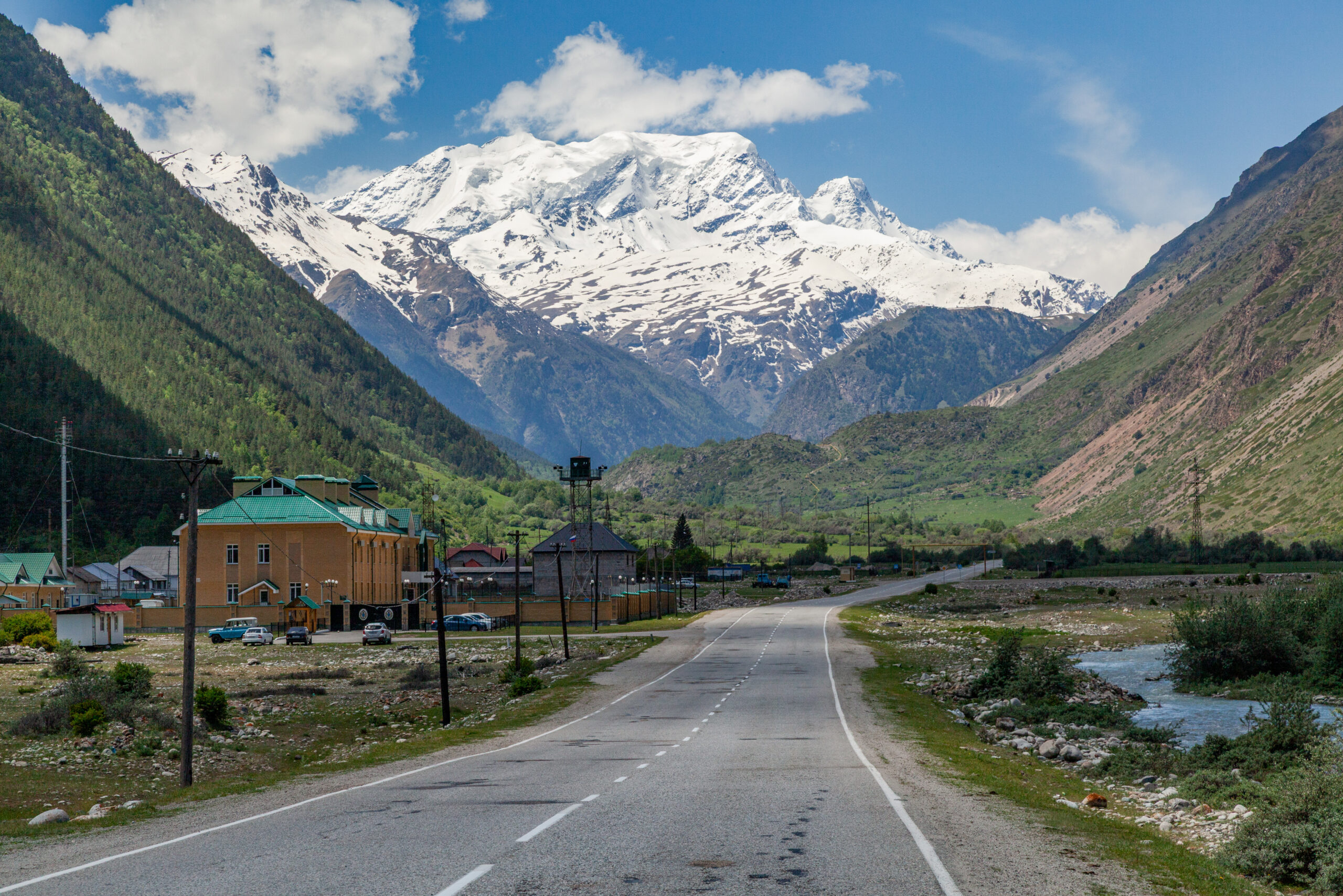
Climb the Mountain You Are Ready For.
Cerro El Plomo rewards endurance, acclimatization and patience more than advanced climbing technique. Build enough altitude margin, verify the current upper route and treat the summit sanctuary with the respect its history deserves.
Was this helpful?
🏔Related peaks nearby
🧭Explore & compare
Global Summit Guide is an independent mountaineering resource founded in 2026. The team combines first-hand trekking and climbing experience with in-depth research and professional health and nutrition review to help climbers choose objectives, prepare properly, and stay safe.
Health, altitude, and nutrition content is reviewed by Taylor Ludlow (Registered Nurse) and Brigg Hoopes (Nutritionist).
What We Don't Know Yet
Mountain information changes quickly. This box explains the limits of what this page can responsibly promise.
- Visa, passport, vaccination, border, insurance, and local transportation rules may change before your trip.
- Route conditions, snowpack, closures, and weather can change quickly after this page is updated.
- Permit rules, fees, quotas, and reservation windows may change between review cycles.
- Operator availability, pricing, guide ratios, and cancellation terms can change by season.
- Your fitness, altitude response, risk tolerance, and experience level may change what is safe or realistic.
Verify current conditions with official land managers, guide services, local forecasts, and current route reports before booking or climbing.
Mountaineering, rock and ice climbing, glacier travel, and high-altitude activity are inherently dangerous and can result in serious injury or death. The information on Global Summit Guide is provided for general informational and educational purposes only and is not a substitute for professional instruction, qualified guiding, proper equipment, or your own judgment and experience.
Route conditions, weather, snowpack, permits, regulations, and hazards change constantly and may differ from what is described here. Details may be incomplete, out of date, or contain errors. Always verify current information with local authorities, certified guides, and official sources before making any decision in the mountains.
Nothing on this site is medical, legal, or financial advice. Our fitness, acclimatization, altitude, and nutrition content is general in nature; consult a qualified physician before beginning any strenuous exercise program or exposing yourself to high altitude.
You are solely responsible for your own safety and decisions. To the fullest extent permitted by law, Global Summit Guide and its team accept no liability for any loss, injury, damage, or expense arising from use of, or reliance on, this information. By using this site you acknowledge these risks and accept these terms.
Some links on this site may be affiliate links. If you buy through them we may earn a small commission at no extra cost to you; this never affects our recommendations.
Global Summit Guide recommendation path
Next Best Mountain to Research
Use these recommendations to continue the right planning path instead of stopping on one page.
Use current permit, weather, route, and operator information before booking or climbing.