Last updated October 9, 2026

Kumano Kodo Nakahechi vs Kohechi: Which Route Should You Walk?
Choose the Nakahechi if this is your first Kumano Kodo pilgrimage: ancient oji shrines, village inns, hot springs, strong waymarking, buses and luggage support without removing the mountain challenge. Choose the Kohechi if you already know you can handle four consecutive 6–8 hour mountain days, limited transport and repeated 1,000-metre passes between Koyasan and Kumano Hongu Taisha.
Walk Nakahechi First. Choose Kohechi When the Mountains Are the Point.
Nakahechi is the best route for most international pilgrims. The historic route from Takijiri toward Kumano Hongu Taisha gives you real mountain walking while keeping useful support nearby: English signs, buses, inns, detailed maps and luggage-transfer options.
Kohechi is not the “shorter alternative.” It is a more committing mountain crossing from Koyasan to Hongu, covering more than 65 km over multiple high passes. The official tourism bureau specifically recommends it only for experienced hikers.
The difference is best understood this way: Nakahechi lets you build the pilgrimage around the walker. Kohechi asks the walker to fit the mountain route.
Do Not Choose Between These Routes by Distance Alone.
The Kumano Kodo is a network of historic pilgrimage roads crossing Japan’s Kii Peninsula. Nakahechi and Kohechi both lead into the sacred Kumano landscape, but they were shaped by different approaches.
Nakahechi approaches from the west through Takijiri, historic oji sites, small villages and the Hongu area. It is the core route most international walkers experience first.
Kohechi begins at the Buddhist mountain center of Koyasan and heads south across the interior mountains directly toward Hongu. The line is shorter than many famous long-distance pilgrimages, but each day is constrained by passes, valleys and sparse settlements.
The route you choose should therefore reflect your mountain experience, tolerance for fixed logistics, season and reason for coming to Kumano.
Choose the Route Before You Book the Inns.
Kumano accommodation is too limited to treat lodging as an afterthought—especially on Kohechi.
Nakahechi vs Kohechi
Both are sacred mountain routes. Nakahechi gives you options. Kohechi removes most of them.
| Factor | Nakahechi | Kohechi |
|---|---|---|
| Traditional role | Imperial route and core approach into Kumano. | Mountain route linking Koyasan and Kumano. |
| Common start | Takijiri-oji. | Koyasan. |
| Main destination | Kumano Hongu Taisha; many continue toward Nachi. | Kumano Hongu Taisha. |
| Core distance | ≈38 km Takijiri → Hongu. | More than 65 km Koyasan → Hongu. |
| Typical itinerary | 3 days to Hongu; 5–6 days if continuing toward Nachi. | 4 consecutive mountain days. |
| High passes | Steep ridges and mountain traverses, especially east of Hongu. | Multiple passes around or above 1,000 m. |
| Official difficulty | Ranges widely; harder major stages reach 4–5/5. | Core days rated 4.5–5/5. |
| Waymarking | Strong English signage and maps. | Marked, but remoteness raises the navigation consequence. |
| Transport | Useful bus network reaches many villages and trail points. | Limited, irregular community transport between valleys. |
| Luggage shuttle | Well-developed on major Nakahechi itineraries. | More complicated and subject to stricter booking conditions. |
| Accommodation | Limited but broader selection across established trail villages. | Very limited; each overnight effectively determines the itinerary. |
| Winter | Route remains open year-round, with winter planning cautions. | Northern sections effectively closed during snow season. |
| Best first Kumano route | Nakahechi. | Only for hikers deliberately seeking greater commitment. |
| Best for | Pilgrimage + culture + flexible mountain walking. | Experienced hikers seeking a harder sacred mountain traverse. |
Nakahechi
The strongest combination of sacred history, mountain trail, village lodging and practical support.
Kohechi
Multiple high passes and four demanding days make the walking itself a central part of the pilgrimage.
Nakahechi → Kohechi
Learn Kumano’s trail, lodging and weather system first. Return later for the harder Koyasan crossing.

Kohechi Begins at a Sacred Destination Before the Hard Walking Even Starts.
Koyasan is one of Japan’s great Buddhist mountain centers. Beginning there gives Kohechi a distinctive structure: you leave one sacred landscape and cross the Kii Mountains toward another at Kumano Hongu Taisha.
Kongobuji Temple, Koyasan · Drivephotographer / Wikimedia Commons · CC0.Nakahechi Connects Sacred Places. Kohechi Connects Sacred Mountains.
Both statements simplify the routes, but they capture the difference in daily experience.

The Historic Pilgrimage Corridor.
Takijiri marks a traditional entrance into the sacred mountains. From there the route climbs toward Takahara, Chikatsuyu and Tsugizakura before approaching Hongu.
The route can be experienced as a three-day core pilgrimage, a five- to six-day deeper traverse or shorter supported walks.

The Mountain Crossing.
From Koyasan the route repeatedly climbs out of a river valley, crosses a major pass and drops to the next small settlement. The sequence is what makes Kohechi demanding.
There is far less room to wake up and simply decide that today’s stage should be ten kilometres shorter.
Kohechi Is Not Slightly Harder. It Is a Different Commitment Level.
Official ratings make the difference much clearer than generic “moderate” or “challenging” labels.
| Difficulty factor | Nakahechi | Kohechi |
|---|---|---|
| Trail surface | Roots, stone steps, dirt, village roads and old paving. | Mountain paths, forest trail, old stone and some road sections. |
| Daily climbing | Can be substantial, but easier stage alternatives exist. | Major climbing is built into nearly every day. |
| High terrain | Lower overall until the harder Hongu–Nachi traverse. | Repeated passes near or above 1,000 m. |
| Exposure to weather | High in heavy rain, but more bailout options. | Greater consequences on high remote sections. |
| Navigation consequence | Strong signage and more frequent access points. | Higher because transport and settlements are sparse. |
| Pack sensitivity | Daypack + luggage shuttle works exceptionally well. | Light packing is even more important over consecutive passes. |
| Experience floor | Strong day hiker comfortable with steep trail. | Experienced multi-day mountain walker. |
If you extend from Hongu through Koguchi to Nachi, Ogumotori-goe is officially rated 5/5 with roughly 1,260 m of climbing over about 14 km. Nakahechi is the more flexible route—not an easy route.

The Routes Approach Hongu Differently—but the Destination Connects Them.
Nakahechi approaches through Kumano’s western pilgrimage corridor. Kohechi descends from Koyasan through the central mountains. Both eventually arrive at one of the great sacred centers that gives the Kumano Kodo its meaning.
Kumano Hongu Taisha · Wakayama Prefecture Official Tourism.Nakahechi Can Be Reshaped. Kohechi Is Built Around Four Passes.
This is why Kohechi accommodation must be solved before the rest of the Japan itinerary.
Three Walking Days to Hongu
- Day 1: Takijiri-oji → Takahara or Chikatsuyu
- Day 2: Continue through Chikatsuyu / Nonaka
- Day 3: Nonaka / Tsugizakura → Kumano Hongu Taisha
Strong hikers can compress the route, but splitting the western section gives the shrines, villages and inns enough room to become part of the pilgrimage.
Add Kogumotori-goe and Ogumotori-goe through Koguchi to Kumano Nachi Taisha. This turns the trip into a serious five- to six-day mountain pilgrimage.
Four Passes, Four Committing Days
- Day 1: Koyasan → Omata · ≈17 km
- Day 2: Omata → Miura-guchi · ≈19 km
- Day 3: Miura-guchi → Totsukawa Onsen · ≈20 km
- Day 4: Totsukawa → Kumano Hongu Taisha · ≈15 km
The distances look ordinary until the climbing, high passes and limited escape options are added. Several days require most of the daylight available to a normal hiker.
The official reservation system requires the overnight chain to be confirmed because there may be no realistic alternative once a village’s limited beds are full.

Both Routes Eventually Enter the Same Sacred Landscape.
Oyunohara marks the historic site of Kumano Hongu Taisha. The immense torii makes the transition visible: the road through the mountains exists because of the sacred destination, not the other way around.
Oyunohara · Wakayama Prefecture Official Tourism.Spring and Autumn Favor Both. Winter Separates Them.
Nakahechi has a much broader operating season. Kohechi’s high passes materially reduce the winter window.
| Season | Nakahechi | Kohechi |
|---|---|---|
| March–April | Excellent spring walking; early March can still be cool. | Wait for official reopening and safe high-pass conditions. |
| May | Excellent; increasingly warm and green. | Excellent mountain window. |
| June | Warmer and wetter as rainy season develops. | Usable, but rain on high terrain deserves respect. |
| July–August | Hot, humid and wet; early starts matter. | Open but physically taxing in heat and humidity. |
| September | Good, with typhoon risk requiring forecast attention. | Good, but high exposed sections amplify storm concerns. |
| October–November | Excellent. Cooler temperatures and autumn conditions. | Excellent. Strong Kohechi window before winter snow. |
| Winter | Open year-round, though cold fronts, short daylight and occasional snow matter. | Northern high passes effectively closed from winter snow; Hatenashi-toge remains a separate year-round option. |
The Kii Peninsula receives abundant rainfall. Wet stone and roots become slippery, while intense rain can contribute to landslides and temporary closures. Weather is part of route selection, not just a packing question.

Onsen Recovery Matters More When Tomorrow Starts With Another Pass.
Totsukawa is not simply a convenient overnight. It creates the recovery point before the final Hatenashi-toge crossing toward Hongu—and gives the hard Kohechi a distinctly Japanese rhythm.
Totsukawa Onsen · Nara Kotsu.Nakahechi Requires Reservations. Kohechi Requires an Itinerary.
The distinction matters. Kumano is not a Camino where you simply walk until you feel finished.
| Logistics | Nakahechi | Kohechi |
|---|---|---|
| Accommodation supply | Limited village inventory but multiple established itinerary options. | Extremely limited in several required overnight locations. |
| Walk-up lodging | Not recommended. | Do not rely on it. |
| Meal planning | Many inns provide dinner and breakfast; trail lunches can be arranged. | Even more important because services between valleys are sparse. |
| Bus access | Useful network along the western and Hongu areas. | Irregular community buses; route rescue is not simple. |
| Luggage transfer | One of Nakahechi’s major planning advantages. | Possible in some structures but significantly less flexible. |
| Stage shortening | Possible in several areas using buses or different lodging. | Much harder because the pass and valley system determines the day. |
| Best booking method | Book the hardest village nights first. | Confirm the entire four-day overnight chain before committing. |
The official community reservation system explicitly requires confirmation of the complete Kohechi itinerary for supported reservations. A missing Miura-guchi night can break the route—not simply make it less luxurious.
Nakahechi Makes the Kumano Shrines the Story. Kohechi Makes the Crossing Part of the Story.
Neither route should be reduced to a hiking challenge. The sacred geography is why these trails exist.
The Stronger First Pilgrimage Narrative
Nakahechi carries the walker through a dense sequence of oji shrines, old route markers, historic villages, Hongu and—if extended—Nachi.
It is easier to understand how generations of pilgrims approached Kumano because the sacred points remain present throughout the daily itinerary.
- Takijiri-oji as the traditional gateway
- historic oji sites through the forest
- Kumano Hongu Taisha
- Yunomine purification tradition
- Kumano Nachi Taisha on the extended route
The Stronger Sacred-Mountain Traverse
Kohechi links Koyasan’s Buddhist mountain landscape directly with Kumano’s sacred centers.
The remoteness changes the spiritual texture: fewer tourist touchpoints, longer stretches in forest and repeated physical crossings between isolated valleys.
- Koyasan as a major sacred beginning
- mountain passes as the structure of the journey
- small valley settlements
- Jizo and Kannon markers along the road
- arrival at Kumano Hongu Taisha

Nakahechi Can Continue Beyond Hongu to One of Japan’s Great Pilgrimage Arrivals.
Continuing through Koguchi and over Ogumotori-goe transforms Nakahechi from the practical first route into a much deeper mountain journey ending beneath Nachi Falls.
Nachi sacred landscape · Japan World Cultural Heritage.Kohechi Requires a Closure Check Before Every Trip.
The mountain route has fewer practical alternatives when landslide, weather or road issues change a stage.
Obako-toge Detour
The official safety page currently lists a detour on the north side of Obako-toge because of landslide damage. Follow local signs and current official mapping.
Check Every Morning.
Conditions at a valley inn do not guarantee conditions on a high pass. Fog, wind and heavy rain can be materially worse above.
Do Not Start With Missing Beds.
Kohechi’s required village sequence is part of the safety system. Confirm accommodation before committing to the traverse.
Landslides, typhoons, bridge conditions, road closures and bus schedules can change faster than an evergreen pilgrimage guide should pretend otherwise.
Both Need Hiking Gear. Kohechi Needs a Larger Safety Margin.
These are not technical mountain routes, but neither should be packed like an urban sightseeing walk.
| Gear priority | Nakahechi | Kohechi |
|---|---|---|
| Footwear | Trail shoes or light hikers with strong wet-stone grip. | Proven hiking footwear with secure footing on long descents. |
| Rain shell | Essential. | Essential, with less tolerance for failure. |
| Warm layer | Useful in spring, autumn and winter. | Important on exposed high passes even when valleys feel mild. |
| Trekking poles | Very useful on wet steps and repeated descents. | Highly useful across consecutive pass days. |
| Headlamp | Carry one for delayed forest finishes. | Essential margin on long stages. |
| Water | Carry enough for known service gaps. | Plan conservatively between valleys. |
| Navigation | Official map + offline backup. | Official map + offline backup + stronger route awareness. |
| Pack strategy | Daypack plus luggage shuttle is excellent. | Keep weight low because every unnecessary kilogram crosses every pass. |


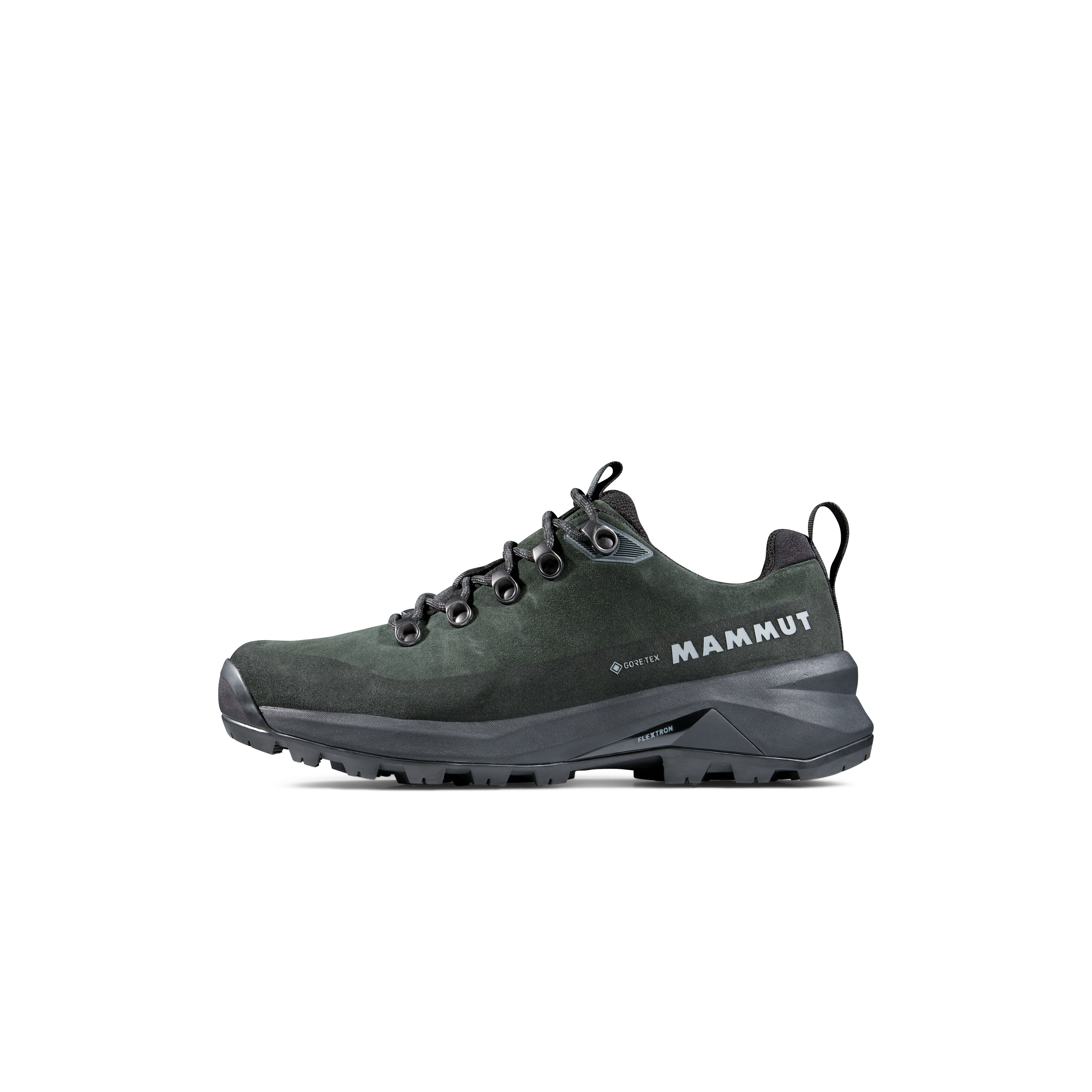
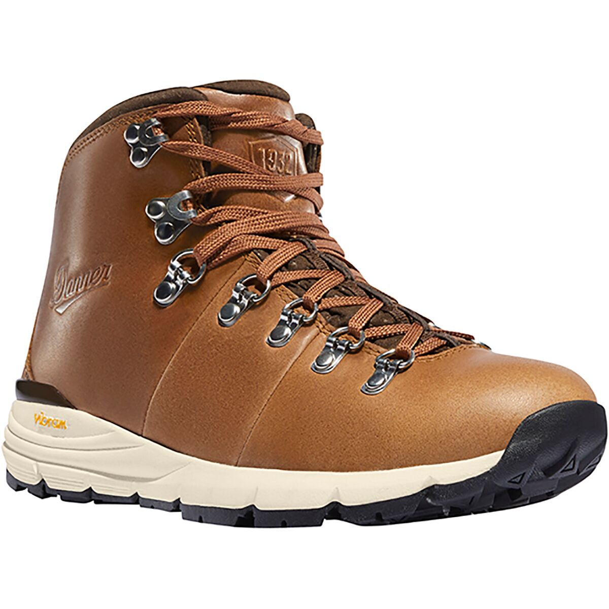
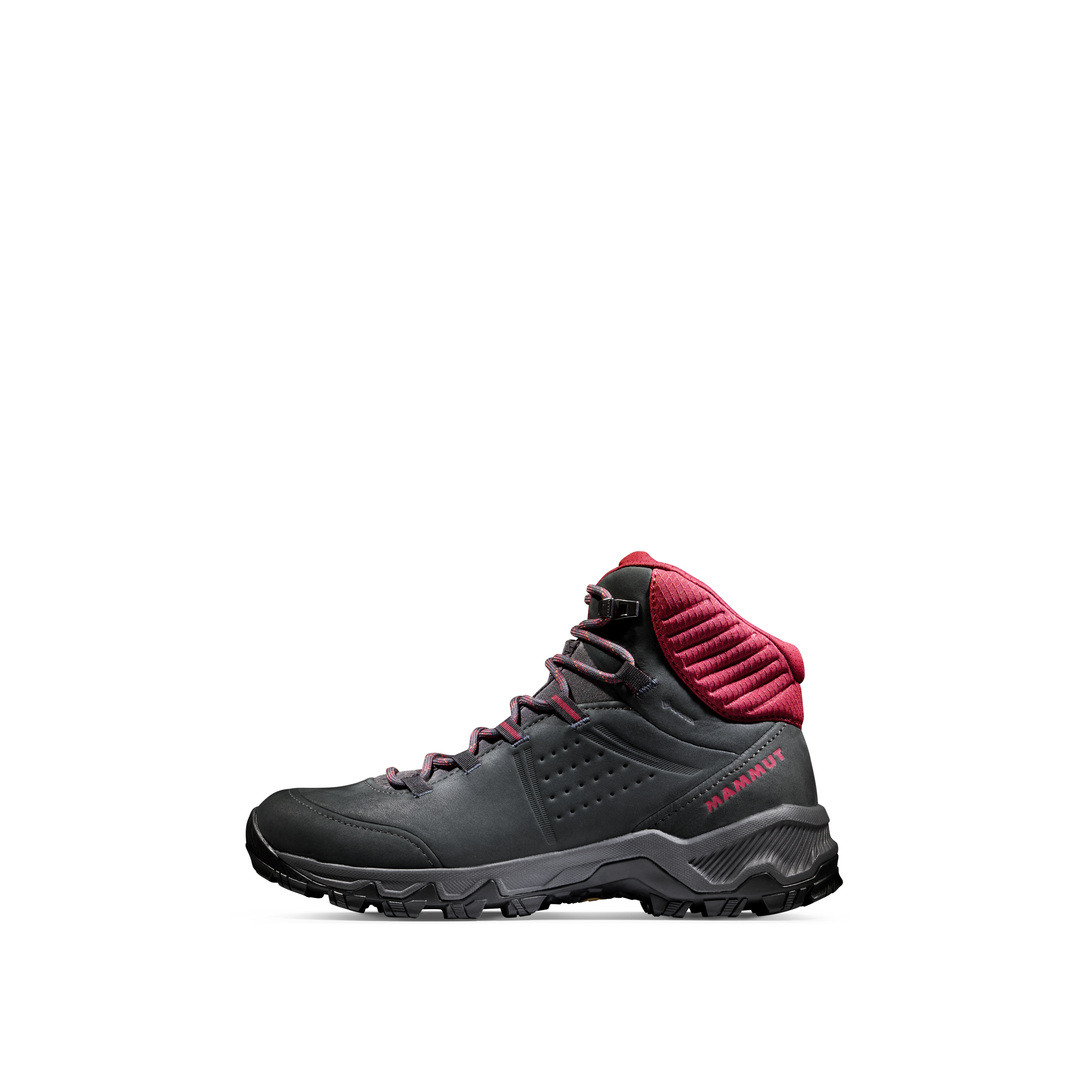
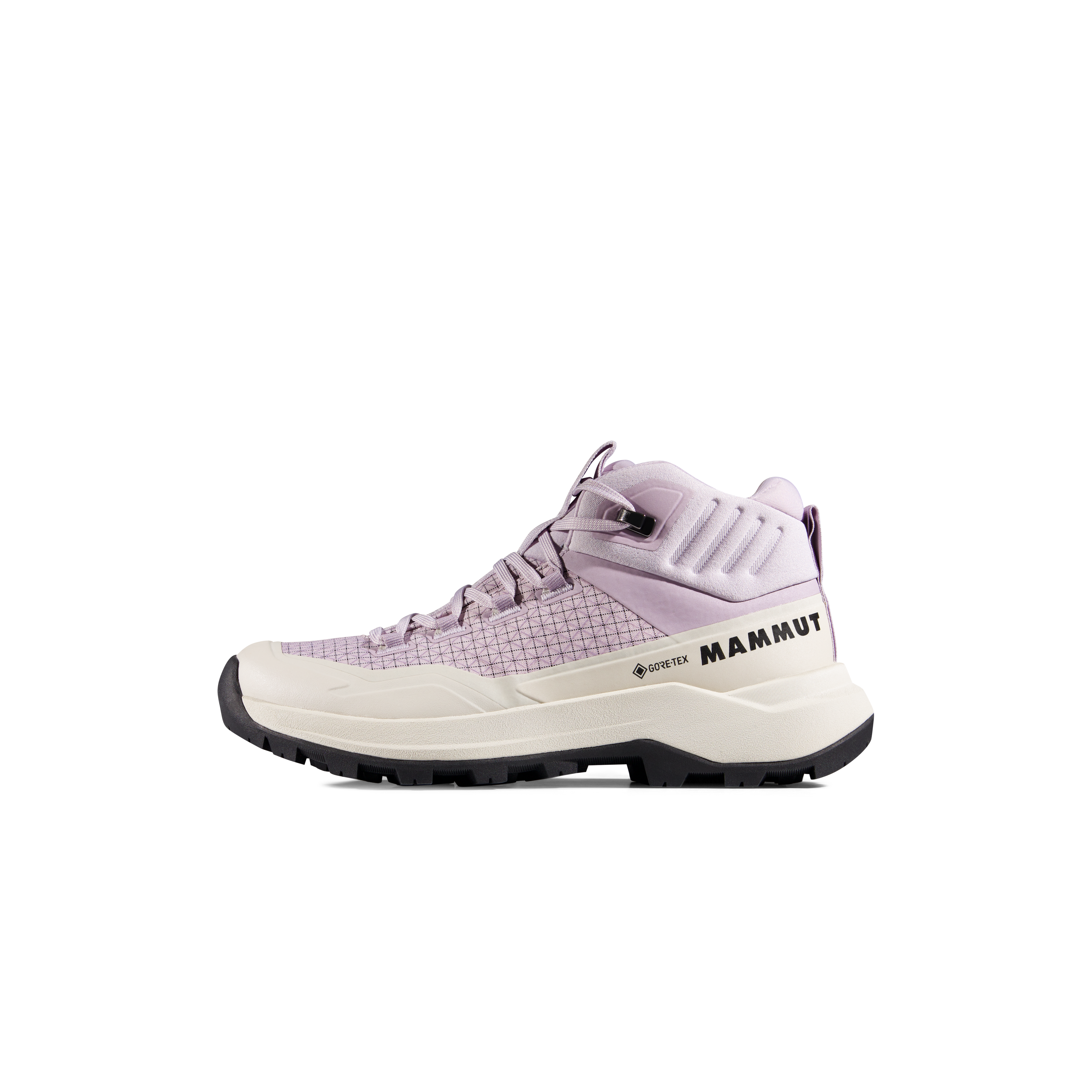
We may earn a commission if you buy through these links, at no extra cost to you. Affiliate disclosure

Kohechi’s Villages Feel Earned Because the Road Between Them Is Hard.
Hatenashi sits high above the Totsukawa valley on the final major Kohechi crossing toward Hongu.
That contrast—steep mountain trail, a tiny ridge settlement and another long descent— is the character of Kohechi in miniature.
It is also why a warm layer belongs in the pack even when the forecast at the overnight village appears mild.
Hatenashi village · Sakaori / Wikimedia Commons · CC BY-SA 4.0.





Nakahechi Approaches Kumano From the West. Kohechi Drops South From Koyasan.
These maps are for route orientation only. Use Tanabe City’s official Kumano Kodo maps for field navigation.
Takijiri → Hongu → Nachi
The core western route approaches Hongu through mountain villages. The deeper extension continues east through Koguchi toward Nachi.
Koyasan → Totsukawa → Hongu
The route runs north-to-south through the central Kii Mountains, repeatedly crossing high ridges before descending toward Hongu.
Which Kumano Kodo Route Fits You?
If you are still undecided after the mileage comparison, use experience and logistics to make the call.
This Is Your First Kumano Journey.
- You are a strong hiker but new to Kumano.
- You want oji shrines and village culture throughout the route.
- You value buses and luggage transfer.
- You want 3–6 days of flexible walking.
- Yunomine or Kawayu Onsen is part of the trip.
- You want the strongest first Dual Pilgrim option.
You Want the Harder Sacred-Mountain Crossing.
- You regularly hike 6–8 hour mountain days.
- Repeated 700–1,100 m climbing days are normal for you.
- You are comfortable with limited exits.
- You can commit to fixed overnight villages.
- Koyasan is part of the pilgrimage objective.
- Solitude matters more than logistical flexibility.
You Want the Middle Ground.
- You want more challenge than Takijiri → Hongu alone.
- You still want stronger support than Kohechi.
- You want both Hongu and Nachi as major destinations.
- You can handle a difficulty-5 final mountain day.
- You want a five- to six-day pilgrimage.
- You prefer one route rather than returning for Kohechi later.
When the pilgrimage system matters most.
When the mountain crossing matters most.
Kumano Kodo Nakahechi vs Kohechi FAQ
The questions that usually decide between Kumano’s core pilgrimage route and its advanced mountain crossing.
Which is harder, Nakahechi or Kohechi?
Kohechi is harder overall. Its four primary days are officially rated 4.5, 5, 4.5 and 4.5 out of 5 and include repeated high-pass crossings. Nakahechi has difficult sections too—including difficulty-5 Ogumotori-goe—but offers more ways to shorten or restructure the trip.
Which Kumano Kodo route is best for first-time walkers?
Nakahechi is the strongest first choice. It is the core route, has English waymarking, established village lodging, buses, luggage transfer and enough itinerary flexibility to match different hiking abilities.
How long is the Nakahechi?
The popular Takijiri-oji to Kumano Hongu Taisha core is roughly 38 km and works well as three walking days. Continuing through Koguchi to Kumano Nachi Taisha creates a substantially harder five- to six-day pilgrimage.
How long is the Kohechi?
The official route is more than 65 km from Koyasan to Kumano Hongu Taisha. The classic itinerary divides the mountain crossing into four long walking days with overnights at the key valley settlements.
Can beginners walk Kohechi?
Kohechi is not recommended as a first serious multi-day mountain hike. The official route authority describes it as a route for advanced, experienced hikers because of steep passes, limited transportation and remote sections.
Does Kohechi require technical climbing?
No. Standard Kohechi is a hiking route rather than a technical mountaineering objective. Its seriousness comes from steep terrain, long days, weather exposure and limited bailout options.
Can you walk Nakahechi in winter?
Yes. The official tourism bureau describes Nakahechi as open year-round. Winter brings shorter daylight, possible freezing conditions, occasional snow at higher elevations and reduced services, so accommodation and transport still require careful planning.
Can you walk Kohechi in winter?
Not as a normal full Koyasan-to-Hongu traverse. The northern passes are effectively closed during the snowiest winter period. Hatenashi-toge in the southern section can be walked year-round when conditions allow.
Do I need to book accommodation in advance?
Yes on both routes. Walk-up accommodation is not a reliable Kumano strategy. Advance booking is particularly important on Kohechi, where a small number of required village overnights effectively determine the whole itinerary.
Can I use luggage transfer on Nakahechi?
Yes. Daily luggage-shuttle services are one of Nakahechi’s strongest practical advantages and make a small daypack an excellent system for travelers combining Kumano with a wider Japan trip.
Does Kohechi qualify for the Dual Pilgrim program?
Yes. Completing Kohechi from Koyasan to Kumano Hongu Taisha is one of the recognized Kumano options in the Dual Pilgrim program linking Kumano Kodo and the Camino de Santiago.
Which route would Global Summit Guide recommend first?
Nakahechi for almost every first-time Kumano visitor. Choose Kohechi first only when you already have strong multi-day mountain experience and the Koyasan-to-Hongu crossing itself is specifically the pilgrimage you want.
Choose the Route Here. Use Tanabe for the Trail.
Kumano has unusually good official route data: stage distance, climbing, difficulty, buses, closures, accommodation and safety information.
Check that material again immediately before travel, particularly for Kohechi where a closure or missing overnight can materially alter the itinerary.
Primary Planning Sources
Global Summit Guide · Kumano Kodo / Nakahechi → Global Summit Guide · Kumano Kodo vs Camino → Tanabe City · Official Nakahechi → Tanabe City · Official Kohechi → Tanabe City · Official Difficulty Ratings → Tanabe City · Trail Safety, Closures & Weather → Kumano Travel · Community Reservation System →Once You Choose the Route, Move Into the Actual Kumano Plan.
This page owns the Nakahechi-versus-Kohechi decision. The Kumano parent guide owns the detailed stages, route maps, Hongu, Nachi, lodging, luggage and access planning.
First Kumano? Nakahechi. Returning for the Harder Road? Kohechi.
Choose Nakahechi for the strongest first pilgrimage: sacred sites, village inns, onsen, buses, luggage support and enough flexibility to shape the route around your ability. Choose Kohechi when flexibility is no longer what you want— when four hard mountain days from Koyasan to Hongu are precisely the pilgrimage you came to Japan to walk.
Was this helpful?
Global Summit Guide is an independent mountaineering resource founded in 2026. The team combines first-hand trekking and climbing experience with in-depth research and professional health and nutrition review to help climbers choose objectives, prepare properly, and stay safe.
Health, altitude, and nutrition content is reviewed by Taylor Ludlow (Registered Nurse) and Brigg Hoopes (Nutritionist).
What We Don't Know Yet
Mountain information changes quickly. This box explains the limits of what this page can responsibly promise.
- Route conditions, trailhead access, crevasse exposure, stream crossings, and rescue access may vary from published planning guidance.
- Comparisons simplify complex decisions; the better mountain depends on current conditions, skills, timing, budget, and risk tolerance.
- Visa, passport, vaccination, border, insurance, and local transportation rules may change before your trip.
Verify current conditions with official land managers, guide services, local forecasts, and current route reports before booking or climbing.
Mountaineering, rock and ice climbing, glacier travel, and high-altitude activity are inherently dangerous and can result in serious injury or death. The information on Global Summit Guide is provided for general informational and educational purposes only and is not a substitute for professional instruction, qualified guiding, proper equipment, or your own judgment and experience.
Route conditions, weather, snowpack, permits, regulations, and hazards change constantly and may differ from what is described here. Details may be incomplete, out of date, or contain errors. Always verify current information with local authorities, certified guides, and official sources before making any decision in the mountains.
Nothing on this site is medical, legal, or financial advice. Our fitness, acclimatization, altitude, and nutrition content is general in nature; consult a qualified physician before beginning any strenuous exercise program or exposing yourself to high altitude.
You are solely responsible for your own safety and decisions. To the fullest extent permitted by law, Global Summit Guide and its team accept no liability for any loss, injury, damage, or expense arising from use of, or reliance on, this information. By using this site you acknowledge these risks and accept these terms.
Some links on this site may be affiliate links. If you buy through them we may earn a small commission at no extra cost to you; this never affects our recommendations.
Global Summit Guide recommendation path
Next Best Mountain to Research
Use these recommendations to continue the right planning path instead of stopping on one page.
Use current permit, weather, route, and operator information before booking or climbing.