
Last updated September 10, 2026
Canyonlands Hiking Guide: Best Hikes in Island in the Sky, The Needles & The Maze
If you want Canyonlands’ best full hiking day, go to The Needles and hike Chesler Park with the Joint Trail. If you want the highest scenery return with the least route complexity, choose Grand View Point at Island in the Sky. Druid Arch is the stronger choice for a hard destination hike; Mesa Arch is the best short walk. The Maze is a different category entirely—remote, minimally maintained and better treated as a self-reliant backcountry trip than a normal Moab day hike.
Which Canyonlands District Should You Hike?
Choose The Needles if hiking is the reason you are coming to Canyonlands. Its trail network is deeper, more varied and more immersive than the short mesa-top walks at Island in the Sky. Chesler Park, Druid Arch, Confluence Overlook and the canyon loops can each fill a substantial day.
Choose Island in the Sky if this is your first Canyonlands visit, you have limited time or you want several short hikes and overlooks in one day. Grand View Point, Mesa Arch, White Rim Overlook and Upheaval Dome give an enormous amount of scenery without committing to a 10-mile desert route.
Choose The Maze only when remoteness is part of the goal. NPS describes its trails as steep, minimally maintained and difficult to navigate. Access can require high-clearance four-wheel drive, and many itineraries make more sense as multi-day backpacking trips.
The districts look close on a map because the Green and Colorado rivers divide the same park. They are not close by road. NPS says travel between districts can take roughly two to six hours, so build each day around one district rather than trying to check off the entire park at once.
Canyonlands Is Not One Trail Network
The rivers divide the park so completely that district choice is the first real hiking decision.
The Needles
The Needles is the strongest hiking district. Long day hikes connect Cedar Mesa Sandstone spires, grassy basins, slickrock benches, sandy canyons, ladders and narrow rock joints.
- Best overall: Chesler Park / Joint Trail.
- Hard destination: Druid Arch.
- River view: Confluence Overlook.
- Shorter choice: Slickrock Trail.
From Moab: roughly 90 minutes. UT 211 is the only paved road in and out.
Island in the Sky
Island in the Sky puts you on a high mesa more than 1,000 feet above the surrounding canyon country. The paved scenic drive links short trails, enormous overlooks and several much harder descents.
- Best easy hike: Grand View Point.
- Best short sunrise: Mesa Arch.
- Best quieter overlook: White Rim Overlook.
- Hardest route here: Syncline Loop.
From Moab: roughly 40 minutes to the visitor center.
The Maze
The Maze is not the place to improvise a spare afternoon. Trails are steep, minimally maintained and often difficult to follow. Access roads can require high-clearance four-wheel drive and become impassable when wet.
- Strong navigation expected.
- No drinking water in the district.
- Many routes fit multi-day backpacking better than day hiking.
- Horseshoe Canyon is the most approachable remote cultural hike nearby.
Choose it when: self-reliance and remoteness are part of the objective.
The 12 Best Hikes in Canyonlands National Park
The ranking favors routes that reveal a district’s character and help you build a coherent Canyonlands trip.
| # | Hike | District | Distance | Time | Best for | Key issue |
|---|---|---|---|---|---|---|
| 1 | Chesler Park / Joint Trail | The Needles | 10.7 mi | 5–7 hr | Best overall | Long exposed desert day; carry substantial water. |
| 2 | Druid Arch | The Needles | 10.8 mi | 5–7 hr | Best hard destination | Deep sand, loose rock, ladder and scrambling near the end. |
| 3 | Grand View Point | Island in the Sky | 1.8 mi | ~1.5 hr | Best easy payoff | Cliff-edge walking; exposed sun. |
| 4 | Confluence Overlook | The Needles | 11 mi | 5–6 hr | Best river-confluence day | Dry open country; little shade. |
| 5 | Mesa Arch | Island in the Sky | 0.6 mi | ~30 min | Best short hike | Very popular at sunrise. |
| 6 | White Rim Overlook | Island in the Sky | 1.8 mi | ~1.5 hr | Best late-day view | Very limited trailhead parking. |
| 7 | Big Spring → Lost Canyon | The Needles | 8.7 mi | 4–6 hr | Best canyon loop | Ladder, rough grades and possible wet vegetation. |
| 8 | Slickrock Trail | The Needles | 2.4 mi | 1.5–2 hr | Best shorter Needles hike | Uneven slickrock; little shade. |
| 9 | Upheaval Dome Overlooks | Island in the Sky | 0.6 mi to first overlook | ~1 hr | Best geology stop | Short but steep. |
| 10 | Syncline Loop | Island in the Sky | 8.1 mi | 5–7 hr | Best advanced Island route | NPS says most park rescues occur here. |
| 11 | Horseshoe Canyon / Great Gallery | Remote unit near The Maze | 7 mi | 5+ hr | Best rock-art hike | Remote dirt-road access, heat and 780-ft climb out. |
| 12 | Murphy Point | Island in the Sky | 3.4 mi | ~2 hr | Best quiet mesa walk | Open sun; fewer built-in landmarks than Grand View. |
The Needles: Build the Trip Around One Big Route
The Needles gives you the most immersive trail experience in Canyonlands, but its best routes are long enough that trying to stack them together usually makes the day worse.
Chesler Park / Joint Trail
Chesler Park is the route that best explains why The Needles deserves its own district. The trail moves through narrow passes into a broad grassland ringed by sandstone spires, then continues through the Joint Trail—deep fractures in the rock that feel completely different from the open park.
This is the best choice when you have one full Canyonlands hiking day and want variety rather than one single viewpoint.
Druid Arch
Druid Arch follows the beginning of the Chesler route, then commits to Elephant Canyon. NPS describes deep sand and loose rock before the upper section steepens sharply, with a ladder and scrambling near the finish.
The arch itself is the stronger single destination, but the route has less of the looped, continuously changing character that makes Chesler Park our #1 choice.
Confluence Overlook
This trail is different from the sandstone-maze feeling of Chesler and Druid. It crosses drier open country toward a cliff overlooking the meeting of the Green and Colorado rivers roughly 1,000 feet below.
Choose it when the river geography is the point of the day and you are comfortable with a long, exposed route that offers little shade.
Big Spring Canyon to Lost Canyon
This loop goes deeper into canyon terrain than the shorter scenic walks near the Needles road. NPS notes steep rocky grades, a ladder and vegetation that can become wet in Lost Canyon.
It is a useful alternative when you want a serious route but prefer canyon travel over the headline formations at Chesler Park or Druid Arch.
From Moab, Desert Canyons and 12,000-Foot Mountains Sit in the Same Trip.
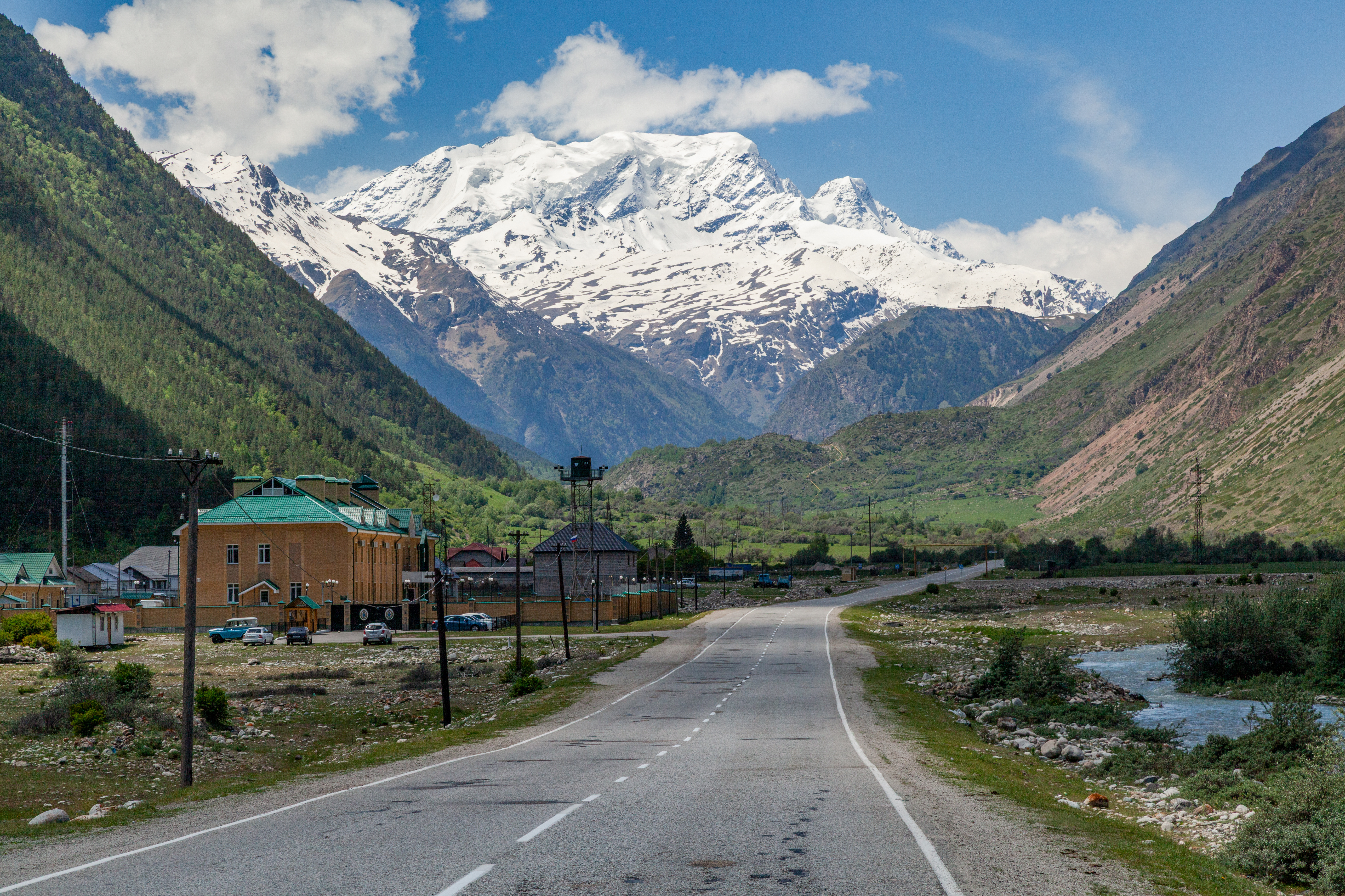
The La Sal Mountains rise beyond the canyon country east of Canyonlands. That contrast is why Moab works so well as a base: use spring and fall for long desert routes, then shift higher when the low desert becomes too hot.
Island in the Sky: The Best First Canyonlands Day
Island in the Sky is the right choice when you want several worthwhile stops rather than one long wilderness route.
Grand View Point
1.8 miles · about 1.5 hours. The trail follows the mesa edge from the southern end of the scenic drive. It is the best Canyonlands choice for someone who wants an actual hike—not just a pullout—without committing to a strenuous day.
The panorama reaches across the White Rim, Monument Basin and distant Needles country.
NPS Grand View Point →Mesa Arch
0.6 mile · about 30 minutes. Mesa Arch frames canyon country and the La Sal Mountains from the mesa edge. Sunrise is famous and correspondingly busy.
If photography is not the priority, later in the day can deliver a better hiking experience with less pressure around the arch.
NPS Mesa Arch →White Rim Overlook
1.8 miles · about 1.5 hours. The east-facing overlook reaches toward the Colorado River, Monument Basin and the La Sal Mountains.
NPS specifically notes very limited parking, so do not build a rigid schedule around arriving at a crowded time.
NPS White Rim Overlook →Upheaval Dome
0.6 mile to the first overlook · about 1 hour. It is short, steep and unlike the normal horizontal canyon layers around it.
This is an easy way to add a different geologic problem to a day otherwise built around overlooks.
NPS Upheaval Dome →The Maze and Horseshoe Canyon
Do not treat The Maze as a distant version of Island in the Sky. The access, navigation and self-rescue assumptions are different.
Experienced Backcountry Travelers
NPS describes Maze trails as steep, minimally maintained and sometimes unmarked. Basic climbing moves can be required around slickrock and pour-offs, while access to trailheads may require high-clearance four-wheel drive.
There is no drinking water at Hans Flat or elsewhere in The Maze. Bring a real map, not only a phone, and treat weather-driven road changes as part of the route.
Horseshoe Canyon / Great Gallery
7 miles round trip · five hours or more · 780 feet down and back up. The Great Gallery is one of the most significant rock-art panels in the region.
The trail itself is only half the planning problem. The west-rim trailhead is reached by long unpaved approaches that can change quickly after rain or wind. NPS specifically warns against relying on GPS alone.
Summer heat is severe enough that NPS recommends very early or post-4 p.m. hiking during June–August and one gallon of water per person.
NPS Horseshoe Canyon →Canyonlands Permits, Entry Fees & Reservations
The most important distinction is between hiking trails and backcountry road/bike permits.
NPS currently states that timed-entry reservations are not required for Canyonlands.
Normal day hiking on established trails does not require a hiking permit.
All overnight backcountry trips require an overnight permit.
White Rim, Elephant Hill, Lavender Canyon and Peekaboo/Horse Canyon road travel have separate day-use rules.
| Item | Current NPS amount / rule | Planning note |
|---|---|---|
| Private vehicle entrance | $30 | Standard park entrance fee; America the Beautiful passes accepted. |
| Motorcycle entrance | $25 | Standard entrance. |
| Per-person entrance | $15 | For entry on foot/bicycle when applicable. |
| Canyonlands annual pass | $55 | Useful for repeat local trips. |
| Overnight backpack permit | $36 reservation + $5/person/night | Separate from the normal park entrance fee. |
| Needles backpack group size | 7 people | Per overnight permit. |
Best Season, Heat & Water
Canyonlands is a high desert, but that does not make summer heat a minor issue.
Spring and Fall
NPS identifies April–May and mid-September–October as the temperate, popular seasons, with typical daytime highs roughly in the 60–80°F range.
Those periods are ideal for 8–11-mile Needles routes because you can use more of the daylight without turning the middle of the day into a heat-management problem.
Often Above 100°F
Summer daytime temperatures frequently exceed 100°F. NPS advises avoiding peak heat and shifting strenuous activity toward mornings and evenings.
On exposed routes such as Confluence Overlook or the open approaches in The Needles, shade is not something you can assume will appear when you need it.
Carry More Than a Mountain Hike of the Same Length
NPS’s general Canyonlands hiking guidance says to plan up to one gallon / four liters per person per day. Its Druid Arch page goes further and tells hikers to bring one liter per person per hour.
Backcountry water is scarce and unreliable. Do not build a day-hike water plan around finding a spring or pothole.
Know Before You Drive In
- Island in the Sky Visitor Center — year-round.
- The Needles Visitor Center — year-round.
- Needles Campground — spring through fall.
- The Maze — no drinking water.
Canyonlands Itineraries: 1, 2 or 3 Days
Each day gets better when it stays inside one district.
First Canyonlands Visit
- Sunrise or early Mesa Arch.
- Grand View Point Trail.
- Buck Canyon / Green River overlooks.
- White Rim Overlook late afternoon.
District: Island in the Sky only.
Best Hiking Weekend
- Day 1: Island in the Sky — Grand View, Mesa Arch and one additional short route.
- Day 2: The Needles — Chesler Park / Joint Trail.
This gives you the high-mesa perspective first and the immersive Needles experience second.
Serious Hiker
- Day 1: Island in the Sky.
- Day 2: Chesler Park / Joint Trail.
- Day 3: Druid Arch or Confluence Overlook.
Do not automatically add The Maze. Save it for a separate remote itinerary.
Canyonlands and Arches Work Best as Separate Park Days.
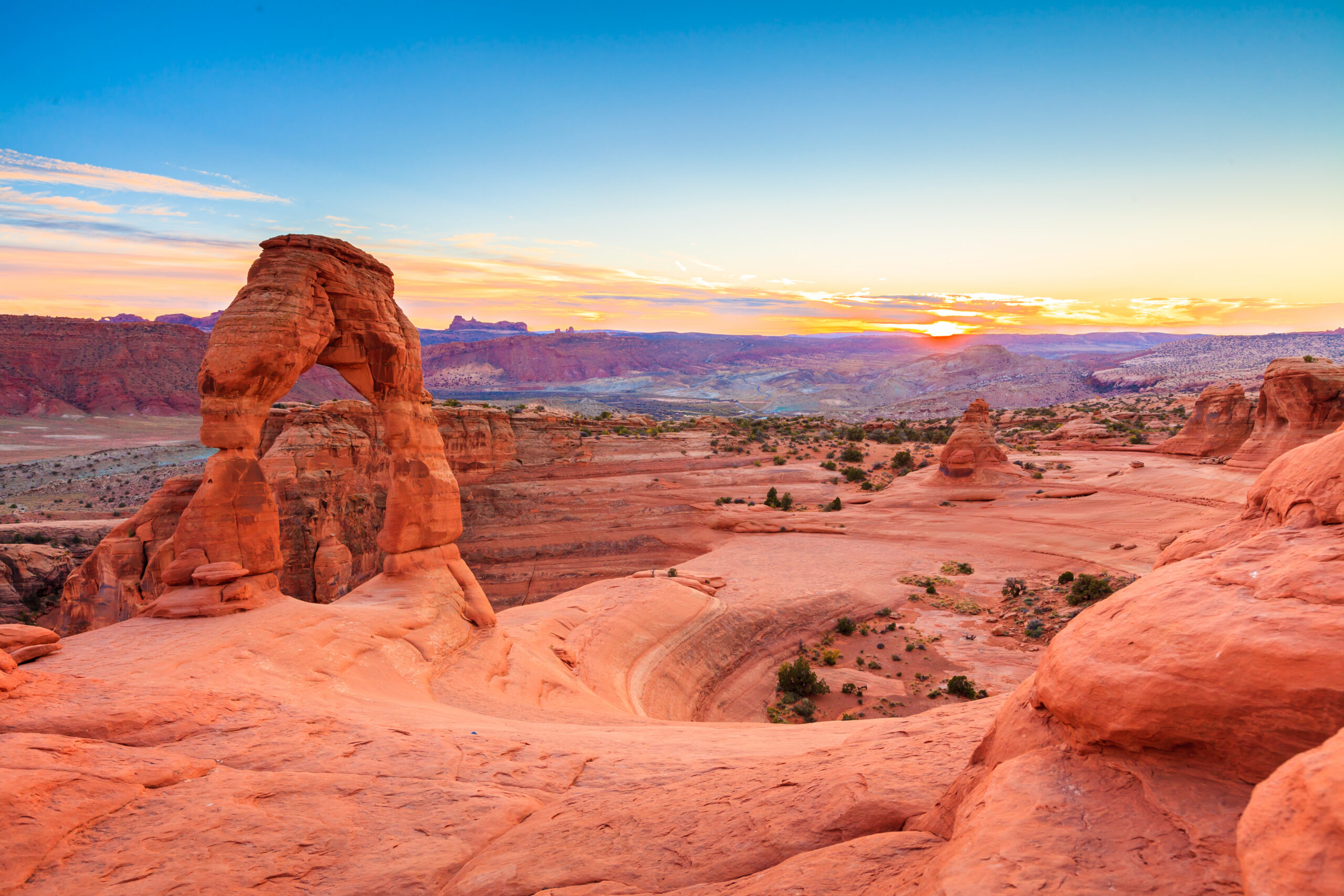
Moab makes both parks easy to combine in one trip, but trying to cram Arches and Canyonlands into the same day usually turns hiking time into driving and parking time. Give Island in the Sky its own day, and give The Needles an even larger block.
Where to Stay for Canyonlands Hiking
Moab is the easiest base for Island in the Sky and the broader Arches/Canyonlands trip. The Needles is far enough away that an early start matters more.
Stay in Moab
NPS puts Island in the Sky Visitor Center roughly 40 minutes from Moab. That makes Moab the obvious base for Mesa Arch, Grand View Point, White Rim Overlook and Upheaval Dome.
Fuel, food and lodging are also much easier to manage in town than near the park district.
Protect the Morning
The Needles is roughly 90 minutes from Moab. For a 10–11-mile route, especially in warm weather, that makes a casual late breakfast in town a poor strategy.
Leave early enough to be moving before the day’s heat builds, or consider lodging/camping that reduces the morning drive when your itinerary allows.
Maps, Cairns & Route Finding
NPS explicitly recommends carrying a topographic map in the backcountry because remote trails can be lightly marked or minimally maintained.
Follow Cairns, but Know the Terrain
Many Canyonlands trails cross bare slickrock where there is no dirt tread. Cairns mark the route, but a missed turn can become difficult to recognize once similar benches and washes repeat.
Download district maps before leaving service and carry a paper or offline topographic backup on the longer routes.
NPS Canyonlands maps →Navigation Is Part of the Difficulty
In The Maze, NPS says canyon washes may not be marked and similar-looking canyons can be difficult to identify. This is a different standard from following a maintained trail in a busy national park corridor.
Route-finding skill should be a prerequisite, not a skill you plan to learn after entering the district.
Learn to read a topographic map →Canyonlands in the Utah Hiking System
Best Hikes in Utah
Compare Canyonlands with Zion, Bryce, Arches, Capitol Reef, the Wasatch and the Uintas.
Explore Utah hiking → Regional parentBest Hikes in the Southwest USA
Compare southern Utah with the Grand Canyon, Sedona, New Mexico and Nevada.
Explore the Southwest → Desert-to-alpineBest Mountains in Utah
Add Mount Peale or another Utah summit when you want to move from canyon country into higher terrain.
Compare Utah mountains → Moab planningWhere to Stay in the Southwest
Choose a Moab base that keeps early Canyonlands and Arches starts practical.
Plan lodging → Deep recovery 1Read a Topographic Map
Especially important when cairns become sparse and slickrock erases the normal trail tread.
Build navigation skill → Deep recovery 2Mountain Weather
Use weather structure—not only a Moab temperature—to judge thunderstorms, wind and fast-changing desert conditions.
Read weather better → Deep recovery 3Endurance Standards
Translate long desert days into a realistic endurance benchmark before choosing a 10–11-mile Needles route.
Check fitness → High-country contrastWasatch Hiking Guide
Shift from shoulder-season desert hiking to high-country summer objectives in northern Utah.
Explore the Wasatch →Check These Before You Drive Into Canyonlands
NPS Canyonlands Hiking
Current district trail distances, typical times, route descriptions and water guidance.
NPS hiking guide →NPS Permits & Reservations
Current overnight permit release windows and day-use road/bike permit requirements.
NPS permits →NPS Basic Information
Current entrance rules, timed-entry status, district access, seasons and fees.
NPS basic information →NPS Canyonlands Maps
Download district maps before entering areas where cell service and trail marking may be limited.
NPS maps →Canyonlands Hiking FAQ
What is the best hike in Canyonlands?
For a strong hiker with a full day, Chesler Park and the Joint Trail is the best all-around Canyonlands hike. It is 10.7 miles and normally takes 5–7 hours. For a much easier first experience, Grand View Point is the best scenery-to-effort choice.
Which district is best for hiking?
The Needles is the best district for serious hiking because it has a dense network of long day hikes and backpacking routes. Island in the Sky is best for short hikes and overlooks. The Maze is best for experienced backcountry travelers who deliberately want remoteness.
Does Canyonlands require timed entry?
No. NPS currently states that timed-entry reservations are not required to enter Canyonlands National Park.
Do I need a permit for Chesler Park or Druid Arch?
Not for a normal day hike on the trail. If you stay overnight in the backcountry, you need an overnight permit. Separate day-use permit rules apply to some four-wheel-drive and bike routes.
Is Chesler Park or Druid Arch better?
Choose Chesler Park / Joint Trail for the better all-around route: varied terrain, a loop and the narrow Joint Trail. Choose Druid Arch if you want the more dramatic single destination and are comfortable with sand, loose rock, a ladder and scrambling near the finish.
How far is Canyonlands from Moab?
Island in the Sky is roughly 40 minutes from Moab. The Needles is roughly 90 minutes away. The districts are not connected internally by road, so they should normally be planned as separate days.
When is the best time to hike Canyonlands?
Spring and fall are the best broad seasons. NPS identifies April–May and mid-September–October as the most temperate and popular periods. Summer highs often exceed 100°F.
How much water should I carry?
NPS recommends planning aggressively for desert hydration. General Canyonlands guidance suggests up to one gallon or four liters per person per day, while its Druid Arch page recommends one liter per person per hour. There is no drinking water in The Maze.
Is Syncline Loop worth hiking?
Only if you specifically want a difficult Island in the Sky route and have the navigation, scrambling and endurance for it. NPS says most park rescues occur on Syncline Loop, so it should not be chosen casually because the trailhead is convenient.
Can I visit Island in the Sky and The Needles in one day?
You can physically drive between them, but for most visitors it is poor trip design. The two districts are separated by long road approaches, and NPS notes that travel between Canyonlands districts can take two to six hours. Give each district its own day.
Choose One District, Then Choose the Hike.
Do not begin with a map pin and assume all of Canyonlands works as one park day. Island in the Sky is the first-visit district. The Needles is the hiking district. The Maze is the self-reliance district. Once that choice is right, the route decision becomes much easier: Grand View for accessible payoff, Chesler Park for the best complete day, Druid Arch for the hard destination, and Horseshoe Canyon when remoteness and cultural history are the reason to go.
More Mountains in Southwest
Other major peaks nearby, each with a full guide to routes, permits and difficulty.
Was this helpful?
Global Summit Guide is an independent mountaineering resource founded in 2026. The team combines first-hand trekking and climbing experience with in-depth research and professional health and nutrition review to help climbers choose objectives, prepare properly, and stay safe.
Health, altitude, and nutrition content is reviewed by Taylor Ludlow (Registered Nurse) and Brigg Hoopes (Nutritionist).
What We Don't Know Yet
Mountain information changes quickly. This box explains the limits of what this page can responsibly promise.
- Permit availability, reservation windows, quotas, and official fee rules may change after this page is updated.
- Route conditions, trailhead access, crevasse exposure, stream crossings, and rescue access may vary from published planning guidance.
- Route conditions, snowpack, closures, and weather can change quickly after this page is updated.
- Permit rules, fees, quotas, and reservation windows may change between review cycles.
- Operator availability, pricing, guide ratios, and cancellation terms can change by season.
Verify current conditions with official land managers, guide services, local forecasts, and current route reports before booking or climbing.
Mountaineering, rock and ice climbing, glacier travel, and high-altitude activity are inherently dangerous and can result in serious injury or death. The information on Global Summit Guide is provided for general informational and educational purposes only and is not a substitute for professional instruction, qualified guiding, proper equipment, or your own judgment and experience.
Route conditions, weather, snowpack, permits, regulations, and hazards change constantly and may differ from what is described here. Details may be incomplete, out of date, or contain errors. Always verify current information with local authorities, certified guides, and official sources before making any decision in the mountains.
Nothing on this site is medical, legal, or financial advice. Our fitness, acclimatization, altitude, and nutrition content is general in nature; consult a qualified physician before beginning any strenuous exercise program or exposing yourself to high altitude.
You are solely responsible for your own safety and decisions. To the fullest extent permitted by law, Global Summit Guide and its team accept no liability for any loss, injury, damage, or expense arising from use of, or reliance on, this information. By using this site you acknowledge these risks and accept these terms.
Some links on this site may be affiliate links. If you buy through them we may earn a small commission at no extra cost to you; this never affects our recommendations.
Global Summit Guide recommendation path
Next Best Mountain to Research
Use these recommendations to continue the right planning path instead of stopping on one page.
Use current permit, weather, route, and operator information before booking or climbing.
Search Flights, Hotels & Rental Cars
Have the mountain or destination picked? Use Expedia to compare the flights, lodging and rental cars that fit your actual trip dates. For mountain travel, consider arriving early enough for delays and adding a buffer night after the climb before a fixed flight home.
Compare current flight, hotel and car options.
Affiliate disclosure: Global Summit Guide may earn a commission if you book through this link, at no additional cost to you.