
Last updated September 10, 2026

Best Hikes in Moab: 12 Trails in Arches, Canyonlands & Beyond
If you are visiting Moab for the first time, start with Delicate Arch, give one real hiking day to Devils Garden or Chesler Park, and save room for a trail beyond Arches. This guide ranks the routes by trip value—not just fame—and folds current access, heat, permits and 1–3 day planning into one page.
Delicate Arch is the first hike. Chesler Park is the best hiking day.
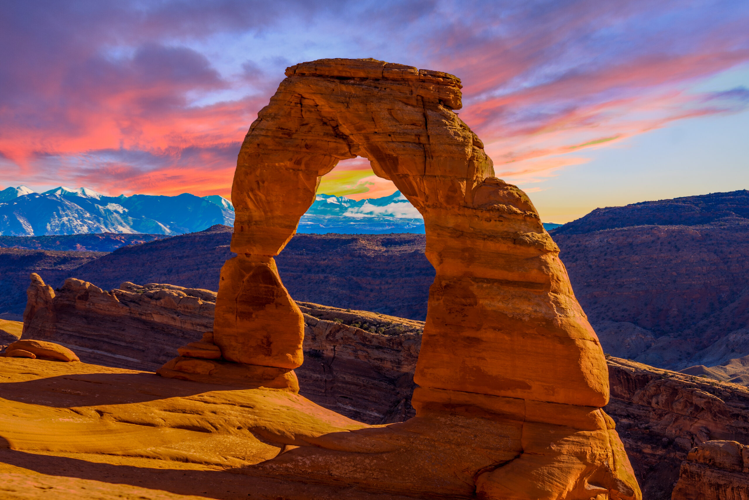
Delicate Arch is the route most first-time visitors should not skip. The National Park Service rates its three-mile round trip as strenuous because the trail climbs exposed slickrock with almost no shade and finishes on a narrow ledge. The payoff is Utah’s defining sandstone landmark rather than just another viewpoint.
If hiking—not sightseeing—is the purpose of the trip, the wider Moab region gets better when you leave the short roadside loops behind. Chesler Park & the Joint Trail in Canyonlands’ Needles District is our best full-day choice. Devils Garden to Double O is the best long route inside Arches. Corona Arch is the strongest major-arch hike outside the national parks, while Mesa Arch is the easiest high-return sunrise walk.
That distinction matters. A list that ranks only by Instagram recognition would overfill your itinerary with short Arches stops. A better Moab trip mixes one icon, one immersive hiking day, one canyon-edge route and one landscape outside the park gates.
3.0 mi · 2–3 hr · iconic payoff · strenuous by NPS.
10.7 mi · 5–7 hr · Needles immersion · strong hikers.
3 mi · BLM · cables, cut steps and a short ladder.
Plan the whole Moab hiking trip
How we ranked these: trip value combines scenery, trail quality, uniqueness, hiking substance, logistical friction and how much each route improves a multi-day Moab itinerary. This is not a pure difficulty list or popularity contest. Distances and current access rules are checked against the National Park Service, Bureau of Land Management and Utah State Parks where applicable.
Choose the experience first, then the trail
Moab’s most famous hikes are not interchangeable. Decide whether you want a landmark, a serious hiking day, a sunrise stop, hands-on slickrock or a park-free alternative.
Delicate Arch
The landmark hike. Three miles is manageable for many visitors, but exposed slickrock and heat make it more serious than the mileage suggests.
Open the Delicate Arch guide →Chesler Park
Go to the Needles for a 10.7-mile landscape journey through sandstone spires, open parkland and the Joint. This is the day’s main event.
Devils Garden
Landscape Arch is easy; Double O and the Primitive Trail add fin walking, scrambling, exposure and route-finding. Turn around where your comfort ends.
Use the Arches hiking guide →Corona Arch
A 3-mile BLM route with enough slickrock, cables and ladder movement to feel adventurous without requiring a national-park itinerary.
Mesa Arch
Only 0.6 mile. The cliff-edge arch frames canyon country and the La Sal Mountains. Pair it with another Island in the Sky hike.
Windows + Double Arch
The best scenery-to-effort cluster in Arches. Several major arches fit into short, flexible walks with almost no itinerary risk.
Fiery Furnace
A permit-controlled sandstone maze where navigation and body movement are the point. First-timers are better served by a ranger-led experience.
Fisher Towers
Trade arches for vertical red-rock towers along the Colorado River corridor. A strong second- or third-day route outside both national parks.
The 12 best hikes around Moab
The first four are the core decision set. After that, ranking depends more heavily on your district, available time, temperature and comfort with exposure.
Delicate Arch
The classic route climbs from Wolfe Ranch across open slickrock before wrapping around a narrow rock ledge to the arch. NPS specifically warns there is no drinking water at the trailhead and recommends at least two liters per person. The arch is not visible until the end, which makes the arrival unusually effective even if you have seen it in hundreds of photos.
Choose it: your first Moab morning, or a cool-season late afternoon with a headlamp for the return. Avoid midday summer heat.
Chesler Park & Joint Trail
Chesler Park is our best hiking day in the Moab region because it replaces drive-to-overlook tourism with hours inside the Needles landscape. The route moves through Elephant Hill terrain into a broad grass-and-sand basin ringed by sandstone spires, then threads the narrow Joint. The long drive from Moab is a feature rather than a flaw: it forces you to treat the Needles as its own destination.
Choose it: cool weather, strong desert fitness and an early departure. Carry real navigation and water reserves, not a short-trail daypack.
Double O + Primitive Trail
Devils Garden is the best way to turn Arches into a hiking day. Landscape Arch is straightforward, but beyond it the route climbs sandstone fins and uses narrow ledges with meaningful exposure. The Primitive Trail adds route-finding, steep slopes, scrambling and places where water can collect. There is no prize for forcing the full loop if wet rock, ice or exposure exceed your comfort.
Choose it: when you want mileage inside Arches. For many visitors, Double O out-and-back is the cleaner objective than automatically adding the Primitive loop.
Corona Arch
Corona Arch is the strongest answer to “what should I hike outside Arches?” The BLM route crosses railroad tracks and open slickrock, then uses safety cables, steps cut into the rock and a short ladder before reaching a huge freestanding arch. There is mild height exposure but the outing stays compact enough to pair with a Colorado River scenic drive or a second short trail.
Choose it: a flexible morning or evening when you want a major sandstone payoff without national-park parking pressure.
Grand View Point
The trail follows the rim from an already excellent overlook to a second viewpoint over the White Rim and an enormous cross-section of Canyonlands. Almost no elevation is required for the scale of the view. The current ranking assumes the trail is open; temporary 2026 weekday construction closures make White Rim Overlook the better backup on affected dates.
Choose it: a first Island in the Sky day, mixed-ability groups, or a Mesa Arch pairing when current access allows.
Fisher Towers
Fisher Towers changes the visual language of the trip. Instead of arches or canyon rims, the trail winds beneath narrow red-rock towers with broad views toward Castle Valley and the Colorado River basin. The BLM lists the National Recreation Trail at 2.2 miles one way. It is exposed to sun, so the attractive spring and fall temperatures are a better match than a hot summer afternoon.
Choose it: photographers, repeat Moab visitors, or anyone trying to make the trip feel larger than the two national parks.
Mesa Arch
Mesa Arch is famous for sunrise photography because reflected light can illuminate the underside of the arch, but it is worthwhile at any hour. The arch sits right at the cliff edge and frames distant canyons and the La Sal Mountains. Because the walk is so short, treat it as the opening move in an Island in the Sky day rather than the day’s sole objective.
Choose it: sunrise, a low-effort scenic stop, or a pairing with White Rim Overlook and Grand View Point when open.
Windows + Double Arch
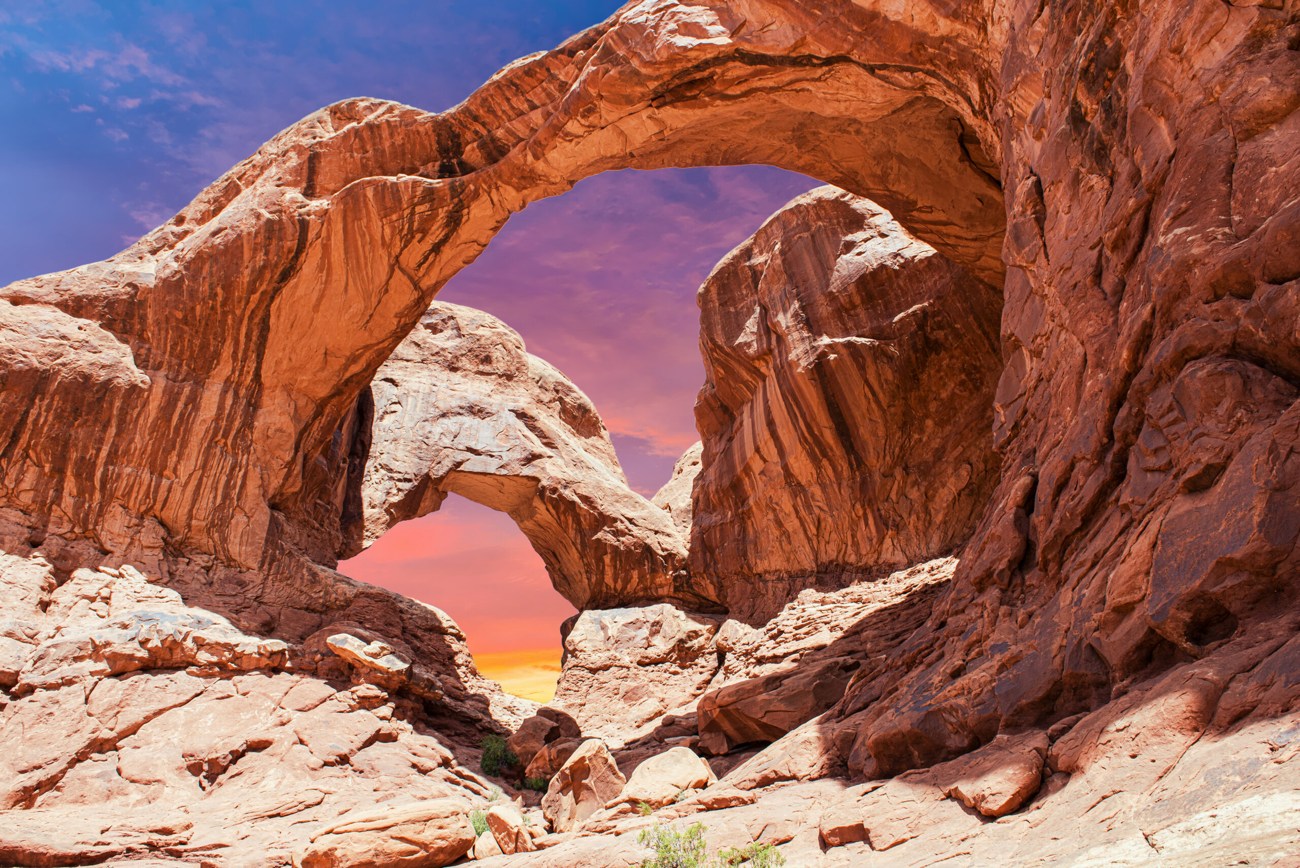
Few places in the park return this much scenery for so little walking. North Window, South Window and Turret Arch sit along the Windows loop, while Double Arch is a separate short walk in the same general area. This is excellent for families, a first evening after driving into Moab, or the tail end of a morning that began at Delicate Arch.
Choose it: families, short daylight windows, tired legs or a high-return evening without committing to another big hike.
White Rim Overlook
White Rim Overlook is the quiet strategic choice at Island in the Sky. The walk reaches a broad east-facing view over Monument Basin and the White Rim with the La Sal Mountains beyond. It does not have Mesa Arch’s photo fame or Grand View’s road-end drama, but it can feel more like a trail and is especially useful when Grand View access is disrupted.
Choose it: late afternoon, construction-affected Island in the Sky days, or when you want a short walk with less crowd incentive.
Druid Arch
Druid Arch uses part of the same approach country as Chesler Park before moving into Elephant Canyon. Deep sand and loose surfaces make the mileage feel longer, and the final quarter-mile becomes noticeably more physical with a ladder and scrambling. The formation itself is spectacular, but for a first Needles day we still prefer Chesler Park because the entire route has more varied landscape payoff.
Choose it: experienced hikers who want a harder destination objective and are comfortable with the steeper finish.
Fiery Furnace
The Fiery Furnace is deliberately different from a normal trail. Narrow fins, dead ends and limited GPS performance make navigation part of the experience, and NPS requires either a ranger-guided hike or a self-guided permit. Current rules limit self-guided groups to six, require all participants to attend an orientation, and strongly encourage first-time visitors to go with a ranger or experienced companion.
Choose it: only when the maze-like route-finding experience itself is what you want—not because you are trying to collect one more famous Arches stop.
East Rim + West Rim
Dead Horse Point is the overlooked fourth zone of a Moab hiking trip. Mesa-top trails connect broad overlooks with relatively modest elevation change, and the park can make a smart alternative when national-park trailheads are crowded. It is also one of the more useful options for travelers with a dog because leashed pets are allowed on the hiking trails under state-park rules.
Choose it: sunset, mixed-ability groups, dog-friendly hiking or an Island in the Sky pairing.

Moab is not one park
Most weak itineraries spend too much time repeating short arch walks. Build variety by matching each district to what it does best.
Delicate Arch, Devils Garden, Windows and Fiery Furnace. Highest landmark density and the greatest parking pressure.
Best first-trip role: one full or split day.Mesa Arch, Grand View Point and White Rim Overlook. Easy to pair with Dead Horse Point.
Best first-trip role: half to full day.Chesler Park and Druid Arch. Longer approach drive, much deeper trail immersion and greater self-sufficiency.
Best first-trip role: dedicated full day.Corona Arch, Fisher Towers and state-park rim trails broaden the trip beyond NPS gates and timed parking pressure.
Best first-trip role: morning, evening or flex day.
Slickrock, exposure, sand and heat change the rating
A mountain hiker can underestimate Moab because the elevation numbers look small. Direct sun, radiating rock, route-finding and exposed ledges can make a short desert route surprisingly consequential.
| Hike | Physical effort | Exposure / scrambling | Navigation | Best caution |
|---|---|---|---|---|
| Mesa Arch | Easy | Cliff edge near arch | Easy | Sunrise crowds; winter ice |
| Windows + Double Arch | Easy | Low on standard trails | Easy | Heat and busy parking |
| Grand View Point | Easy | Canyon-edge hiking | Easy | 2026 closure schedule; cliff awareness |
| Delicate Arch | Moderate mileage / NPS strenuous | Final narrow ledge | Moderate slickrock markers | No shade or trailhead water |
| Corona Arch | Moderate | Cables, cut steps, short ladder | Moderate | Mild height exposure; hot slickrock |
| Fisher Towers | Moderate | Some rough desert terrain | Generally straightforward | Sun exposure; turn around before overheating |
| Devils Garden / Double O | Moderate–Hard | Fin walking and ledges | Moderate | Wet or icy slickrock changes the route |
| Primitive Trail | Hard | Scrambling / steep slopes | Higher | Route-finding and exposure |
| Chesler Park + Joint | Hard | Backcountry desert terrain | Higher | Distance, heat, water and remoteness |
| Druid Arch | Hard | Ladder + scramble finish | Higher | Deep sand, loose rock, long return |
| Fiery Furnace | Variable | Agility in narrow fins | Core challenge | Getting lost; permit rules |

Most day hikes do not need reservations—but three planning details matter
Older Moab advice can be wrong in 2026. Arches changed its entry system, Fiery Furnace still has its own permit rules, and a new shuttle launched in September.
| Area / hike | Current rule | What to do |
|---|---|---|
| Arches park entry | No advanced timed-entry reservation in 2026 | Bring or buy a valid entrance pass; still expect entrance lines and limited parking at peak times. |
| Moab–Arches shuttle | Pilot service began Sep. 9, 2026 | Grand County says service is free with a valid Arches pass, 7 days/week, 8 a.m.–5 p.m. in season. Check current stops/schedule before using it for trail logistics. |
| Delicate Arch | No separate hiking permit | Parking, temperature and water are the real constraints. Early or late is usually the smarter operating window. |
| Devils Garden day hiking | No day-hike permit | Campground reservations are separate from trail access. Do not confuse the two. |
| Fiery Furnace | Ranger hike or self-guided permit required | Self-guided permits must be reserved online at least 2 days before, no more than 7 days in advance; current fee is $10/person and group size is capped at 6. |
| Canyonlands day hikes listed here | No ordinary day-hike permit | Backcountry camping and other activities have separate permit systems. Carry navigation on remote routes. |
| Grand View Point | Temporary 2026 weekday closure through Oct. 1 | Closed Mon. 6 a.m. to Thu. 4 p.m. during the project window; open Thu. afternoon through the weekend. |
| Corona Arch | No hiking fee | Follow BLM trail protections; roped activities at the arch are separately restricted. |
| Dead Horse Point | State-park day-use rules | Check current Utah State Parks entrance fees and hours separately from the federal parks. |
The new shuttle is a useful development, but do not assume it functions like Zion’s mandatory in-park shuttle. The current Grand County program is a pilot and route details can change. Confirm your exact stop and last-return time before leaving a vehicle in Moab.
The best 1-, 2- and 3-day Moab hiking plans
The goal is not to maximize the number of trailheads. It is to build contrast while preserving cool hours for the routes that actually need them.
The essential Moab sampler
- Early: Delicate Arch.
- Morning: Windows + Double Arch.
- Midday: food, shade and recovery in Moab.
- Evening: Corona Arch or Dead Horse Point sunset.
This gets you the landmark, another major Arches cluster and one experience outside the park without turning the day into a parking-lot race.
Arches + Island in the Sky
- Day 1: Delicate Arch early; Devils Garden to Landscape Arch or Double O depending on weather and comfort.
- Day 2: Mesa Arch, White Rim Overlook and Grand View Point when open; finish at Dead Horse Point.
The second day changes scale completely—from freestanding arches to canyon-rim panoramas—so the weekend feels broader than two days inside Arches.
Add the Needles
- Day 1: Delicate Arch + Windows.
- Day 2: Chesler Park & Joint Trail.
- Day 3: Corona Arch or Fisher Towers, then Island in the Sky / Dead Horse Point.
If hiking is why you came to Moab, this is our preferred first-trip structure. The Needles day becomes the centerpiece rather than another set of roadside photo stops.
Spring and fall make the best Moab hiking days
The destination is open year-round, but route quality changes dramatically with temperature, daylight, ice and crowd pressure.
Prime long-hike season
Usually the easiest window for Delicate Arch, Devils Garden, Corona Arch and full Needles days. Spring breaks and weekends can be busy, so early starts still matter.
Heat-management season
NPS says summer temperatures regularly exceed 100°F. Sunrise and short routes become strategic rather than optional, especially for long exposed objectives.
Second prime window
Excellent long-hike potential as daytime temperatures moderate. Fall weekends remain popular, and early September can still behave like summer.
Quiet but condition-dependent
Cold mornings and low crowds can be excellent. Snow or ice can make ledges and slickrock hazardous; traction may be useful on routes such as Mesa or Delicate Arch.
Moab mileage lies to mountain hikers
A three-mile hike on bare slickrock under direct sun can demand more water and restraint than a longer shaded trail at the same pace.
Move the hard hours
During extreme summer heat, NPS advises avoiding strenuous activity from 10 a.m. to 5 p.m. A 5 a.m. trail start is often a better solution than simply carrying more water at noon.
Scale by exposure, not mileage
NPS suggests about 2–3 liters per person for frontcountry hiking and up to roughly 4 liters for long backcountry routes. Needles days require larger margins because shade and reliable water are scarce.
Watch storms and confined terrain
Flash flooding can occur away from where rain is visible. Check current weather before canyon or wash travel, and remember that wet sandstone can also become slippery and vulnerable to damage.
Carry salty food as well as water, use sun-protective clothing and a brimmed hat, and keep enough reserve to solve an unexpected delay. For remote Canyonlands routes, add a topographic map and basic first-aid equipment; NPS notes that not every backcountry trail is maintained or consistently marked. Desert competence means being willing to turn a planned “big day” into a shorter day when temperature, thunderstorms or pace change the equation.
Do not use Delicate Arch as the definition of “easy”
It is short enough to tempt families, but NPS rates it strenuous. For younger hikers or mixed abilities, choose routes where turning around is simpler and exposure is lower.
Windows + Double Arch
Short, visually dense and easy to shorten. This is our first recommendation when a group wants major arches without a multi-hour commitment.
Mesa Arch
A 0.6-mile loop with little elevation change. Keep children close at the arch because the feature sits at a cliff edge.
Dead Horse Point
National parks sharply limit where pets can hike. Dead Horse Point State Park allows leashed dogs on hiking trails, making its rim system much more useful for pet travelers.
For a family that is fit and comfortable on slickrock, Delicate Arch can still be a great objective in cool conditions. The decision point is not age alone: consider heat tolerance, footwear, the exposed final ledge, the ability to carry enough water and whether every person can walk back after sunset if the outing takes longer than expected.
Stay in Moab unless the Needles is the center of the trip
Moab is the practical hub for Arches, Island in the Sky, Corona Arch, Fisher Towers and Dead Horse Point. The Needles is the major exception because the road approach turns it into a dedicated day.
Moab town
Best for restaurants, gear, recovery and flexible access to most trail systems. A central base also makes it easier to change plans when Arches parking, heat or storms force a pivot.
Compare where to stay in the Southwest →Reduce the commute strategically
If two major Needles hikes are the core objective, consider lodging or camping that reduces repeated driving. For a standard three-day first visit, one early Needles departure from Moab remains simpler.
The landmark and the landscape
A strong trip includes both. Delicate Arch is the icon; Fisher Towers and the Needles show why Moab remains interesting after the first famous viewpoint.

Best hikes in Moab: planning questions
Use these as decision rules, then confirm current park alerts and weather immediately before your trip.
What is the best hike in Moab for a first visit?
Delicate Arch. It delivers the region’s defining landmark on a real three-mile slickrock hike. The short mileage is deceptive: NPS rates the trail strenuous, it has almost no shade and the final approach uses a narrow exposed ledge. Start early and bring at least two liters of water per person.
What is the best long hike near Moab?
Chesler Park & the Joint Trail is our best all-day choice for experienced desert hikers. At about 10.7 miles and typically five to seven hours, it gives you much more backcountry immersion than Arches’ short roadside walks. If you specifically want a long route inside Arches, choose Devils Garden to Double O and extend onto the Primitive Trail only when conditions and comfort are appropriate.
Do you need a timed-entry reservation for Arches National Park in 2026?
No. NPS announced that advanced timed-entry reservations are not required in 2026. A valid entrance pass is still required, and entrance lines, limited parking or temporary vehicle diversions can happen when the park is congested. Do not pay a third party for a 2026 Arches timed-entry reservation.
Which Moab hike is best outside the national parks?
Corona Arch is the best short-to-moderate non-park choice for most visitors. The three-mile BLM trail includes slickrock, mild exposure, safety cables, steps and a short ladder. Choose Fisher Towers instead when you want a longer landscape hike rather than another arch destination.
Is Moab too hot for hiking in summer?
Not for every hike, but long exposed routes can become a poor or dangerous choice in summer afternoons. NPS says temperatures regularly exceed 100°F and recommends moving strenuous activity into cooler morning or evening hours during extreme heat. A sunrise Mesa Arch or early Delicate Arch can be a much smarter day than a ten-mile Needles loop in midday heat.
What is the easiest scenic hike near Moab?
Mesa Arch is one of the highest-return easy routes at about 0.6 mile. The Windows and Double Arch area is the strongest easy cluster in Arches. Grand View Point is also easy when open, with enormous canyon scenery for only about 1.8 miles round trip.
Do you need a permit to hike the Fiery Furnace?
Yes. Enter with a ranger-guided hike or obtain a self-guided exploration permit. Current NPS rules require self-guided reservations online in advance, limit groups to six and require all participants to attend an orientation. First-time visitors are encouraged to join a ranger or someone who already knows the area.
How many days should you spend hiking in Moab?
Three days is the sweet spot for a hiking-focused first visit. Give one day to Arches, one full day to the Needles or another major Canyonlands objective, and one flexible day to Island in the Sky, Corona Arch, Fisher Towers or Dead Horse Point. Two days can still produce a strong Arches + Island in the Sky trip.
Official trail data first
Conditions, closures and permit rules can change faster than an editorial guide. Use this page to design the trip, then re-check official alerts close to departure.
- National Park Service — Arches National Park lifts timed-entry reservation requirement for 2026.
- National Park Service — Delicate Arch Trail for distance, time, elevation change, difficulty and water guidance.
- National Park Service — Fiery Furnace permits for reservation windows, group size, orientation and fee.
- National Park Service — Canyonlands hiking for Needles/Island in the Sky route data, navigation and water guidance.
- National Park Service — Mesa Arch Trail and Grand View Point.
- National Park Service — 2026 Grand View Point construction closure.
- Bureau of Land Management — Corona Arch Trail and Fisher Towers National Recreation Trail.
- National Park Service — 2026 extreme-heat precautions for the 23 heat-related rescues reported through August 4 and current water guidance.
- Utah State Parks — Dead Horse Point rim hiking trails for trail mileage, difficulty and leashed-dog rules.
- Grand County, Utah — Moab–Arches Shuttle launch, published September 9, 2026.
Distances can vary slightly by mapping method, optional spurs and where a tracker starts. We use official published distances where available and label approximate combinations as approximate. Temporary closures and shuttle details are dated deliberately so readers can separate enduring route guidance from current operating conditions.
Go deeper from Moab
Use the destination hubs for the big trip, then open the route guides when you are ready to make trail-level decisions.
More Southwest Guides
More trips, peaks and planning guides from the same region.
Was this helpful?
Global Summit Guide is an independent mountaineering resource founded in 2026. The team combines first-hand trekking and climbing experience with in-depth research and professional health and nutrition review to help climbers choose objectives, prepare properly, and stay safe.
Health, altitude, and nutrition content is reviewed by Taylor Ludlow (Registered Nurse) and Brigg Hoopes (Nutritionist).
What We Don't Know Yet
Mountain information changes quickly. This box explains the limits of what this page can responsibly promise.
- Visa, passport, vaccination, border, insurance, and local transportation rules may change before your trip.
- Route conditions, snowpack, closures, and weather can change quickly after this page is updated.
- Permit rules, fees, quotas, and reservation windows may change between review cycles.
- Operator availability, pricing, guide ratios, and cancellation terms can change by season.
- Your fitness, altitude response, risk tolerance, and experience level may change what is safe or realistic.
Verify current conditions with official land managers, guide services, local forecasts, and current route reports before booking or climbing.
Mountaineering, rock and ice climbing, glacier travel, and high-altitude activity are inherently dangerous and can result in serious injury or death. The information on Global Summit Guide is provided for general informational and educational purposes only and is not a substitute for professional instruction, qualified guiding, proper equipment, or your own judgment and experience.
Route conditions, weather, snowpack, permits, regulations, and hazards change constantly and may differ from what is described here. Details may be incomplete, out of date, or contain errors. Always verify current information with local authorities, certified guides, and official sources before making any decision in the mountains.
Nothing on this site is medical, legal, or financial advice. Our fitness, acclimatization, altitude, and nutrition content is general in nature; consult a qualified physician before beginning any strenuous exercise program or exposing yourself to high altitude.
You are solely responsible for your own safety and decisions. To the fullest extent permitted by law, Global Summit Guide and its team accept no liability for any loss, injury, damage, or expense arising from use of, or reliance on, this information. By using this site you acknowledge these risks and accept these terms.
Some links on this site may be affiliate links. If you buy through them we may earn a small commission at no extra cost to you; this never affects our recommendations.
Global Summit Guide recommendation path
Next Best Mountain to Research
Use these recommendations to continue the right planning path instead of stopping on one page.
Use current permit, weather, route, and operator information before booking or climbing.
Search Flights, Hotels & Rental Cars
Have the mountain or destination picked? Use Expedia to compare the flights, lodging and rental cars that fit your actual trip dates. For mountain travel, consider arriving early enough for delays and adding a buffer night after the climb before a fixed flight home.
Compare current flight, hotel and car options.
Affiliate disclosure: Global Summit Guide may earn a commission if you book through this link, at no additional cost to you.