
Last updated September 9, 2026
Best Hikes in Bhutan: 12 Treks from Tiger’s Nest to the Snowman Trek
Bhutan’s hiking range runs from a half-day monastery walk to nearly a month above 4,000 metres. Tiger’s Nest is the essential first hike; Druk Path is the best introduction to camping; Jomolhari opens the high Himalaya; and Snowman is a long, remote expedition on foot rather than simply a harder version of an ordinary trek.
Choose the trek by commitment, not by which name sounds most Himalayan.
Tiger’s Nest is the best first hike and belongs on nearly every Bhutan trip. Druk Path is the cleanest first multi-day trek because it connects Paro and Thimphu in about a week. Jomolhari is the best high-Himalaya choice for most experienced trekkers, while Dagala Thousand Lakes fits travelers who want high camps in a six-day window.
Snowman is different: 26 to 28 days, repeated passes, a maximum official elevation of 5,320 m and remote northern logistics. Merak Sakteng is the better eastern Bhutan choice when cultural immersion matters as much as altitude. Bumthang Cultural Trek is the best easy multi-day route.
Bhutan hiking ranges from five hours to four weeks
The most important question is not which trek is most famous. It is how much altitude, remoteness, camping and schedule risk you want to absorb.
| Priority | Choose | Official time / high point | Why it fits | Main constraint |
|---|---|---|---|---|
| Essential first hike | Tiger’s Nest | 5-6 hr | Culture + trail + Paro valley | Steady climb at altitude |
| First camping trek | Druk Path | 7 days / 4,200 m | Paro-to-Thimphu crossing | High camps + weather |
| High-Himalaya trek | Jomolhari | 10 days / 5,000 m | Sacred peak scenery + altitude | Acclimatization |
| Six-day high trek | Dagala Thousand Lakes | 6 days / 4,270 m | Lakes + ridges + yak country | Weather and altitude |
| Maximum commitment | Snowman | 26-28 days / 5,320 m | Remote passes + Lunana | Duration, altitude, weather |
| Eastern culture | Merak Sakteng | 7 days / 4,100 m | Remote eastern communities | Longer overland logistics |
| Easy multi-day | Bumthang Cultural | 3 days / 3,120 m | Village and temple walking | Central Bhutan travel time |
| Gentle valley | Gangtey Nature Trail | 4-5 km / ~1 hr | Phobjikha scenery | Short rather than strenuous |
The best hikes and treks in Bhutan
The ranking balances landscape, cultural depth, distinctiveness and trip value. It does not rank difficulty: Snowman is far harder than Tiger’s Nest despite appearing lower on the list.
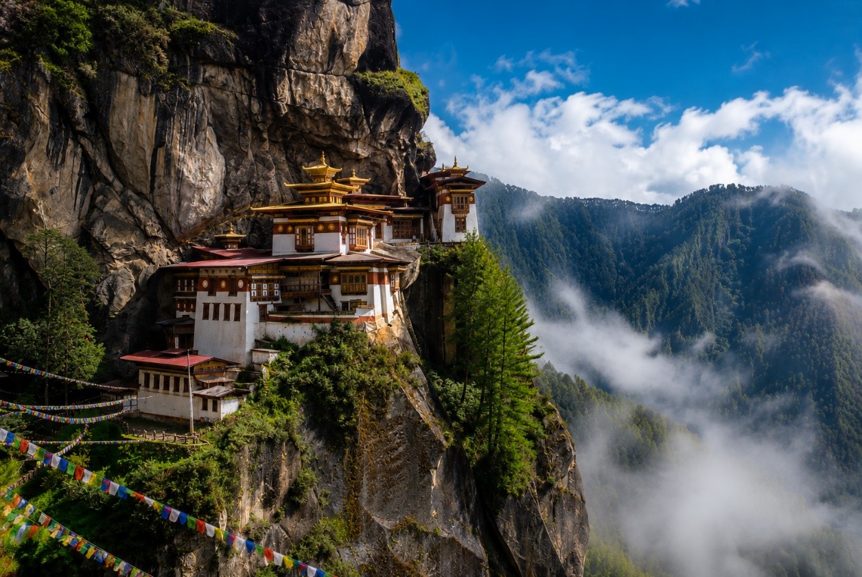
Paro Taktsang / Tiger’s Nest
Bhutan’s signature hike climbs from the Paro valley through pine forest to the cliffside monastery complex. The official tourism site lists roughly five to six hours for the outing. It is the best first hike because it combines culture, altitude and trail time without requiring a camping trek.
Druk Path Trek
A compact high-country crossing between Bhutan’s two main western gateways. The official tourism page rates it Medium and lists March-June and September-November among the suitable months.
Jomolhari Trek
A classic high-altitude trek into the country beneath sacred Jomolhari. It is long enough to feel Himalayan without the huge commitment of Snowman and gives a better altitude progression than trying to rush directly into the highest passes.
Dagala Thousand Lakes Trek
A medium-grade trek through high ridges, yak country and alpine lakes. Its six-day format makes it one of Bhutan’s strongest options for travelers who want real altitude but cannot give two or three weeks to the mountains.
Snowman Trek
Bhutan’s toughest trekking journey crosses a long chain of high passes through remote northern country. The official tourism site lists two Snowman versions at 26 and 28 days, both rated Hard, with maximum elevations of 5,320 m.
Merak Sakteng Trek
A medium-grade cultural and mountain trek through the remote east, associated with the distinctive communities of Merak and Sakteng. It is a better choice than Snowman for travelers who value cultural depth over extreme altitude.
Bumthang Cultural Trek
An easy three-day trek in central Bhutan linking valleys, villages and temples at much lower altitude than the great northern routes. It is an excellent way to add camping and walking without making altitude the central challenge.
Phobjikha / Gangtey Nature Trail
A short walk through pine forest and open pasture in the Phobjikha Valley near Gangtey Monastery. It is one of the best hiking additions to a cultural road trip, especially for travelers who want scenery without a long mountain day.
Dochula to Lungchutse Lhakhang
A short ridge-and-forest outing from Dochula with the possibility of broad Himalayan views in clear weather. It fits naturally between Thimphu and Punakha and is one of the easiest ways to turn a road-transfer day into a hiking day.
Bumdra Hike
A higher Paro-area objective that can be combined with camping and views across the valley. It is useful when Tiger’s Nest alone feels too short but a full Druk Path itinerary is too long.
Phajoding Hike
A substantial climb from the Thimphu side into monastery and high-forest country. It gives a useful training day before a higher trek while remaining close to the capital.
Punakha Winter Trek
An easy lower-altitude trek that the official tourism site lists for spring and autumn months. It works well for travelers who want several walking days but prefer warmer valleys and less altitude exposure.

Jomolhari is the point where a Bhutan walking trip becomes a high-Himalaya trek.
The official tourism site lists the standard Jomolhari trek at 10 days with a maximum elevation of 5,000 m and a Medium rating. That altitude makes acclimatization a planning decision, not just a fitness problem. Use the altitude acclimatization guide before deciding how aggressively to structure the first trekking days.
The Bhutan trekking system starts with these six
These routes create a useful progression from an easy cultural trek to expedition-length wilderness. Each is developed here now; dedicated route pages can take over the detailed itinerary once their final canonicals are verified.
Snowman Trek
Bhutan’s longest and hardest classic trek, crossing repeated high passes through remote northern country.
Plan Snowman → Medium · 7 daysDruk Path Trek
The best introduction to Bhutan camping, connecting Paro and Thimphu through high lakes and ridges.
Plan Druk Path → Medium · 10 daysJomolhari Trek
A high-Himalaya trek beneath one of Bhutan’s most important sacred mountains.
Plan Jomolhari → Medium · 6 daysDagala Thousand Lakes
High alpine lakes and ridges in a shorter schedule than Jomolhari or Snowman.
Plan Dagala → Easy · 3 daysBumthang Cultural Trek
The easiest core multi-day trek and the best way to pair walking with central Bhutan culture.
Plan Bumthang → Medium · 7 daysMerak Sakteng Trek
An eastern Bhutan route where remote communities and landscape matter as much as altitude.
Plan Merak Sakteng →Do not treat Snowman as a longer Jomolhari itinerary
The official Bhutan tourism page calls Snowman the toughest trekking trail in the country. The problem is cumulative: multiple weeks, repeated high passes, remote camps and limited margin for losing days.
Two official Snowman versions
Bhutan Travel lists Snowman Trek I at 26 days and Snowman Trek II at 28 days, both reaching a maximum of 5,320 m and both rated Hard. The long schedule is not filler; it is the defining feature of the trip.
Fitness does not substitute for acclimatization
Repeated days near or above 4,000 m change sleep, appetite and recovery. Before booking, compare the route’s ascent pattern with the acclimatization framework and ask the operator how it handles illness, delays and evacuation.
Train for repeated days, not one heroic climb
The relevant test is whether you can hike for many consecutive days, recover overnight and keep moving with altitude and imperfect sleep. The mountaineering fitness standards are a useful bridge for thinking about endurance and vertical capacity before a long high-altitude trek.
The official window is narrow
Bhutan Travel lists July-October for Snowman I and June-October for Snowman II. A commercial departure may use a much narrower practical window because monsoon, snow and pass conditions can decide whether the complete route works.
Ask what happens when the itinerary slips
On a 26- to 28-day trek, a lost day has consequences. Compare spare days, horse and crew logistics, communication, evacuation plans and what the operator does if a pass is unsafe.
Completion is not the only measure
The route crosses some of Bhutan’s most remote mountain country. Weather, health and trail conditions can force changes. A responsible plan treats alternate exits and itinerary changes as part of the trek rather than as failure.
Western Bhutan has the cleanest progression from day hike to high trek
A first trip can move from Tiger’s Nest to Druk Path, then into Jomolhari or Dagala on a later visit. That progression gives the traveler time to learn Bhutan’s travel system before committing to remote northern logistics.
Tiger’s Nest
Bhutan Travel lists Paro Taktsang at about five to six hours. The climb gains enough elevation that recently arrived travelers should pace it deliberately. The monastery is a sacred site, so the hike is also a cultural visit rather than simply a viewpoint objective.
Winter can be excellent for clear skies and quieter trails, while autumn is popular for stable weather. The route is accessible only on foot for the final approach.
Druk Path
The official tourism page rates Druk Path Medium and lists March, April, May, June, September, October and November. Its Paro-to-Thimphu geography makes it especially efficient because the trek moves the traveler between two important trip bases rather than returning to the same roadhead.
Jomolhari
Jomolhari is the high-altitude step up. Bhutan Travel lists September-November for the standard route, while related Jomolhari loop and Laya-Gasa variants have broader spring/autumn windows. Ask exactly which itinerary the operator means when it says “Jomolhari trek.”
Dagala Thousand Lakes
Dagala is a smart middle option: more altitude and camping than an easy cultural trek, but far less time than Snowman. Official guidance lists April-June and September-October, which makes it particularly useful for spring and autumn trips.
Dochula to Lungchutse
This short hike belongs in a driving itinerary between Thimphu and Punakha. It adds trail time and forest to a pass that many visitors otherwise experience only from the road.
Phajoding
A stronger fitness day close to the capital. It can be used as a shakedown hike before a multi-day trek, especially for checking pacing, footwear and how the group responds to a sustained climb.
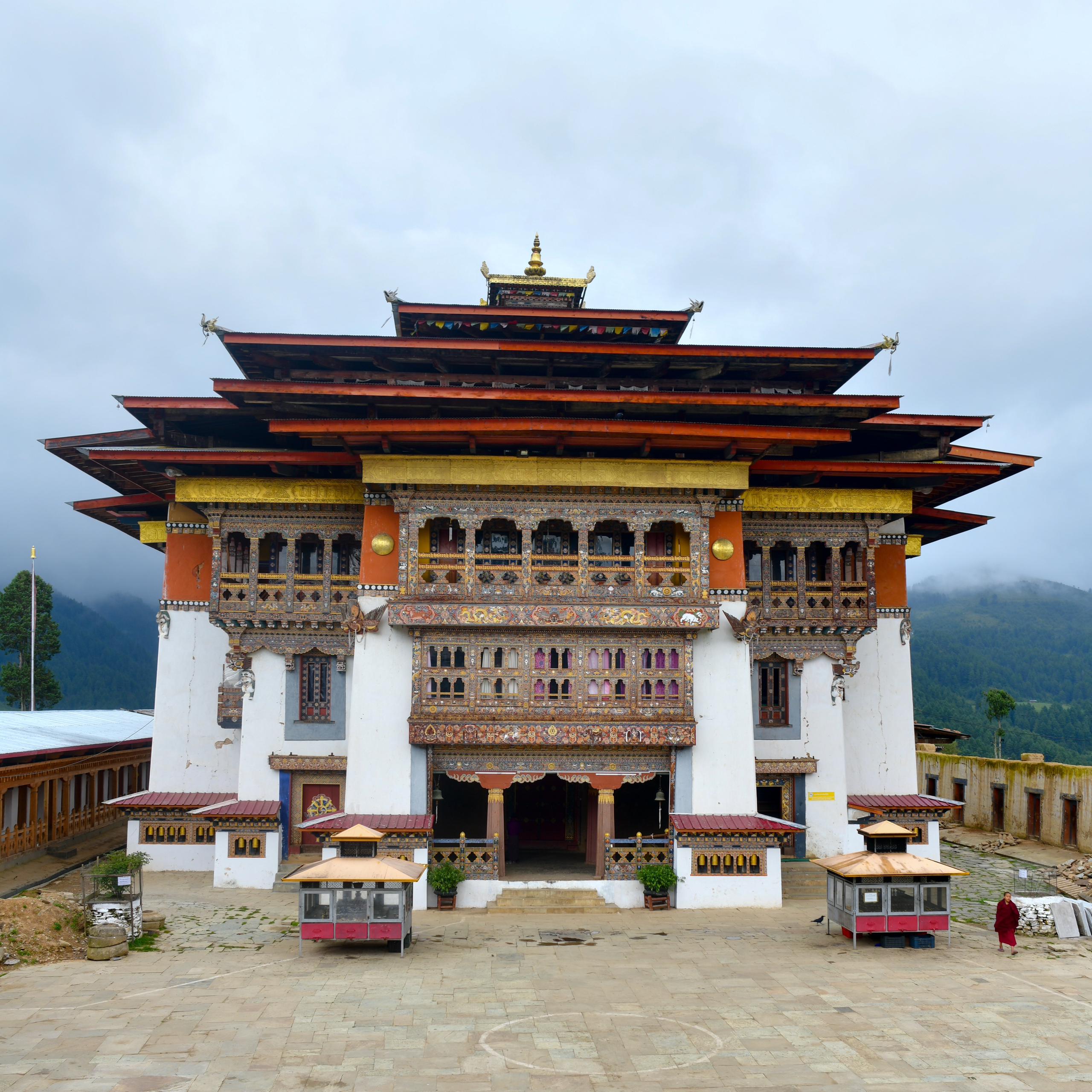
Bhutan hiking does not need to be high altitude to be worthwhile.
The official tourism site describes the Gangtey Nature Trail as roughly four to five kilometres through pine forest and pasture. Short valley hikes like this one make a Bhutan road trip stronger because they give the traveler time on foot without turning every day into a pass crossing.
Bumthang and Merak Sakteng change the rhythm of the trip
The west owns the best-known trekking names. Central and eastern Bhutan reward travelers who are willing to spend more time moving across the country and less time chasing maximum elevation.
Bumthang Cultural Trek
Bhutan Travel rates the route Easy, with a maximum elevation around 3,120 m. It is the strongest core trek for travelers who want village and temple walking with modest altitude and a short camping commitment.
Merak Sakteng
The official tourism site lists a maximum elevation of 4,100 m and seasons in March-May and September-November. The route is a reason to travel into eastern Bhutan rather than treating every trekking trip as a western loop.
Gangtey Nature Trail
A gentle short hike near Gangtey Monastery and the black-necked-crane landscape. It works well for mixed-ability groups and for rest days between more strenuous mountain objectives.
Trans Bhutan Trail
The restored trail runs more than 400 km across Bhutan from west to east. It can be walked end-to-end or in selected sections, making it a cultural long-distance alternative to the high northern trekking system.
Punakha Winter Trek
This short route keeps the trip at lower elevation than Druk Path or Jomolhari. It is useful when the goal is consecutive walking days, not a maximum-altitude experience.
Do not underestimate overland time
Bhutan is mountainous, and moving east takes time. A route such as Merak Sakteng or a central Bhutan trek should shape the entire itinerary rather than being added casually to a short Paro-Thimphu-Punakha trip.
Spring and autumn are broad starting points; the exact trek decides the month
Bhutan’s official route list is more useful than a generic “best season” rule because different trails have different altitude and monsoon exposure.
| Route | Official listed season | Why it matters |
|---|---|---|
| Druk Path | Mar-Jun; Sep-Nov | Broad spring/autumn window for a first high trek. |
| Dagala Thousand Lakes | Apr-Jun; Sep-Oct | High lakes and ridges need stable enough weather for camps and visibility. |
| Jomolhari | Sep-Nov | The standard route has a narrower official window than some related Jomolhari variants. |
| Snowman I | Jul-Oct | Long route makes pass conditions and schedule resilience critical. |
| Snowman II | Jun-Oct | Official window is broad, but operator departures may be much narrower. |
| Merak Sakteng | Mar-May; Sep-Nov | Strong eastern spring and autumn choice. |
| Bumthang Cultural | May | Official list gives a very narrow recommended month for this named route. |
| Day hikes | Year-round in suitable conditions | Tiger’s Nest, Gangtey and lower walks can fit more months than the high camping treks. |
Summer is not automatically impossible. Bhutan Travel explicitly lists June, July and August for several trekking routes, including Snowman. The trade-off is monsoon rain, cloud and less predictable lower-elevation trail conditions. Build the itinerary around the named route rather than applying one season label to the entire country.
Know the government charges before comparing trek prices
Bhutan’s trip economics are different from Nepal or the Alps. The SDF is tied to nights in the country, so adding acclimatization or recovery days changes the government-fee portion of the budget.
| Item | Current 2026 rule | Planning effect |
|---|---|---|
| SDF – most international adults | USD 100 per night | Multiply by every night in Bhutan, not only trekking nights. |
| Children 6 to under 12 | USD 50 per night | Half adult SDF under the current rule. |
| Children under 6 | No SDF | Still include all other travel and operator costs. |
| Visa application | USD 40 one-off fee | Separate from SDF and operator price. |
| Visa processing | Official guidance allows up to 5 working days for a correct application | Do not leave the visa until the departure week. |
| Indian nationals | Permit process; SDF Nu./INR 1,200 per night for adults | Different entry and fee structure. |
| Wilderness guide | Official visitor guidance says not to venture into the wild without an accredited guide | Use a licensed trekking guide/operator and verify credentials. |
Paro and Thimphu are the logistics anchors; Punakha and Bumthang change the trip
The lodging strategy centers on Paro, Thimphu, Punakha and trek-staging accommodation. That structure works because Bhutan trekking normally begins and ends with several non-trekking nights.
Paro
Use Paro for arrival, recovery, Tiger’s Nest and western trek staging. It is the natural base before Druk Path and many Jomolhari itineraries. An extra Paro night can also create a useful buffer around international flights and the first high hike.
Thimphu
Thimphu is useful before or after Druk Path, for operator meetings, guide coordination and shorter hikes such as Phajoding. It is also the best place to solve trip details before moving into more remote valleys.
Punakha
Punakha lowers the elevation and changes the climate. It is useful for recovery, lower-altitude walking and a cultural itinerary between western trekking blocks.
Bumthang
Bumthang is the proper base for the cultural trek and central Bhutan walking. It should be treated as its own destination rather than a quick side trip from Thimphu.
Trek staging lodges
Jomolhari, Snowman and eastern routes use specific road-end, camp and village logistics. Confirm the last hotel night, the first camp, baggage handoff and return transport in the written itinerary.
Route first, hotels second
For a remote trek, lock the route, guide/operator and realistic trekking dates before optimizing hotels. The mountain schedule should control the city nights rather than the other way around.
Three Bhutan hiking trips that make sense
A coherent Bhutan itinerary combines one major trekking commitment with cultural and lower-altitude days rather than stacking multiple high routes into one vacation.
First Bhutan hiking trip
Paro + Tiger’s Nest, Thimphu, Dochula/Lungchutse and Punakha. This is the right first trip for someone who wants hiking every few days without camping or high-pass logistics.
Druk Path or Dagala focus
Use Paro and Thimphu as the bookends, place one six- or seven-day camping trek in the middle, then finish with Punakha or a recovery day. This is the cleanest first trekking itinerary.
Jomolhari + Bhutan culture
Give Jomolhari enough time to acclimatize properly, then add lower cultural days rather than another major trek. Snowman should be treated as its own expedition-length trip with a much larger total schedule.
Bhutan is also a useful contrast with the neighboring trekking system of Nepal: Bhutan has a different visitor-fee model, fewer mass-market trail corridors and more dependence on organized local support.
Check Bhutan’s official tourism pages before paying the final balance
Visa rates, SDF policy, guide listings and route-season guidance can change after an evergreen regional page is published.
Entry + trekking
Guides + trip planning
Planning a Bhutan hiking trip
Use these answers to choose the route family, then verify the exact visa, fee, operator and trail details for your travel dates.
What is the best hike in Bhutan?
For most first-time visitors, Paro Taktsang or Tiger's Nest is the best single hike. For a first multi-day trek, Druk Path is the easiest place to start. Jomolhari is the stronger high-Himalaya trek, while Snowman is the major expedition-length objective.
How hard is the Snowman Trek?
Bhutan's official tourism site rates both Snowman Trek versions Hard. It lists 26- and 28-day itineraries, maximum elevations of 5,320 m and many high passes. The difficulty comes from altitude, duration, remoteness, weather and repeated recovery demands rather than technical climbing.
How much is Bhutan's Sustainable Development Fee in 2026?
Bhutan's official tourism FAQ currently lists the Sustainable Development Fee at USD 100 per night for most international adults. Children aged 6 to under 12 pay USD 50 per night and children under 6 pay no SDF. Indian nationals use a separate rate.
How much does a Bhutan visa cost?
Bhutan currently charges a one-off non-refundable visa application fee of USD 40. Most international visitors need a visa before travel. Indian nationals use a permit process, and Bangladesh and Maldives nationals have special visa arrangements.
Do I need a guide to hike in Bhutan?
Bhutan's official visitor guidance says not to venture into the wild without an accredited guide. The Department of Tourism maintains searchable directories of licensed guides and tour operators, including trekking-qualified guides. Remote multi-day treks should be organized with appropriate local support.
When is the best time to trek in Bhutan?
For many high treks, spring and autumn are the strongest broad windows. The official tourism site lists route-specific seasons: Druk Path March-June and September-November; Dagala April-June and September-October; Jomolhari September-November; and Snowman mainly June or July through October depending on version.
Is Tiger's Nest a difficult hike?
It is a sustained uphill hike rather than a technical mountain route. Bhutan Travel lists the outing at about five to six hours. The altitude and climb can surprise travelers who arrive from low elevation, so pacing and hydration matter.
Which Bhutan trek is best for beginners?
Bumthang Cultural Trek is the easiest of the six core multi-day routes in this guide. Bhutan Travel rates it Easy, with a maximum elevation around 3,120 m. Druk Path is the next step for hikers who want higher camps and a more alpine feel.
Can I trek in Bhutan during summer?
Yes, but route choice matters. Bhutan's official trekking list includes summer months for some high routes, including Snowman. Monsoon rain, cloud, leeches at lower elevations and trail conditions can make summer less predictable than spring or autumn.
Where should I stay before and after a Bhutan trek?
Paro is the main arrival and Tiger's Nest base; Thimphu is useful for Druk Path and western logistics; Punakha works for lower hikes and cultural travel; Bumthang supports central Bhutan walking. Long treks use route-specific staging lodges and camps.
Choose the trek before building the rest of Bhutan around it.
The route decides the season, altitude, number of SDF nights, operator support, city buffers and how much time remains for Paro, Punakha, Bumthang or eastern Bhutan.
Open My Climb →Compare the next mountain-hiking region
Continue into another high-altitude hiking system, or move from Bhutan route selection into the two readiness resources that matter most for Jomolhari, Dagala and Snowman.
Was this helpful?
Global Summit Guide is an independent mountaineering resource founded in 2026. The team combines first-hand trekking and climbing experience with in-depth research and professional health and nutrition review to help climbers choose objectives, prepare properly, and stay safe.
Health, altitude, and nutrition content is reviewed by Taylor Ludlow (Registered Nurse) and Brigg Hoopes (Nutritionist).
What We Don't Know Yet
Mountain information changes quickly. This box explains the limits of what this page can responsibly promise.
- Weather, snowpack, avalanche risk, road access, and route conditions can change quickly and may be different on your climbing dates.
- Visa, passport, vaccination, border, insurance, and local transportation rules may change before your trip.
- Route conditions, snowpack, closures, and weather can change quickly after this page is updated.
- Permit rules, fees, quotas, and reservation windows may change between review cycles.
- Operator availability, pricing, guide ratios, and cancellation terms can change by season.
Verify current conditions with official land managers, guide services, local forecasts, and current route reports before booking or climbing.
Mountaineering, rock and ice climbing, glacier travel, and high-altitude activity are inherently dangerous and can result in serious injury or death. The information on Global Summit Guide is provided for general informational and educational purposes only and is not a substitute for professional instruction, qualified guiding, proper equipment, or your own judgment and experience.
Route conditions, weather, snowpack, permits, regulations, and hazards change constantly and may differ from what is described here. Details may be incomplete, out of date, or contain errors. Always verify current information with local authorities, certified guides, and official sources before making any decision in the mountains.
Nothing on this site is medical, legal, or financial advice. Our fitness, acclimatization, altitude, and nutrition content is general in nature; consult a qualified physician before beginning any strenuous exercise program or exposing yourself to high altitude.
You are solely responsible for your own safety and decisions. To the fullest extent permitted by law, Global Summit Guide and its team accept no liability for any loss, injury, damage, or expense arising from use of, or reliance on, this information. By using this site you acknowledge these risks and accept these terms.
Some links on this site may be affiliate links. If you buy through them we may earn a small commission at no extra cost to you; this never affects our recommendations.
Global Summit Guide recommendation path
Next Best Mountain to Research
Use these recommendations to continue the right planning path instead of stopping on one page.
Use current permit, weather, route, and operator information before booking or climbing.