Last updated October 30, 2026
5-Day Scotland Hiking Itinerary
Five hiking days, two overnight bases, and some of Scotland’s most compelling landscapes: Glencoe’s Lost Valley and ridges, the waterfall-filled Nevis Gorge, then the Quiraing and Old Man of Storr on Skye. This is an achievable self-drive hiking itinerary for visitors comfortable on rocky and occasionally exposed trails—not a race across the whole country.
Best planning window: broadly late spring to early autumn for non-winter hillwalkers; still expect wind and rain. Start: Glencoe. Finish: Portree/Skye, with onward travel to Inverness as one option. Arrival & departure: best handled outside the five hiking days.

Where should you hike in Scotland for five days?
For a first five-day Scottish Highlands hiking trip, spend two nights around Glencoe/Ballachulish and two nights on Skye (Portree or Broadford), then leave the fifth night open if your departure requires it. Start with the Lost Valley, reserve the second day for a demanding but flexible Munro outing, walk to Steall Falls as you change regions, and finish with the Quiraing and Old Man of Storr. This concentrates the driving into one transfer day and leaves room for the weather to dictate which ridge is sensible.
This is not Scotland’s only possible five-day trip. If your goal is to walk continuously from lodging to lodging without a car, consider a section of the West Highland Way instead. Its full 154 km / 96 mi route usually takes more than five comfortable walking days.
Five-day overview: hikes, distances and honest demands
| Day | Hike | Published trail length | Time / ascent | Difficulty and key issue |
|---|---|---|---|---|
| 1 | Lost Valley (Coire Gabhail) | 4 km / 2.5 mi | 2–3 hr; steep rocky path | Short but rough, mild scrambling and stream conditions |
| 2 | Buachaille Etive Beag: two Munros | 8 km / 5 mi | 5–6 hr; 900 m ascent | Hard hillwalk; optional shorter single summit |
| 3 | Steall Falls / Nevis Gorge | 3.5 km / 2.25 mi | 1.5–2 hr; 220 m ascent | Rough path and steep drops; drive to Skye afterward |
| 4 | Quiraing circuit | 6.5 km / 4 mi | 3–4 hr; 374 m ascent | Rough path, one scramble, exposed hilltop return |
| 5 | Old Man of Storr viewpoints | 5 km / 3 mi | 1.5–2 hr; 340 m ascent | Steep walk, loose rock and rockfall warning zones |
Distances, times and ascent figures follow the specific summer-route variants at Walkhighlands, not all possible tracks. Real days can take longer for photography, navigation and weather. Neither hikes nor driving are suitable by default in snow and ice.
Key decision: five hiking days are not five total travel days
Flying into Scotland at noon on Day 1 and flying home from Edinburgh on Day 5 leaves significantly less time than this itinerary assumes. Ideally add an arrival night before Day 1 and a departure night after Day 5; alternatively remove the hardest hike or make the fifth day a travel day. Route timing should be planned door-to-door, not trailhead-to-trailhead.
The complete five-day Scotland itinerary
Start early enough to allow for the first hike. Reserve more strenuous summit hikes for the best forecast rather than rigidly insisting that a particular peak must be visited on Day 2. Each day below includes a clear alternative when rain, wind or fatigue changes the plan.
Lost Valley: start beneath Glencoe’s Three Sisters

Route: begin from an appropriate marked Glencoe parking area near the Three Sisters, then follow the rocky approach toward Coire Gabhail (the Lost Valley). Its tucked-away floor feels surprisingly secluded despite the proximity of the A82. Streams, boulder steps and slippery rock are part of this walk: the distance is short, but it is not a flat introductory footpath.
Morning: drive from your departure base to Glencoe and get oriented. Have lunch or supplies before walking. Afternoon: complete the Lost Valley out-and-back, then check into a Glencoe or Ballachulish stay. The road is scenic, but avoid treating roadside pullouts as unlimited parking.
Bad-weather adjustment: if streams are high or wet rock is unsafe, choose a low-level Glencoe walk or a National Trust for Scotland visitor stop rather than forcing the crossing. If arriving from a distant airport, make this a gentler arrival day and shift the Lost Valley to another morning.
Route details: Walkhighlands — Lost Valley. Continue with GSG’s Scotland hiking comparison for alternatives.
Buachaille Etive Beag: a proper Glencoe mountain day

Route: from the usual A82 approach, climb on the improved path to the col between Stob Coire Raineach and Stob Dubh. The full outing visits two Munros and involves sustained ascent, changing ridge weather and mountain navigation, especially when cloud covers landmarks. The 8 km/900 m published figures apply to the two-summit route.
Skill check: this is not the same difficulty as a scenic viewpoint hike. Boots or trail shoes with dependable wet-ground grip, carried insulation, waterproof layers, navigation skill and a conservative turnaround point are important. If the forecast worsens, visit only the first summit when appropriate—or stay low entirely. Do not substitute the nearby Aonach Eagach; it is a different and much more exposed scrambling objective.
Evening: recover in the same Glencoe accommodation. A second night in one place means no long drive after the mountain.
Route source: Buachaille Etive Beag two-Munro circuit.
Steall Falls and the transfer to the Isle of Skye

Morning: head toward Fort William, then into Glen Nevis for the short but dramatic Nevis Gorge walk to Steall Falls. The trail is rough underfoot and passes steep drops: this is a scenic waterfall outing, not an easy paved promenade. The well-known wire bridge beyond the main approach is not required for a good view of the falls; do not cross it merely for a photograph.
Afternoon: travel toward Skye by the A82/A87 and the toll-free Skye Bridge, ideally booking your room before leaving the mainland. Plan about 2½–3½ hours from Fort William to Portree as a broad driving allowance before stops, road delays or detours; routing varies with accommodation. If weather is poor or you’re tired, omit the hike and make this a dedicated transfer day.
Stay: Portree reduces driving for the two Trotternish hikes; Broadford can offer different lodging options but adds time to the northeastern peninsula. Do not schedule a second demanding hike on arrival.
Route source: Steall Falls and Nevis Gorge. For a separate major objective, see GSG’s Ben Nevis guide; the full mountain is not an add-on to this transfer day.
The Quiraing: walk the real Trotternish landscape

Route: drive north from Portree toward the Quiraing car park on the narrow road between Staffin and Uig. The full published circuit follows rugged lower paths among the landslip formations before returning across higher, weather-exposed ground. It includes rocky surfaces and a minor scramble, and the elevated return demands more care than the road viewpoint suggests.
Best use of time: get an early start to avoid crowded parking and give yourself flexibility for fog. Stop and turn back if the path is slick, gusts are strong or visibility does not permit safe route-finding. A short out-and-back along the lower path is a reasonable alternative to completing the exposed upper loop.
Afternoon: explore Portree or take a relaxed scenic drive; avoid stacking extra Cuillin climbs or distant attractions into the same day. The Quiraing is the purpose of this day, not a passing photo stop.
Route source: Walkhighlands Quiraing hill circuit.
Old Man of Storr: the final iconic Skye hike

Route: from the signed Storr car park north of Portree, climb toward the dramatic pinnacles. The popular route is steep but relatively short; higher rocky sections and rockfall areas still warrant caution. The iconic photograph is of the Old Man of Storr pinnacle, not necessarily the separate summit of The Storr above it.
Travel decision: this is the best day for a shorter morning walk before departure toward Inverness or another part of Scotland. Allow a large buffer for rural roads, stops, rental-car return and any flight. Do not promise an international afternoon flight will work after a casual morning start.
Wet-weather alternative: a short safe viewpoint outing, local low-level walk or another Skye day. Avoid exposed pinnacles in lightning, severe gusts or icy conditions. Hikers wanting the higher summit can plan The Storr as a separate longer hillwalk, not as a default extension.
Route source: Walkhighlands Old Man of Storr.
How Glencoe, Fort William and Skye fit together
The primary drive runs northwest through Glencoe, then Fort William, before continuing via Invergarry, Glen Shiel and the Skye Bridge to the island. The broad regional map below is an orientation aid, not a trail-navigation map. Use detailed walking maps for each day and follow current road directions.
These map viewports are regional orientation only. They do not display the complete footpaths or substitute for offline maps, weather advice, and your route-specific navigation.
Where to stay for this five-day Scotland itinerary
Two accommodation bases are enough. Book nights 1–2 around Glencoe or Ballachulish, then nights 3–4 around Portree or Broadford. If you have a fifth overnight before returning to a distant airport, choose Skye for extra time or Inverness for an easier departure. This page does not assume a particular hotel has availability.
Glencoe village
Best for the Lost Valley and the Glencoe scenery. Expect a smaller lodging inventory than a major town, with easy access to the A82 and local food options.
Choose if: waking up near the valley matters most.
Ballachulish / Fort William
Ballachulish keeps you close to Glencoe; Fort William gives more services and access to Glen Nevis but is farther from some Glencoe trailheads.
Choose if: flexibility and town services matter.
Portree / Broadford, Skye
Portree is convenient for the Storr and Quiraing. Broadford can be useful if lodging prices or availability push you farther south.
Choose if: you can accept Skye’s slower roads and early starts.

When to book
Reserve accommodation before booking nonrefundable parts of the trip. Popular Highland and Skye properties can fill early in summer. Compare cancellation conditions, whether parking is provided, and the actual drive to the next morning’s trailhead. Budget for meals, parking and fuel rather than relying on the room rate alone.
Lodging links: use VisitScotland for official regional orientation and current accommodation discovery. GSG can add verified lodging children when those pages are published; this article does not link to unpublished destinations.
How much does five days hiking Scotland cost?
It varies mainly with season, accommodation, rental-car arrangement and the number of people sharing costs. Scotland’s access rights generally allow responsible non-motorized walking on most land, but individual car parks, amenities and lodging charge fees. Do not confuse open walking access with free driving or free roadside parking.
Editable five-day trip budget
This is an illustrative calculator, not verified market pricing. Enter quotations you’ve actually received. Values are in GBP for the entire traveling party except the food-per-person-per-day field. International flights, insurance and travel before/after Day 1–5 are excluded.
Total: £1,360 · £680 per person
Example input illustrates only the arithmetic; change it to your actual lodging, rental and food quotes before making financial decisions. If a shared room is insufficient for your group, increase the room total.
What this budget often misses
Seasonal and transport costs
Extra arrival/departure nights, rental-car insurance, fuel surcharges, parking fees, baggage and airport transfers. On Skye, rural driving and parking choices may add time as well as money.
Contingencies
Rest days after severe weather, an extra night if travel is disrupted, appropriate replacement gear or navigation equipment, and a reserve for accommodation changes.
Commercial policy: GSG does not promote a hotel, tour, or guide here merely because an affiliate program exists. If a verified accommodation partner is added later, the referral and any sponsorship must be disclosed and kept separate from editorial recommendations.
When should you hike—and what if Scotland’s weather changes the plan?
May, June and September are attractive starting points for visitors seeking a balance of long daylight and a chance of more manageable trail conditions. July and August offer long days but can bring intense tourism and biting midges. Rain and cold wind remain possible in every month. October brings shorter days and a greater chance of serious high-ground conditions, while winter routes can require ice axe, crampons and training—not simply warmer jackets.
| If the forecast says | Do this | Why |
|---|---|---|
| Strong winds on a ridge | Move the Buachaille or upper Quiraing circuit; select lower ground | Balance and route-finding deteriorate quickly in gusts |
| Heavy rain / flooded burns | Reassess Lost Valley crossings and Nevis Gorge; avoid hazards | Rock and stream risk can outweigh a short distance |
| Low cloud over Trotternish | Use a lower section of Quiraing only if navigation remains safe | Cliff proximity and path choice matter |
| Snow or ice above low ground | Do not follow summer hillwalk grades without winter skills | Seasonal conditions change equipment and terrain |
| One excellent forecast day in Glencoe | Prioritize Buachaille Etive Beag, subject to skill | The high route gains most from stable mountain weather |
Check Mountaineering Scotland’s forecast resources, including the Mountain Weather Information Service and Met Office mountain forecasts, before every walk. Wind at summit level can be very different from the valley forecast. Local warnings, road closures and parking rules always take precedence over a static itinerary.


Scottish access rights are generous, but not unlimited
The Scottish Outdoor Access Code allows responsible walking on most land, but access rights do not extend to driving off-road or blocking roadside entrances. Keep dogs controlled, leave gates as found, avoid disturbing livestock and wildlife, and take litter away. Responsible lightweight camping is possible in many places, but specific byelaws and local restrictions apply, particularly in parts of Loch Lomond & The Trossachs; this article assumes conventional accommodation, not roadside car camping.
Official reading: Scottish Outdoor Access Code and responsible camping rules.
If your group is less experienced
Replace Day 2’s full twin-Munro climb with a shorter scenic walk in Glencoe, and use the lower Quiraing route instead of the exposed full circuit. The goal is five rewarding days outdoors, not collecting summits in unsafe weather. If you want Ben Nevis or the Cuillin, plan them as separate well-resourced objectives.
What to pack for five days of Scottish hiking
Waterproofs, navigation, and reliable footwear matter more here than fashionable equipment. Choose kit for wet rock, sudden gusts and the possibility of waiting out bad weather. For the higher Buachaille Etive Beag day, carry a real emergency layer even if the forecast looks mild.
0 of 10 checklist items marked
See the GSG mountain gear guide and free planning tools for broader comparisons. Specialized winter equipment does not make a summer route safe without the ability to use it.
Relevant hiking footwear
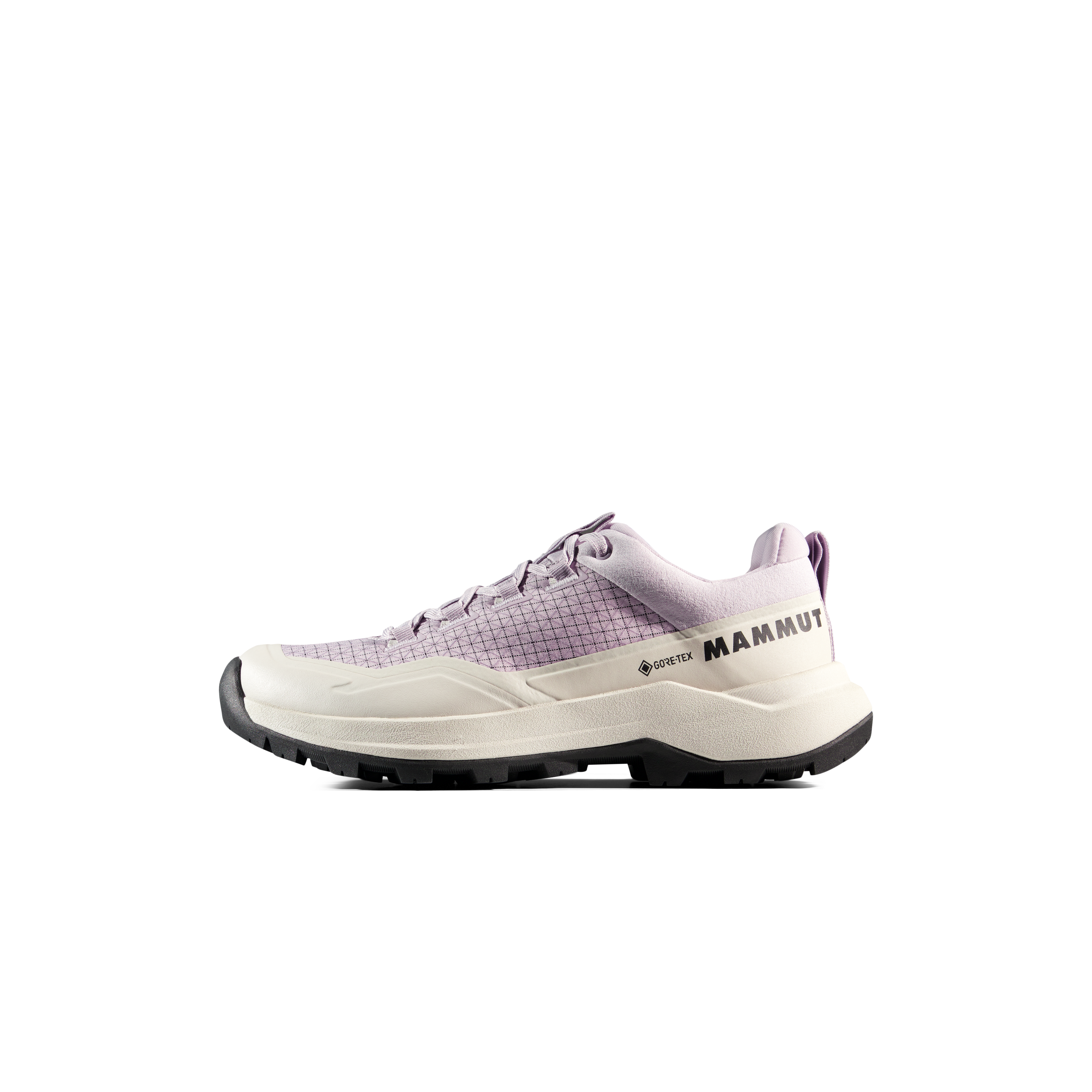
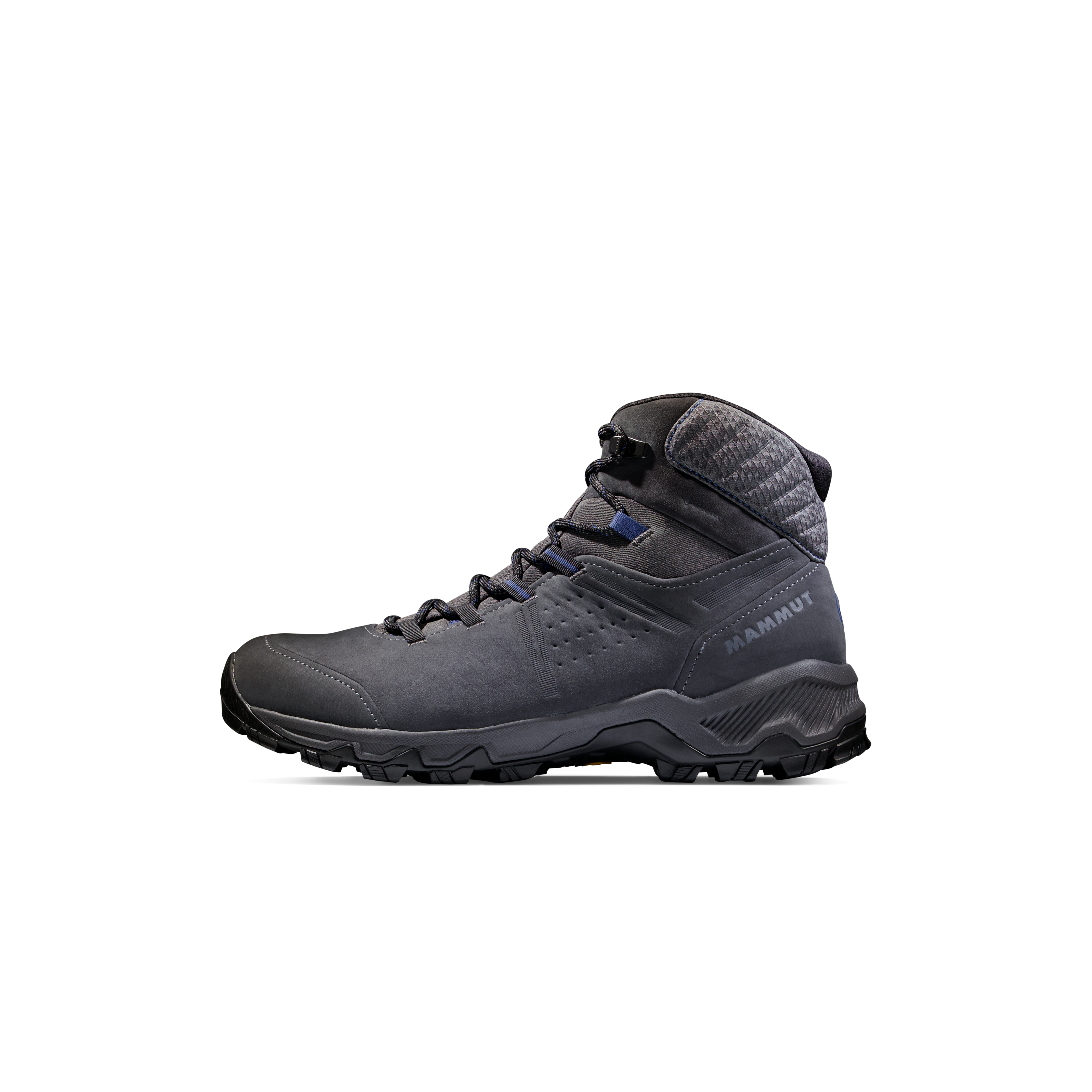
A pair you have worn on wet, rocky terrain is usually worth more than a last-minute purchase. Below is one optional GSG gear module, shown after the packing advice rather than interrupting the itinerary.
Affiliate disclosure: Global Summit Guide may earn a commission on qualifying purchases from some links at no additional cost to you. Gear placement does not determine editorial route recommendations.
Hiking Footwear for Scotland's Wet and Rocky Trails


What if you don’t have a rental car—or want more summit time?
Without a car
Stay longer in one place, use available public transport for a limited number of trailheads, or walk a shorter section of the West Highland Way. Do not assume all Quiraing or Glen Nevis trailheads have frequent bus service.
Five days, one home base
Choose Fort William/Glencoe only and swap Skye for nearby low-level hikes and—when suitably prepared—an independent Ben Nevis day. This eliminates the transfer and is often less rushed.
Focused Skye trip
Spend five days on Skye, repeat or reschedule the Trotternish walks around the weather, and leave more time for lesser-known low-level coastal walks. The Black Cuillin requires a different skill assessment.
Five-day West Highland Way? The full 154 km trail in five days averages over 30 km per day before detours—a demanding pace unsuitable as an automatic beginner itinerary. GSG’s seven-day West Highland Way itinerary is a better reference for most visitors.
5-Day Scotland Hiking Itinerary FAQs
Is five days enough to hike in Scotland?
Yes for a focused Highlands/Skye road trip with five hiking days and two overnight bases. Allow separate time for airport arrival and departure if possible.
What are the best five hikes in five days?
A practical progression is Lost Valley, Buachaille Etive Beag, Steall Falls, Quiraing and Old Man of Storr. Substitute lower options when the forecast or group experience demands it.
Can I hike the entire West Highland Way in five days?
Experienced fast walkers may, but 154 km in five days averages more than 30 km daily. Most people should allow more time; this itinerary is a road trip, not a full West Highland Way walk.
Do I need a car for this Scotland itinerary?
A car is strongly recommended. Some of the individual hikes have bus options, but the five-day combination and trailhead timing are difficult without a vehicle. A car-free trip should use fewer bases or a long-distance trail.
Where should I sleep for a five-day Highlands and Skye trip?
Use two nights in Glencoe or Ballachulish and two around Portree or Broadford; add a departure night if needed. This avoids moving accommodations every evening.
How far is Glencoe from the Isle of Skye?
Driving from Glencoe toward Portree over the bridge is broadly a few hours before stops and delays. Exact mileage depends on your accommodations and route. Allow extra time on Highland roads.
Is the Quiraing walk difficult?
The full 6.5 km circuit includes rough paths, a minor scramble and an exposed high-level return. A shorter out-and-back on lower ground can be a better choice in poor conditions.
How hard is Buachaille Etive Beag?
The standard two-summit route covers around 8 km with roughly 900 m of ascent in 5–6 hours. It is a demanding hillwalk, especially in cloud, rain or wind.
Can beginners hike the Lost Valley?
Its short 4 km distance is misleading: the trail is rocky and steep with some easy scrambling and potentially problematic stream conditions. Cautious beginners should assess conditions and not treat it as a gentle flat walk.
Is Old Man of Storr the summit of The Storr?
No. The Old Man is the famous rock pinnacle and common viewpoint walk; the summit of The Storr is a separate, longer hillwalking route.
Can I add Ben Nevis on Day 3?
Not sensibly alongside Steall Falls and the transfer to Skye. Ben Nevis is a full mountain day with substantial ascent; replace a planned hike and allow suitable conditions.
When is the best month for Scotland hiking?
May to September is a common non-winter planning window, though mountain weather can be severe at any time. Choose each high walk according to the current forecast and your skills.
What if rain ruins one of the five days?
Keep the days flexible, replace high or exposed terrain with safe lower options, and allow a rest or sightseeing day instead of pushing through hazardous water, rock or wind.
Is hiking legal and free in the Scottish Highlands?
Scotland generally supports responsible walking access on much land under the Outdoor Access Code, but parking, camping and particular site facilities have separate rules and costs.
Are there midges in Scotland?
Yes, biting midges are common in sheltered, damp Highland conditions in warmer months. Carry repellent and consider a head net; wind can reduce their activity.
Sources and what to verify before your trip
This independent article uses published route descriptions, official Scottish outdoor access guidance, and mountain weather safety advice. Trail lengths and times are for specific recorded routes in summer conditions. This is not a claim that our editors have personally walked all five hikes, and no live parking or accommodation inventory is represented here.
- Walkhighlands — Coire Gabhail (Lost Valley) — route, distance and wet-rock risk.
- Walkhighlands — Buachaille Etive Beag — twin-Munro length and ascent.
- Walkhighlands — Steall Falls — Nevis Gorge trail and exposure.
- Walkhighlands — Quiraing circuit — length, time, ascent, minor scrambling.
- Walkhighlands — Old Man of Storr — main hiking route and rockfall hazards.
- Mountaineering Scotland — Mountain weather and avalanche forecasts.
- Mountaineering Scotland — Using mountain weather forecasts.
- Scottish Outdoor Access Code — Walking responsibly.
- Scottish Outdoor Access Code — Camping and parking guidance.
- Global Summit Guide — Best Hikes in Scotland — parent guide and alternative routes.
Recheck these shortly before departure
Trailhead parking restrictions and charges; road works; lodging cancellation policy; bus or rental-car arrangements; live Highland and Skye mountain weather; water levels, snow/ice, rockfall notices, and your exact route track. Conditions can change during the same day.
Images are actual named Scottish locations with individual author/license/source-file links. Some upstream Wikimedia thumbnail redirects may be unavailable in some WordPress environments; test and replace with correctly licensed media-library copies if necessary.
Turn this five-day outline into a real Highlands adventure
Book the two accommodation bases first, choose routes for your group rather than a social-media photograph, and treat the forecast as part of the itinerary. Then continue into the published Scottish hiking cluster for more detailed decisions.
Explore all Scotland hikes
Compare Glencoe, Skye, Ben Nevis and other mountain and coastal routes.
Prefer a long-distance walk?
See the established, town-to-town 154 km walk instead of a road-trip itinerary.
Plan your next decision
Keep budgets, training and equipment organized before you go.
Independent editorial planning · Updated October 30, 2026 · Intended for non-winter hiking with appropriate skill and judgment.
Was this helpful?
🏔Related peaks nearby
🧭Explore & compare
Global Summit Guide is an independent mountaineering resource founded in 2026. The team combines first-hand trekking and climbing experience with in-depth research and professional health and nutrition review to help climbers choose objectives, prepare properly, and stay safe.
Health, altitude, and nutrition content is reviewed by Taylor Ludlow (Registered Nurse) and Brigg Hoopes (Nutritionist).
What We Don't Know Yet
Mountain information changes quickly. This box explains the limits of what this page can responsibly promise.
- Visa, passport, vaccination, border, insurance, and local transportation rules may change before your trip.
- Route conditions, snowpack, closures, and weather can change quickly after this page is updated.
- Permit rules, fees, quotas, and reservation windows may change between review cycles.
- Operator availability, pricing, guide ratios, and cancellation terms can change by season.
- Your fitness, altitude response, risk tolerance, and experience level may change what is safe or realistic.
Verify current conditions with official land managers, guide services, local forecasts, and current route reports before booking or climbing.
Mountaineering, rock and ice climbing, glacier travel, and high-altitude activity are inherently dangerous and can result in serious injury or death. The information on Global Summit Guide is provided for general informational and educational purposes only and is not a substitute for professional instruction, qualified guiding, proper equipment, or your own judgment and experience.
Route conditions, weather, snowpack, permits, regulations, and hazards change constantly and may differ from what is described here. Details may be incomplete, out of date, or contain errors. Always verify current information with local authorities, certified guides, and official sources before making any decision in the mountains.
Nothing on this site is medical, legal, or financial advice. Our fitness, acclimatization, altitude, and nutrition content is general in nature; consult a qualified physician before beginning any strenuous exercise program or exposing yourself to high altitude.
You are solely responsible for your own safety and decisions. To the fullest extent permitted by law, Global Summit Guide and its team accept no liability for any loss, injury, damage, or expense arising from use of, or reliance on, this information. By using this site you acknowledge these risks and accept these terms.
Some links on this site may be affiliate links. If you buy through them we may earn a small commission at no extra cost to you; this never affects our recommendations.
Global Summit Guide recommendation path
Next Best Mountain to Research
Use these recommendations to continue the right planning path instead of stopping on one page.
Use current permit, weather, route, and operator information before booking or climbing.